

2011 Trips


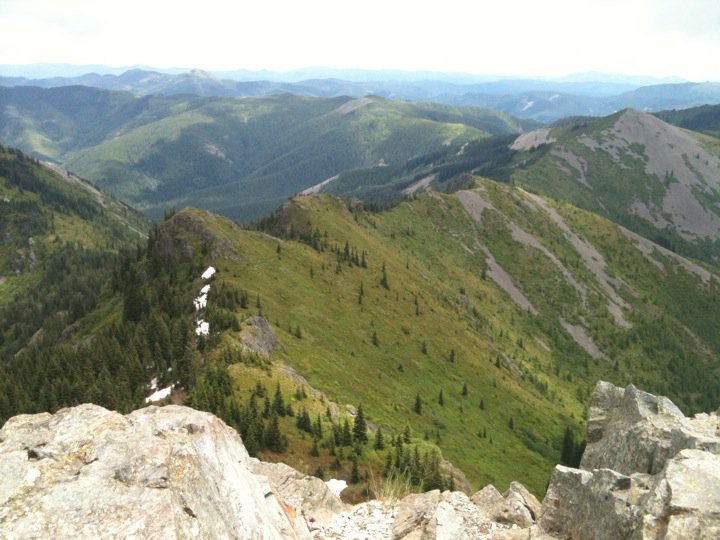
Mississippi Head
15 miles of hiking • 5000' elevation gain •
Really rough day on Mount Hood. hiked the Timberline Trail to Paradise Park, fairly easy even with the climb out of Zigzag Canyon. Ascended through the wildflowers up to the pumice slopes near the top of the canyon. Began to feel tired, some clouds to the south. made it to the snowfields above Mississippi Head when clouds rolled in. Opted not to descend to look for the airplane wreckage. Decided to turn back rather than push on to Palmer Glacier, despite doubling my mileage. Sketchy downclimbing on snow, even with poles, fast scree-skiing to Paradise Park. Back at Zigzag, the clouds broke. The climb back out of the canyon was exhausting and hot. Finally reached the car near 4pm. One of my hardest dayhikes yet, but I think had I pushed on and come down at the ski lifts it would've been much better. Will attempt again at some point.

August 23, 2011

 1
1
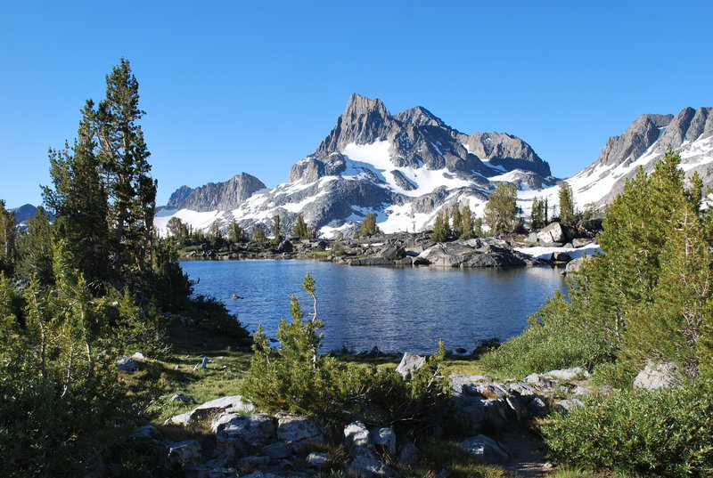
Tuolumne to Agnew Meadows Backpacking trip
35 miles of hiking • 5000' elevation gain • 3 nights
The hubs and I roadtripped down to Cali and spent four days on the JMT this month. We started at Tuolumne, were surprised at the beauty of Lyell Canyon, tackled Donahue Pass out of Yosemite, filled up our camera's memory at the lakes, and exited at Agnew Meadows via the River Trail. It was challenging and spectacular, especially past 1000 Island lake. Snow was manageable, but skeeters most definitely were not. Amazing trip, highly recommended. Insanely easy public transportation to and from trailheads.
August 14 – August 17, 2011

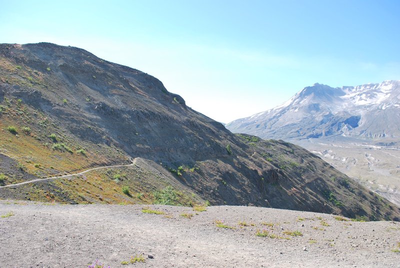
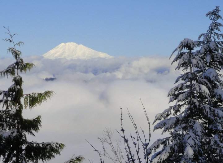
Loowit-Coldwater combo
14.5 miles of hiking • 2000' elevation gain •
Started off at Johnston Ridge Observatory early, undecided as to whether I'd try for Loowit Falls or Coldwater Peak. Had initially intended to scope out Mt Margaret snow levels for next week's hike, but have been wanting to head out to the base of the crater for some time. the hike along the blast zone was phenomenal, had actually never done that one before, but the descent to Loowit proved hot and dusty. i got bored and decided to head back up towards Coldwater. Still some snow on the trail over St Helens Lake, especially in one sketchy traverse, but overall easily manageable. Lots of hikers out, perfect weather, could see Saddle mountain, the olympics, and a whole lotta snow on Goat Rocks. Mt Margaret looked mostly melted out, but I might wait on that one. Long hot hike back to the car, a great day.
August 1, 2011

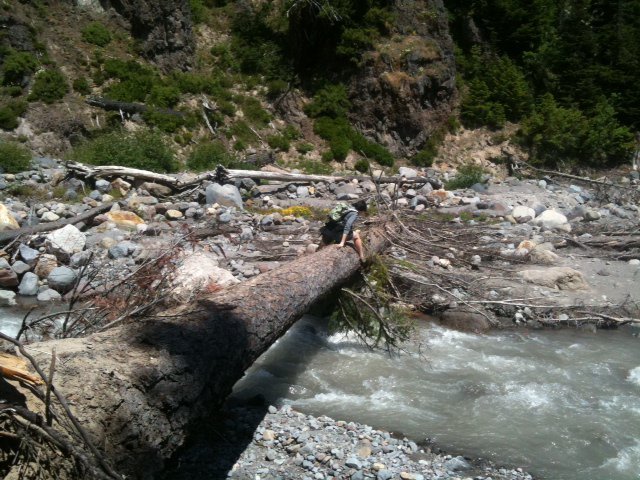
Elk Meadows Loop
6 miles of hiking • 1250' elevation gain •
Fun, easy dayhike with the hubs. Pretty weather, even though Hood was mostly obscured by clouds and didn't show up in our pictures too well. The meadows were pretty through the trees, but the highlight of this little hike was the river crossing. Definitely our most challenging yet, and prepared us well for some much easier crossings on our partial JMT next month. We used the big log to the north of the smaller makeshift bridges. Scooted on our butts the first time, balance beamed it on the return. Some hikers chose not to cross the river, as it was either too high or they weren't comfortable getting that wet and continuing hiking. Fun adventure, highly enjoyed.
July 25, 2011

Silver Star Mountain
8 miles of hiking • 2000' elevation gain •
First time to Silver Star, and maybe my expectations were too high. The road was terrible, and the trail itself was rough and unspectacular. Logging on the WA Larch Mountain was depressing. On the plus side, I very much liked the views of Strugeon Rock when the trail opened up about halfway up, and of course the summit was quite nice, with closeups of the Indian Heaven Wilderness. Wildflowers were in full display, lingering snow piles up top.
July 20, 2011

Hamilton Mtn
8 miles of hiking • 2250' elevation gain •
3rd time, first time w/husband. Great day, but crowded trail and gnats. Hiked fast, felt strong. Relatively easy.
June 3, 2011

Indian Point Loop
8.5 miles of hiking • 2750' elevation gain •
Boring walk up Gorton Creek to Indian Point, but views from Saddle almost worth it. Snow on trail to Deadwood Camp, but not on Nick Eaton Ridge. Impressive views of canyon on the descent (I think of Tomlike, Chinidere and Green Point, as well as a very snowy Benson Plateau). GPS read 2850ft at highest, so strenuous elevation but felt gradual since spread out over 4 miles. Probably won't do this one again unless to a larger peak in the canyon.
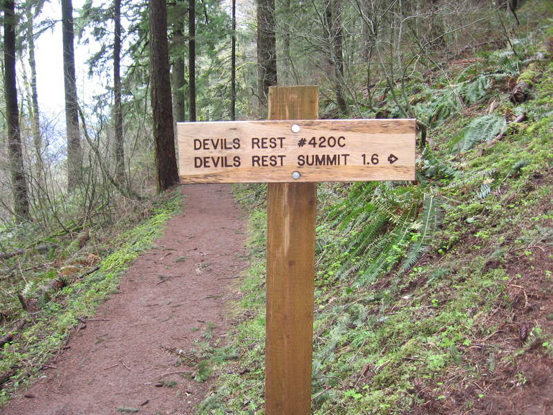
April 17, 2011

.jpg)
Multnomah Falls->Devil's Rest->Wahkeenah Loop
12 miles of hiking • 2500' elevation gain •
Decent conditioning hike, moderately difficult but nothing too strenuous. Muddy trail (especially Foxglove Tr.), hailstorms, and wind, but otherwise a nice spring hike. No views to speak of at the top. Switchbacks coming down Wahkeenah were a bit tedious.
April 10, 2011

Forest Park, Pittock Mansion
7 miles of hiking • 750' elevation gain •
Been doing this about once a month or more. Saw an awesome Monkey Puzzle tree this time.
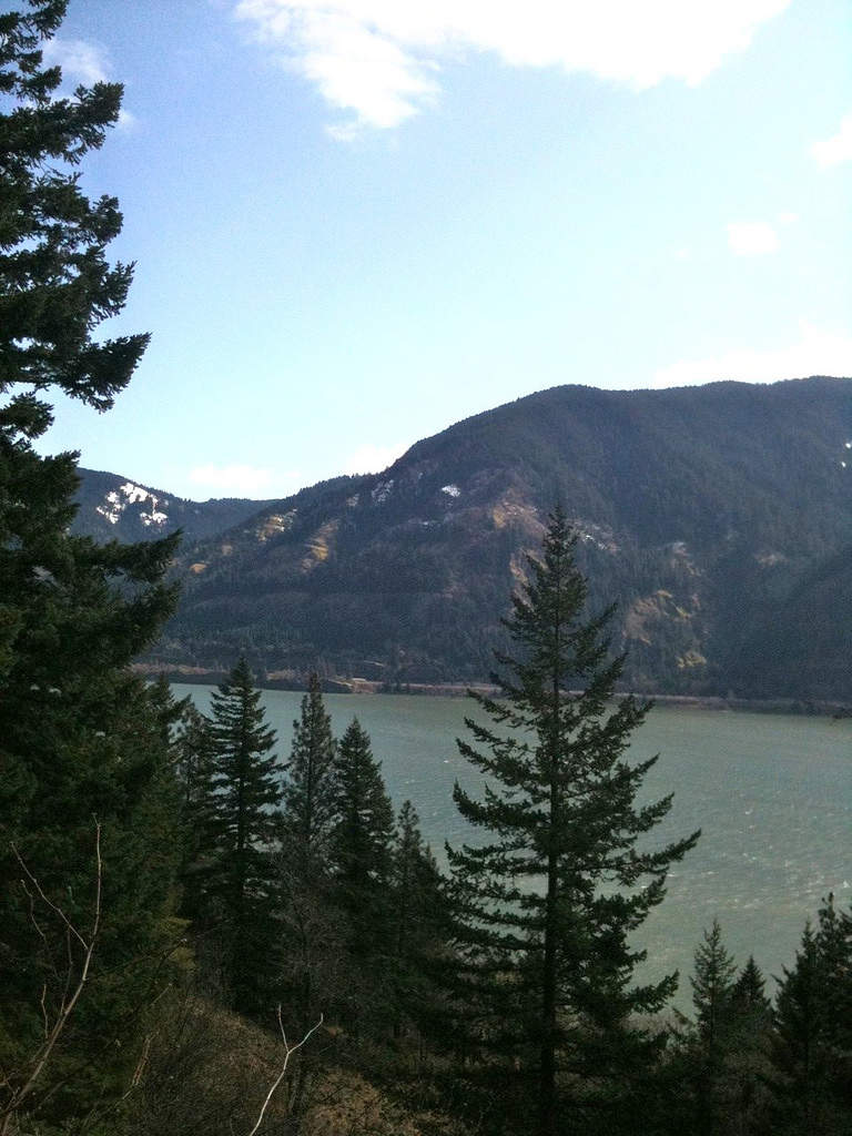
March 22, 2011

.jpg)
Dog Mountain
6 miles of hiking • 2500' elevation gain •
Beautiful sunny day, felt good hiking but stopped at Puppy Point due to wind and exposed traverse across snow before summit.
March 6, 2011

Greenleaf Peak
4 miles of hiking • 1750' elevation gain •
Didn't make it to the cliffs, returned the way I came up due to hip-deep snow at the summit. Turnoff at the ridge tricky to find, had to bushwhack up to the ridge and saw the trail only on the return trip.
February 18, 2011

Hamilton Mountain
7.5 miles of hiking • 2000' elevation gain •
Light dusting of snow on open ridge between summit and turnaround point.
January 30, 2011

Nesmith Point
10 miles of hiking • 3750' elevation gain •
Rainy day, steep and difficult going. Felt stronger towards the top. No views at top, and nowhere to sit for lunch. Maybe better in the summer?
January 26, 2011

Mirror Lake
3 miles of hiking • 500' elevation gain •
My first real winter snow hike! Hah hah, okay, so this was really easy, but aside from mountain snowfields on sunny hot days, I've never hiked in the snow before. It was fantastic and I'm super excited to do more winter hiking.
January 1, 2011

.jpg)