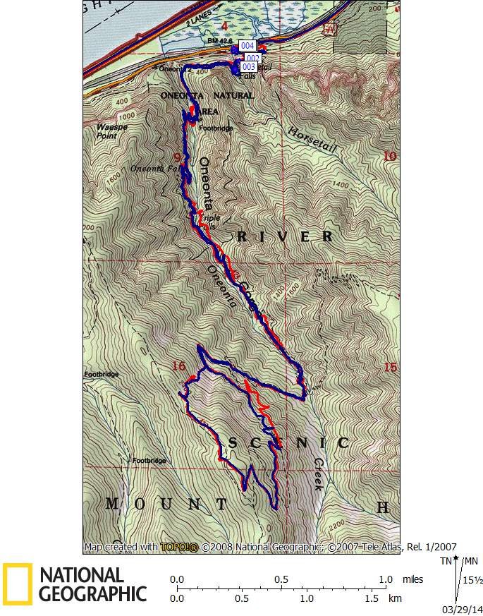
10 miles of hiking • 3250' elevation gain •
Tested new 64s Garmin GPS+GLONASS against a 62s GPS in a canyon - went up Oneonta Tr to Franklin Ridge starting from Horsetail Falls. Got rained on, lots. Results inconclusive.


10 miles of hiking • 3250' elevation gain •
Tested new 64s Garmin GPS+GLONASS against a 62s GPS in a canyon - went up Oneonta Tr to Franklin Ridge starting from Horsetail Falls. Got rained on, lots. Results inconclusive.

Allison
March 29, 2014
Better than mine. My tracks always end up in the Columbia River in this canyon. :)