

2011 Trips


December 10 – December 11, 2011

Clear Lake Butte Snowshoe
8 miles of hiking • 1250' elevation gain •
Did Clear Lake Butte from Skyline snow park. 2 miles of the hike were off trail snowshoe up the north side of the butte. Great views on top
November 26, 2011

Frog Lake Snowshoe
3.5 miles of hiking • 500' elevation gain •
First snowshoe of the season. Did a short goof around hike around Frog Lake, and a little bit of the PCT. Snow was great, 30" of fresh fluffy powder.
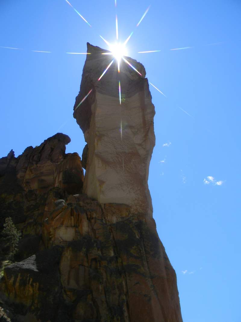
November 19, 2011

Smith Rock
3 miles of hiking • 750' elevation gain •
A cold day at Smith Rock with friends. After the hike it was off to Baldy's in Bend for some BBQ...
November 5, 2011

High Ridge LOT
3 miles of hiking • 1000' elevation gain •
I enjoy the old lookout towers, since I was in the area I could'nt resist. It had recently snowed, and was extremely foggy and I could barely see the top of the tower.
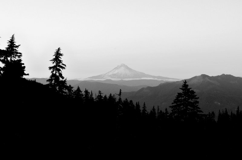
October 6, 2011

Huckelberry Mountain
3.5 miles of hiking • 1000' elevation gain •
Was in the area needed to go for a hike. Had been out here many years ago, was nice to come back and visit.
September 29, 2011

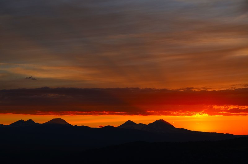
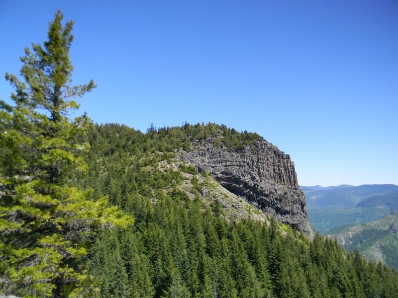
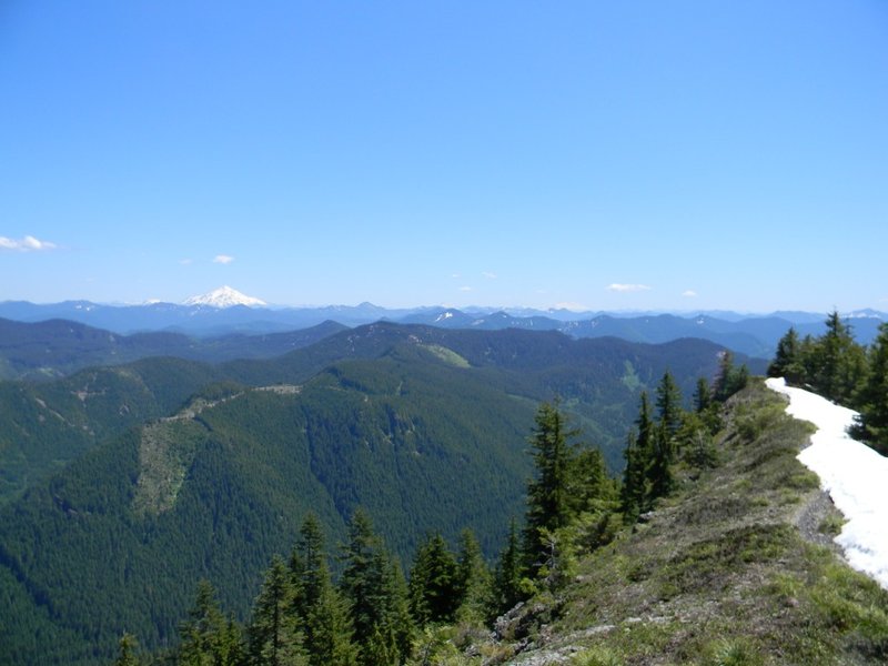
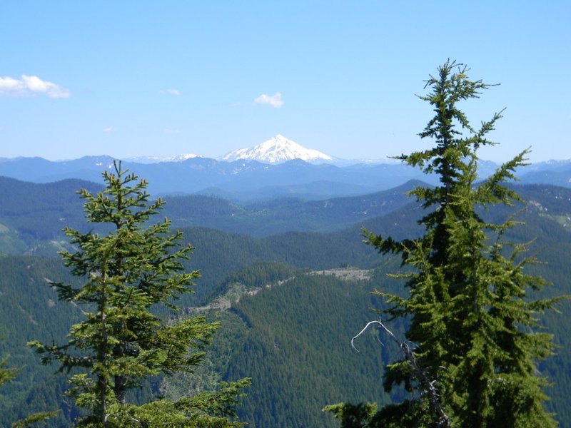
Devil's Peak, Wildcat, Squaw Mountain
10 miles of hiking • 2250' elevation gain •
Spent the day visiting old fire lookouts or lookout sites.
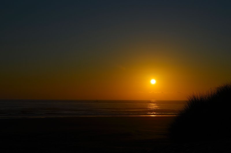
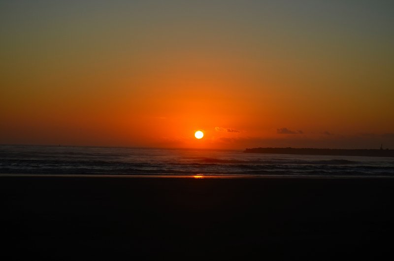
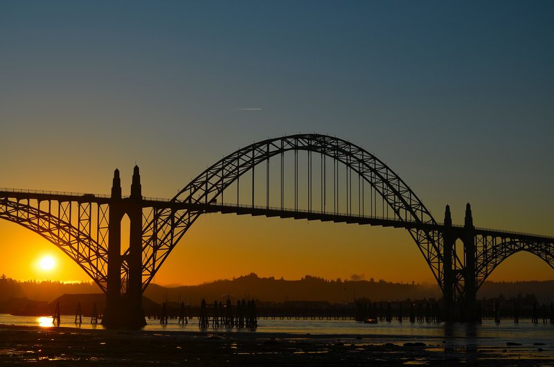
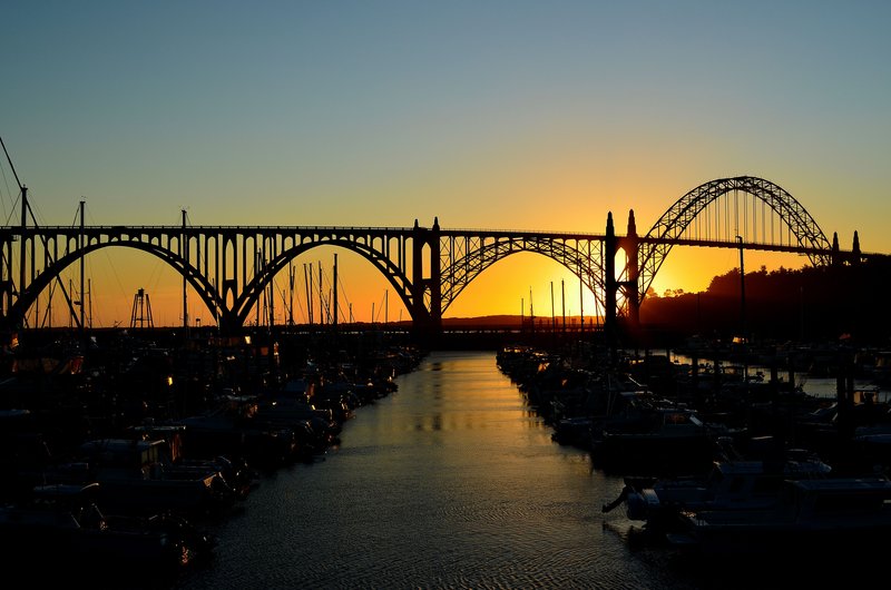
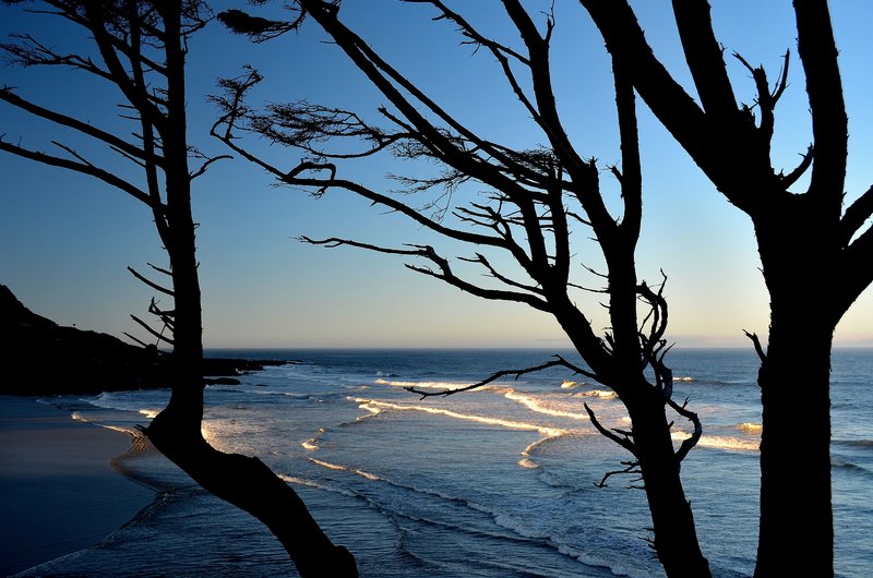
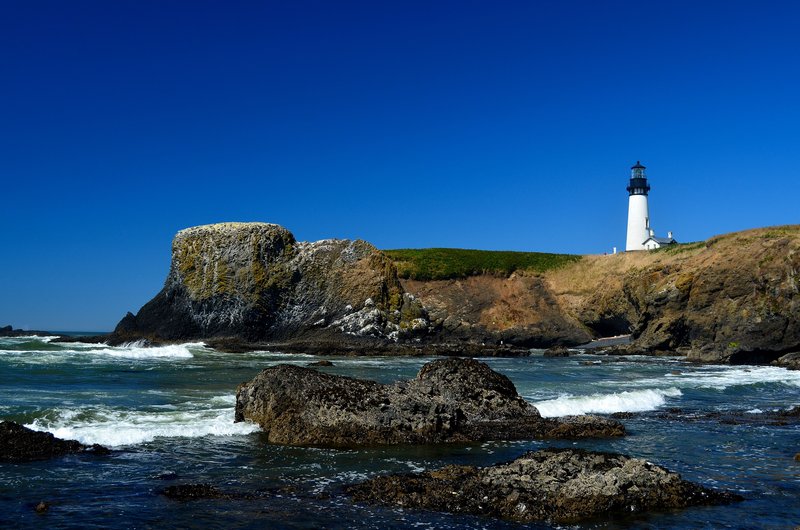
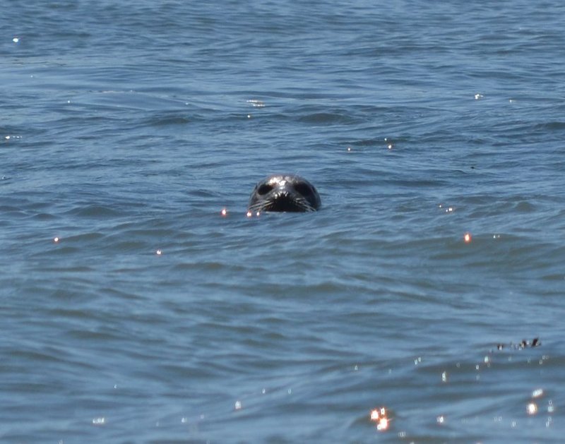
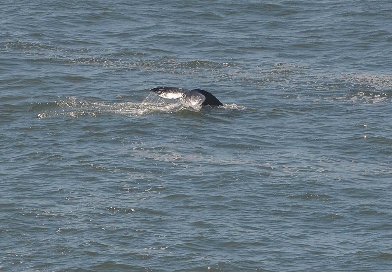
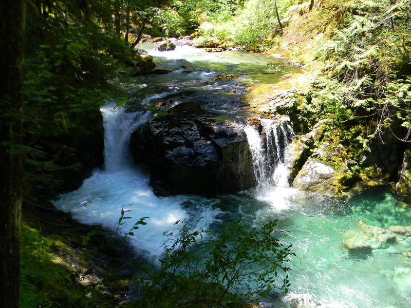
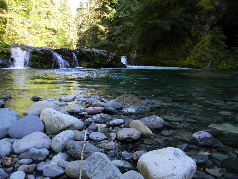
September 24, 2011
 2
2
6 days on the Central Oregon coast
19.5 miles of hiking • 1500' elevation gain •
Spent 6 days with the family based in Newport. Made several jaunts from base, mostly in the morning when some were sleeping in. South Beach, Cape Perpetua, Yaquina Head, Yaquina Bay, Devils Punchbowl, Otter Crest, Cape Fowlweather.
September 4, 2011


Green Lakes
15.5 miles of hiking • 1500' elevation gain • 1 night
Met up with friends Saturday morning at the company ranch. The 6 of us, 3 dads and our 3 boys headed in to Green Lakes.. Awesome!! A few snow drifts lingering, but for the most part the trail is clear. Had great weather and enjoyed the full moon. Did a few short explorations from camp including one around the lake. To get back to camp we waded accross the stream that comes out of Middle Green lake, Brrrrr'
There were millions if not billions of mosquitos, but either the bug spray or the wind kept them at bay...Whew...
Great Hike!!
August 13 – August 14, 2011

Bend
3 miles of hiking • 0' elevation gain •
I was in Bend for a few days on business, waiting for friends to meet up with, we are going into Green Lakes in the morning. I did Tumalo Falls last night with a friend, but he had went back home, so I was bored... Found a little piece of BLM just outside of town and went for a quick hike. I wanted to make it back to Pilot Butte for the sunset so I had to make it quick...
August 12, 2011

Beth Lake
6 miles of hiking • 1500' elevation gain •
Crazy off trail adventure... We left the house at 4pm, bombed up to the 550 trailhead by 6pm. Took the 550 to the Pansy Lake cutoff trail and bailed over the edge. We thought for sure we would cut some kind of trail getting to this lake, but not so... It was so steep there were times I could hear the buckles on my pack rubbing rocks behind me.Spent about 15 minutes at the lake and headed back somewhat the way we came down. Back at the truck by 10pm.
August 6, 2011

Ape Cave Upper
3 miles of hiking • 500' elevation gain •
My youngest son missed out on the spelunking last weekend, so we went back again today to do the upper portion of the caves. It was a balmy 40 degrees underground and 85 outside..
July 30, 2011

Ape Cave Lower
1.5 miles of hiking • 250' elevation gain •
Spent this hot day underground with family and friends.. Had fun spelunking...
July 23, 2011

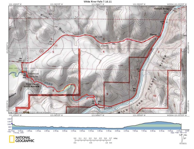
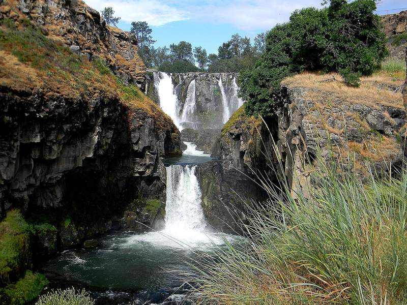
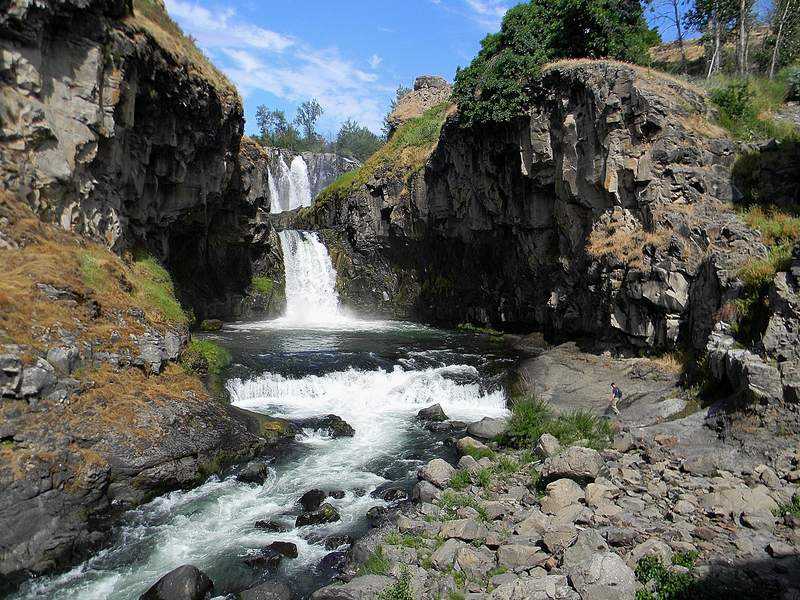
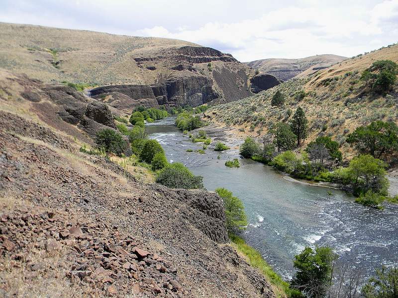
White River Falls to Sherar Falls
9.5 miles of hiking • 750' elevation gain •
A strange loop hike, but we had a blast... First we checked out White River Falls, amazing... Then down the canyon we went, visited the old power station on the way by. Then it was on and off trail all the way to the Dechutes, even crossed White River once on our way through. Had nice weather and thunder storms, great day...
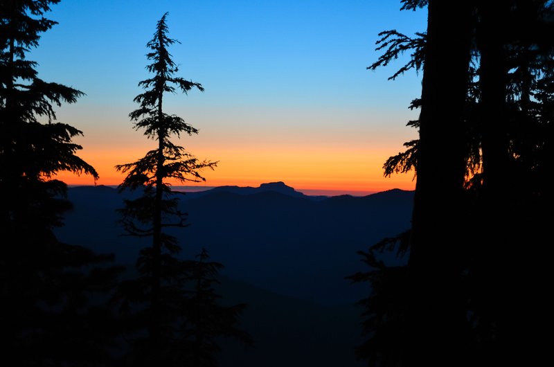
July 16, 2011

Hawk Mountain
2 miles of hiking • 250' elevation gain •
Did a late evening hike with hopes of making it to the lookout. We got about half way in and started hitting some pretty good snow drifts back in the tree cover. Probably could've made it in, but she (the better half) would have never forgiven me if we had kept going... Still an enjoyable evening..
July 3, 2011

Table Rock Wilderness
8 miles of hiking • 3000' elevation gain •
Great hike up to Table Rock today just me and the dog.. Quite a few other hikers heading up today, this hike has gotten quite popular.
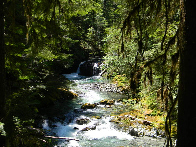
July 2, 2011


Opal Creek
12.5 miles of hiking • 1000' elevation gain •
Spent the day exploring the opal creek area. Way cool!
June 25, 2011

Smith Rock State Park
5.5 miles of hiking • 1000' elevation gain •
Spent Fathers Day with the family hiking in the park. Good times....
June 19, 2011

Cazadero Trail
6 miles of hiking • 0' elevation gain •
I did a quick in and out on the old Cazadero trail, starting in Boring. Fun hike for an after work fix..
June 17, 2011

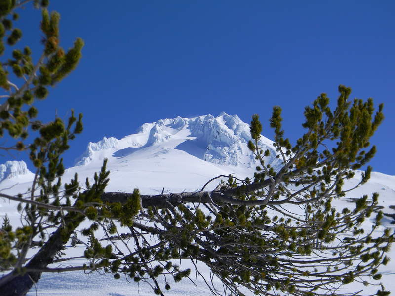
Timberline snowshoe
2.5 miles of hiking • 750' elevation gain •
Spent the morning snowshoeing around Timberline. Great weather, but a little windy. It was worth putting up with the wind though.
June 3, 2011

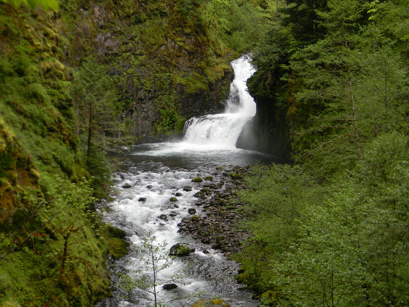
Eagle Creek
9.5 miles of hiking • 750' elevation gain •
Had a great day of waterfall viewing with the better half...
May 28, 2011

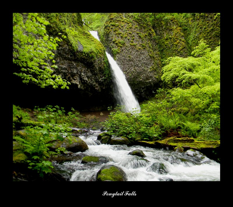
Gorge trail 400 Ponytail Falls modified loop
6.5 miles of hiking • 750' elevation gain •
Hiked from Oneonta to Ponytail Falls and out to the 400 trailhead at the east end, returned though Ainsworth area an the historic highway.
May 27, 2011

Pup Creek Falls
8 miles of hiking • 750' elevation gain •
Late evening hike to Pup Creek Falls, most of the way out by flashlight.
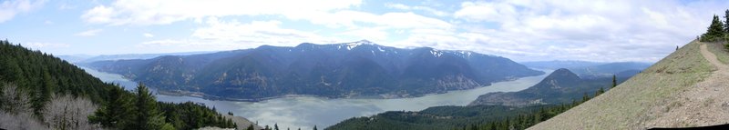
May 1, 2011

Dog Mountain
7.5 miles of hiking • 3000' elevation gain •
First time up Dog Mountain, but will not be the last..
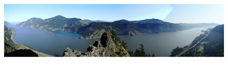
April 30, 2011

Mitchell Point
2.5 miles of hiking • 1250' elevation gain •
Only had a short amout of time today, this one worked perfectly. Awesome weather, almost no wind at the top.
April 23, 2011

Drift Creek Falls, Yaquena Head, Cape Fowlweather
7 miles of hiking • 1250' elevation gain •
Saturday we went and checked out Drift Creek Falls and the way cool suspension bridge, did the main trail including the north loop. Then went to Depot Bay for lunch, and then hit some coastal trails around Yaquena Head and Cape Fowlweather.
April 15, 2011

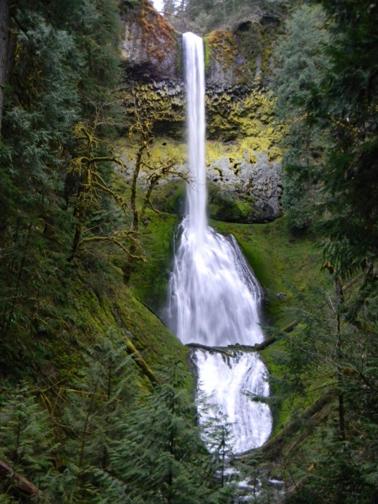
Silver Falls State Park
9.5 miles of hiking • 1750' elevation gain •
Enjoyed the park and all it's waterfalls today.
March 25, 2011

Indian Point and beyond via Gorton
9 miles of hiking • 3000' elevation gain •
Just me and the dog today. Hit the first snow on the trail at around 2700' and after Indian point it was nasty slushy between 1-2 feet deep in spots..
March 18, 2011

Mt. Talbert, Portland
2.5 miles of hiking • 750' elevation gain •
Did a quick burn over and around Talbert on the way home from work. Surprisingly as hard as it rained today, it didn't rain at all on my hike.
March 9, 2011

Tumalo Falls- Bend, Oregon
5.5 miles of hiking • 500' elevation gain •
Great little snowshoe to a cool falls. Ok I'm caught up for the year...
March 4, 2011

Bridal Viel Creek, Elowah & Upper McCord Falls, Latourell Falls- Columbia River Gorge, Oregon
5.5 miles of hiking • 1250' elevation gain •
Spent the day doing some short frozen waterfall hikes. Amazing day!
February 25, 2011

Table Mountain- Wenatchee National Forest, Washington
15.5 miles of hiking • 2250' elevation gain • 1 night
Spent the night at an awesome a-frame cabin, wish we could have got another night. Amazing country!!
February 17 – February 18, 2011

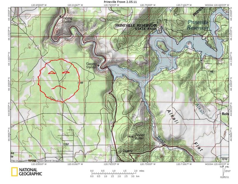
Prineville, Oregon
10 miles of hiking • 250' elevation gain •
Spent the day on a goofy geocaching mission. 10 miles of hiking in loose sand..
February 4, 2011

Catherine Creek- Bingen, Washington
5 miles of hiking • 1250' elevation gain •
Spent another day exploring Catherine Creek, beautiful area..
January 28, 2011

Stahlman Point- Idanah, Oregon
5.5 miles of hiking • 1500' elevation gain •
Started out a foggy day all the way up the trail, but when we summited Stahlman point we were pleasantly surprised with incredible views...
January 21, 2011

Catherine Creek-Bingen, Washington
8 miles of hiking • 2000' elevation gain •
Spent the day exploring the Catherine Creek area.
January 14, 2011

Sandy River Delta- Troutdale, Oregon
3 miles of hiking • 0' elevation gain •
After a quick meeting at the office this morning, I met up with a couple of friends for a short tour of the Sandy River Delta. This was the warm up hike for the day.
January 7, 2011

Wahkeena- Columbia River Gorge
7 miles of hiking • 3000' elevation gain •
2nd hike for the day after a quick warm up at the Sandy River Delta, I had some unfinished business up the Wahkeena area.
January 7, 2011

Forest Park- Portland, Oregon
9.5 miles of hiking • 2000' elevation gain •
Was a fun day of hiking/ geocaching with friends. The weather was a little cloudy, but at least wasn't wet.
January 1, 2011

View trips from: 2012