

2011 Trips


Lake Stuart and Colchuck Lake
18 miles of hiking • 3500' elevation gain • 2 nights
Camped out with a big group of friends at Lake Stuart for 2 nights. Day hiked to Colchuck Lake, swam around and caught/cooked up a bunch of delicious trout! Great weekend!

September 3 – September 5, 2011

 1
1
Opal Creek Wilderness
8 miles of hiking • 1750' elevation gain • 1 night
Awesomeness! Had a great trip: swimming, fishing and hiking. Also, the place is covered in wild blueberries. We came out with just enough to make a delicious blueberry pie!
August 13 – August 14, 2011
 1
1
Burnt Lake
7 miles of hiking • 1750' elevation gain •
The snow is gone. The water is cool, but eminently swimmable! The views, amazing!
August 2, 2011

Grass Lake + Day hiking and bouldering in the lake basin
8 miles of hiking • 1250' elevation gain • 2 nights
Spent a couple nights camping out at Grass Lake. We took the afternoon to climb up towards the Cracked Cragg, but snow stopped us short. It was an amazing trip, and I can't wait to go back in a year with normal snow-level.
July 2 – July 4, 2011

June 30, 2011


Gillette Lake Hike
6 miles of hiking • 750' elevation gain • 1 night
Nice day for a nice hike. Even better day for eating delicious lake trout and sleeping under the stars!
June 17 – June 18, 2011

Dog Mountain
6.5 miles of hiking • 2500' elevation gain •
Saw the TR for this hike on portlandhikers, and had to go check out the wildflowers. They are immaculate, but I left my camera in the car. We didn't quite make it to the summit because we had to get back to town. No worries there - I've been to the top, just wanted to see the flowers in person.
June 14, 2011

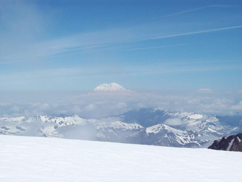
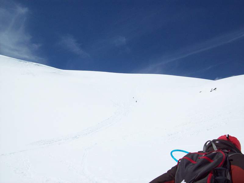
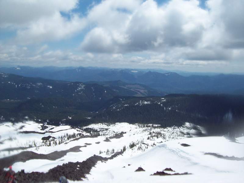
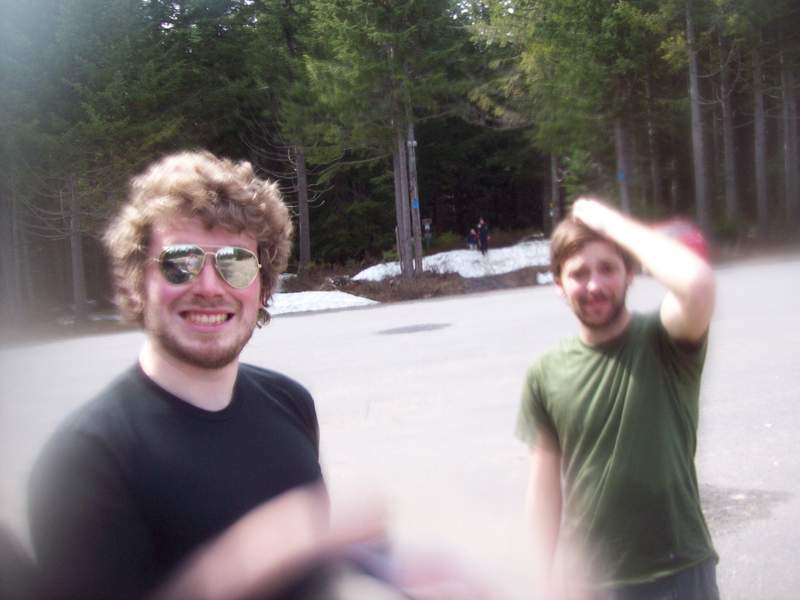
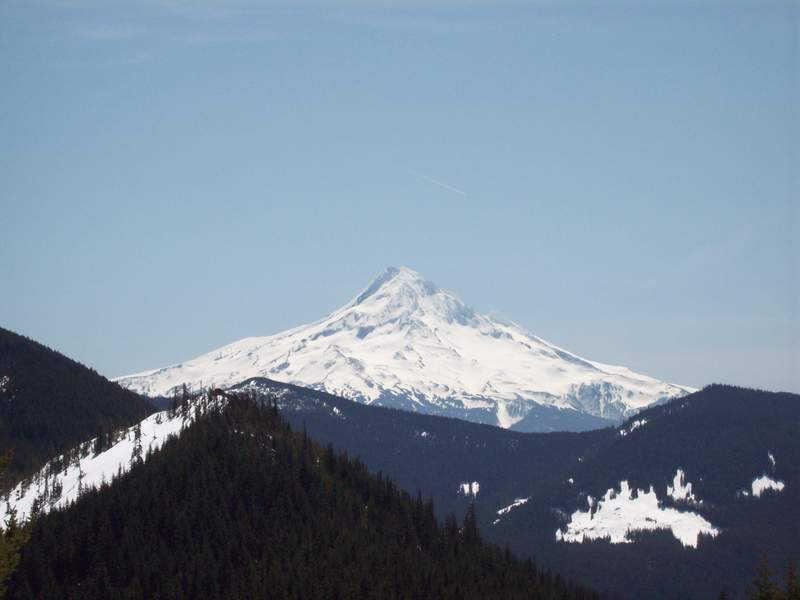
Mount Saint Helens
7 miles of hiking • 5500' elevation gain •
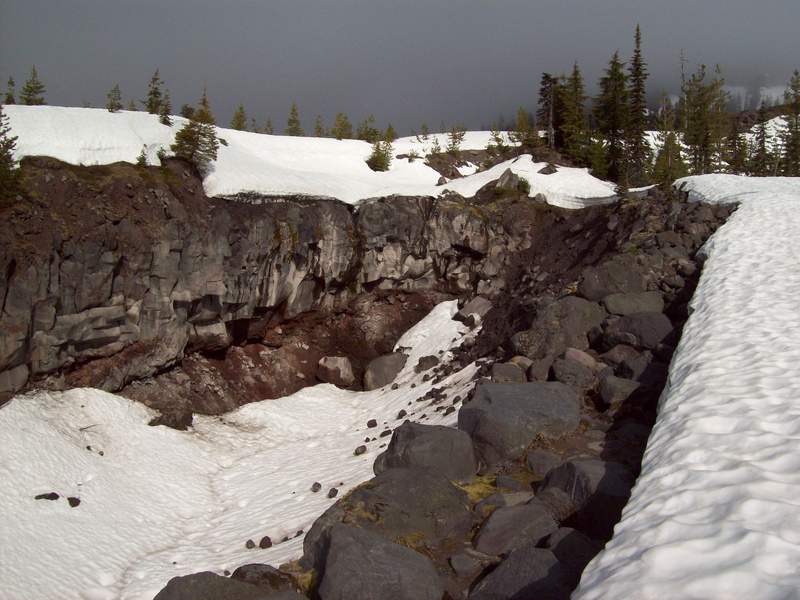
Only a very good reason is going to get me out of bed by 4:00 AM. Promise of a sunny, 53 degree day on MSH fits that bill. Kyle, Jon, Kevin and I set out from the trailhead just after 7. My Salomon Comet 3D GTXs, Kahtoola Microspikes and Outdoor Research gaiters were more than adequate to keep me stable and dry the whole way up. It was really warm, and by the time we had reached the summit, the snow was getting very wet. Next time, I think we'll pick up our passes the night before, and head out earlier (unless MSHI does the smart thing and begins allowing you to print your passes at home). After a break to relax and eat tuna on top, I donned my waterproof pants, queued an Iron and Wine playlist and headed down. The warm, wet snow really slowed down the glissade. So, we looked to some of the less traveled, steeper bowls for a little more adventure. Apparently, this made some other group on the mountain uncomfortable. We felt the risks were minimal, and if you've seen the video Kyle produced, you'll know that the fun was maximal! Overall, the day was a complete blast! Despite going the longer, steeper route this year, I felt much better by the end of the day vs last year's summit-ing. And, the Ninkasi Total Domination was the perfect treat to have waiting back at the car.
June 8, 2011

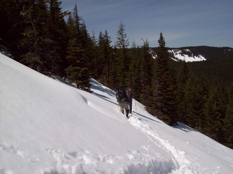
HERMAN CREEK TRAIL TO ALMOST TOMLIKE MOUNTAIN
18 miles of hiking • 4750' elevation gain • 1 night
It was beautiful out, so we hoped to spend the day by a just-melted Wahtum Lake. Unfortunately, Wahtum is still very much covered in snow, and there was enough snow around to discourage Kyle, Jon and I from completing that part of the trip. We did get to do a little glissade on the way down from the ridge to Tomlike; that was fun. It was a gorgeous day, and we capped it with a trip to Double Mountain before heading back to PDX. I'm guessing that Wahtum needs a few more weeks yet.
June 2 – June 3, 2011

Oak Spring Area - Moundtain Summit
9 miles of hiking • 2500' elevation gain •
This was a beautiful day, and the wildflowers are certainly in bloom. Unfortunately, the trail is very unclear, so we ended up kind of making our own, treading lightly and around as many of the flowers as possible. Climbed up to the top of the area, an un-named mountain to the East of Stacker Butte. We decided to name it Moundtain.
May 10, 2011

Eagle Creek to 7.5 Mile Camp
16 miles of hiking • 1500' elevation gain • 1 night
The forecast must have kept most people from venturing out this weekend. We only saw a handful of people on the hike out to 7.5 Mile Camp. While it was supposed to rain the whole time, we never saw more than some spats of rain until about dinner time. The rain didn't let up until morning though, so no hope of a campfire. It was beautiful out on Sunday, hardly any sprinkles of rain, but with all that fell over night, the falls were gushing like crazy. The sun even came out a few times, making for some great visions of vibrant wildflowers.
May 7 – May 8, 2011

Chinidere Attempt from Herman Creek TH via PCT
20.5 miles of hiking • 6000' elevation gain •
Kyle Meyer has a good one of this hike. It was beautiful out, but that just made the snow impassable by the afternoon. Too bad. We'll be back.
May 4, 2011

April 21 – April 22, 2011

Cape Horn Day Hike
9 miles of hiking • 2000' elevation gain •
I've done versions of this hike many times, and I'll say it's been improving. The portlandhikers.org page is now inaccurate, the signage is fairly good on this hike now. The only confusion from today was due to the construction zone plopped down right by where the trail crosses Hwy 14. We turned around at this point instead of venturing down because it's just a little ways beyond that where you have to turn around anyway, for the peregrine falcon nesting grounds. Overall, it was a pretty good day with good sun, and a budding abundance of wildflower growth (really good trillium diversity).
April 20, 2011

April 15 – April 16, 2011

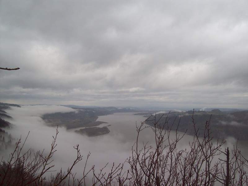
Angel's Rest & Wahkeena Springs Trail
6 miles of hiking • 2000' elevation gain •
On a rainy Thursday afternoon, we went for a quick afternoon hike. The clouds made for a great layered view of the Gorge today. Contrary to Kyle's TR, I believe this hike was just shy of 2,000 feet elevation gain.
April 13, 2011

Weldon Wagon Trail
7 miles of hiking • 1250' elevation gain •
It was a beautiful day on the trail. Dry, and just enough clouds in the sky to make leaving the sunglasses in the car a fine idea. The hike is fairly easy, and set on a nice wide trail. There were a handful of cars at the trailhead, but we only passed a single group of two the whole time out and back. While the hike doesn't have the waterfalls and evergreens that many Gorge hikes do, the Oregon White Oaks are both wretched and beautiful, providing plenty of eye candy. There were some small wildflowers, but I'm told that in a few weeks it should really be bursting. TICK ALERT! THIS HIKE IS COVERED IN TICKS! I had two on me when I got back. Check thoroughly after hiking.
April 8, 2011

Coyote Wall
9 miles of hiking • 2000' elevation gain •
It was a nice, sunny Sunday. Very crowded with the mountain bikers, and the wind was howling. Otherwise, it was great! Flowers are coming up, and it's close enough to Hood River that you can't finish this one and NOT stop by Double Mountain on the way home. Great day!
April 2, 2011

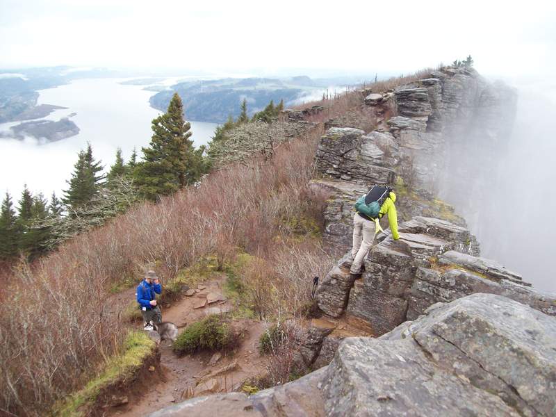
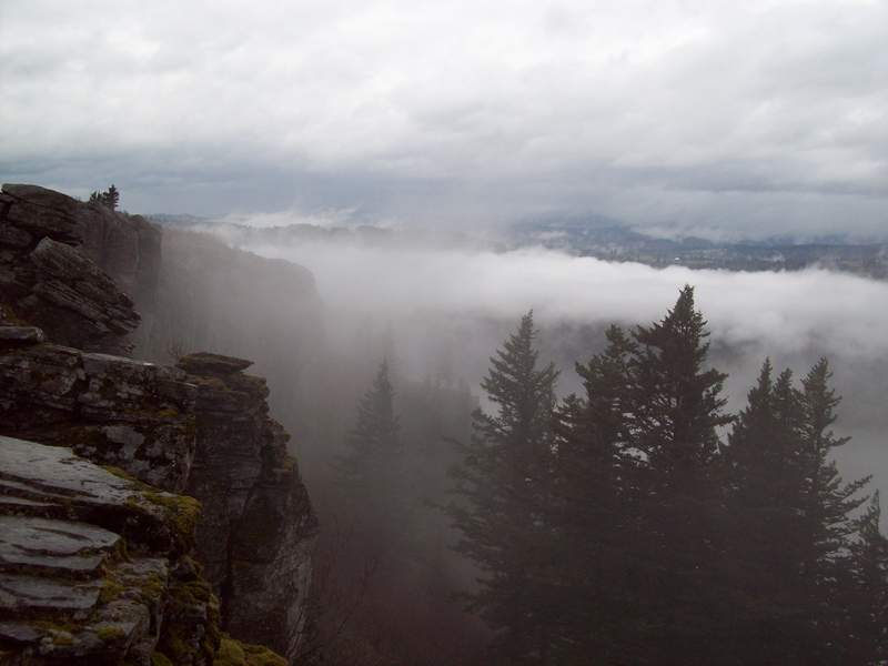
Elevator Shaft to Cougar Rock
6.5 miles of hiking • 1750' elevation gain •
Fun day, super intense hike/climb. There was a double rainbow, which was awesome! This hike will be better soon. The wet rocks on the boulder field really slowed us down.
March 25, 2011


March 20 – March 21, 2011

Deschutes River Hike
23 miles of hiking • 500' elevation gain • 1 night
Great weekend! We had to deal with a few clouds when we set out, but it was sunny and almost 60 degrees when we arrived at camp. There wasn't a ton of scenery changes or elevation gains, but it was very scenic and a great taste of spring weather!
March 12 – March 13, 2011


Multnomah Falls & Wahclella Falls Hike
4.5 miles of hiking • 750' elevation gain •
Was misinformed by my compatriots that Wahclella Falls was around 8 miles. So by the time we got back to the car, we decided to at least salvage a modest climb to the top of Multnomah Falls. Nice day.
February 11, 2011

View trips from: 2012