

2013 Trips

 1
1
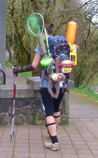
Tamanawas and Lamberson Spur attempt
10 miles of hiking • 2000' elevation gain •
Winter's happening.

December 16, 2013
 1
1
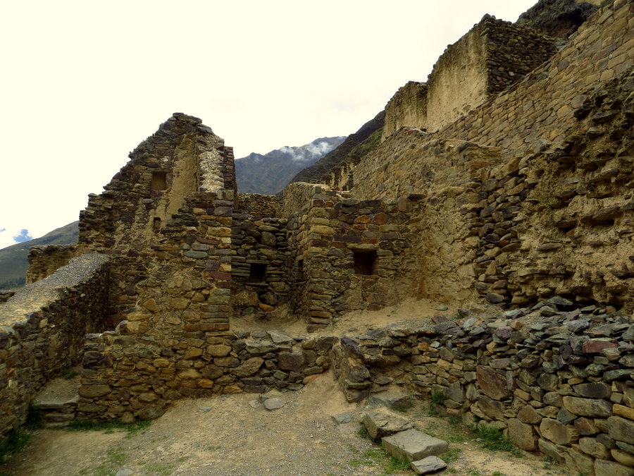
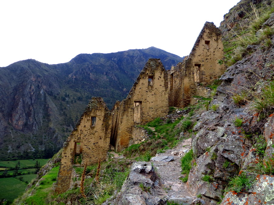
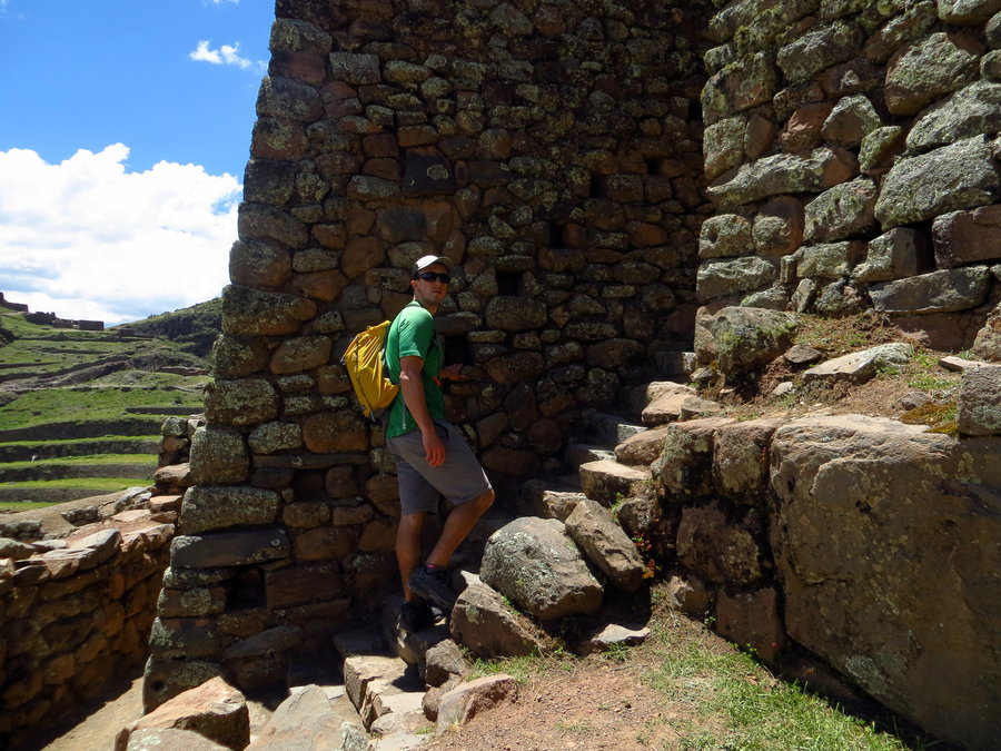
Ollantaytambo Ruins/Pinkuylluna Ruins - Ollanta, Cusco, Peru
5 miles of hiking • 3000' elevation gain •
Ruins hikes around Ollanta, Peru. Trail was sketchy on the Pinkuylluna trail, so I didn't go the whole way. But still a good lung workout, huffing at 10,600'.
December 8, 2013


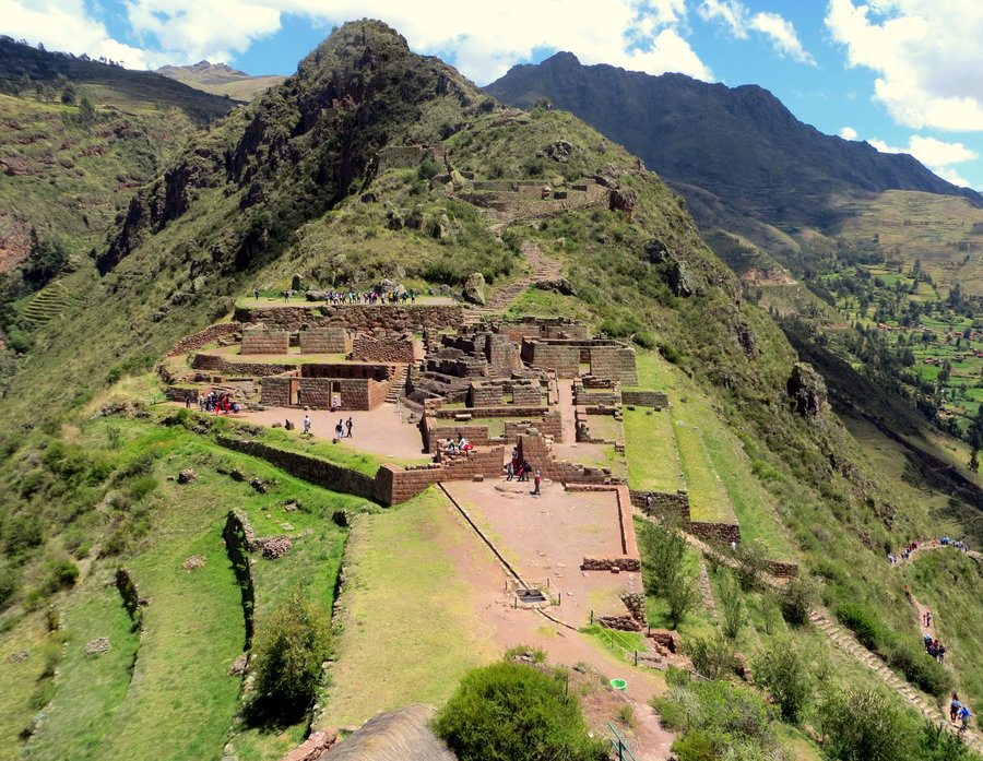
Pisaq Ruins - Pisac, Cusco, Peru
5 miles of hiking • 2000' elevation gain •
First hike of our trip in Peru - Pisaq ruins outside of Pisac, Peru.
November 28, 2013


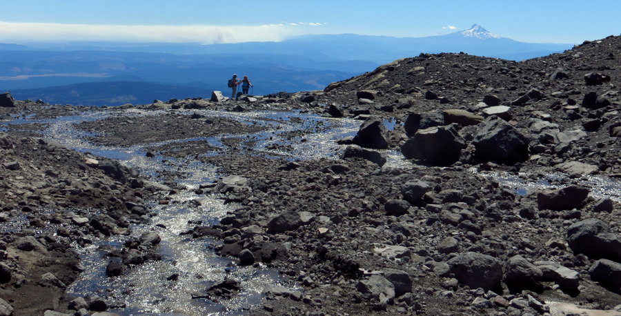
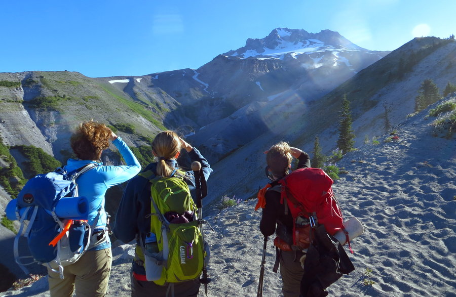
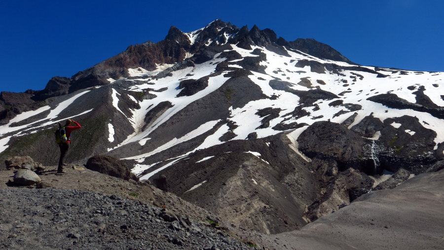
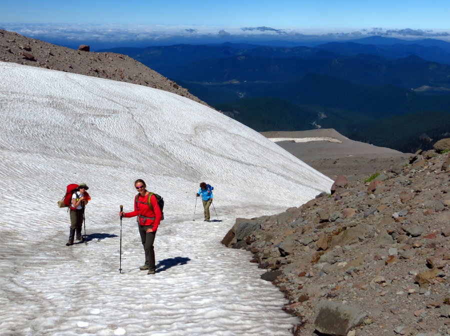
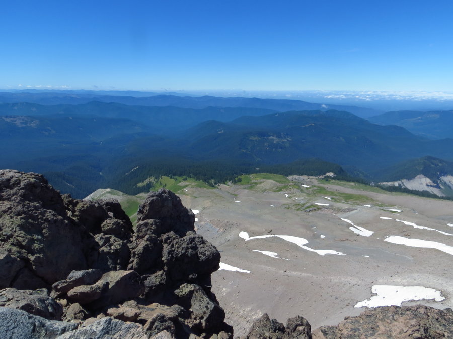
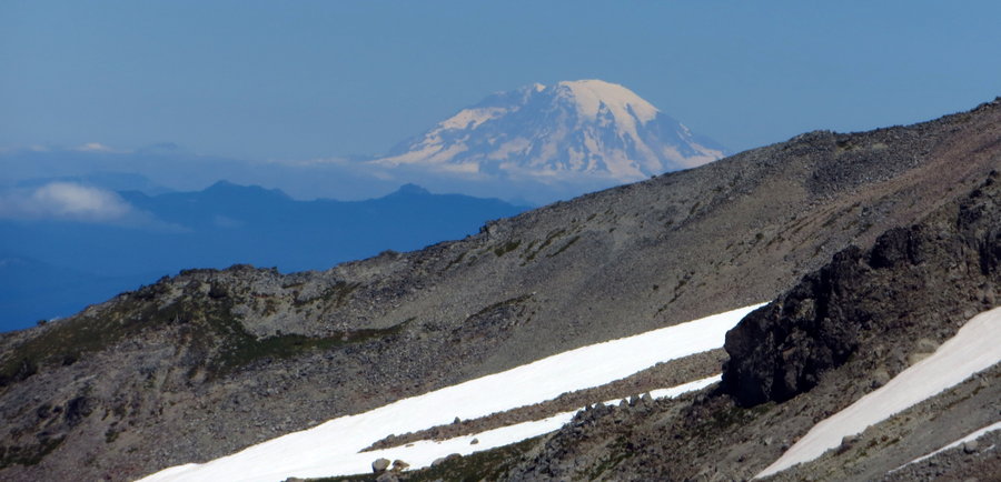
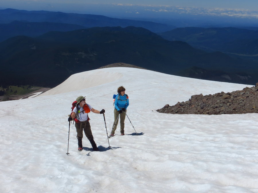
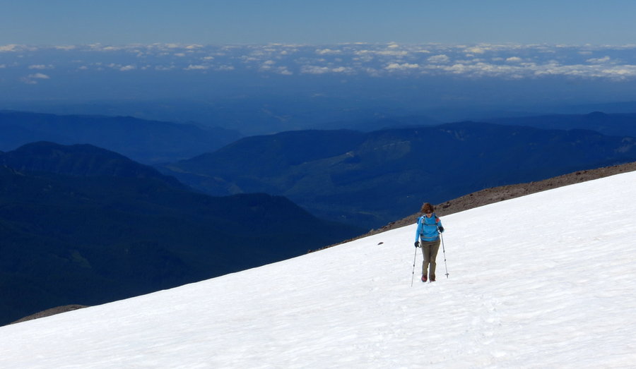
Mt Hood, South Side
7 miles of hiking • 5250' elevation gain •
First summit. Awesome weather. Great conditions. Whoop!
November 24, 2013
 2
2
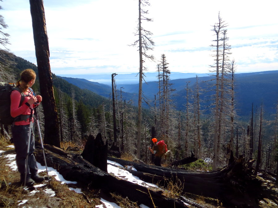
Gumjuwac Saddle to Lookout Mtn
10 miles of hiking • 3000' elevation gain •
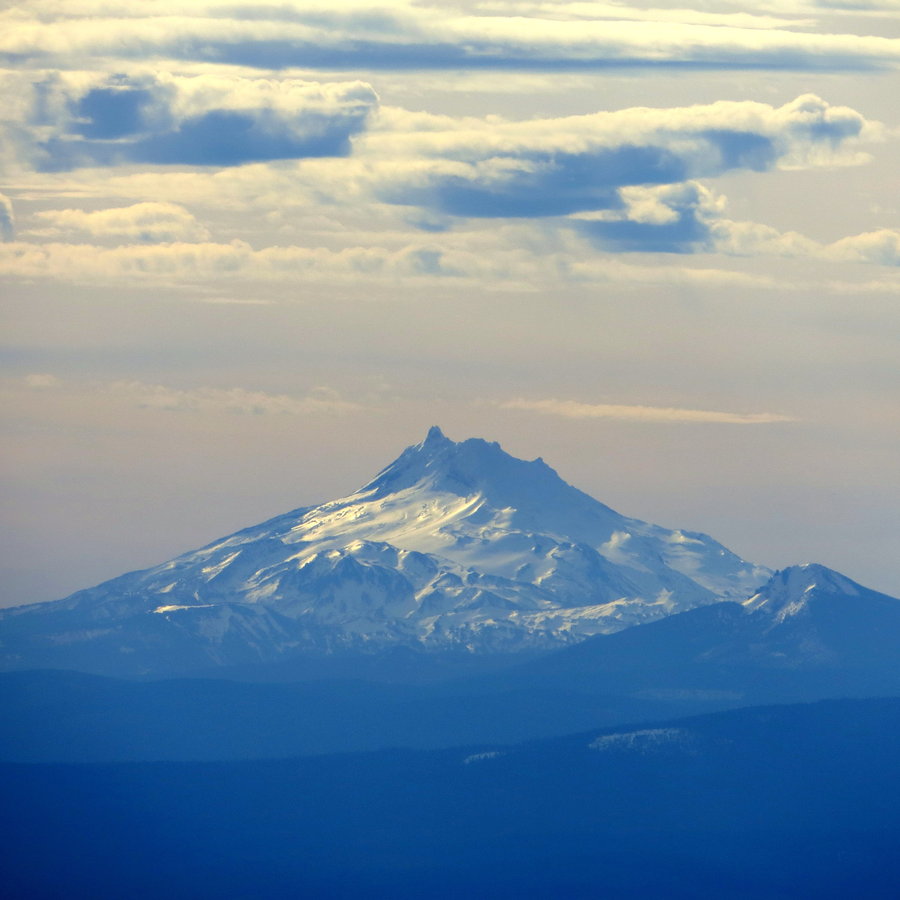
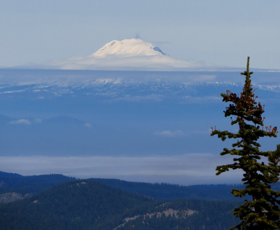
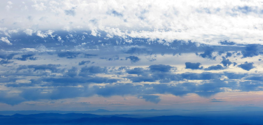
Lookout Mtn via Gumjuwac Saddle. Very nice trail and fantastic views all day. Very surprised by lack of snow, considering Hood has been dumped on this past week. Despite clouds and some haze, had view of peaks all around, from Rainier to Bachelor.
November 10, 2013


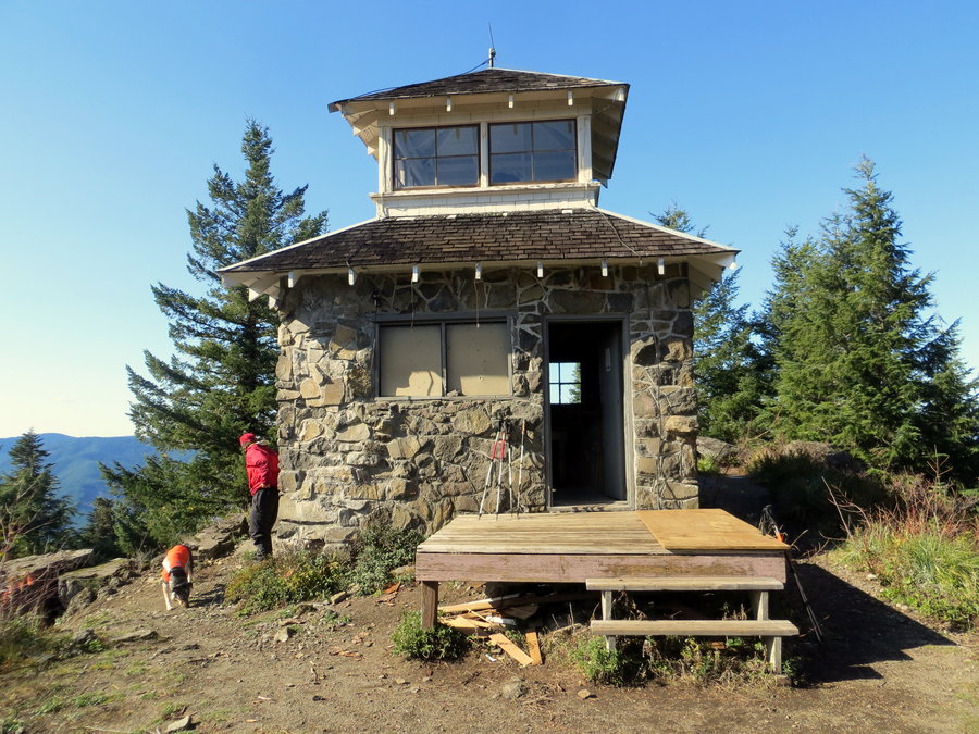
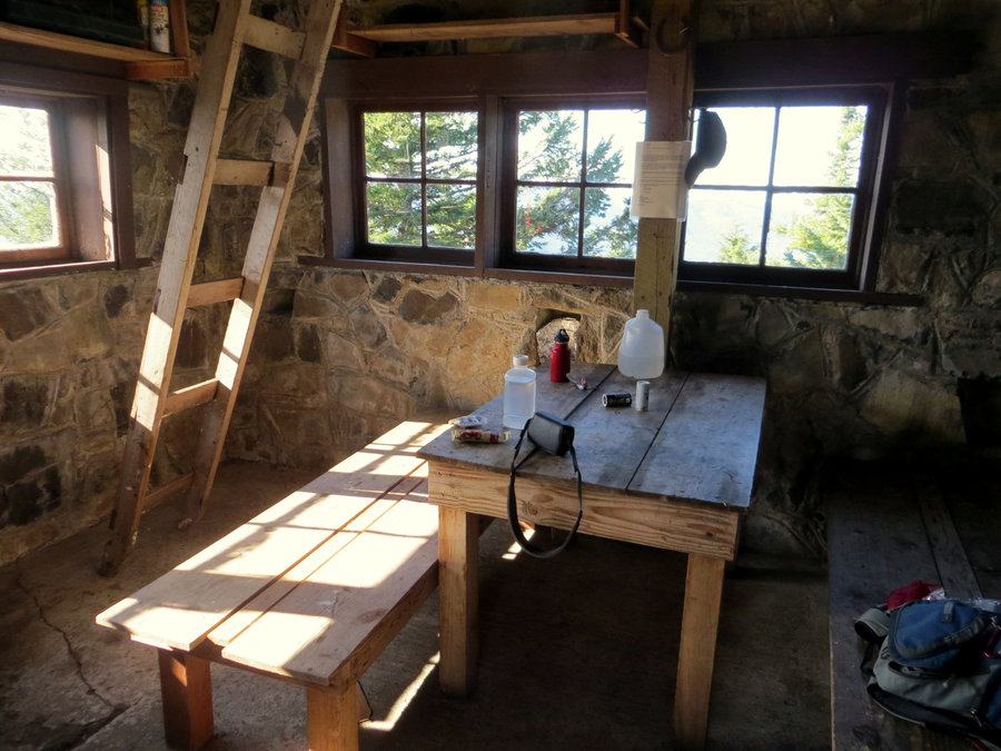
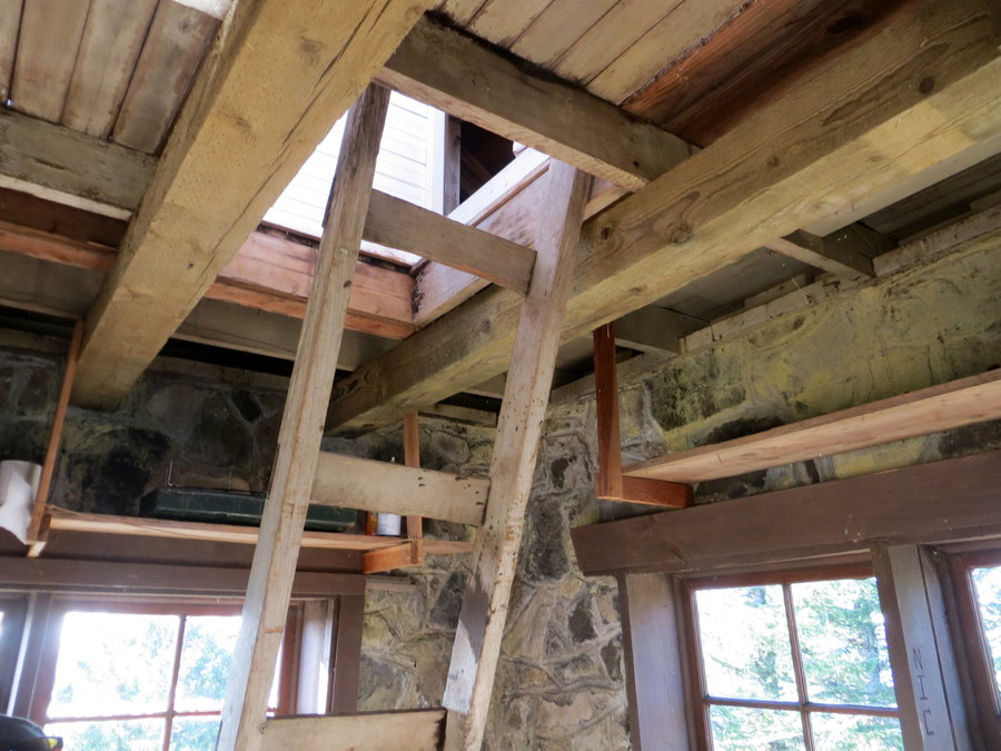
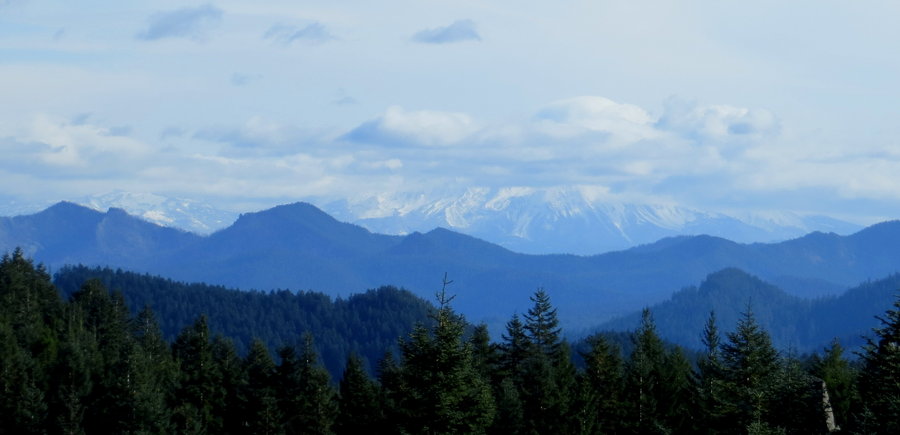
Pechuck Lookout & Rooster Rock
6.5 miles of hiking • 2000' elevation gain •
Took a stroll out in the sun and air with some girlfriends. Parked at Rooster Rock and made our way up to Pechuck Lookout. Pechuck is super cute and interesting, if bit on the small side and lacking mountain views. Nice trail, bonus that we were the only ones out there. After Pechuck we went back towards the first junction and took a side trip to Rooster Rock. Jefferson and Sisters hiding in the clouds, and Hood barely visible in the haze. Windy, brisk day, but nice to be out.
October 28, 2013


 2
2
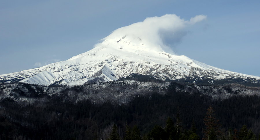
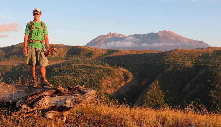
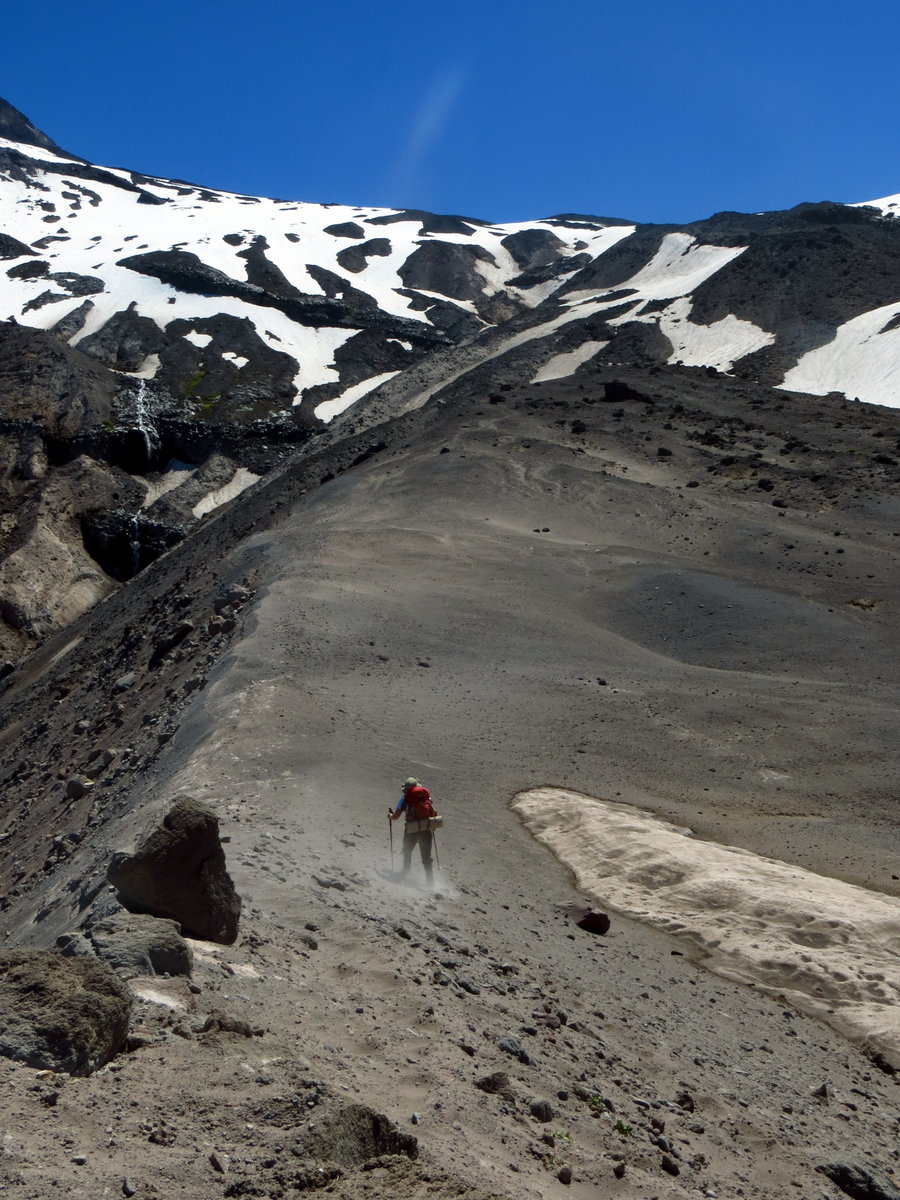
Mt St Helens via Monitor Ridge
9 miles of hiking • 4500' elevation gain •
First Helens summit - a great day! See Karl's TR on PH for more.
October 13, 2013
 2
2
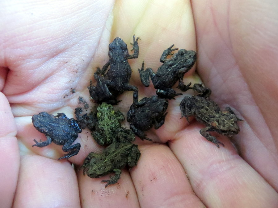
Mt Whittier
22 miles of hiking • 5500' elevation gain •
Set out early with Bosterson and a girlfriend of mine to make the 22mi loop from Coldwater Lake and around Whittier and back along the south Coldwater trail. Lovely day, abundance of happy things, including hundreds of newly hatched frogs, herd of elk, goats, ladybug swarms, ripe huckleberries, basking snakes, peaks all around, plenty of sun and breeze, and a gorgeous sunset. Kinda long day of 11hrs, but furthest day hike I've ever done, so beat one of my personal records.
September 8, 2013


 3
3
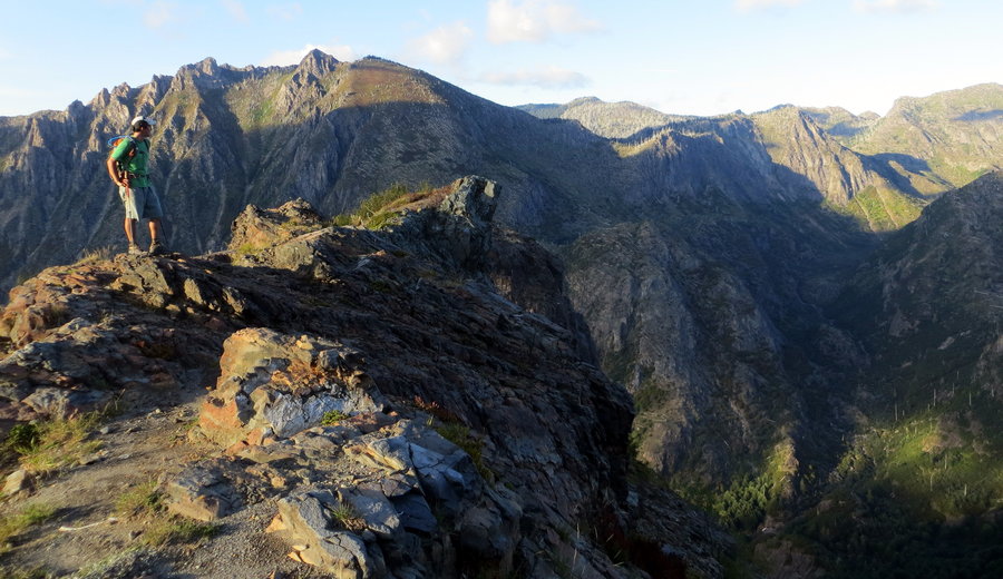
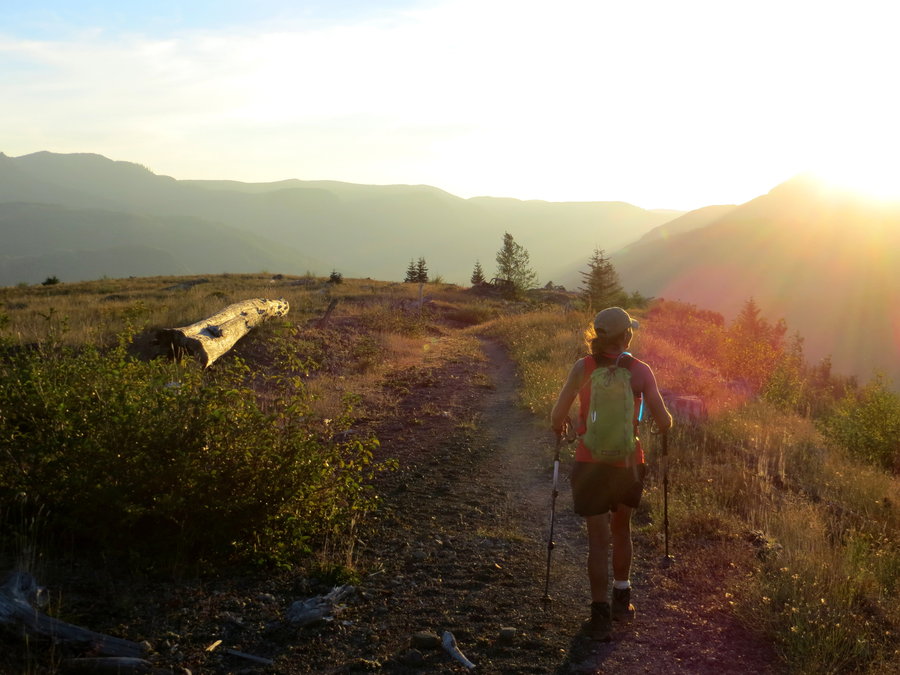
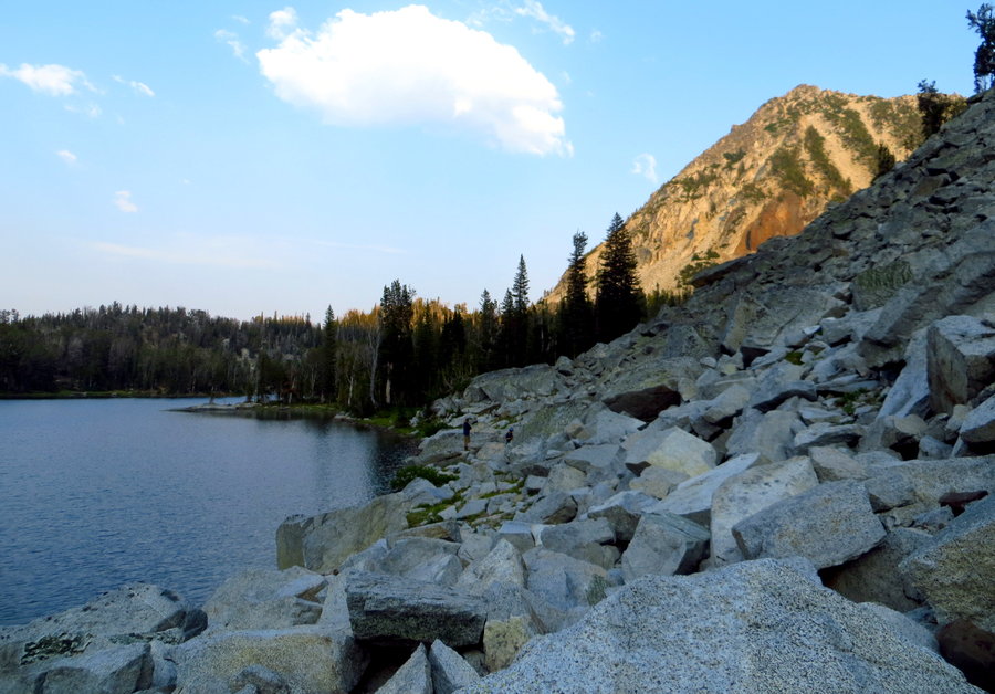
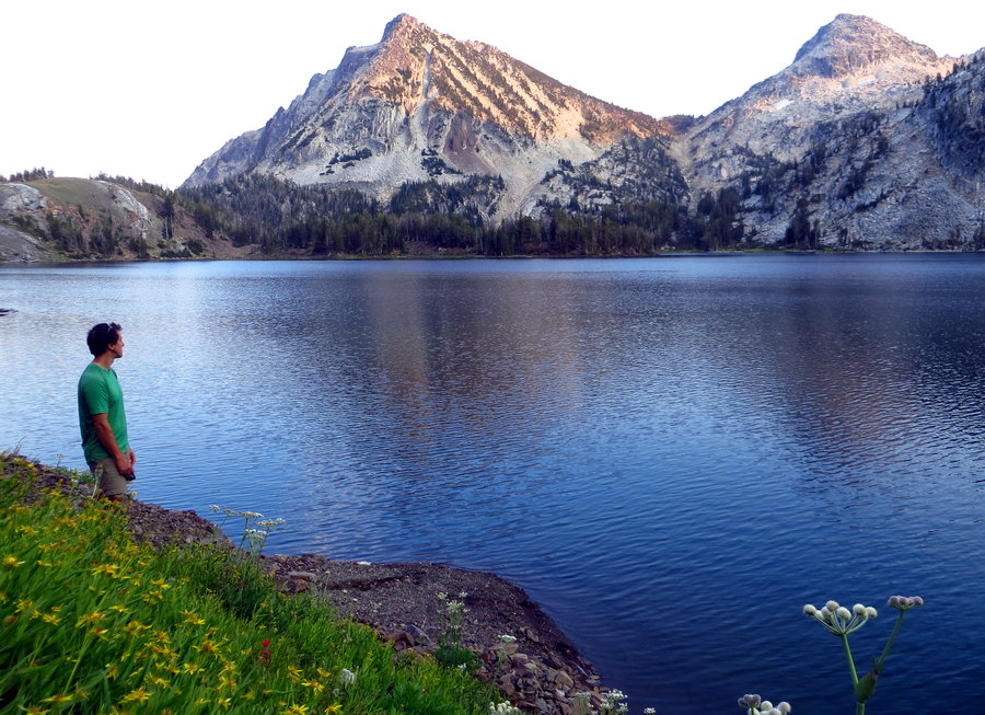
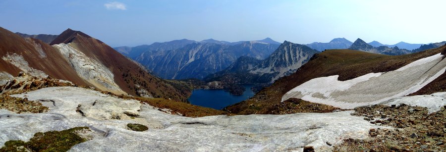
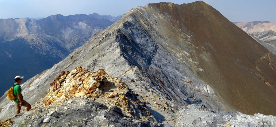
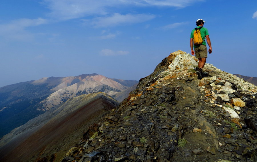
Eagle Cap: Ice Lake, Matterhorn, Sacajawea
22 miles of hiking • 7000' elevation gain • 2 nights
August 27 – August 29, 2013


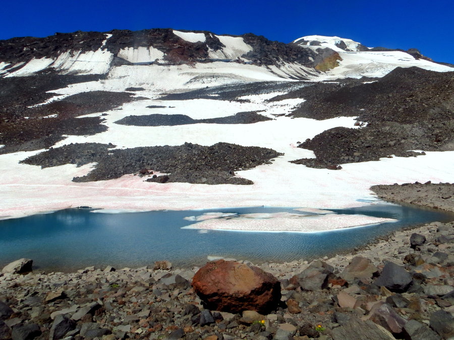
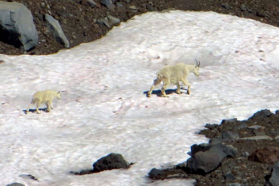
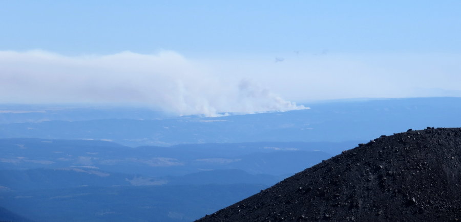
Sunrise Camp and Bird Creek Meadows
13 miles of hiking • 4250' elevation gain • 1 night
Went up Adams from Bird Lake to Sunrise Camp with a gaggle of girlfriends. Beautiful day. Mostly a bunch of rock and scree scrambling, but a few remaining snowfields were a welcome sight for traversing. In the distance, could see a huge fire to the east of Hood/Warm Springs area. Saw plenty of goats, active booming rockfall, and two climbers descending through heavily crevassed snowfields - more thrilling than a James Bond movie! Our original plan was to descend via Ridge of Wonders and to Little Mt Adams and Bench Lake, but we dilly-dallied at Sunrise a bit too long and it was decided to head back down the known route the way we came. Anyway, after the long, happy day, my friends went back home and I made camp at Bird Lake for the night. The next day, I had originally endeavored to do a 16-17mi loop around Snipes Mtn and Aiken Lava Beds...buuut I really didn't feel like it and didn't think it would be that interesting of a trail anyway. So I slept-in to the late hour of 8am (but I did catch the early morning orange glow of Adams through my tent mesh) and decided to start my morning with a trail run around Bird Creek Meadows Loop - an easy hiking trail, a moderate running trail. Crooked Creek Falls was quite a sight. After that, ate breakfast and ventured on home. The road access is super-dicey, but my dinky little sedan made it okay. Slow and steady.
August 18 – August 19, 2013


 1
1
August 5, 2013


Pinnacle Ridge to Cairn Basin & Elk Cove
16 miles of hiking • 4000' elevation gain •
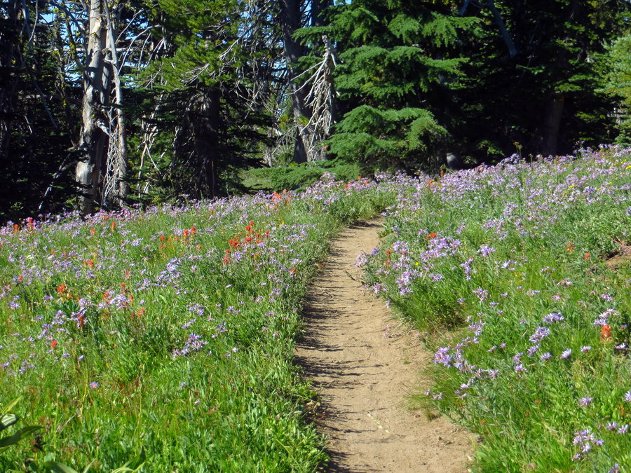
After Mississippi Head on Sunday, I drove out to the north side of Hood and made camp at the Elk Cove Trailhead. Super nice campsite with easy stream access. However, the next morning as I set out at 8am on foot up the road to the Pinnacle Ridge TH, I quickly realized a camp up there would have had a stellar view of Hood bathed in sunset and sunrise glow directly through the tent mesh. Aw well, next time. So I started my hike from Pinnacle Ridge, up through the cool but eerie burn area (and by cool I mean HOTTT...I thought I was going to drink through all my water in the first hour!), and up to Wy'east Basin, looped around Cairn Basin, headed back and on to Elk Cove and descended the Elk Cove trail where my car was patiently waiting. I definitely was not making record-breaking time because the FLOWERS ARE OUTSTANDING RIGHT NOW!! And I was also trying to keep an eye out for the Dollar Lake trail, which I still missed, so that ate up time. I had hoped to do an all-encompassing northern tour with Dollar Lake and Barrett Spur to the black knoll...but not meant to be this time around. Got back to my car by 3:30pm.
July 29, 2013
 3
3
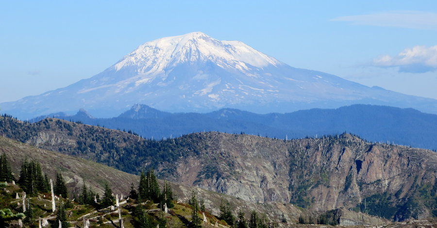
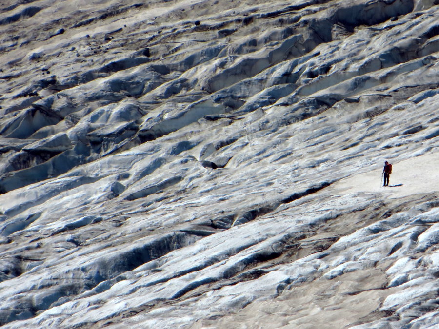
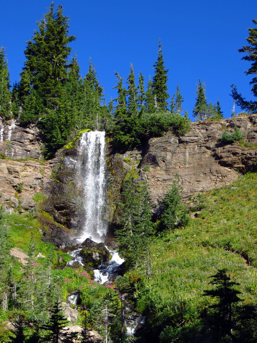
Mississippi Head
11 miles of hiking • 3750' elevation gain •
Set out early Sunday morning with some girlfriends for Mississippi Head on Hood. Started at Timberline at 7am and made our way to Paradise Park. There is a route up the mountain from the Paradise Park meadows, as well as from Split Rock - we went up from Split Rock. We followed a scree path followed by some snow-traversing up to the Head, at about 7500'. Took in the views of Jefferson, Sisters, Helens and even Adams. But no plane crash wreckage - we aren't brave enough souls to lean out over the cliff or scramble down. We then headed up the glacier to 8200', although you really only need to go up to 8000' in order to safely traverse above the deathly drop into Zig Zag Canyon. Descended via Palmer ski lift where there were hoards of skiiers and snowboards and tents and jumps and snow bowls set up. School or training or practice? My friend said that Hood is where Olympic athletes practice because it is the only mountain the lower 48 that has snow year-round. True??? Anyway, fabulous day.
July 28, 2013


July 21, 2013
 2
2
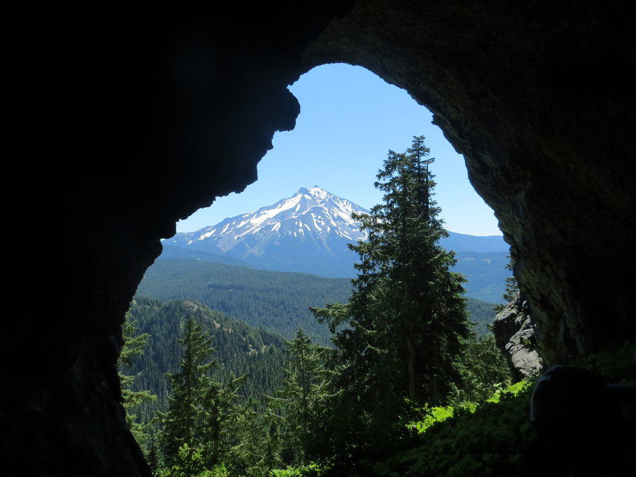
Cheat Creek - Trigangulation - Jefferson Park
24 miles of hiking • 4500' elevation gain • 1 night
Started from Cheat Creek TH - trail through the forest had quite a bit of deadfall and route is overgrown, but you can't lose it...unless your daydreaming. Cheat Meadow is in full bloom with wildflowers - quite lovely! Definitely ate up some time there. Continuing up to Triangulation Peak with views of Jefferson, Sisters, and Hood, and possibly even Thielson/Baily wayyyy to the south??? Scrambled down to Boca Cave - awesome view of Sir Jeff from the cave mouth. On again back down the trail towards Jefferson Park to meet up with a gaggle of girlfriends. HOTTT and buggy out. Snow-free. And saw beautiful a sunset and sunrise of the mountain from our campsite. The next day, hiked and dilly-dallied around the lakes and up to a waterfall along the PCT. Then toe-mashing commenced back down Whitewater trail, where I hitched a shuttle back to my car at Cheat Creek.
July 14 – July 15, 2013


Olympics - North Fork Quinault River
22.5 miles of hiking • 1500' elevation gain • 6 nights
'Expedition' with Big City Mountaineers.
June 26 – July 2, 2013

Larch Mountain
15.5 miles of hiking • 4250' elevation gain •
Nice trail for a rainy day....except no views. Took Mult Falls straight up to Larch, made a balloon loop through the Larch crater trail, reconnecting with the Mult spur trail and Larch Mtn trail back to the falls. In bloom were rhodies, beargrass, vanilla leaf, avalanche lillies (first this season for me!), penstamon, bunch berries, huckleberries, and surprised to see a couple patches of columbine as well. Also, couple small patches of snow along the crater trail.
UP: 6.7mi, 2:20hrs
DOWN: 8.9mi, 2:45hrs
Total Hiking time: 5:05hrs
June 24, 2013


Devil's Peak & Salmon Butte
17 miles of hiking • 6250' elevation gain •
DP: 8mi, 3200' gain (hiking time 3:15hrs) SB: 9mi, 3000' pain (yes, pain...my poor toes!) (hiking time 4:10hrs)
June 10, 2013


Kings Mtn Junior Loop
5 miles of hiking • 2250' elevation gain •
I ventured up Kings Mtn Junior trail in the evening after work. Really quite a beautiful route, if a little sketchy - I was not expecting such an unmaintained trail when I set out. It follows a rough old jeep road that is grown over with ferns and flowers, complete with rockslides, constant blowdown, and washouts for your hiking pleasure. I managed to successfully lose the trail twice, which in retrospect I see now I was over-thinking things. After all the brush and bramble and many super confusing junctions (I wonder where all those unmaintained trails go?) for the first two miles, the trail meets up with the Wilson River trail, followed that for 100 yards, then turned up another super faint (totally missed it the first time past) and sketchy trail that steeply switchbacks up the Kings Jr ridge. This is marked overkill-style with orange tape AND blue paint on the trees…but I can see why, since I really had to use my imagination to see a trail at all. Great views of the area and of Kings with a bright setting sun. Unfortunately, I left my camera and gaitors at home, so my only proof of the adventure are scratched up legs and arms!
I was following Lorain’s Afoot/Afield 2008 – pretty confusing, but I’m sure he did his best. :) Portlandhikers.org describes a different loop – returning on King’s Mtn trail rather than Wilson River trail; a little longer of a hike, but the Wilson is a gentler, and probably prettier, descent down (I was able to comfortably run the whole way, and I don’t think that’s feasible on Kings trail). I was just glad to be out of there before nightfall – hiking time was 6:00pm-7:50pm. The late sunlight was nice, actually - the lay of the ridges and contours of the canyon allowed for direct golden sunlight for much of the time, whereas I wonder if on other trails the sun would be hindered by Kings Mtn and other ridges. Not many flowers out there, but some patches of monkeyface and irises on the Wilson, and tiny white flowers glittered the entire route - especially scenic on the jeep path. Great evening, but I'll stick to clearer trails when the threat of a setting sun is imminent...
June 5, 2013

Saddle x 2
11 miles of hiking • 3500' elevation gain •
Went out to Saddle Mountain to meet up with some friends, but wanted more of a workout....and since there aren't other mountains within reasonable driving distance (the hour drive from Kings was too far), I just did it twice. Pretty foggy early in the morning - couldn't see more than 100 yards away. But on the second run the fog and clouds had burned off and could see Adams, Helens, Rainier, Hood, but didn't spot Jeff - some clouds still hovering in the way. Parts of the trail towards the middle were pretty wet and muddy, and the chainlinks that have been put down make it slippery...but maybe it's better than loose rock and dirt. Doesn't make for a scenic trail though. Flowers weren't out as much as I had hoped, but there is an array - monkey face, irises, phlox, columbine, indian paintbrush, larkspur, etc. This was my first visit to Saddle -- glad to have gone, won't be in a rush for another visit.
June 3, 2013

Siouxon Creek and Horshoe Ridge
16 miles of hiking • 3000' elevation gain • 2 nights
Set out for Siouxon Creek and Horseshoe Ridge this soggy Memorial Weekend. Quick report: Horseshoe still has some light snow and blowover on the north side of the ridge. The trail towards the top of the ridge is light in some places, but it just follows the ridge so it's pretty navigable. I had planned to to Huffman Peak as well, but opted not due to the two river fords, wet boots, snow, and rain. I'll be back...
May 25 – May 27, 2013

Double Dog... plus some
15 miles of hiking • 6000' elevation gain •
Kinda not-so-creative hike, but I was already meeting friends mid-morning, so decided to have a pre-dawg Dog warm-up. Just took the typical scenic trail up and down x 2, plus escorted the last few of the group up to the top after I was already on my second run down. Flowers are still out all over the place! Poison oak everywhere. Beautiful, sunny day.
1st run: 1hr 7min up, 55min down; 2nd run: 1hr 12min up, 35min down (second time I had met up with my group and some very necessary photo-ops slowed me a bit); plus 10-15mins for the peak escort service.
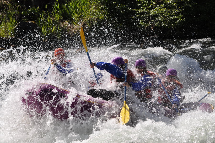
Followed by rafting the White Salmon River. A spectacular day, needless to say.
May 20, 2013

 1
1
Mt St Helen's Mother's Day Sog
7 miles of hiking • 2500' elevation gain • 1 night
Hiked into what we knew was going to be a soggy Mother's Day. The mountain had record permit numbers on beautiful Saturday - 649 climbers!! The parking lot was a craziness of cars and costumes and parties when we arrived in the evening. It was so balmy all evening and night that the snow was still slushy when we set off at 4am. Wore microspikes in some parts, but trail also had lots of exposed rock and dirt throughout. At 5000' and 7am, the wind and rain picked up and we decided there wasn't much need to keep going through the misery of it all. Got out my Magic Carpet and had a great, if short, roller coaster of a glissade down!
Last year was extremely warm and with high avalanche danger as well. Love the Mother's Day extravaganza and will continue to go each year, but will hold out for the actual climb several weeks earlier when snow and weather is better. I was up there just three weeks ago and conditions were PERFECT, but didn't get an early enough start to summit. Dag!
May 12 – May 13, 2013


April 20 – April 22, 2013


March 31 – April 1, 2013

March 24 – March 25, 2013

March 11, 2013


February 24 – February 25, 2013


February 4, 2013


January 14, 2013


