


2013 Trips


September 1 – September 3, 2013

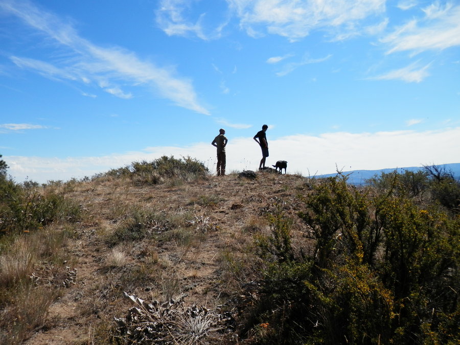
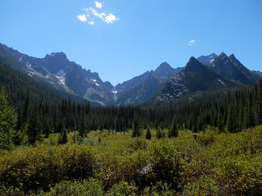
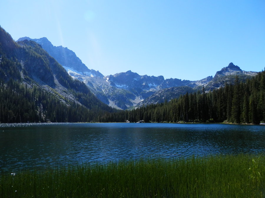
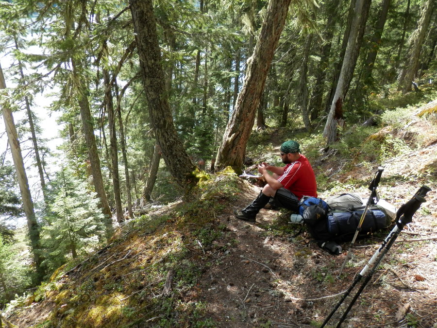
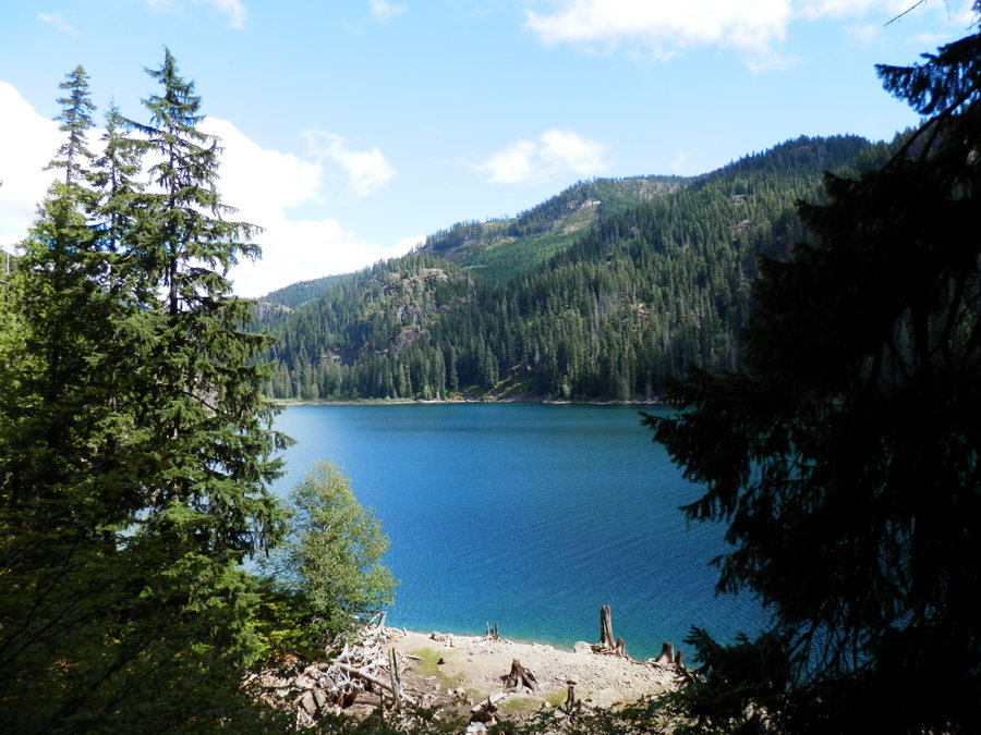
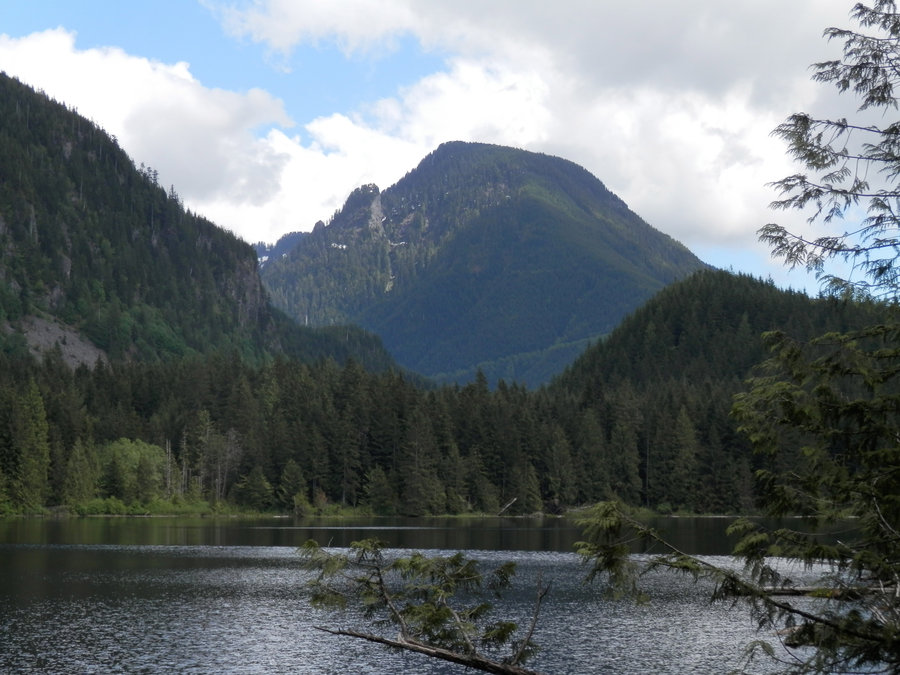
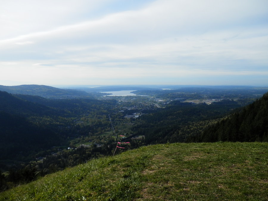
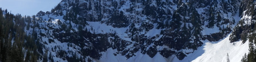
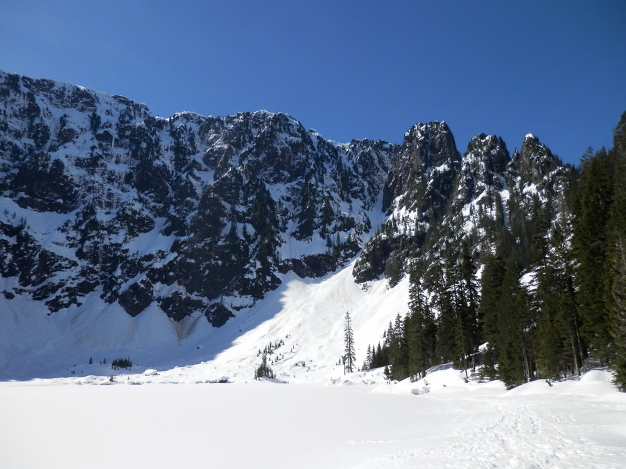
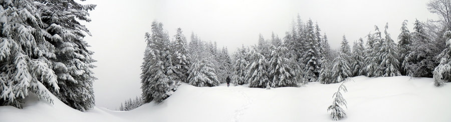
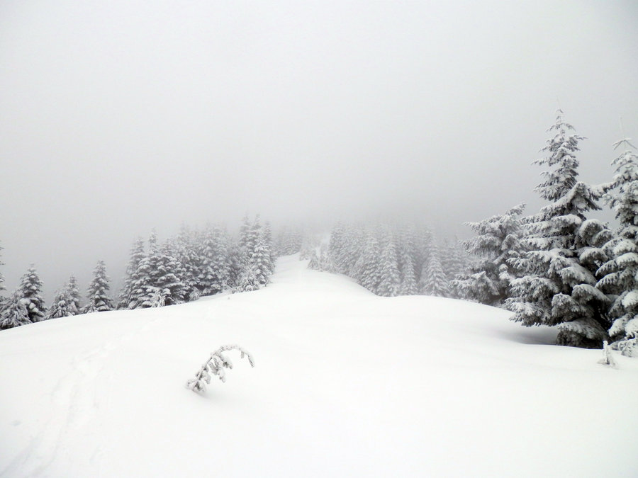
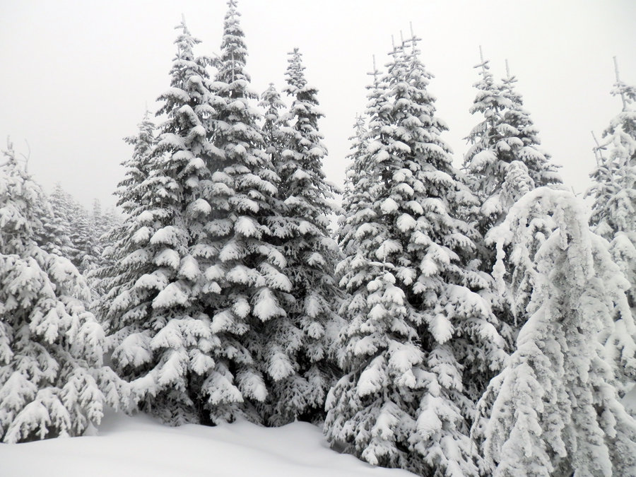
Lake Stuart
10 miles of hiking • 1750' elevation gain •
Axis Peak was the goal but got a late start and decided to turn around at the lake.
August 30, 2013

August 26 – August 27, 2013

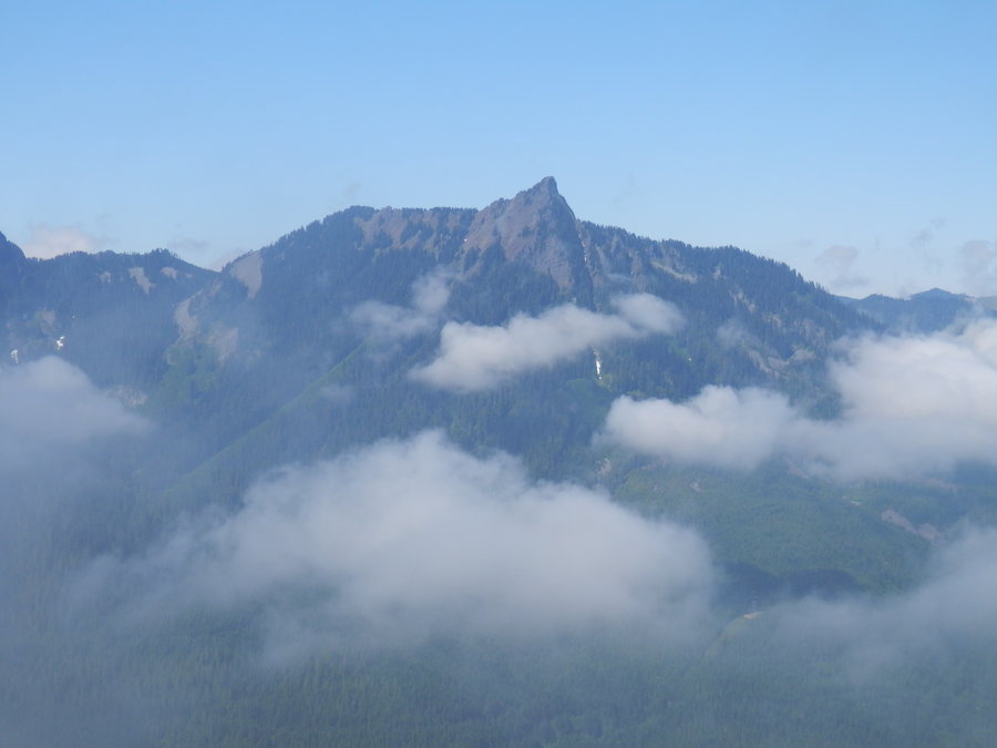
August 11, 2013

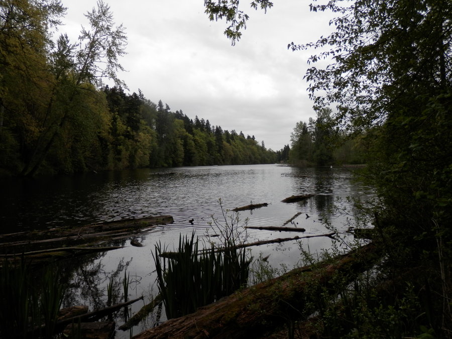
Green River Trail: Lake Fenwick to Bicentennial Park
8 miles of hiking • 0' elevation gain •
August 10, 2013

July 11, 2013

 2
2
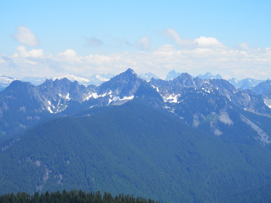
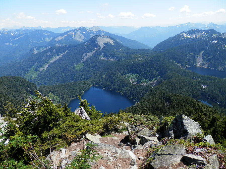
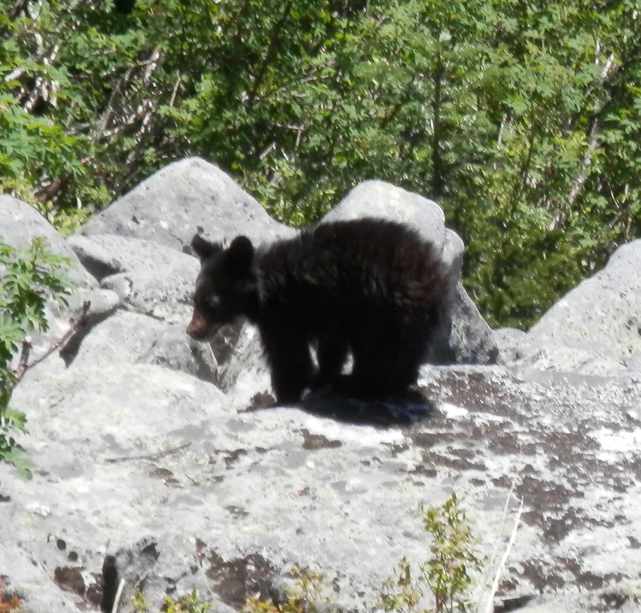
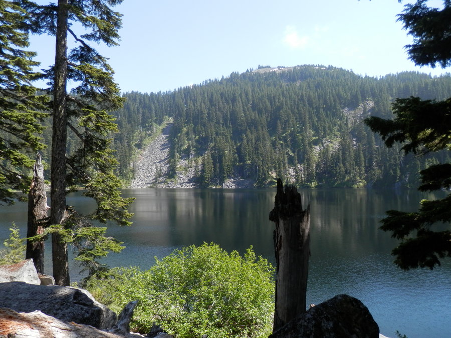
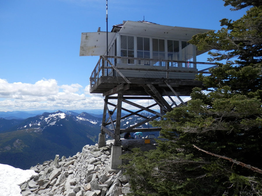
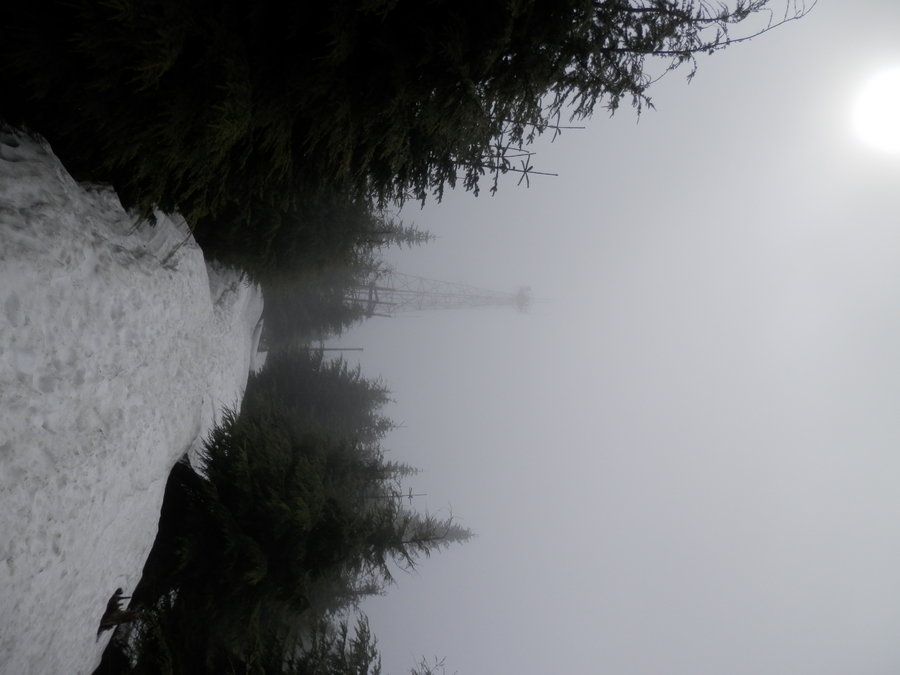
Mt. Defiance via Dirty Harry's Trail
20 miles of hiking • 4750' elevation gain •
I've done this one via the standard route a few times, so I decided to try a difference approach and went up Dirty Harry's Trail to the Bird Box Trail Connector, then to the Ira Spring Trail, up to Mason Lake, and from there to Defiance. It turned into the longest hike I've ever done, and I got to see a bear cub in the meadow.
July 6, 2013

Green River Trail: Briscoe to Bicentennial Park
5.5 miles of hiking • 0' elevation gain •
July 2, 2013

July 2, 2013


Green River Trail to Interurban Trail to Lake Fenwick
12 miles of hiking • 250' elevation gain •
June 15, 2013

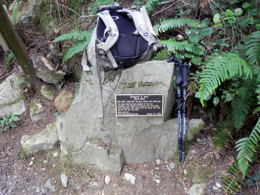
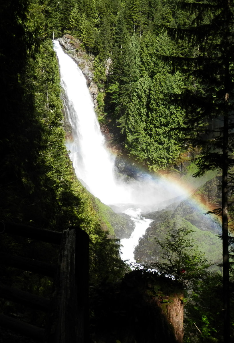
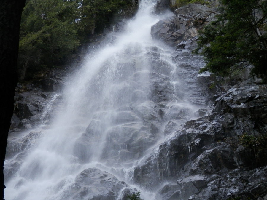
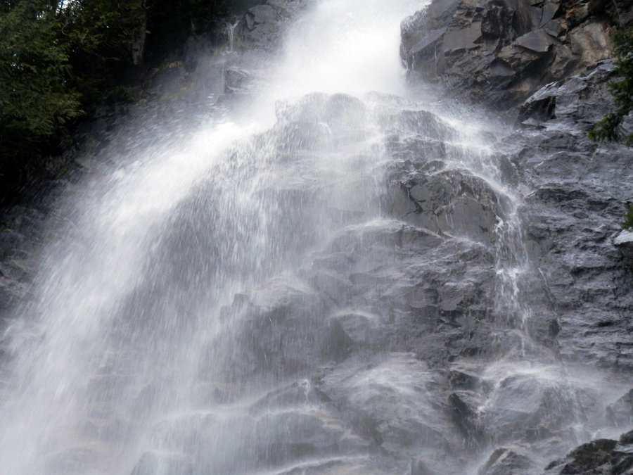
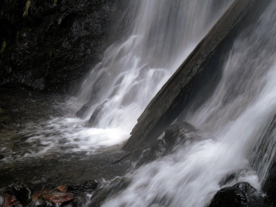
Wallace Falls via Greg's Balls
11 miles of hiking • 1500' elevation gain •
Had to visit family this weekend but was able to squeeze in a quick hike up to a boring lake Sunday afternoon. Took a sort of roundabout way up to Wallace Lake and then looped back down to the obligatory falls.
June 9, 2013

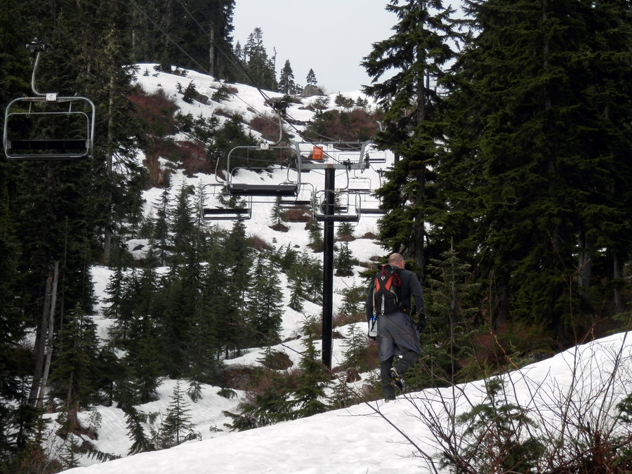
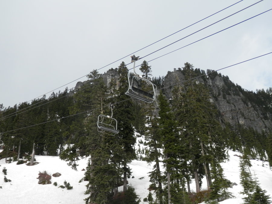
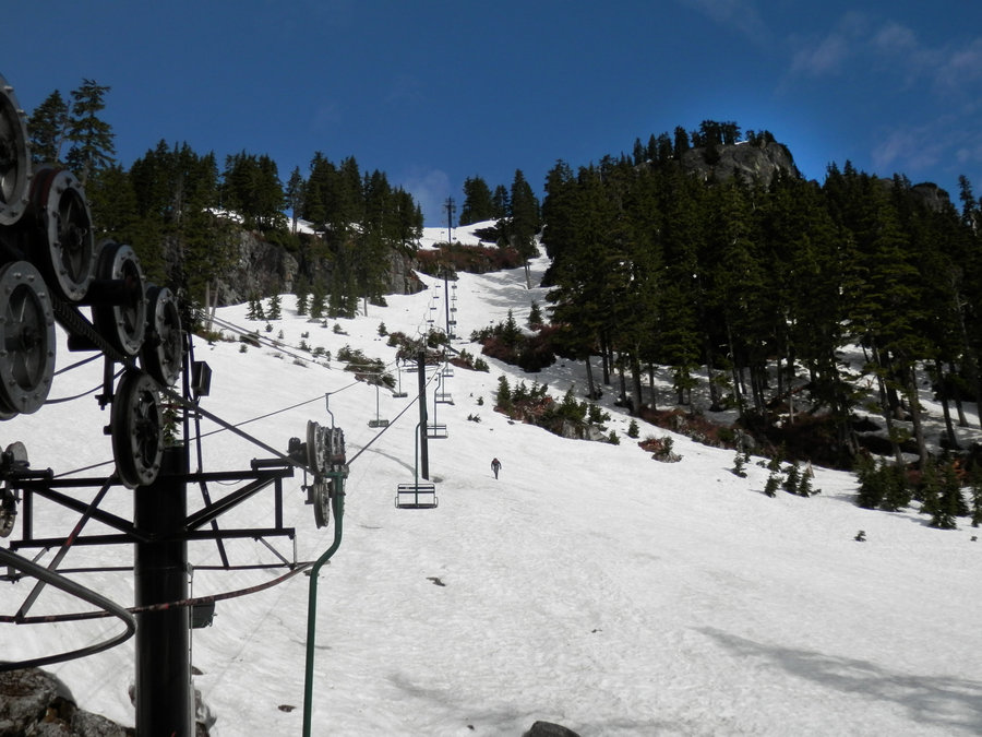
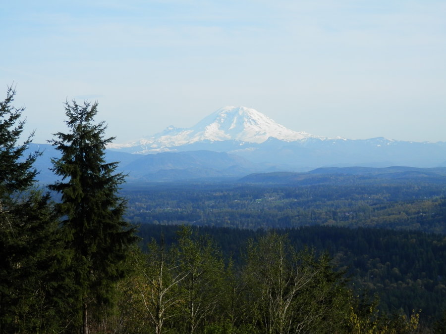
Denny Mountain
4 miles of hiking • 2500' elevation gain •
Got up at 4 am and carried B-Dog up Denny Mountain, a short slog up an abandoned ski slope that was pretty popular in it's hay-day. It got a little dicey near the top. I fell into a moat and B-dog was attacked by a rabid dog, but we were rewarded with some great views and some excellent glissades back down.
June 1, 2013

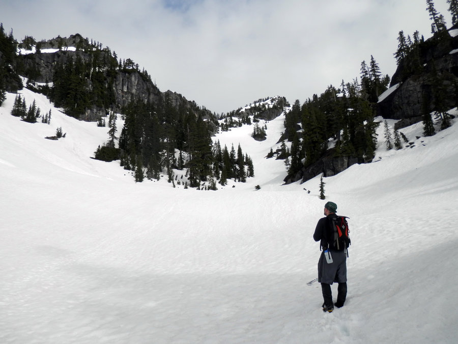
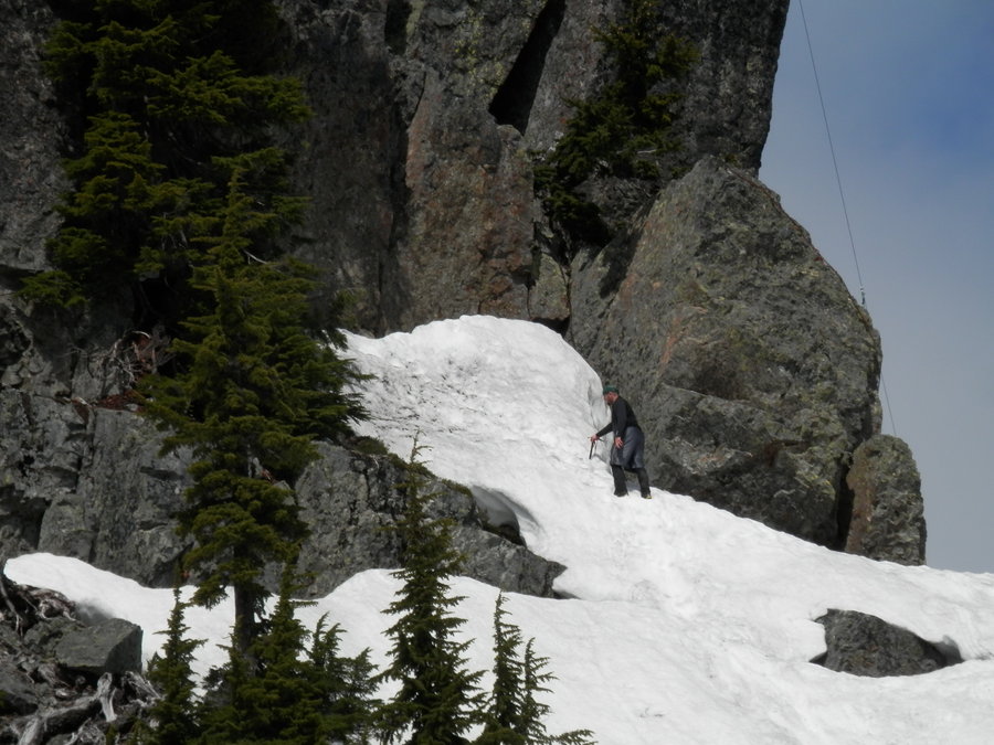
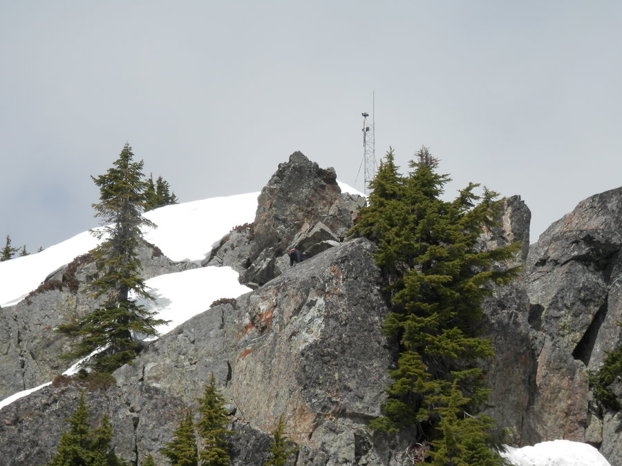
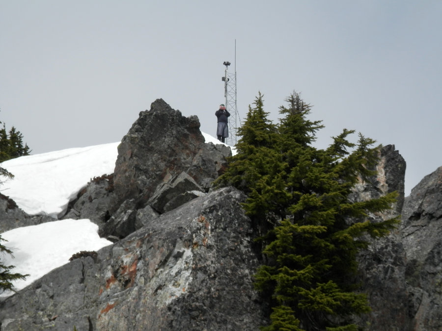
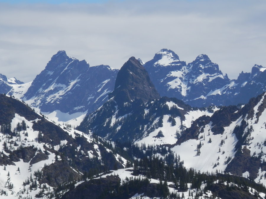
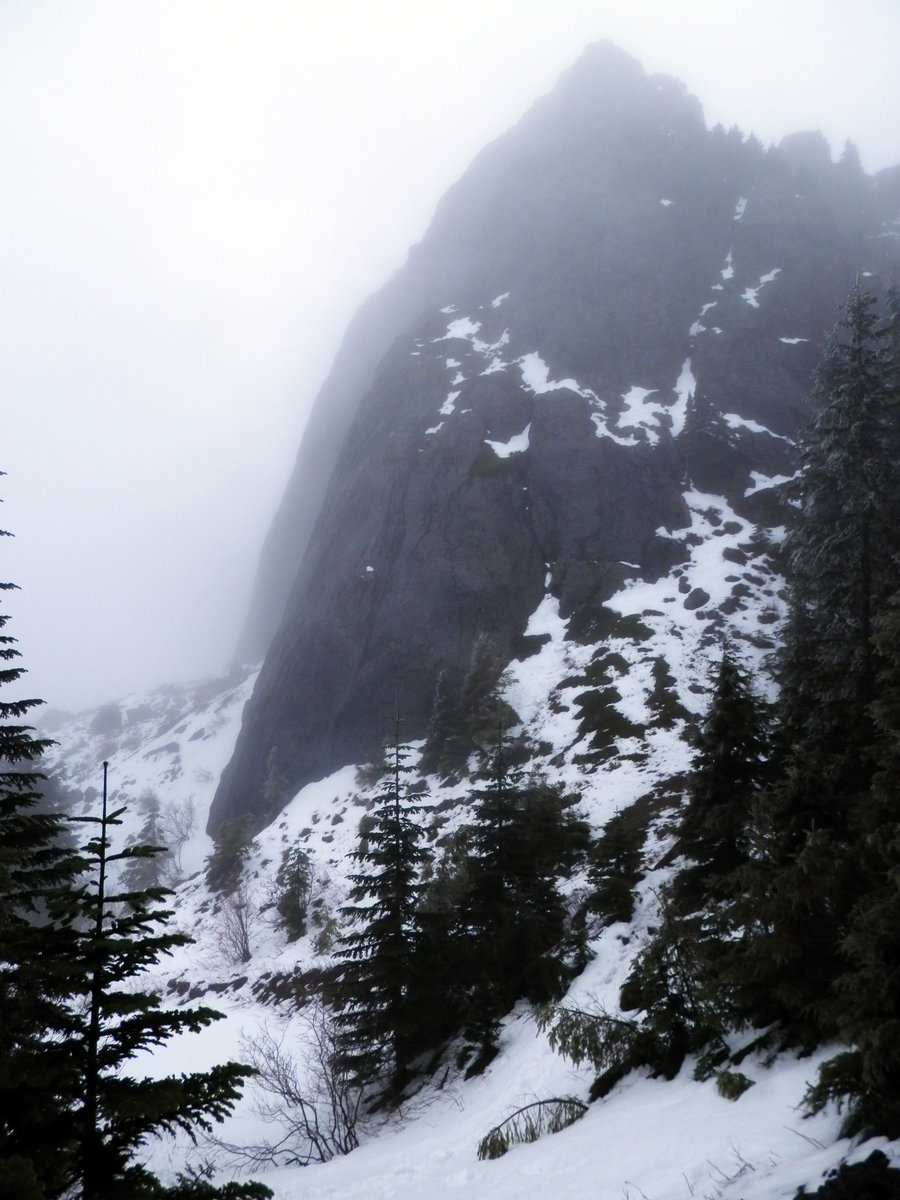
Mt. Washington - First Ascent
13.5 miles of hiking • 3500' elevation gain •
On Sunday, May 26, 2013, I was the first person to climb Mt. Washington. Let the historical magnitude of that sink in for a minute. Go ahead, I'll wait.
After that monumental achievement, I also became the first person to become lost on Mt. Washington on May 26, 2013. The intent was to climb another peak on the ridge, but I wandered around in the snow for a mile or two and wound up popping out on the Great Wall, which is neither "great" nor a "wall".
May 26, 2013

May 21, 2013

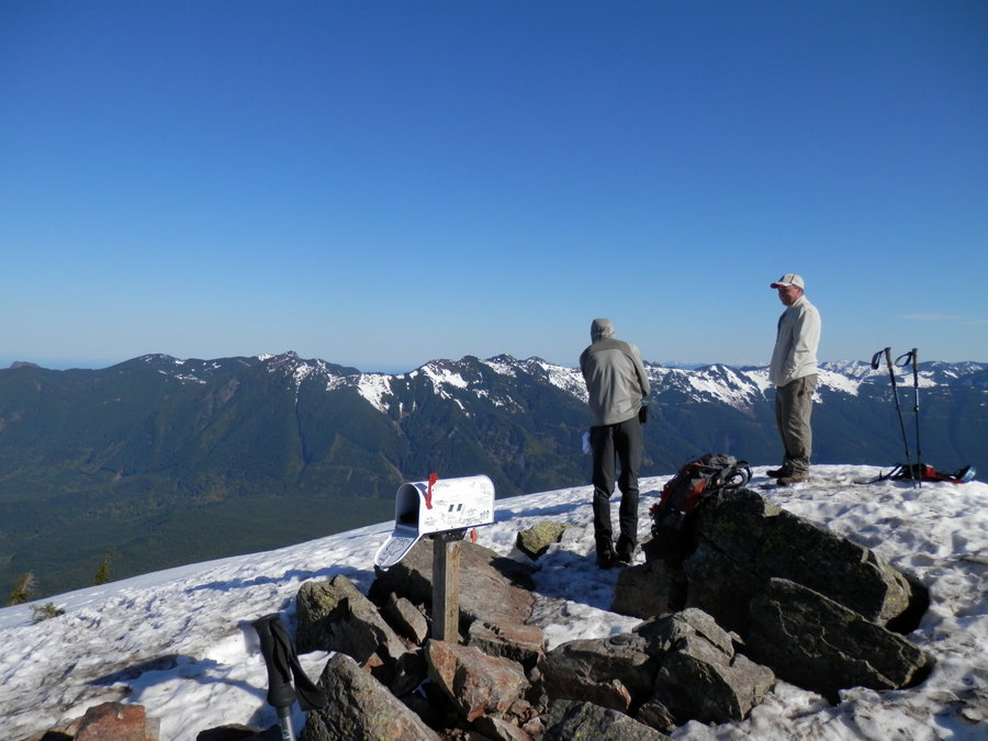
Mailbox Peak (Again)
7.5 miles of hiking • 4250' elevation gain •
Mailbox Peak is 4100 feet of elevation in 3 miles. It starts out steep and stays steep. The whole trail is nothing but mud, and roots, and human skulls from trailhead to summit. It's a serious hike for serious hikers only, and if you can't hack it, then maybe you should take your poodle up Navajo Peak or some other girly Eastern Washington cakewalk that draws weenies like flies to a turd.
Explored an old logging road on the way down but, like most logging roads, it lead to a dead end.
May 20, 2013
 1
1
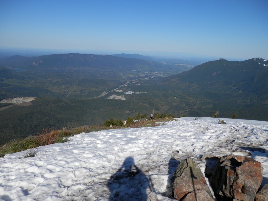
Mailbox Peak
6 miles of hiking • 4000' elevation gain •
Holy crap was it packed. My plan was to sneak up there early and kick the mailbox down the back side of the peak, but there was already a small crowd of eyeballs watching me by the time I got there. I might do this one again on a rainy day.
May 4, 2013

West Tiger 3, 2, 3
6 miles of hiking • 2500' elevation gain •
Ran up to West Tiger 3, then over to West Tiger 2, then Back to West Tiger 3, for a grand total of 8 West Tigers.
May 1, 2013

Rattlesnake Ridge - East Poop
9 miles of hiking • 2500' elevation gain •
Rounding out my "Fecal Trifecta" of poop-themed hikes, East Rattlesnake Poop is the highpoint on Rattlesnake Ridge. There was zero visibility on this rainy day, so I was deprived of some great views of the freeway.
April 28, 2013

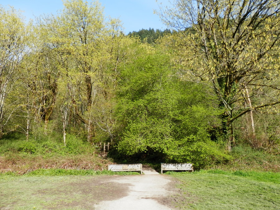
Lake Fenwick X4
6 miles of hiking • 1000' elevation gain •
This is going to be a routine hike so I'm going to put the accumulated mileage and elevation on one post. By the end of the year, this should look like Mt. Everest.
April 28, 2013

Kamikaze Falls via Talus Poop Loop
9.5 miles of hiking • 2500' elevation gain •
Kamikaze Falls was recently renamed "Teneriffe Falls" so as to not offend any kamikazes, but the local still stubborn refer it by its less PC name. I've been up there once before but decided to enter via the Talus Poop Loop this time. I had the whole trail to myself most of the way and didn't see so much as a single kamikaze.
April 27, 2013

Poo Poo Point via Chirico Trail
4 miles of hiking • 1750' elevation gain •
Often used as a "Training Climb" by little old ladies and the morbidly obese, Tiger Mountain's Poo Poo Point is a quick after-work urban hike to a paraglider launching pad.
April 26, 2013

Mount Si
8.5 miles of hiking • 3250' elevation gain •
Took advantage of the rain and snow to get a hike in before the swarms of poodle herders arrived..
April 21, 2013


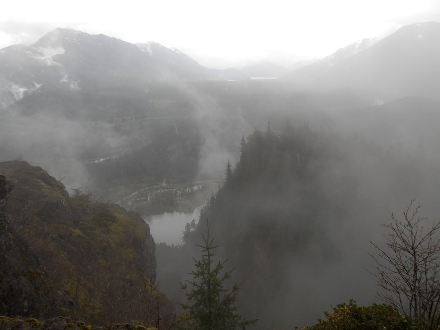
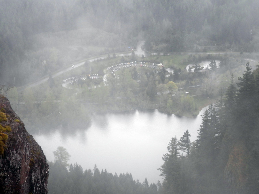
Rattlesnake Ledge #3
4.5 miles of hiking • 1500' elevation gain •
Rough weather in the Pass kept me down in the dumpsters today. Ran up to the 3rd ledge on Rattlesnake and then headed for Ceder Butt (again).
March 16, 2013

Ceder Butt - Iron Horse Trail
7 miles of hiking • 1000' elevation gain •
The plan was to do Rattlesnake, Ceder Butt and then hike up the Iron Horse to the Farting Owl, but the drizzle turned into a downpour with high winds. I turned back a couple miles short of the trailhead to the Owl.
March 16, 2013

Mt. Si - Teneriffe Fire Trail
10 miles of hiking • 4000' elevation gain •
Made it to the summit in short order and decided to explore some of the side trails. Found a connector trail to Teneriffe and hiked along the ridge a bit before turning around.
March 10, 2013


Ceder Butt
3 miles of hiking • 1000' elevation gain •
Cedar Butte, or "Ceder Butt" as it's spelled on the geological marker, is the most boring hike in Washington State. Avoid it like the plague.
March 8, 2013

Dirty Harry's Balcony
6 miles of hiking • 1500' elevation gain •
Named for a dead lunatic who left his rusty garbage all over the mountain.
March 8, 2013


Teneriffe Fire Road Trail
13.5 miles of hiking • 3500' elevation gain •
With the crappy weather and zero visibility, I decided to do a dumpster dive up an old fire road.
February 16, 2013

 1
1
Olallie Lake-ish
8 miles of hiking • 2500' elevation gain •
I have no idea where the hell I was. My best guess is the ridge just before Olallie Lake.
February 10, 2013

Rattlesnake East Peak
9 miles of hiking • 1500' elevation gain •
This is a great pre-season ridge walk if you don't mind the rattlesnakes.
February 3, 2013

The Farting Owl
6 miles of hiking • 1250' elevation gain •
Named for the sound of trees rubbing together in the wind, The Farting Owl is one of I-90's lesser known hiking destinations. My plan was to ascend Change Peak to the East, but I had to turn around about a mile or so after the Farting Owl when the snow became too deep to hike any further.
February 2, 2013

Mt. Si
8 miles of hiking • 3300' elevation gain •
This puppy seemed a little longer and steeper than usual. Maybe I'm getting old.
January 26, 2013

January 19, 2013

Rattlesnake Ledge
4 miles of hiking • 1250' elevation gain •
Compact snow and ice about 1/2 way up. Idgets and poodles most of the way down.
January 12, 2013
