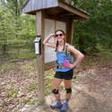
16.81 miles of hiking • 2000' elevation gain •
The Wapack Trail is a 21 mile interstate trail from Mt. Watatic in Ashburnham, MA, to North Pack Monadnock in Greenfield, NH.
The trail is broken up into three sections. I planned to do about 13 miles the first day since the second day had rain in the forecast. The trail is easy to follow up Mt. Watatic, but the trail guide was really unclear on how to continue north towards NH. According to the guide, you follow an unmarked trail and cross under an abandoned ski lift, then re-enter the woods through a side trail after 1.3 miles. The problem was that there were about 5 unmarked trails, and I saw no abandoned ski lift. After losing about an hour and a half, and adding ~4 miles, I decided to retrace my steps down the trail I came up. The Mid-State Trail goes around Mt. Watatic and links up to the Wapack again, so I figured that would be my plan of attack. Either the trail guide is off or the trail was recently re-routed, because to follow the trail north to NH you have to take the same trail back and then pick up the trail North about halfway down.
After getting back on track I followed the blazes instead of relying on the trail guide. The trail levels out and goes through an area that's being cleared (for what, I don't know, but it looks like construction). After a few miles, there is a strenuous climb up Pratt Mountain. The trail descends, and then quickly ascends up New Ipswich Mt., which provides great views of Mt. Monadnock and the surrounding areas.
After a few more miles and another modest mountain, the trail crosses into the Windblown Cross Country Ski Area. There are shelters that hikers can access if they call ahead to the owner. The trail levels out after a gradual descent, then crosses through some power lines before suddenly popping out into civilization (Rt. 123/124). You have to cross the (busy!!) road, and take the first left onto a dirt road. There is a sign that indicates you're on the Wapack, but for about 1-2 miles there are no trail markers. I just followed the path and eventually linked back up to the yellow blazes.
Overall, this was a very secluded hike. There were two groups of people on Mt. Watatic, but then I didn't see anyone until I reached Rt 123/124. Although the mountains aren't particularly challenging, the distance and seclusion of this trail makes it unfit for a beginner. I had a few moments when I thought "why the hell am I doing this alone?". Two days of thunderstorms in the forecast pushed off me finishing the last section. I have two more mountains, around 4.5 miles of trail, left to go!


