2013 Trips


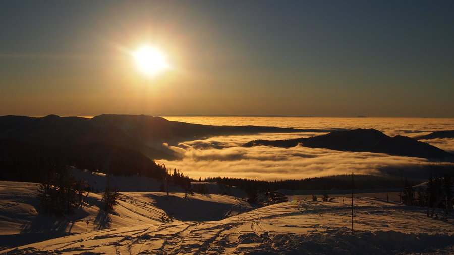
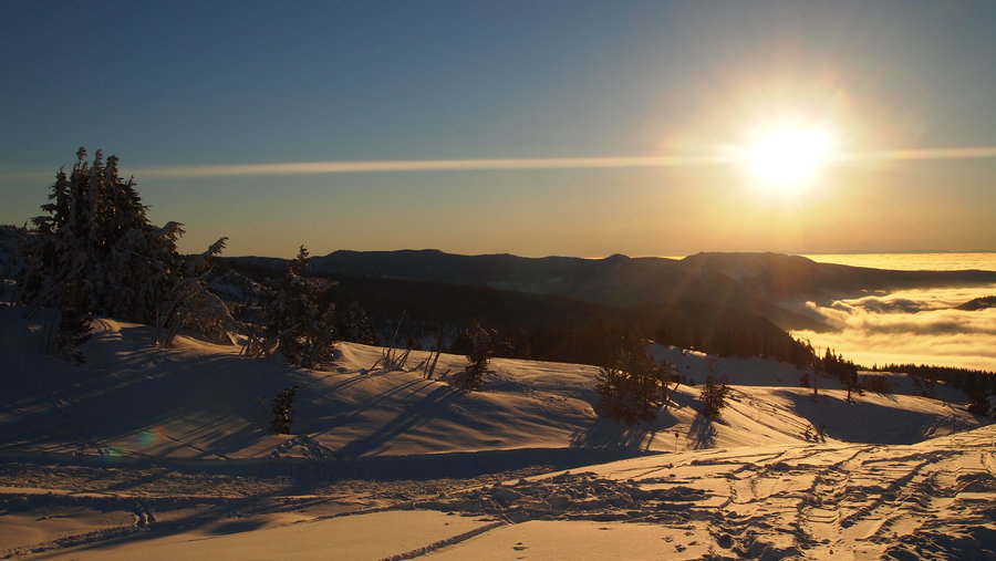
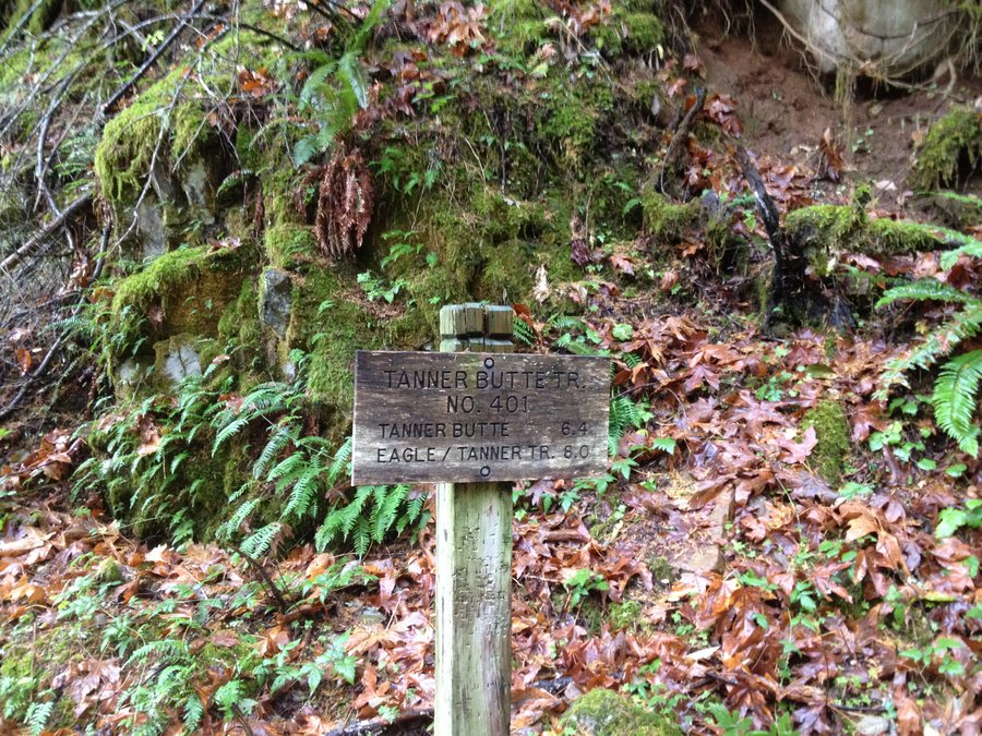
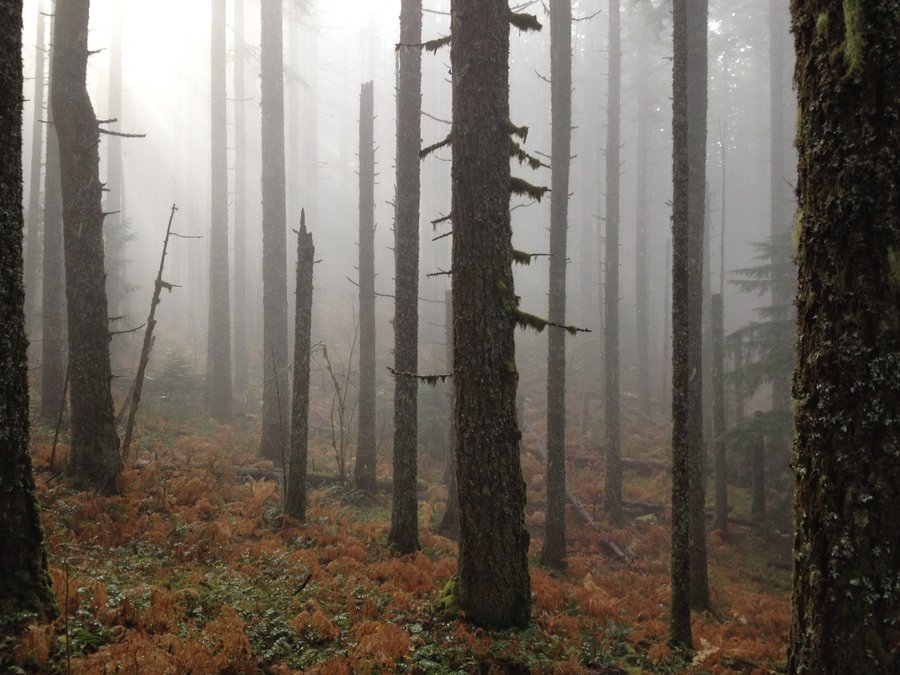
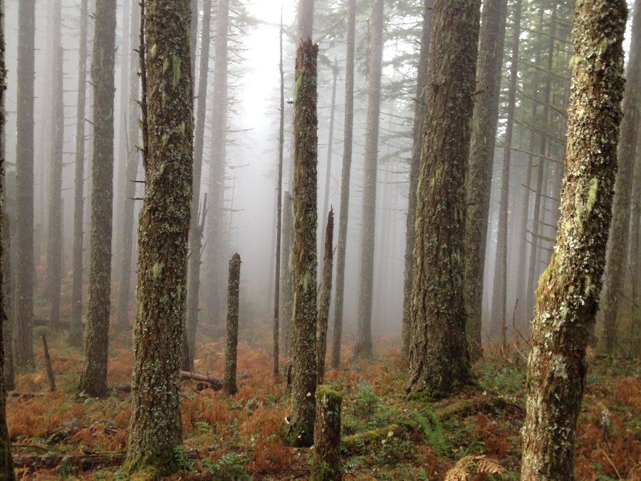
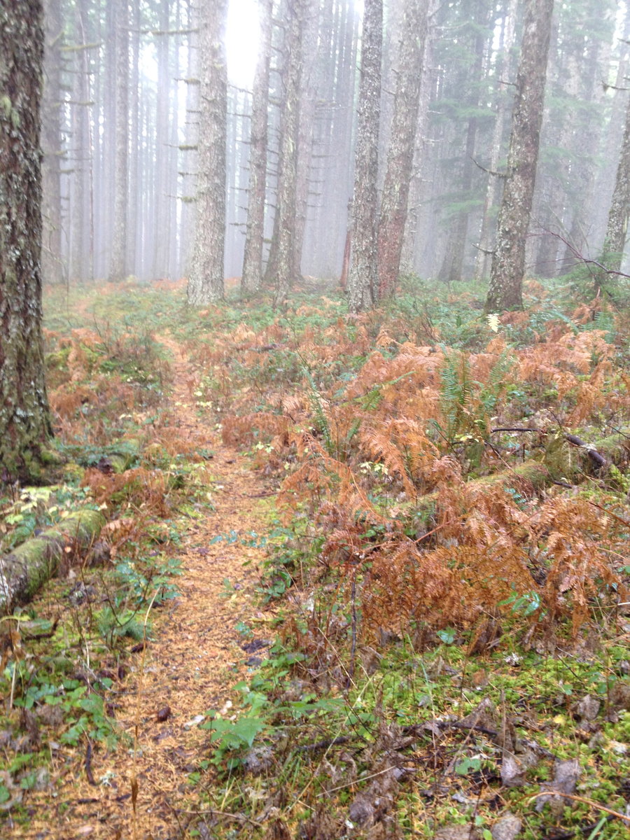
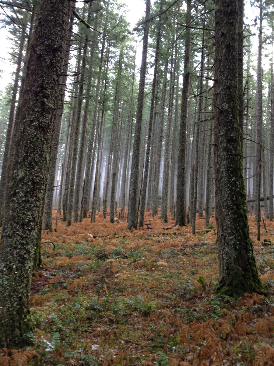
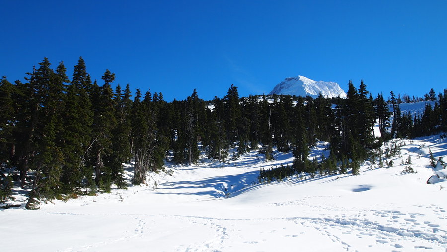
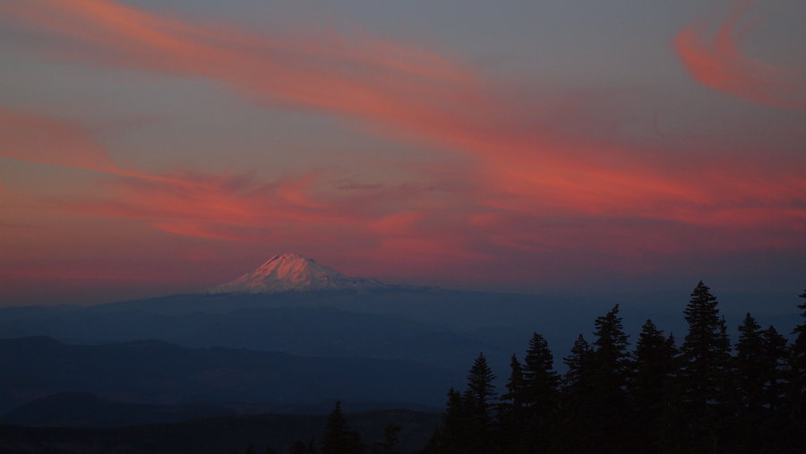
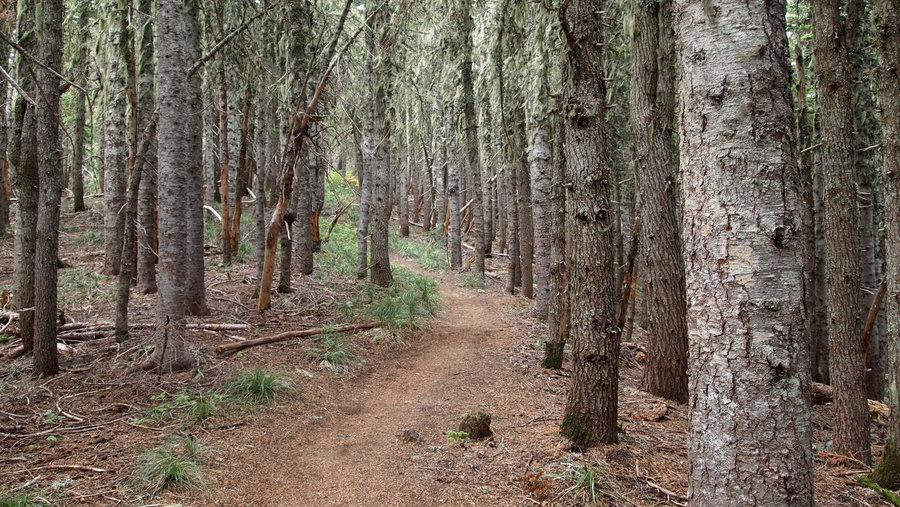
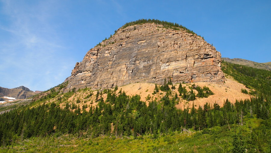
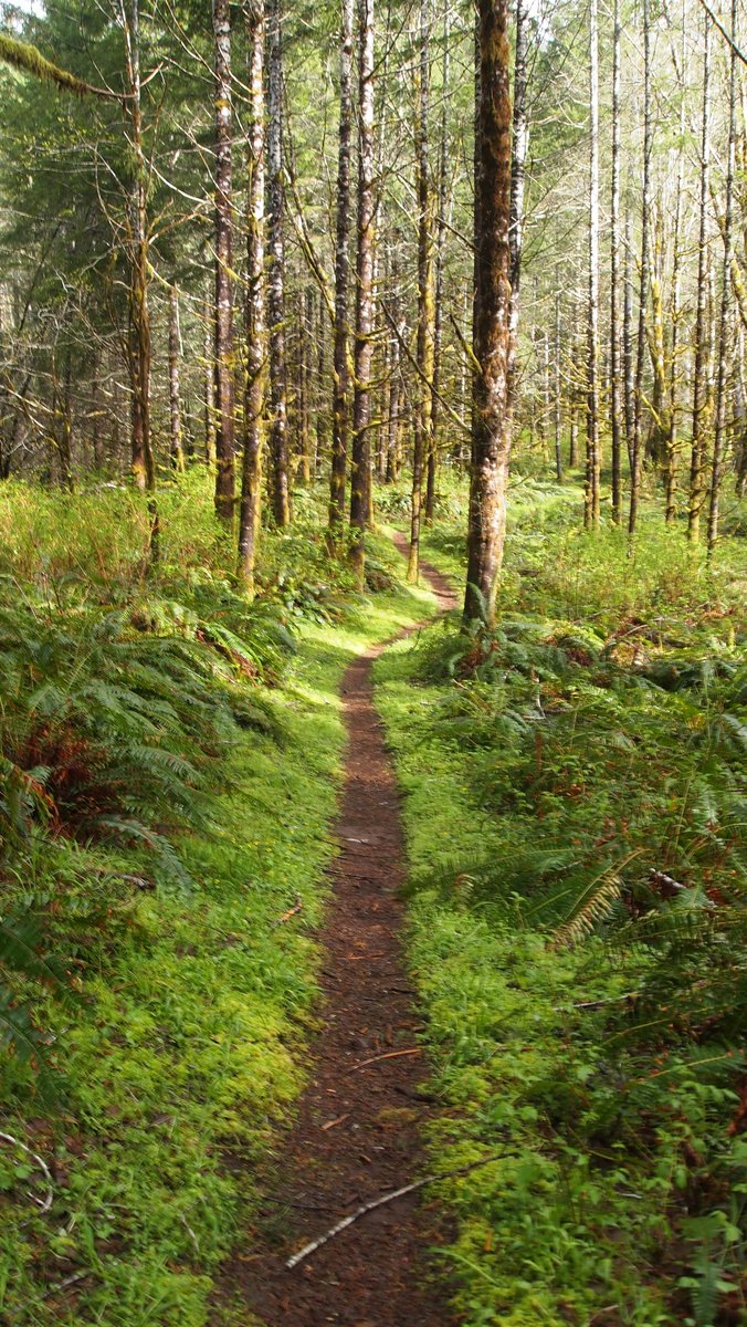
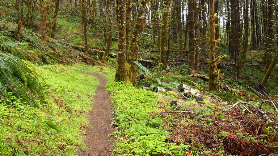
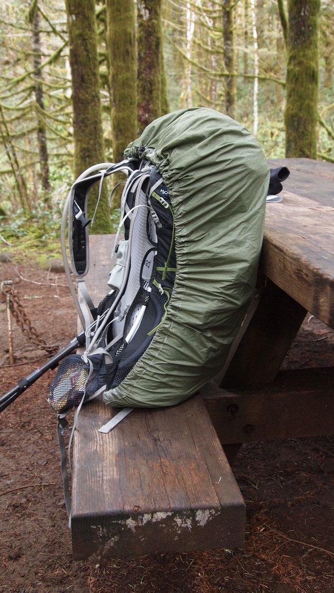
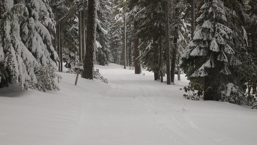
Wauna Point
10.5 miles of hiking • 3250' elevation gain •
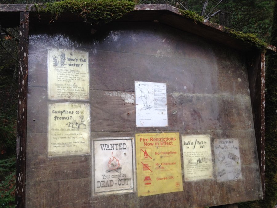
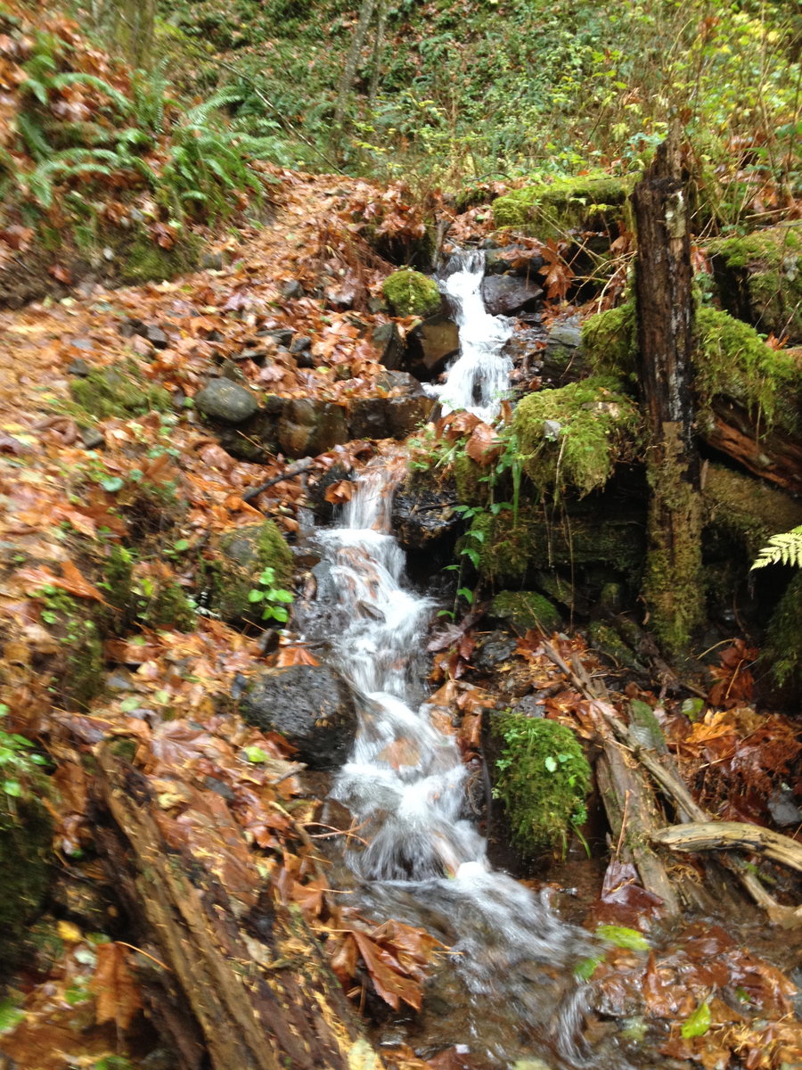
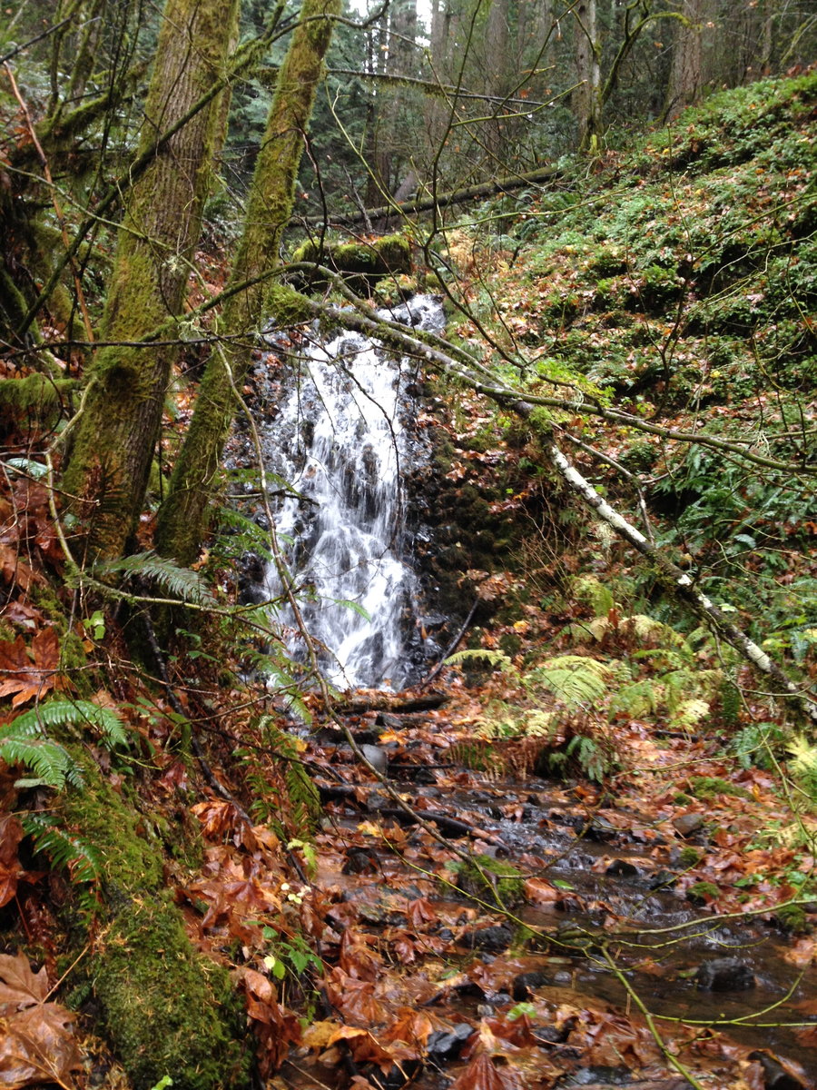
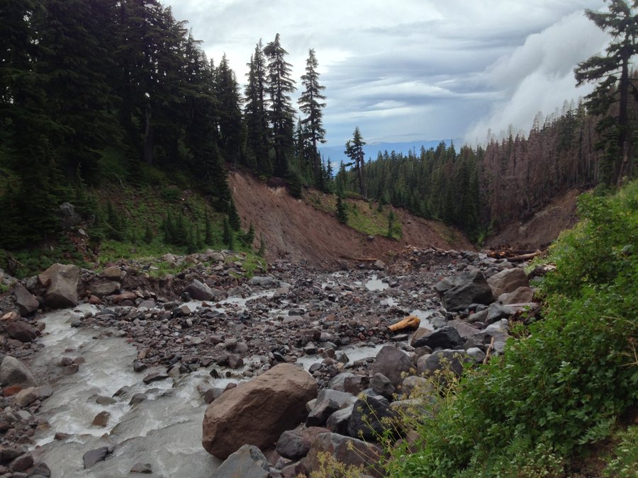
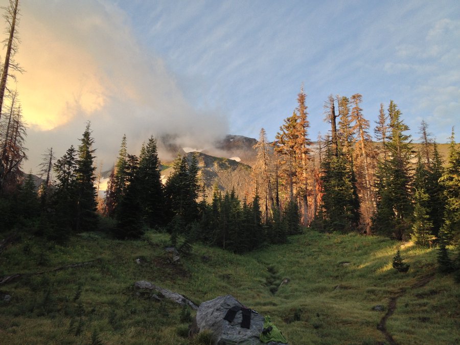
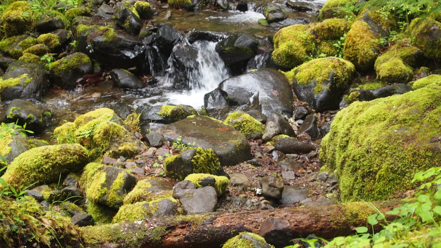
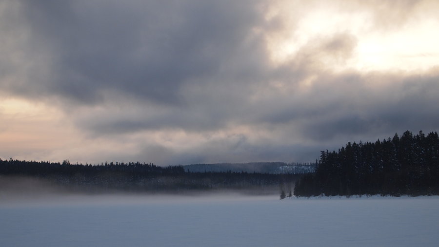
With a 70% chance of rain today I will be honest. I was not looking forward to this hike! It all ended up working out great in the end, with only about 2 miles of rain. We arrived at the Wahclella Falls TH around 8:45a, and returned around 2p. The first two miles to the Tanner Butte TH were a combination of trail and old logging road, and went rather quickly. Once we reached the Tanner Butte TH, the trail started climbing much quicker and about a mile from the turnoff to the unmaintained portion of the trail, it started spitting hail a bit. We also started noticing snow in small patches. We reached the "dry" campsite and proceeded onto the unmaintained trail, which I think was my favorite part. The woods were foggy and cool and there was a quite peacefulness about the place. We reached the Wauna Point while there was still some visibility and were able to see Cascade Locks and Bridge of the Gods pretty easily. After a quick lunch, we returned down the trail. We encountered one gentleman with two dogs at the "dry" campsite, otherwise there were no other people on the trail. Once we reached the Tanner Butte TH again, it started to sprinkle a little bit and then it just started pouring. I whipped out my GoLite umbrella and was happy as a clam wandering down the trail. My hiking partner might have been giving me a hard time earlier about my umbrella but another mile down the trail and she was actually thinking I might be onto something. :)

November 3, 2013


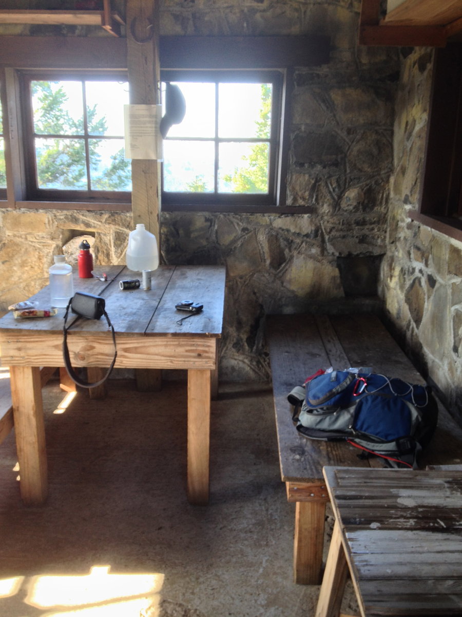
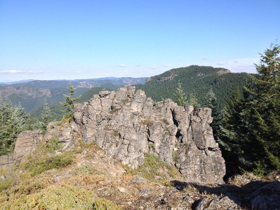
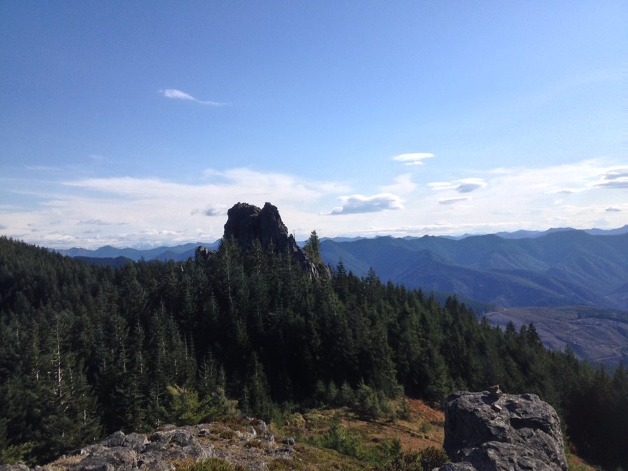
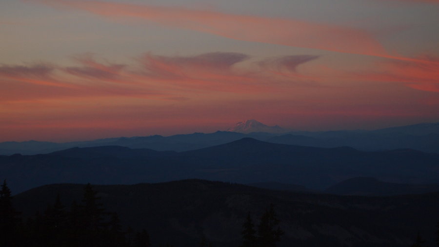
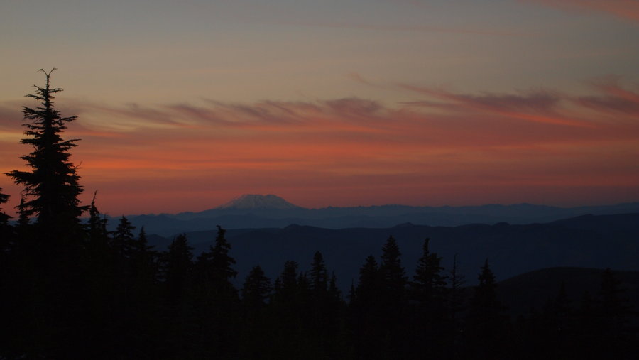
Pechuck Lookout & Rooster Rock
6.5 miles of hiking • 2250' elevation gain •
Went out for a nice hike with no one else on the trail today with a few friends. The wind was a little annoying, otherwise clear skies, a bit of sun and all around great time exploring places new to us. The lookout is amazing and I would love to go back and spend a night there next Spring or Summer. We also went to Rooster Rock (had no idea where the trail was until we were heading back towards the Rooster Rock TH and saw the intersection marked with lots of surveyors tape...) and that was quite the workout with a great reward at the end.
October 28, 2013


Angels Rest
5 miles of hiking • 1500' elevation gain •
Quick day hike to Angel's Rest. I hadn't been up here in a few years so it was nice to revisit it. The weather was perfect and it wasn't windy either.
October 19, 2013
 1
1
Dollar Lake (Attempt) Backpack
6 miles of hiking • 1500' elevation gain • 1 night
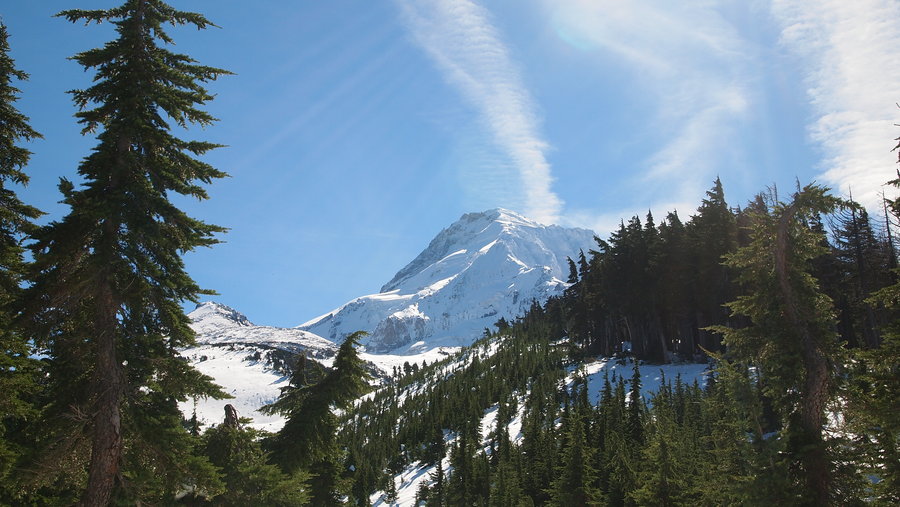
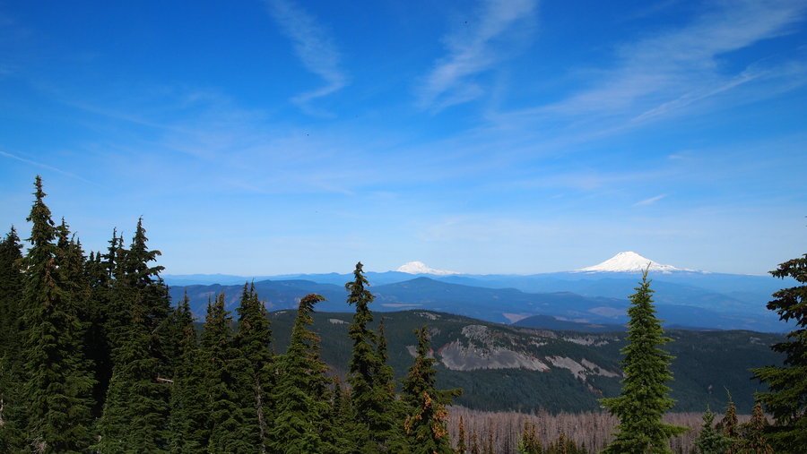
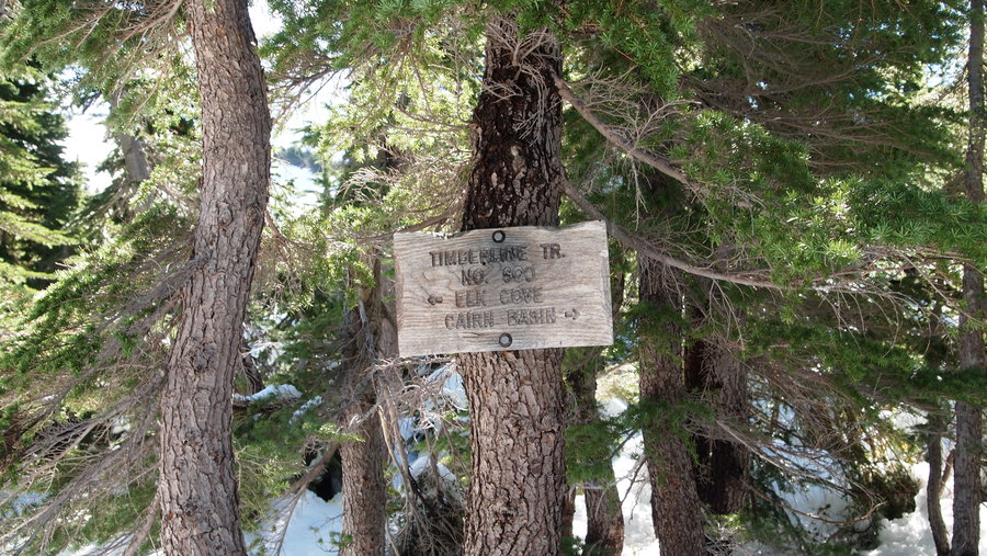
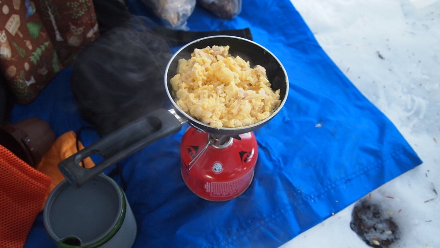
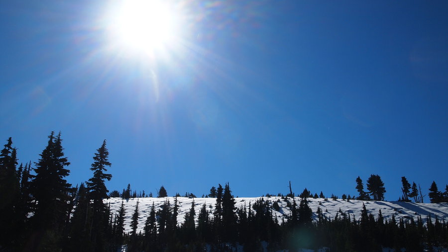
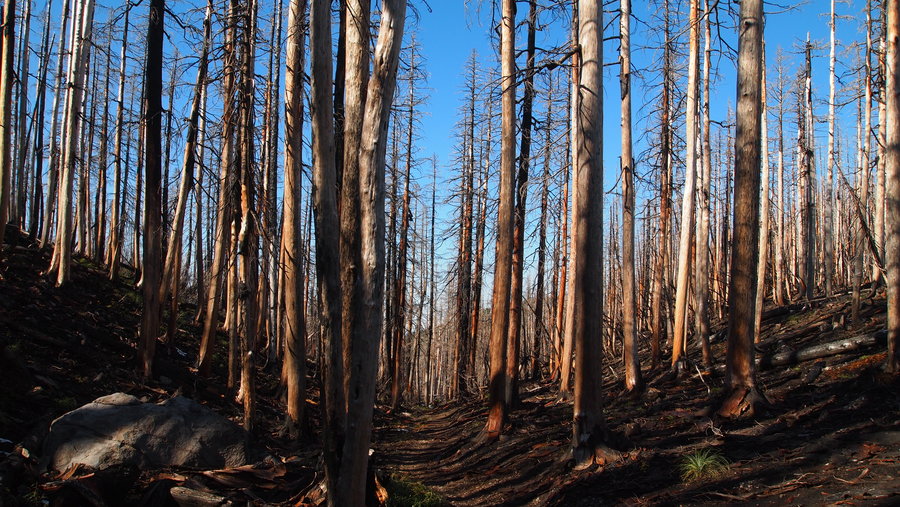
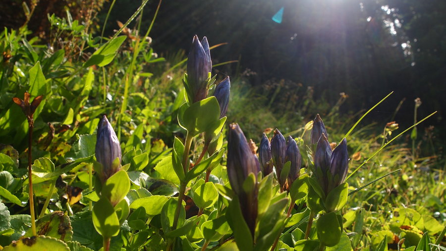
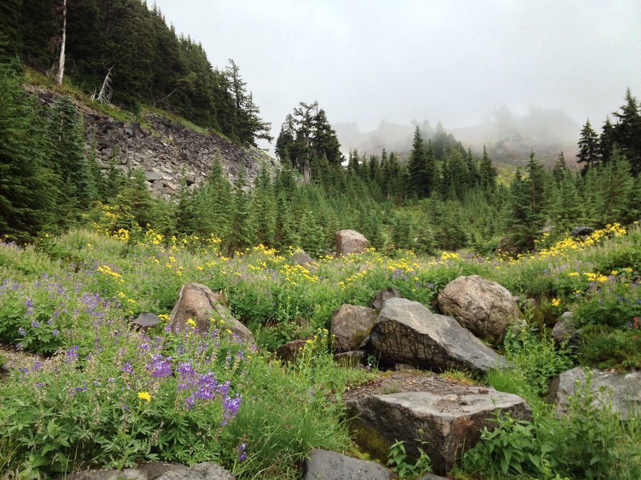
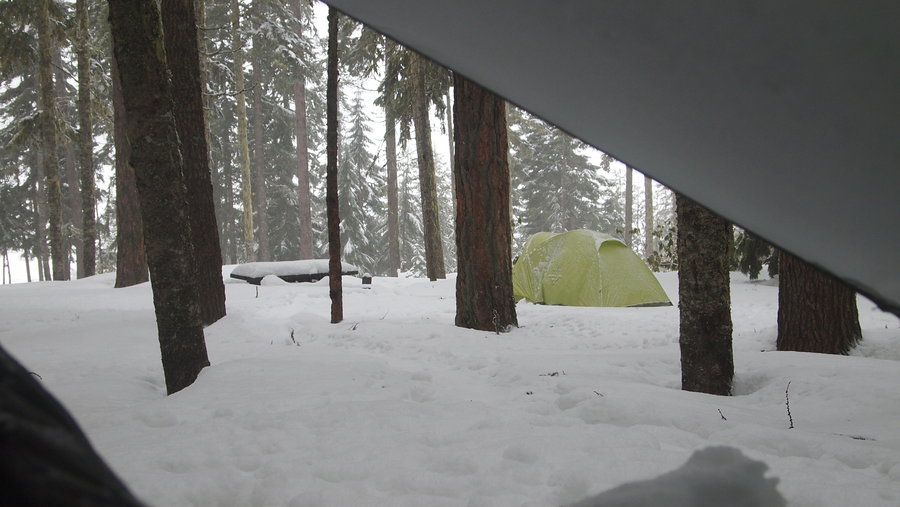
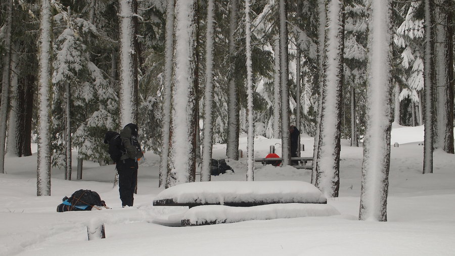
Our original plan was to hike to Dollar Lake to set up camp for two nights, with day hikes to Barrett Spur and Elk Cove. We started at the Vista Ridge Trailhead. About 200 yards up the trail, the snow started and averaged around 2ft deep in most places. We did encounter a few people (including a hunter in camo no one noticed until they walked by him!) and they were all telling us the same thing. "You can get to Wyeast Basin, but after that the snow gets really deep really quick" We decided to continue and evaluate the situation as soon as we reached the Timberline Trail junction. As we came out of the burn area and walked along the ridge to the trail junction, Mt. Hood was there in all his glory, as well as crystal clear views of Mt. St. Helens, Mt. Rainier, and Mt. Adams to the north. We continued to the trail junction and took a left to continue to Dollar Lake. We walked through Wyeast Basin and made it another 1/8 mile before encountering thigh high snow. We decide to set up camp at Wyeast Basin instead.
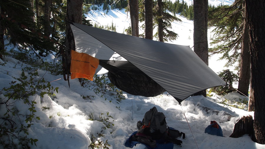
We set up two hammocks and one tent. My hiking partners wanted to see if they could go to Dollar Lake without heavy packs so they took off to see how far they could get. I sat out in the meadow, covered in snow, and basked in the sun, enjoying the view of the mountains to the north. We had a great dinner that evening when my friends returned to camp. I tried steam baking for the first time and was moderately successful with some cheddar bacon biscuits to go with my rice/beans/chicken/cheese FBC meal. Washed everything down with hot cider spiked with honey whiskey. :) It got dark quickly, so we all retired to our respective sleeping quarters.
The night was quiet with the exception of some wind whipping through the trees occasionally. It was a clear night, but we stayed fairly warm in the trees. I used my 20F quilts in my hammock setup and at one point had to shed some layers I was so warm.
Because we got to bed early, we also got up early, around 7a. We had decided the night before to only spend one night out since the weather forecast when we left was showing possible rain showers the second night. Breakfast was a leisurely affair, I made a new specialty of eggs, hashbrowns, chicken, and cheese...it was worth carrying the small one-egg wonder frying pan. Recipe is forthcoming as soon as I perfect it. I washed it all down with a fresh cup of coffee ala Trader Joe's coffee packs and some Medaglia d'Oro espresso powder.
My hiking partners wanted to go back to Dollar Lake for a Barrett Spur attempt. I wanted to read and relax so I stayed behind. They made it to the bottom of Barrett Spur before turning back. They arrived back at camp just before 2p and we packed up and headed out. The snow was much more slick and we took it slowly down the trail into the burn area. At one point I slipped and fell on my a**. I couldn't stop laughing! It was quite comical. I got back up, no harm, no foul. We continued on down the trail eventually coming to a point where the snow had started to melt, then onto some muddy parts and then finally just dirt trail again.
We encountered quite a few people on the trail both days, in various states of dress and readiness. We were prepared for snow and winter weather, so there were not too many surprises for us. In retrospect, micro-spikes or even snowshoes would have been nice. The weather was phenomenal with blue skies and lots of sunshine.
After doing the Timberline Trail earlier this year, I think I may have fallen in love with this side of Hood. The views are stunning and the trails offer so much to see and do. I look forward to getting back there in the coming year.
October 5 – October 6, 2013

Wonderland Trail (Attempt)
23.5 miles of hiking • 2500' elevation gain • 4 nights
I've been sitting on this trail report for a while. It's taken me a couple of weeks to process the entire experience so I am going to try to share what I can at the risk of putting myself out there for criticism and being labeled a "wimp" by some. So, here goes.
I have wanted to do the Wonderland Trail for the past two years and found a hiking partner from one of the local hiking forums. We put in for permits for the end of September thinking the past couple of years the weather has been super nice and figured our odds of getting permits would be better if we waited until after Labor Day. We got our permits and promptly continued with our preparations. For me, I was working on getting miles in and getting my kit dialed in. My hiking partner was also doing the same.
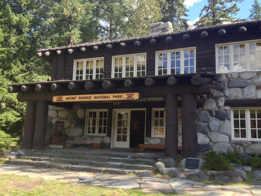
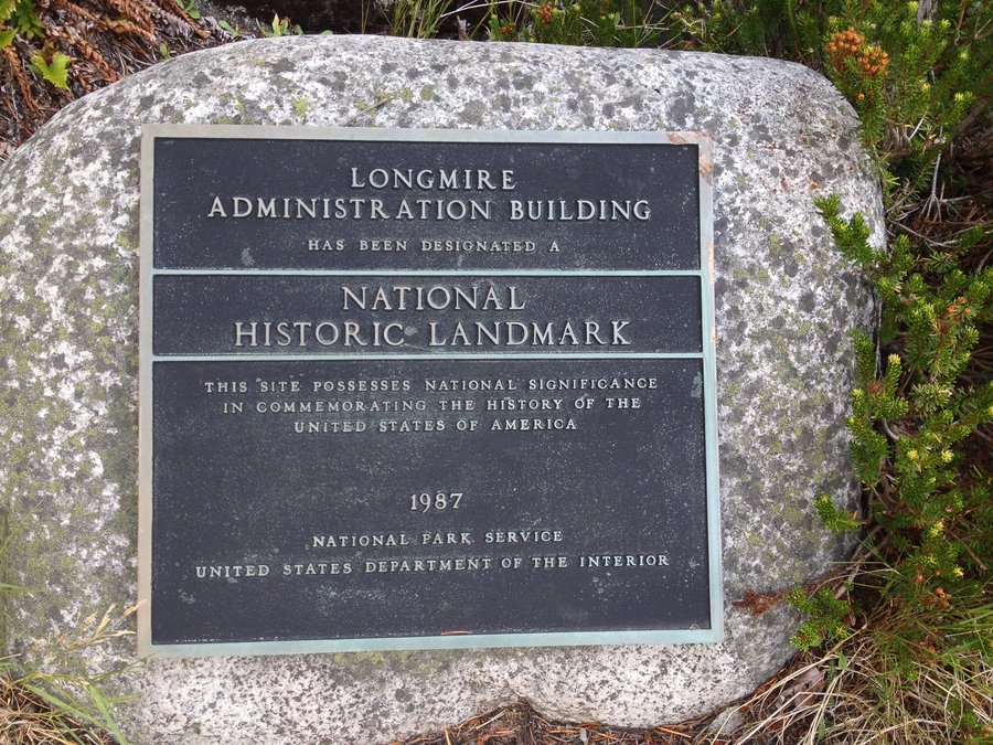
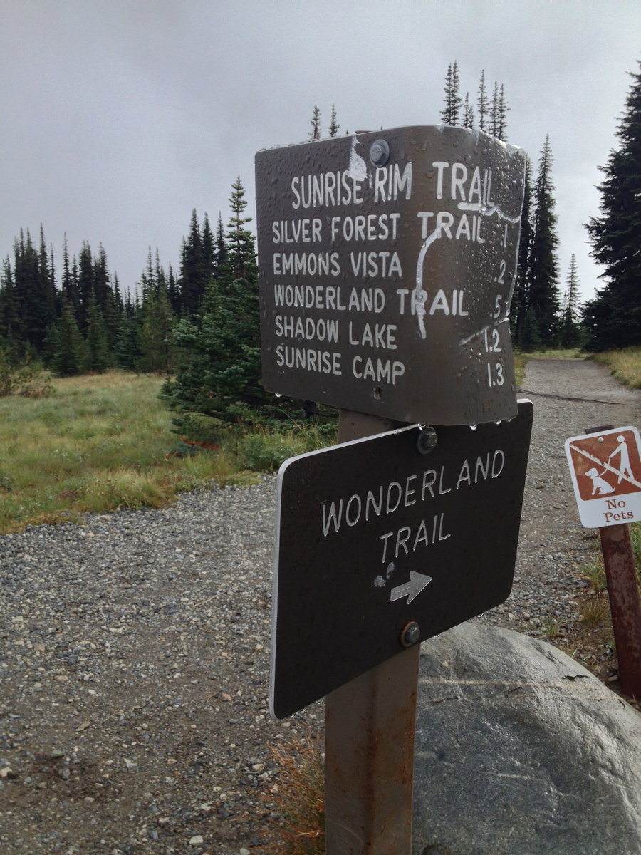
We left Portland on the morning of September 21st with the plan to arrive at Longmire to pick up our permit, then head to Sunrise where we would park the car and hike in to our first campsite 1.3 miles down the trail at the Sunrise Camp.
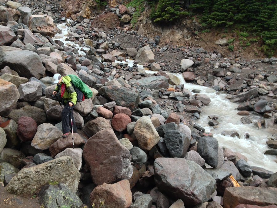
On arrival at Longmire we were told by the park rangers to expect three days of bad weather (rain and definitely snow in the higher elevations) and then things should start looking up. This was before the typhoon weather-front had hit the coast, which as we now know, changed the weather drastically in a short period of time. I figured I could handle a few days of wet weather if it meant the rest was going to be okay. We arrived at Sunrise in the early afternoon and it was socked in. Not a view of anything but a lot of low lying clouds and a few tourists trying to make the best of the situation. We geared up and walked the 1.3 miles to the Sunrise Camp, elevation 6245'. We set up camp and soon after it started raining. I was dead tired from having gotten very little sleep at home the night before so I took a nap in my hammock. It felt good to listen to the rain hitting my tarp while I snoozed. I woke up feeling refreshed and made dinner under my hammock while it was still raining. Since it is late fall, night came quickly so after dinner and a quick outhouse stop (which by the way, smelled horrible!), I was back in the cocoon of my hammock and fell asleep with no problems.
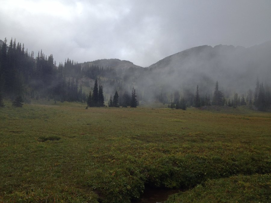
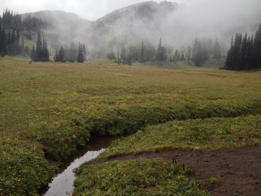
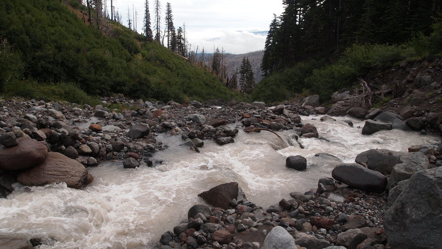
The morning of the 22nd we woke to more rain and remnants of snow from the night before. It was cold and wet, which I'll admit are not exactly motivating factors for me. We made breakfast, packed up and headed out. The first 3.5 miles were all downhill to the White River Campground where we took an extended snack break and used flushing toilets for the last time. We spoke with more rangers who gave us the same weather information and we were also monitoring the barometric pressure on my hiking partner's High Gear Weatherport. We continued on a fairly level part of the trail for another 2.5 miles before the trail started to gradually go up. At this point it really started to rain. This is where I made some bad choices which I would later regret. I had taken my rain pants off (I rarely even bring them but for some reason I did on this trip) at lunch because I was getting hot and my soft shell pants usually do a good job of repelling water. I also had decided to use my trekking poles instead of my umbrella. Another error I would make that would cause issues later on. After lunch we continued heading up towards Summerland, coming across a few other hikers who told us they had seen a black bear on the switchbacks across the stream an up aways. I wasn't worried because I have the worst wildlife mojo of anyone and knew we wouldn't see the little fella since they already had. (I was right...aside from bushy tailed woodrats at the Summerland Shelter, I saw no other interesting wildlife)
As we continued to climb up the switchbacks, I started getting more and more soaked. The rain was coming down pretty hard with no end in sight. My rain jacket was doing a decent job but I think I was sweating so much I was soaking myself from the inside out. I had an Icebreaker mid-weight wool layer on underneath and it was completely soaked by the time we got to camp, as was the synthetic t-shirt I was wearing under that. My feet were soaked as well. My soft shell pants were rather damp too. Do you see where I am going with this?
We got to the shelter at Summerland, elevation 6000', and had planned to set up our sleep systems in it but found two other backpackers who had permits for the shelter, which we thought was odd since the rangers had told us we could camp there if we needed to. They agreed to share the shelter with us and I got out of my wet layers, put my thermal bottoms on with my rain pants over them and put my down puffy on plus dry socks/shoes to try and get warm. I left all my wet stuff hanging in the shelter in the hopes it might get dry (yeah right!) or at the very least, less wet. It took me a while to get my brain to work properly since I was shivering and having trouble putting my thoughts into words. With the help of one of the guys at the shelter, I was able to get my tarp and hammock set up outside the shelter area and I went in it as soon as possible to try to get warm (my hand warmers helped a little bit). I took a nap for about 2 hours, gaining some warmth but still feeling chilled to the core. I knew eating and getting hot beverages inside me would help, so I made dinner and from that, I was able to get a little bit warmer. It became dark quick and after finishing my meal and cleaning up, I went back to my hammock to try to sleep and continue my quest to get warm. Everyone else had vacated the shelter due to the presence of some really adorable (and probably hungry) bushy tailed woodrats. My hiking partner had set her tent up outside of the shelter and the other two guys had set up at a site up the hill near the composting toilet.
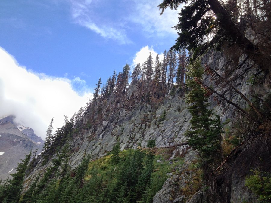
The next morning, September 23rd, we woke to more snow (not really sticking but it was there) and what looked like minimal visibility to Panhandle Gap a mere 800' in elevation from where we were camped. One of the guys we shared our campsite with had gotten lost up there the day before and had to use his GPS to find his way so I was getting worried. I had two concerns. One, that we would have issues finding our way due to visibility and two, if we continued and I got even more wet, I would get hypothermic and we would be far, far away from any kind of help. To be honest, my gut was also telling me not to continue. I had a really bad feeling I couldn't put into words, but there was something about continuing that seemed like a bad idea.
I wrapped my feet in plastic from a cheap, "Dollar Tree" dropcloth I had brought to put underneath my hammock. I cut out out 2, 2X2' pieces and wrapped each foot like a burrito before putting my wet wool socks back on (wool really does retain it's warming properties when wet!) and then put those back into my wet hiking shoes (Keen Dry SUCKS!). I put my still wet Smartwool mid-weight layer back on, then my softshell pants, rain pants and gaiters to complete the ensemble. Trekking poles went in the pack, umbrella came out and we headed back to Sunrise. I had more clothes in the car I could add to my pack and we could get a revised weather forecast as our barometer was starting to drop again. We went back down the trail to the road and were fortunate to hitch a ride with a guy out for a drive. We arrived at Sunrise to find the lot mostly empty, with a few cars here and there.
We hopped in the car, turned on the heater and I started shedding wet layers and added some warm, dry clothes from my stash in the car. We headed back to Longmire, stopping at White River, but the Ranger Station was closed. We continued to Longmire and found out the weather forecast had changed. They were predicting several more days of rain. Hmmm. At this point I was ready to call it, but my hiking partner wanted to continue. So I compromised and offered to pay for a hotel for the night to dry out, regroup, and then set out the next morning. We decided to alter our itinerary so we would start at Narada Falls the following day, and figure out a way to get from Sunrise to our car later. (I put the word out on NWHikers FB page and a generous hiker agreed to help us out. I love the hiking community!).
We went back to Ashford and got a room at the Whittaker Bunk House for a reasonable price. I went over to Whittaker Mountaineering and got a few things to keep me warmer on the trail (btw, they have a great selection of gear at reasonable prices!). We had a delicious burger at a dive bar in Elbe, then back to the hotel to crash for the night.
The next morning, we drove to Narada Falls, set out for Paradise River and set up camp for the night. The weather held and it didn't start raining until almost after dinner. Yay! We had a group of Roads Scholars stop at our campsite for lunch and I chatted them up a bit (continuing to earn my trail name of Chatterbox), asking them questions about their trip, answering questions they had about mine, and deflecting the ire of the group leader who clearly thought we were stupid to be on the Wonderland Trail this late in the season.
On the morning of the 25th, we got started again, heading to Longmire to pick up our cache and check the weather report. At this point, I felt like I had given a good effort on this trail, but my heart was not in it. I told my hiking partner that if the weather forecast was showing three or four more days of rain, I wasn't interested in continuing and putting myself (and her) at risk. We were supposed to go past Indian Henry Hunting Ground and from what I could tell, there was going to be minimal visibility. I had proper gear on this stretch, but spending four days or more with soggy feet with no way to get anything dry was not something I was looking forward to, not to mention the fact I still had not seen the mountain. She agreed that we would call the trip if this was the case. We lucked out and had no rain the entire walk to Longmire. On arrival, I checked out the weather forecast and with the exception of possible sunshine the next day, it was rain, rain, rain, oh and more rain plus snow in the higher elevations. We called it.
I tried to hitch from Longmire and had no luck so we started back to our vehicle at Narada Falls. Eventually, we came to another trailhead and we were able to hitch a ride with a couple of friends out sightseeing. We made it back to Portland by late afternoon.
This was probably one of the hardest decisions I've ever had to make, coupled with the fact I made some big errors in what I brought with me for clothing. My sleep system (Hennessy Hyperlite Hammock with 20F quilts) and tarp (OES MacCat Deluxe) were perfect. My stove (Micro Pocket Rocket) and cook kit were perfect. My food was just the right amount. My water filter system(Sawyer Squeeze) was perfect. My pack (GG Mariposa) performed flawlessly. I'll be honest, even though I am from the PNW and used to hiking and backpacking in the rain, the weather around Mt. Rainier got me good. I don't know if changing my clothing at the beginning would have changed the outcome much. The forecast and eventual weather from the typhoon brought continual precipitation the following week. Coupled with the fact the government shut down would have started the day we were to come off the trail, this helped me come to term with the decision to stop was right. I am not sure how we would have gotten off the trail at Sunrise and back to our car at Narada Falls (even with our arranged ride). At the time I was doubting myself, but in the end, after a little perspective, I know I made the right decision, as painful as it was.
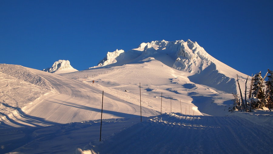
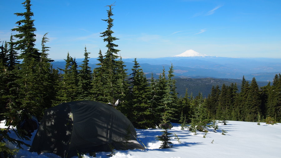
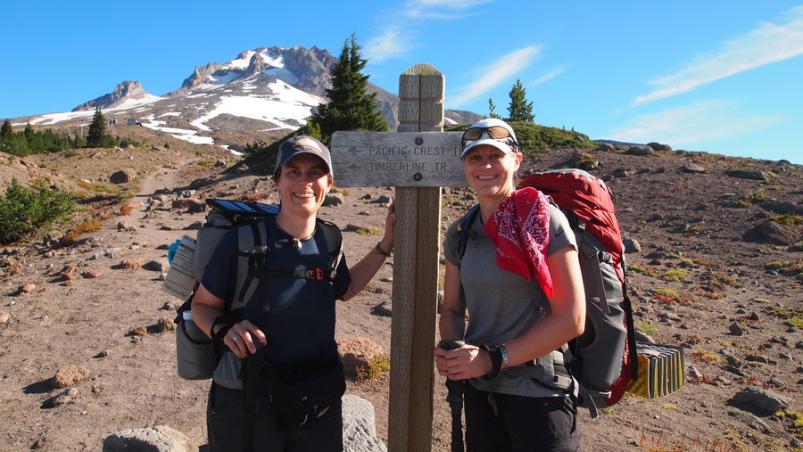
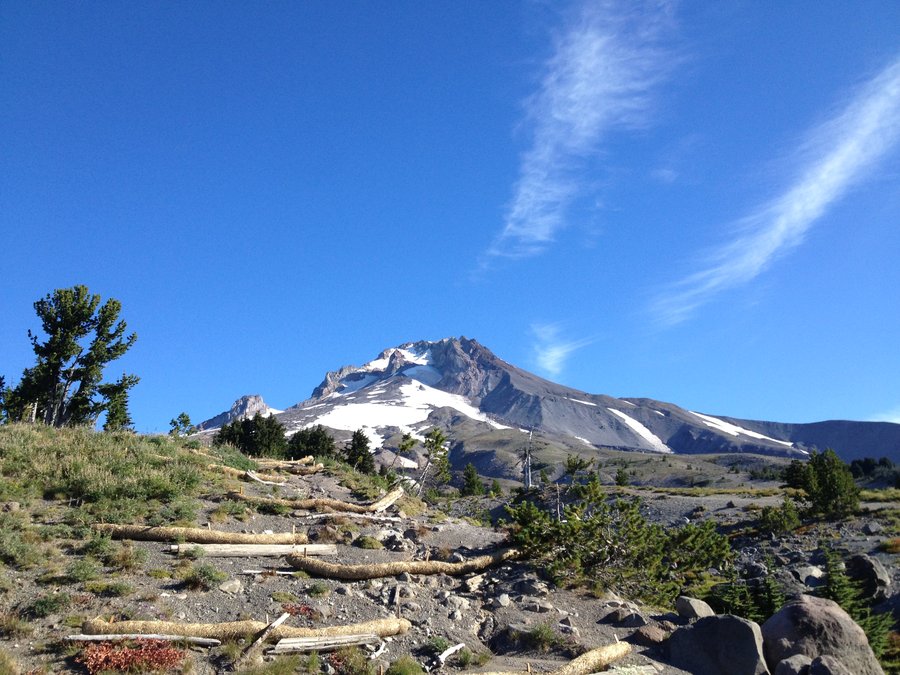
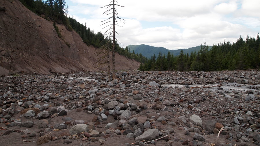
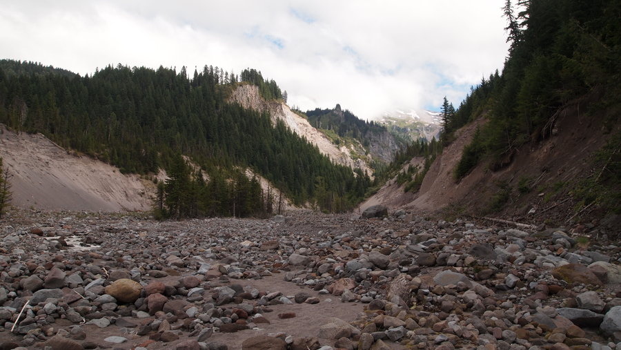
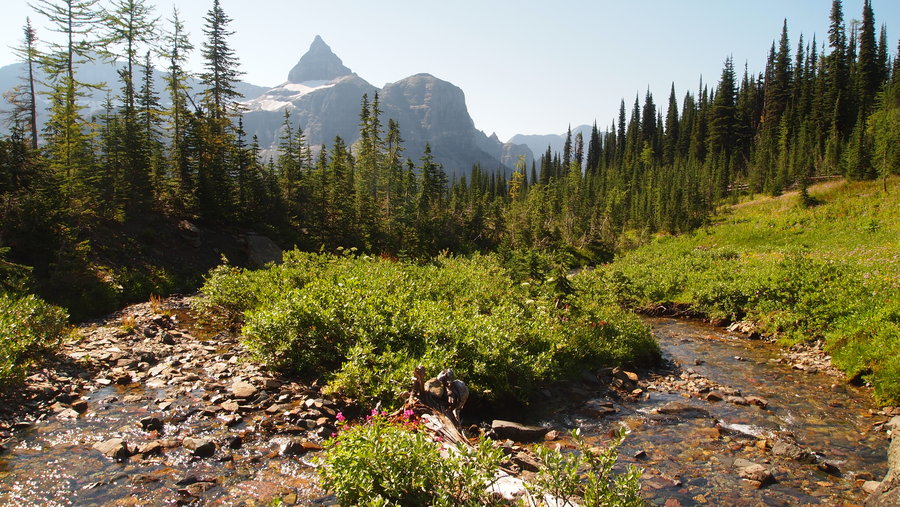
September 21 – September 25, 2013

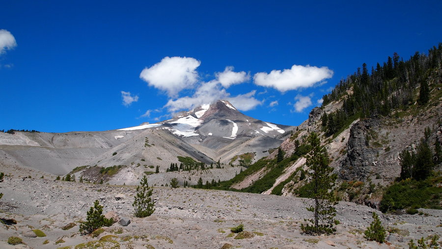
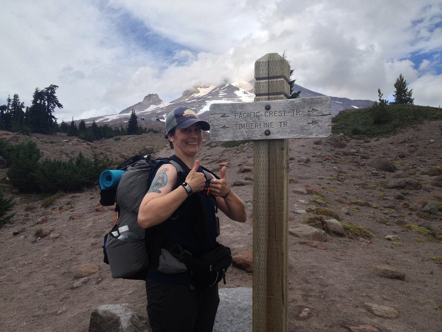
Timberline Trail Backpack (Clockwise)
41 miles of hiking • 8000' elevation gain • 3 nights
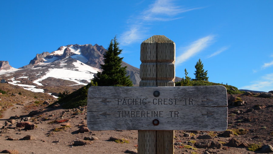
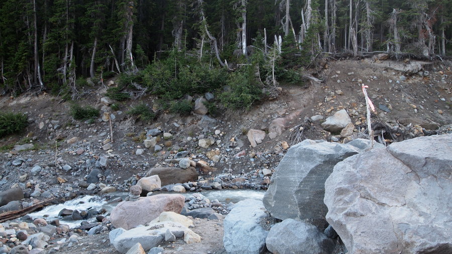
Day 1: Timberline Lodge to Ramona Falls We got a little bit later start than we planned but still made good time. We were on the PCT all day and came across 8 thru-hikers, including 2 SOBO and 6 NOBO. One of the first we met was Hiker Box Special and we chatted a bit with him. The rest weren't too chatty and in a hurry to get their miles in. The trail descended 2500' and even though Mt. Hood was obscured by low clouds most of the day, we did have some spectacular views. We also gorged ourselves on huckleberries. The Sandy River crossing sucked. Mostly because it's so silty, you can't see the bottom, so you have to feel your way with your feet and hope you aren't stepping wrong. My hiking partner had never been to Ramona Falls, so we decided to camp there for the night.
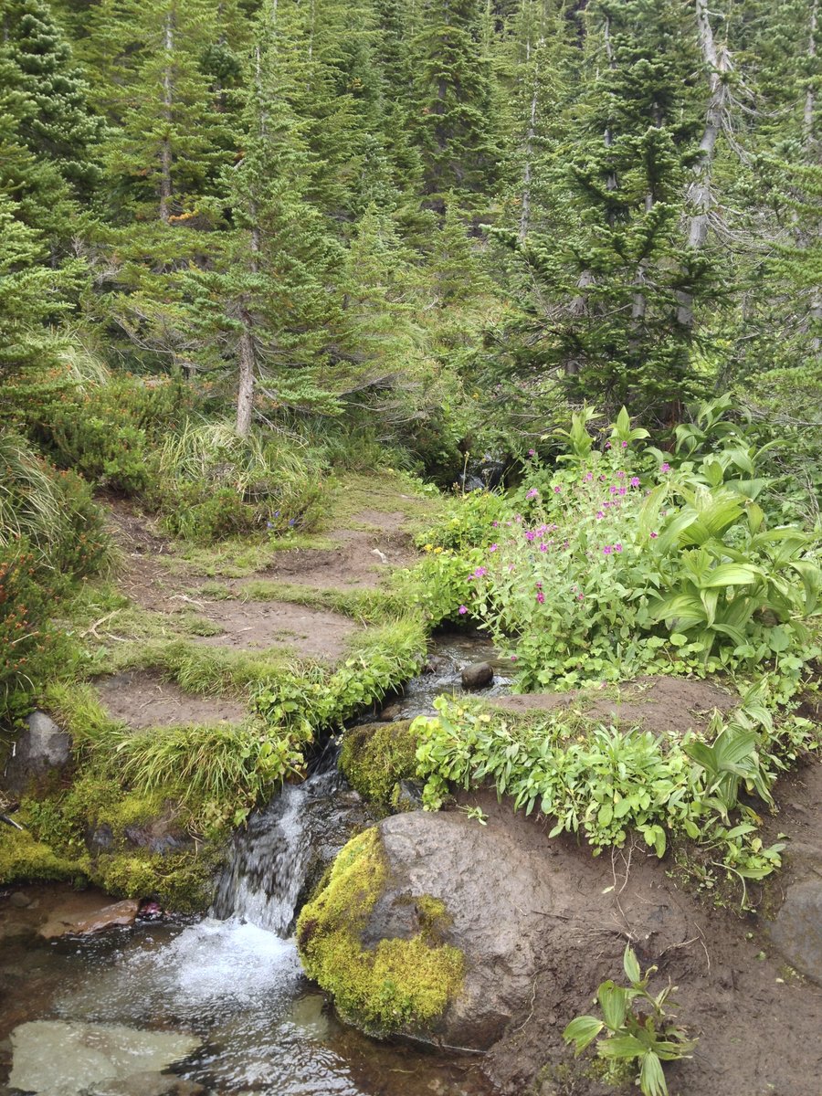
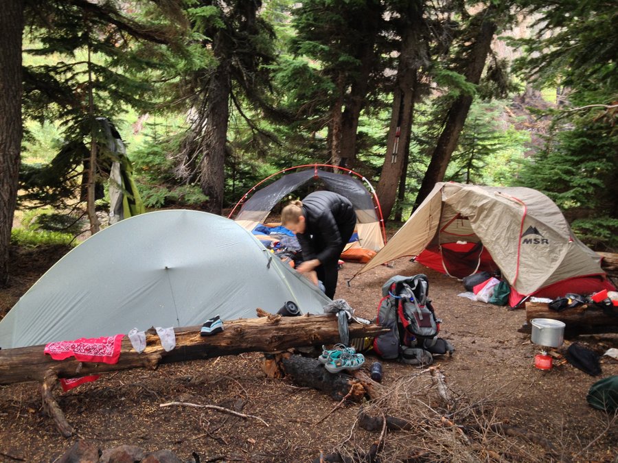
Day 2: Ramona Falls to Elk Cove The day started out with us making some tough decisions about the route. We were both interested in seeing if we would run into any other PCT thru-hikers, so we decided to take the #797 trail back to the PCT and then connect with the Timberline Trail to Cairn Basin and beyond. We had a creek crossing at Muddy Fork that involved two rather large logs but was much easier than having to change shoes and wade through silty water, so we were thankful. We headed up and up through various switchbacks through the forest, hoping it wouldn't really rain much, stopping often to snack on bushes and bushes of huckleberries (this was a theme of our trip!). Once we reached the intersection to reconnect with the Timberline Trail, we took a short break and then continued on our upward travel, hoping to catch some views of Mt. Hood. Unfortunately, the mountain had other plans for us that day and we saw a lot of low-lying clouds and not much else. We continued our climb upwards, only to have a nice rain storm hit us pretty hard. While crossing Ladd Creek, my hiking partner got her feet wet, so we started looking for the Cairn Basin shelter to take refuge and dry off. We found it easily and waited out the rain for about fifteen minutes, changing out socks, grabbing a snack and then heading out to get to Elk Cove. The weather held long enough for us to get to Elk Cove, get our tent/hammock setup, and get water before it started raining again. I made dinner quickly and retired to my hammock. My hiking partner decided to eat a power bar and call it a night. About an hour later, a group of five showed up at our campsite in dire need of ending their day. We shared our small campsite with four more tents and found out one of their people was showing early signs of hypothermia. They got their tents set up quickly and did their best to dry out and put warm clothes on. It was a long night for everyone I think. I had to adjust my tarp on my hammock to keep my underquilt dry, and I was a little worried about our new trail friends.
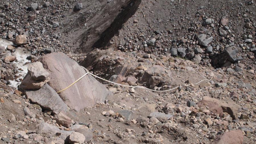
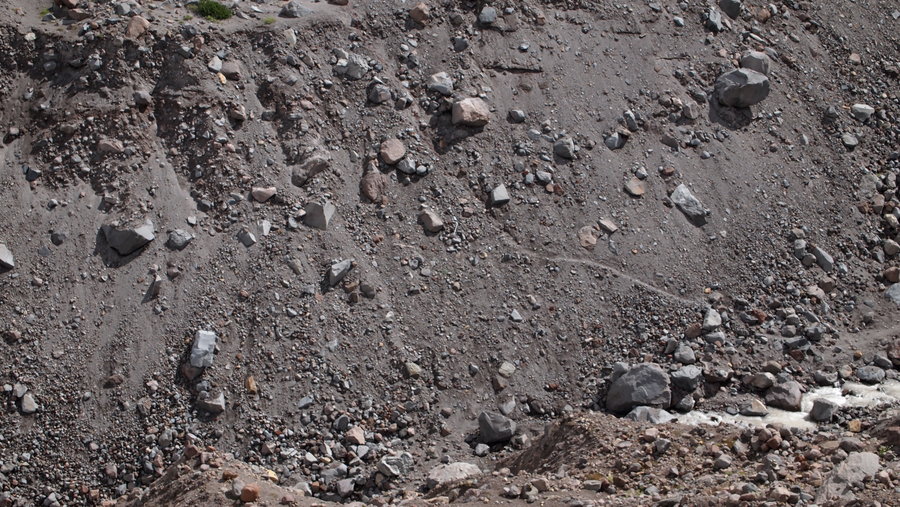
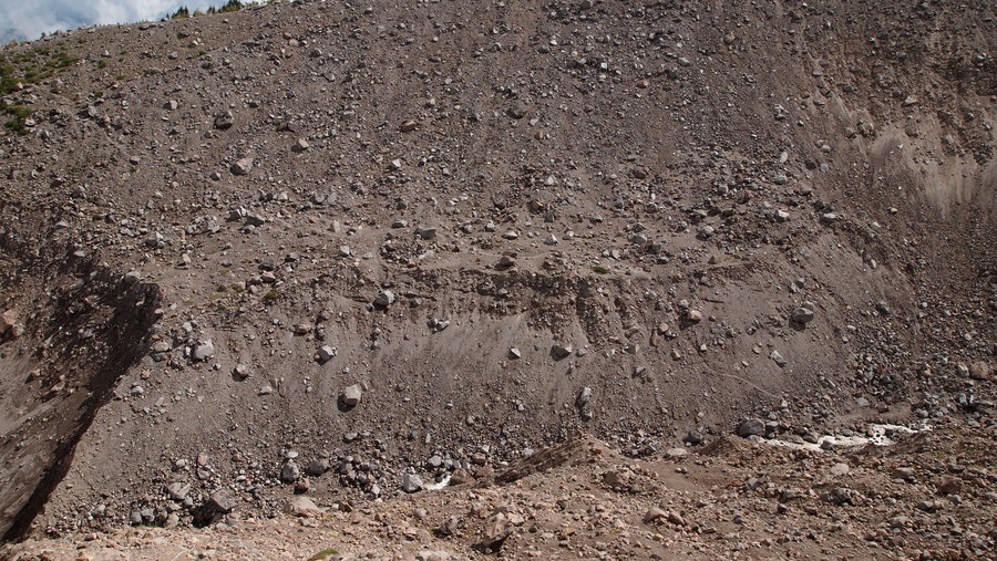
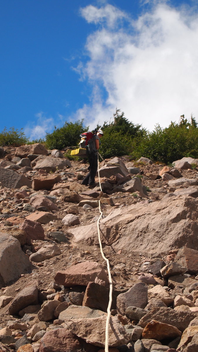
Day 3: Elk Cove to Newton Creek The rain the previous day sucked a lot of my motivation and we got a late start. Our trail friends were all doing much better this morning after a good night's sleep. Hypothermia was averted, food was eaten, hot beverages consumed and conversations flowed with everyone. We had our first really difficult crossings today. Coe Creek was quite a challenge but we made it across eventually. Then we continued along to get to the Eliot Creek crossing. Fortunately, we had talked with a lot of people doing the trail counter-clockwise, so we knew where to find the area most people have been crossing. When you get to the "Trail Closed" sign you will see a well-worn trail to the right. Follow this up the hill, through a small campsite and onto the ridgeline. Start looking for cairns which will eventually lead you to a white rope. Use the rope to get down the hill, then start looking for a place to cross Eliot Creek. Be sure to follow the cairns once you get across Eliot to the red rope which will get you up the hill to another trail which will take you to the top of the ridgeline on the other side. You can follow this ridgeline to the end, then there will be a trail that will cut down and up to the Cooper Spur shelter where you can reconnect with the Timberline Trail. We took a late lunch break at the shelter and continued on our way. We stopped to talk with a Crag Rat out doing trail maintenance and continued up to Gnarl Ridge where I swear to God we were going to get blown off the ridge! We made it to Newton Creek later than I would have liked but were able to get camp set up and eat dinner before it got too dark. Newton Creek crossing was the first one where we didn't have to take our shoes off to cross...a luxury!
Day 4: Newton Creek to Timberline Lodge This was a shorter day, with a bit of elevation gain, but overall a pleasant change from the previous days. It was my first time at Mt. Hood Meadows and now I know where it gets its name. The meadows of wildflowers were beautiful and we enjoyed the peace and quiet of being on the trail the whole day. I think our favorite crossing was at White River. It was so expansive and we even sneaked in some decent views of Mt. Hood. The huckleberry bushes along the way slowed us down a bit and I'd be lying if I told you my fingers weren't slightly purple from all the berries I ate. We made good time to Timberline Lodge and had a celebratory beer and sandwich in the Lodge before heading home.
August 24 – August 27, 2013


 3
3
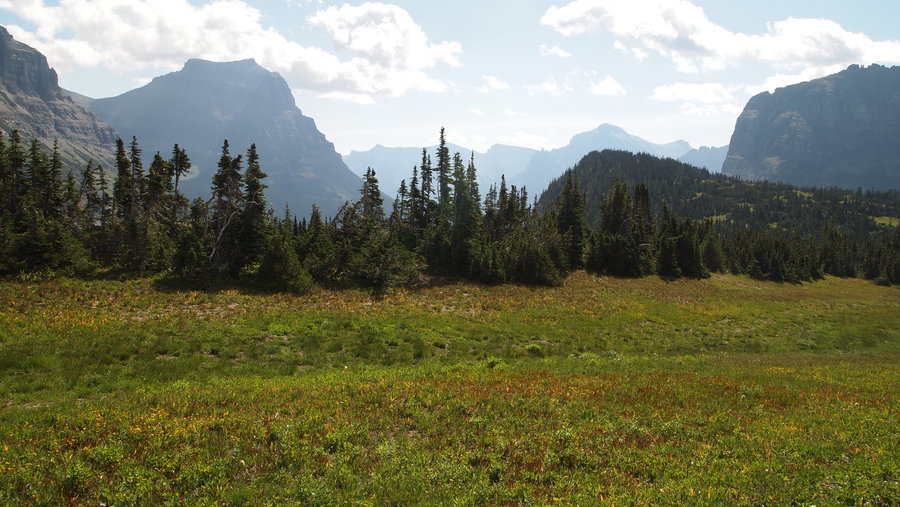
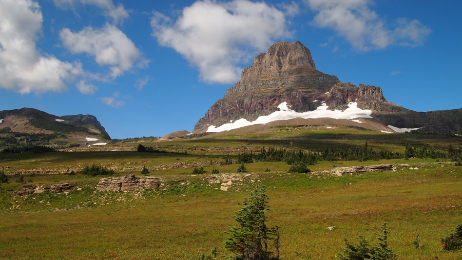
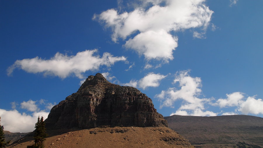
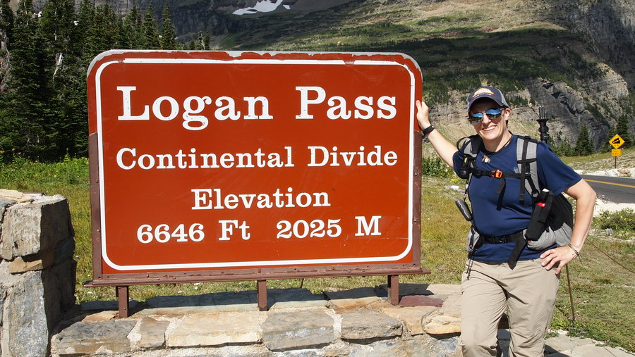
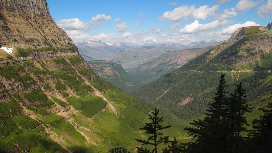
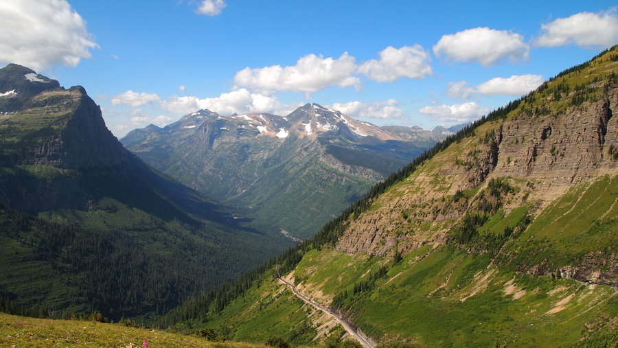
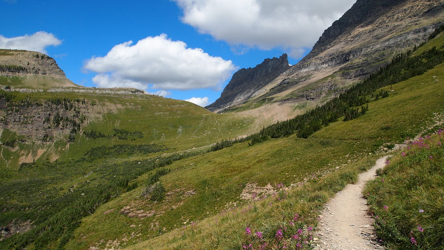
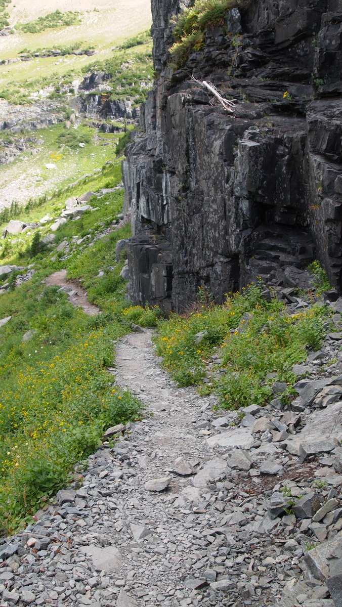
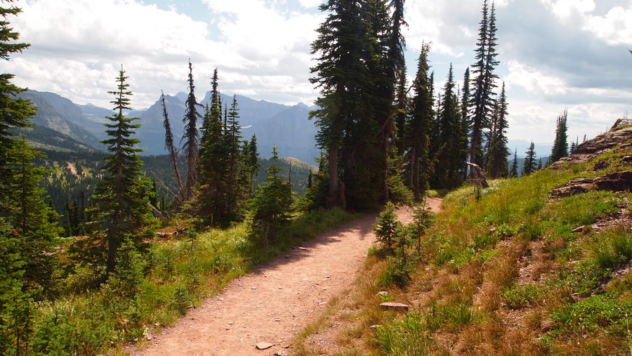
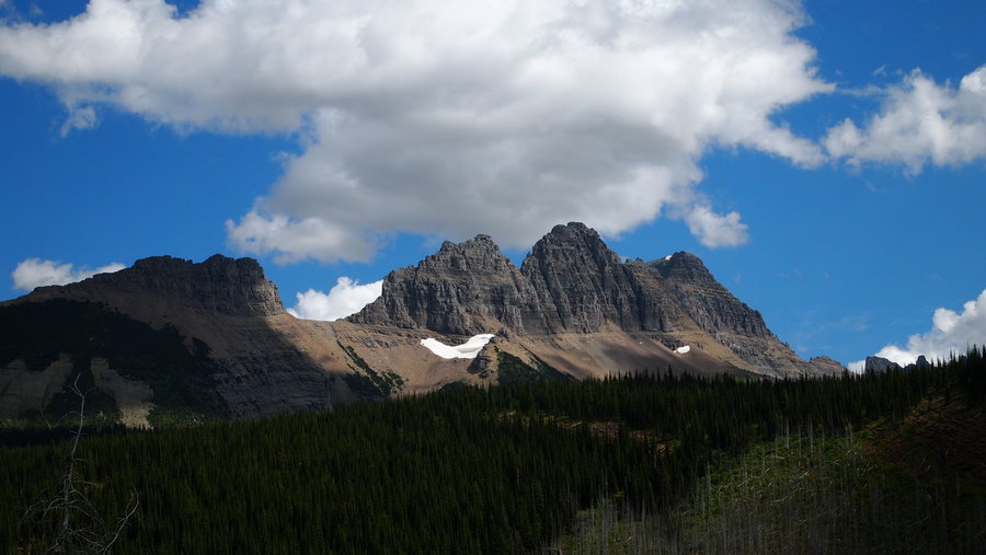
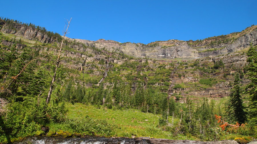
Highline Loop Trail, Glacier NP
12 miles of hiking • 2000' elevation gain •
Start Time: 11:30a Finish Time: 3:30p
After spending 5 days/4 nights in the backcountry on the Bowman-Kintla Horseshoe, we had an extra day to kill at GNP, so we decided to give the Highline Trail a go. GNP has started offering a free park shuttle, which I highly recommend. We were able to park our car at Apgar, take it to Logan Pass, start the hike, then pick up the shuttle at the end of the hike at The Loop parking lot. The shuttle allows you to take in the scenery without having to focus on the windy Going To The Sun Road.
The first 5 or 6 miles featured a steady stream of hikers in various states of preparedness. Apparently the sign at the trailhead warning of bear activity didn't seem to phase most people. I saw very few people with bear spray, much less enough water or other supplies for a day hike in the summer heat. This is not a trail to take in the middle of summer if you are expecting any kind of solitude! Re-entry was hard for us and this trail made it a little more difficult.
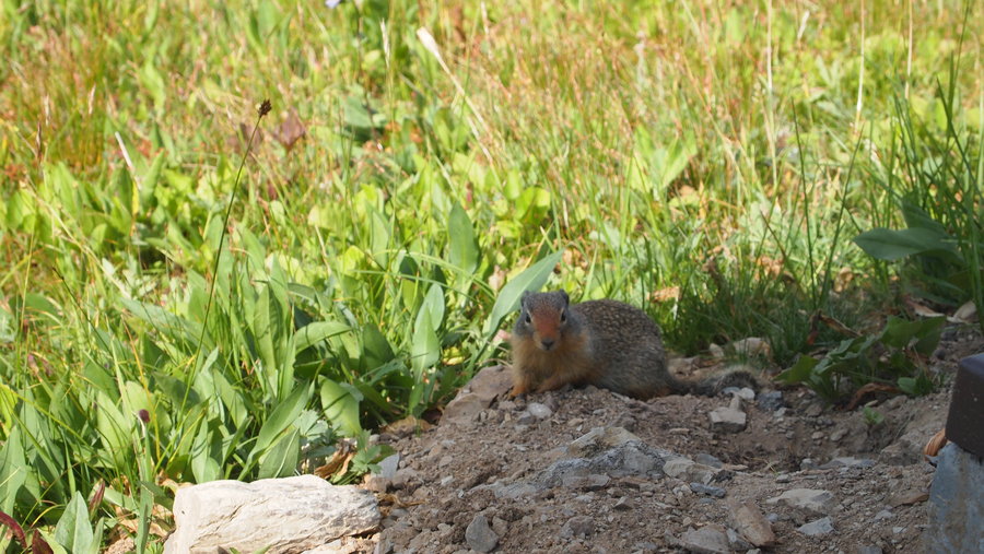
That being said, this really is an amazing hike. It has a minimal elevation gain and you can really move on it if the trail conditions are just right. We saw lots of marmots and ground squirrels. I did find a marmot with a ziploc bag around his head and tried to get it off, but he ran off down the hill. To be fair, I was actually going to grab the bag because I thought it was just a plastic bag someone had left behind and it wasn't until I actually got close that the bag started moving and I realized a marmot had his head caught in it! Poor little guy. I think he finally got it off, but at that point it was on a steep incline so I erred on the side of safety.
Shortly after that, I came across a hiker with a skinned up knee. I offered to bandage him up and promptly took my first aid kit out of my pack and went to work. I had a great conversation with him and his wife (locals from Kalispell) and one of my hiking partners also helped with some leukotape to keep the coban in place. It never fails...I can't seem to go on a hike without rendering first aid at some point. :)
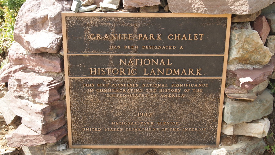
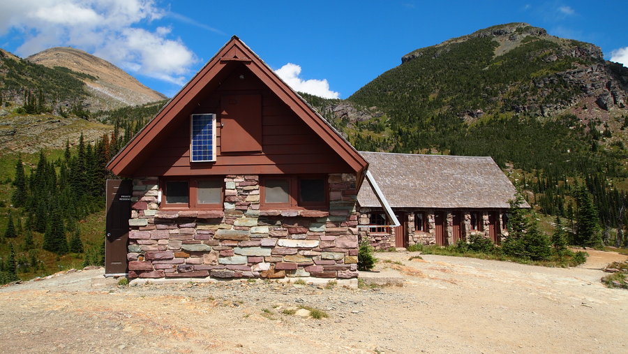
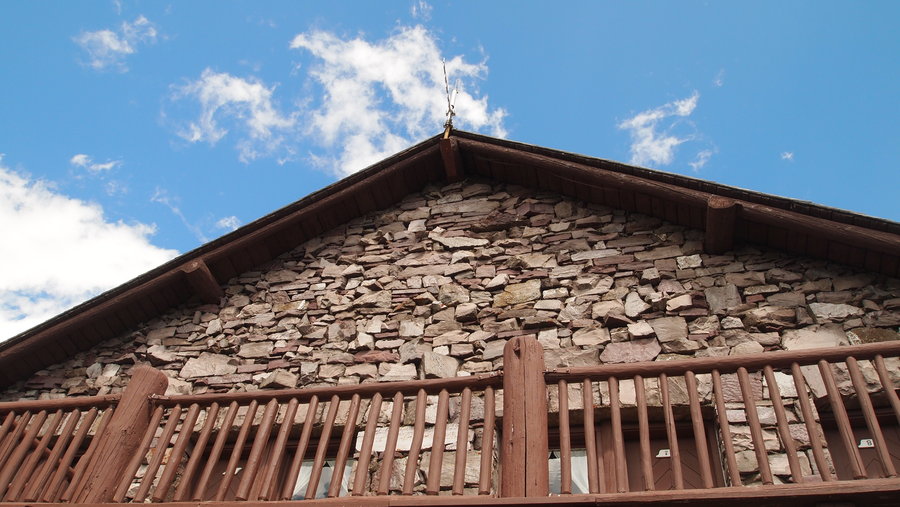
We made good time to the Granite Park Chalet and I took a very brief break before continuing down the trail trying to stay ahead of my hiking partners who were keeping up a pretty steady pace. I finished about 15 minutes before they did, and we took the shuttle back to Apgar.
This trail offers stunning views and I cannot recommend it enough if you ever find yourself in GNP. Just try to avoid it on the weekend and in August if you can. :)
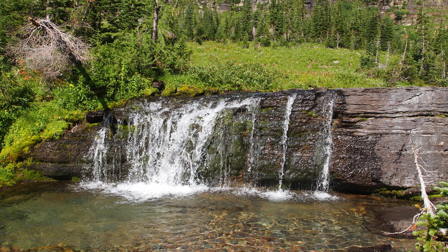
August 17, 2013

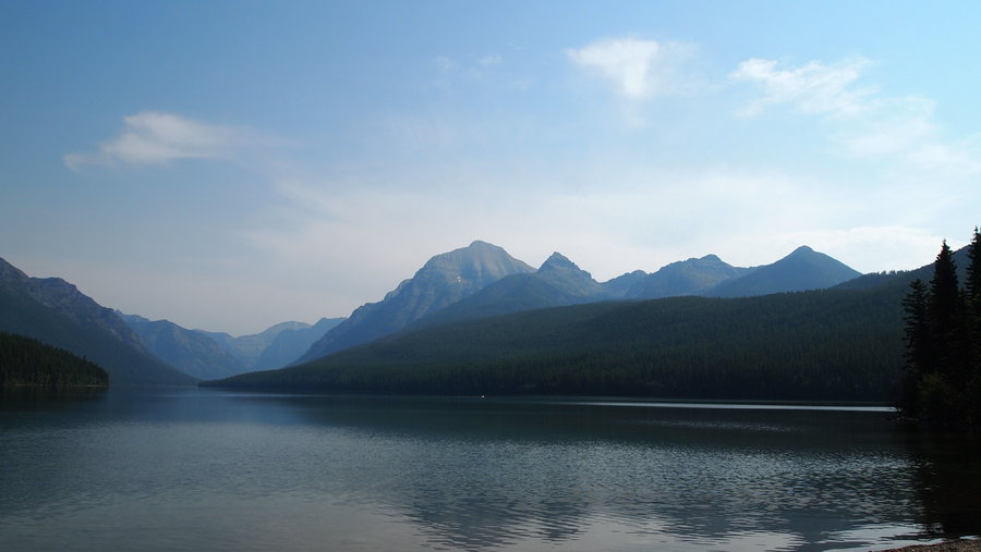
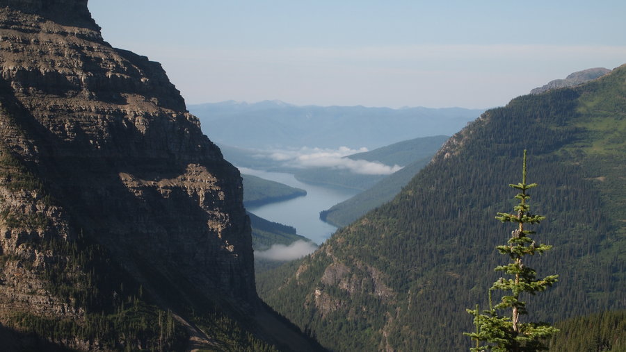
Bowman-Kintla Horseshoe, Glacier NP
40 miles of hiking • 3750' elevation gain • 5 nights
This was a 4 night, 5 day backpack trip in the backcountry, followed by 1 night in the frontcountry at Kintla Lake CG.
Our Itinerary was as follows (using the backcountry campground codes from GNP): BOW to BRO BRO to HOL (must do side trip!) to BOU BOU to UPK UPK to Kintla Lake CG
While lots of things happened along the way, here are the daily recaps:
Day 1: Bowman Lake HD, 7.1 mi, 400' EG Start: 11a End: 3p
This was the morning we got up at the ass-crack of dawn to be first in line at the Backcountry Permit Office at Apgar. We arrived at 5:50a and were first in line to get walk up permits. We settled on the Bowman-Kintla Horseshoe, using two cars, which is the only way to do it. We camped at the Bowman Lake HD campsite with a group of 8 from Valparaiso University, a group of 3 guys from Chicago, a group of 3 from Utah, and a group of 3 from Missoula. At 4:30a that night, the wind had been blowing and one of my tarp stakes went "boing!!!" and my tarp started flapping in the wind. I got out of my hammock quickly and started putting rocks on all of my other stakes while I tried to find the one that flew away. I found it, restaked my guyline down and hopped back into my hammock just in time for a huge thunderstorm to start.
Day 2: Brown Pass, 6.5 mi, 2600' EG Start: 11:30a End: 4:15p
Because of the rain we didn't get up until almost 9a and got on the trail at 11:30a. Our first break was about four miles down the trail at 1p at a river crossing where we could dry out our shoes and socks from walking through TONS of thimbleberry bushes. From this point the trail started gaining elevation and as usual, I started to slow down. I split from my two friends who do better on the hills and had some solo hiking time with my iPhone playing music to let the bears know I was coming around the corner. :) At one point I took a 15 minute break and just allowed myself to soak in the scenery. I arrived about 20 minutes after my friends and set up my hammock in a great spot. I was kind of hungry, so I went to the food prep area to start cooking dinner. This campsite is smaller so we only had neighbors from Montana and Maine. I enjoyed the smaller crowd of people. We finished dinner just in time as another thunderstorm started (the rangers had said we would have two days of thunderstorms and they were right!). We put our food and stuff away, hung everything on the bear hang and retired to our tents/hammock just after 7p, where it continued to rain most of the evening. It did let up enough before it got dark to go use the privy one more time. I spent the evening in my hammock reading an e-book on my iPhone.
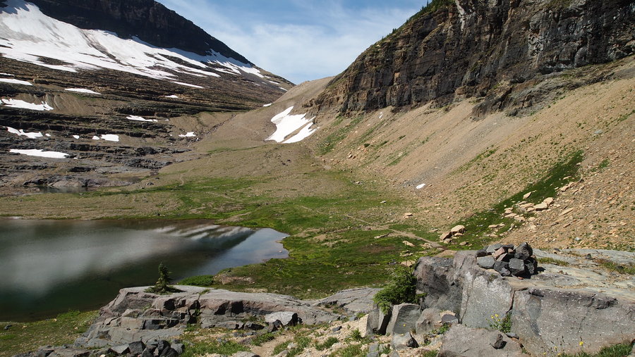
Day 3: Boulder Pass (with side trip to Hole In The Wall), 7.9 mi (incl 2 mi side trip), unsure EG Start: 9a End: 1:30p
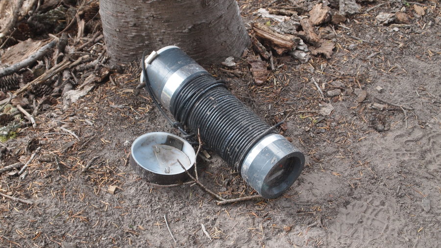
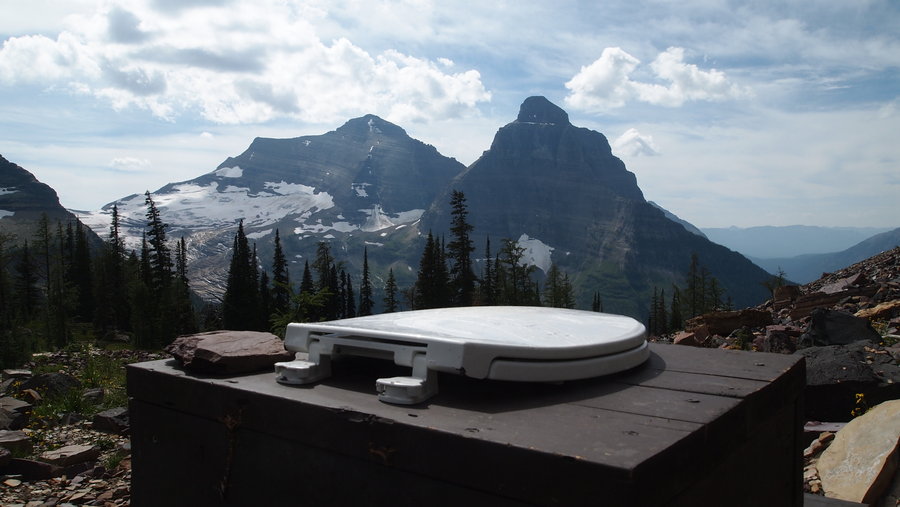
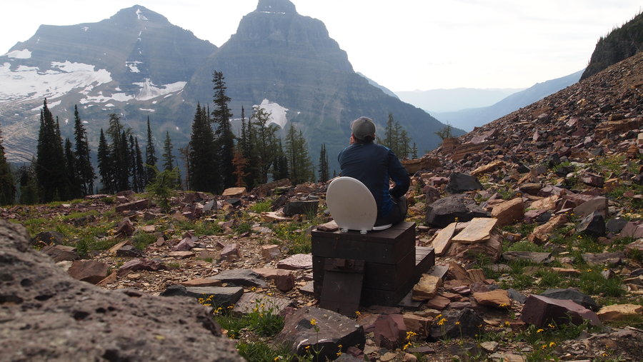
The route out of Brown Pass was gradual and filled with more amazing views. We had decided to stop at Hole In The Wall for a visit just because everyone we had talked to said we should. It was about a mile each way and we didn't mind the extra mileage since our days were so short in general. We arrived at Hole In The Wall and realized what a special place it was. It was gorgeous. It has the only privy with hand sanitizer in the park! The privy has a solar powered fan designed to dry out the urine since 90% of waste is liquid, thus making the waste breakdown quicker. I learned all of this while reading the FAQ posted inside. We also took a "shower" in the glacier-fed waterfalls. So refreshing!
After our stop at Hole In The Wall, we continued a gradual climb up to Boulder Pass, coming across an area where rock cairns guided us along the way, finally coming to Boulder Pass. There were limited trees and I had my first problem hanging my hammock. I made it work but it was not ideal. Boulder Pass is home to a privy with a million dollar view. We all took turns taking pictures of the privy. Several people from the campsite took the afternoon to climb Boulder Peak. In retrospect, there isn't a designated trail to the peak and it appears that overuse is starting to cause some negative environmental impact, so I can't recommend doing the hike. From the photos my friends took, the views were quite stunning.
Day 4: Upper Kintla Lake HD, 5.9 mi, 2800' EL Start: 9a End: 11:30a
Today was a short day that went by quickly due to the 2800' elevation loss. We cruised down the trail through the sub-alpine areas and back into the forests filled with thimbleberries. The campsite at Upper Kintla Lake HD was great. I found the perfect spot to pitch my hammock and decided to sleep without the tarp for the first time. Since we had a lot of time to kill, my hiking partners and I cleaned off in the lake and spent some time laying out in the sun. I'm fortunate that my hiking partners are okay with lots of quiet time, so we each took as much time as we needed to be alone, soaking up the last of the backcountry experience. Our site-mates tonight were from Portland, New York, and Montana. The social time at dinner was fun.
Day 5: Lower Kintla Lake CG, 11.6 mi, 0' EG Start: 8:30a End: 1:30p
We started a little bit earlier this morning, which I am glad we did. We cruised along and took a few short breaks. We ended up with the last campsite at the campground. This is where we met Lyle, a 93 year old NP Ranger. He started as a ranger when he was 72! Super cool guy. Lots of stories to tell and such a sweetheart. The campground had 13 spots so it was relatively small and quiet. We retrieved our car, and were able to change into fresh clothes after taking a "bath" in the lake. The weather was so awesome on this trip, I feel kind of spoiled to have been able to spend so much time keeping clean. :) I was able to set up the hammock here too. I slept without the tarp again and enjoyed the fresh air and clear skies.
All in all...amazing, majestic, gorgeous, beautiful, awesome, epic, fantastic....yeah, words do not describe everything we saw, hopefully the photos do.
August 12 – August 17, 2013


Serene Lake via Dry Ridge Trail
20 miles of hiking • 3750' elevation gain • 3 nights
I decided to post a trip on my Meetup group to do Serene Lake but from a different approach because I was too lazy to drive all the way to the Shellrock TH or the Frazier Turnaround TH. Besides, I had already done that trail and wanted something different. We started at 9a from the Roaring River Campground where the trailhead for the Dry Ridge Trail (#518) starts. There was conflicting information on the mileage for this trail, the stuff I found on the USFS site said it was 5.2 miles to the Grouse Point Trail (#517) but when we got to the trailhead for Dry Ridge, it said it was 6 miles...hmmmm, the plot thickens.
So we started on the 3 miles of insane up, up, up and more up until we arrived at a trail junction for FS Road 4635. Apparently you can drive to this road, and catch a short trail to connect here, thus missing out on the lovely elevation gain. Making mental note for next time. :) We continued along the Dry Ridge trail with gentle inclines upward and sometimes with some flat spots, and two creek crossings that were a piece of cake. Eventually we came to the intersection of Dry Ridge, Grouse Point and another trail to FS Road 4611. The signs said we had gone 6 miles from Roaring River. We continued on the Grouse Point Trail (#517) another 3 miles (according to the signs!) to the Serene Lake Trail (#512) which showed a 1 mile drop down to the lake. The Grouse Point Trail was nice. It had gentle slopes upward and I swear we walked through about a mile of thick rhododendrons before starting a short ascent to the top of the ridgeline and eventually coming to the Serene Lake Trail (#512).
We descended down to the lake around 2:30p and found a nice spot with a breeze and a picnic table. The bugs were not bad because of the breeze and we set up camp. We found a lot of nice firewood for a campfire later and spent the afternoon relaxing, reading books, walking around the lake and basically chilling out. Dinner was followed by a campfire and then we retired to our respective tent and hammock. I had been camping the previous two nights at McIver State Park and it was my third night sleeping without my tarp. There were clear, blue skies, a gentle breeze and lots of stars. It was very quiet, with very few sounds in the night.
The next morning, we started up around 7a and worked on breakfast and breaking down camp. We were on the trail by 9a and started the slog up the hill to the trail junction. We took a quick break and set off at a healthy pace, taking another break at the next trail junction. The first 4 miles went by rather quickly and we stopped around 11:30a for an early lunch with 3 miles of downhill to go. Our return to the trailhead happened at 1:30p and a successful backpack was completed.
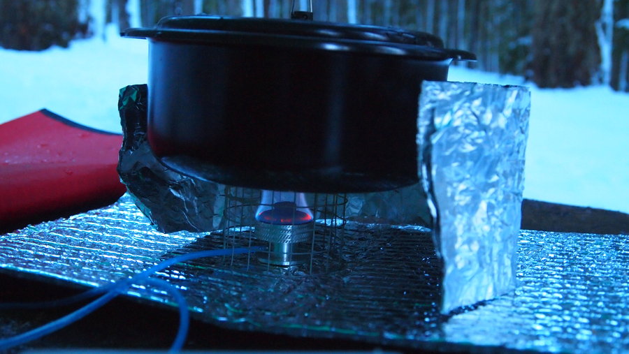
I tested out my Gossamer Gear Mariposa pack and it performed flawlessly. I might be in love. I didn't weigh my pack but with water and food, I am guessing I was around 25-30lbs. I also used my Mini Tattoo alcohol stove again. I'm still not impressed with it, but I think it has more to do with the pot I am using (Snow Peak 700) than the stove itself. I also forgot my windscreen so that might have had something to do with it's performance. I am looking forward to trying out some new alcohol stove ideas this winter when I have more time. In the meantime, I will probably just bring the Micro PocketRocket the next time I go out. It's so simple and light!
My one negative from the experience was the insane amount of microtrash all around the campsite and the large amounts of toilet paper and human feces. My backpacking partner found some really awesome amounts of human feces while out walking. How hard is it to dig a damn cathole? Or pack out your garbage? I just don't get it. Once again, another favorite spot is ruined by people's lack of respect for nature. I'm not sure I will return to Serene Lake anytime soon because of this. It's such an amazing place, it really sucks to see it destroyed by lazy people. It seems to me that since this is such a high use area, it would make sense to have a composting toilet nearby. Just a thought. I know there's no money in the budget.
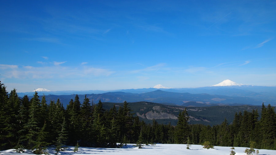
July 26 – July 29, 2013

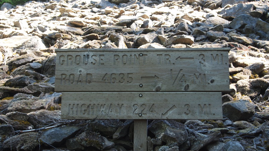
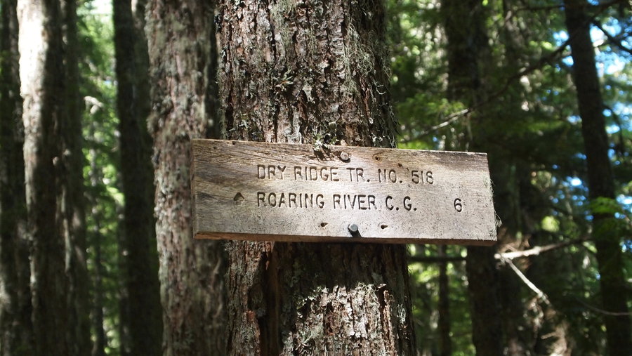
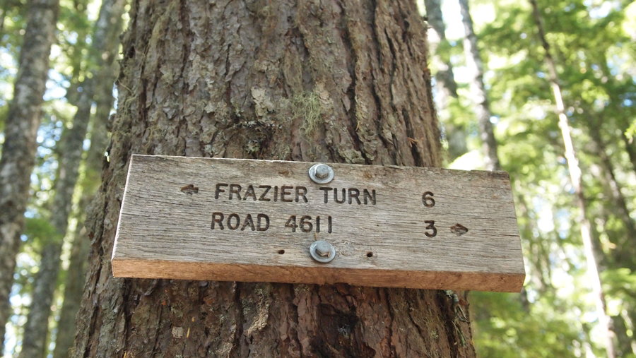
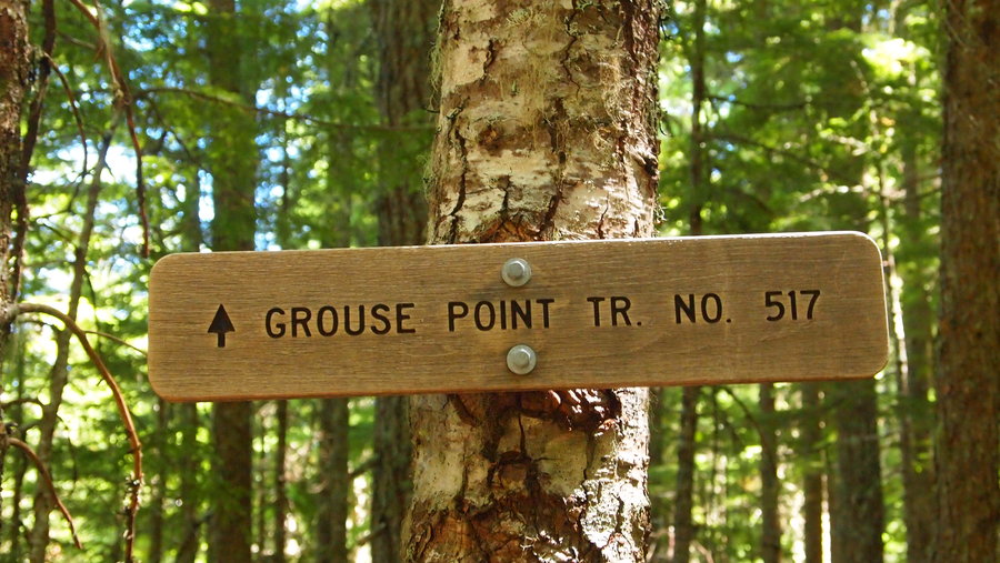
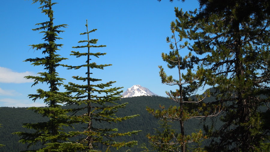
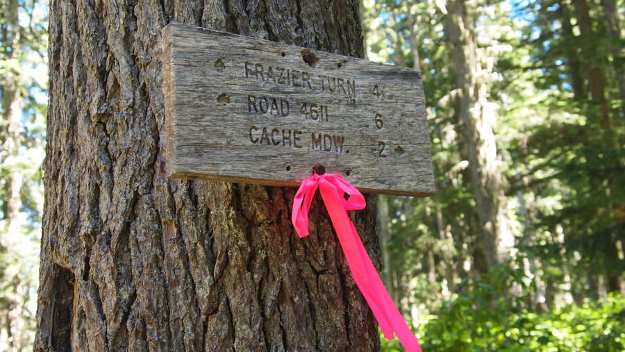
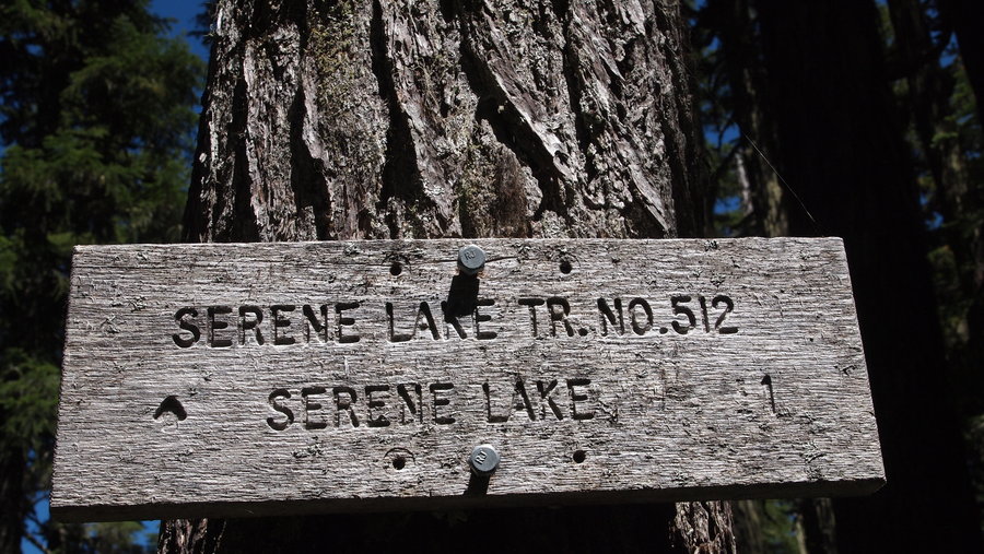
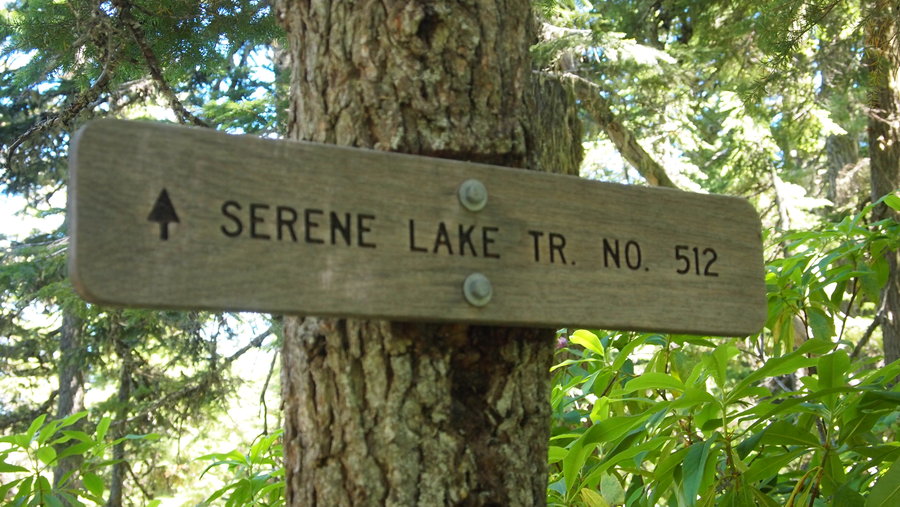
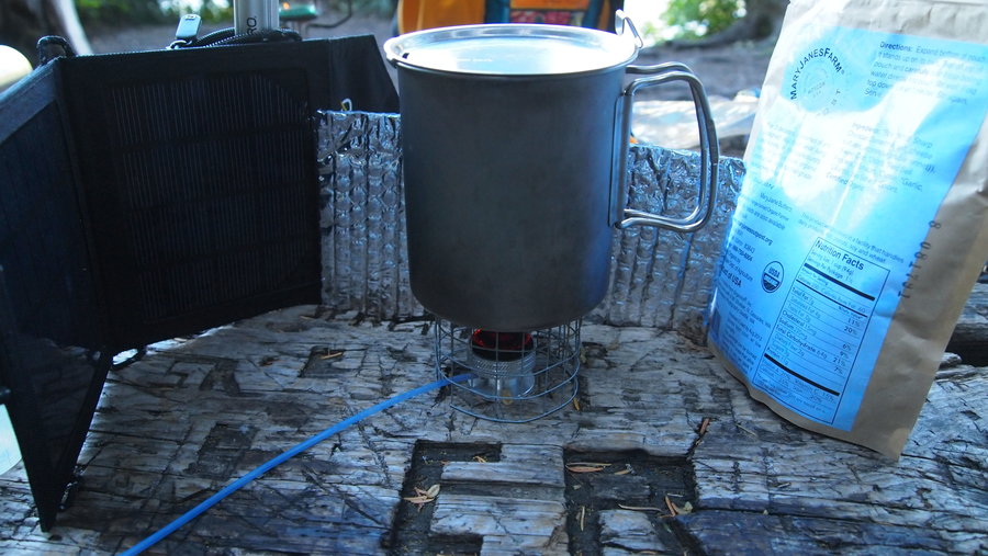


Table Mountain Loop
8 miles of hiking • 3500' elevation gain •
We set out around 9:15a, returned at 4p. We started at the Aldrich Butte TH (I use the term trailhead loosely!) and had a great hike up and up and up! The boulder field was easily navigated and we enjoyed the challenge for sure. It was a clear day with lots of blue skies and mountain views at the top. We saw Mt. Hood, Mt. Jefferson (just poking out in the distance), Mt. St. Helens, Mt. Rainier, and Mt. Adams from the top. Stunning views of the Gorge, too.
Instead of going back the way we came, we did a lollipop, heading down a steep, rocky, slippery way before reconnecting with the trail near the boulder field. We came back down and then connected with the PCT again before hitting the main trail back to the car.
It was a long day, a difficult trail, but the views and the weather made it worth the energy exerted!
July 21, 2013

North Fork Quinault River, ONP
22.5 miles of hiking • 1500' elevation gain • 6 nights
1) Lots of blowdown from about Mile 4 to at least Twelve Mile
2) We saw a bear at Wolf Bar!
3) Lots of mosquitos and the creek crossings were a wee bit of a challenge.
June 26 – July 2, 2013

Salmon River Trail Backpack
13 miles of hiking • 1000' elevation gain • 1 night
My Meetup Group set out Sunday morning with 8 humans and 2 dogs on a leisurely overnight backpack along the Salmon River. Our plan was to head to Goat Creek and hope the campsite was not taken. We were counting on the fact the weather was looking poorly and the fair weather adventurers would be staying home. Our evil plan worked!
We made it to Goat Creek around Noon and set up our camp. We had three tents and two hammocks amongst us, plus we set up a tarp to create a common area for us to hang out, as well as cook, just in case it decided to rain. We experienced rain showers periodically on the hike in, but nothing too crazy. After we set up our camp, we set off to find the Kinzel Lake Trail junction, then continued along the Salmon River Trail for a bit past that.
Our group decided it was time to head back to make dinner. Some of our posse stopped along the way to forage for firewood. We were bound and determined to have a fire in the evening and whiskey was the reward for whoever completed the task. The stakes were high and several in our group were vying for the prize!
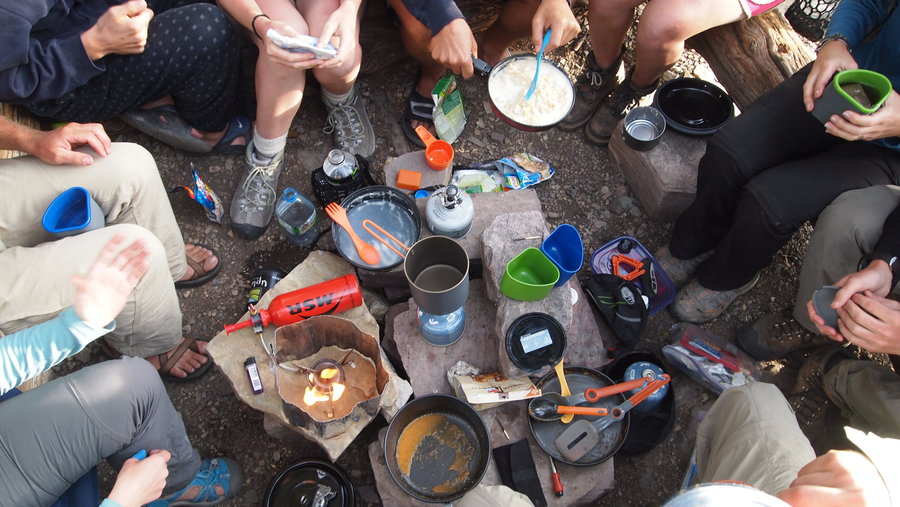
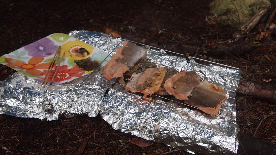
When I travel in the backcountry by myself or with one other person, meals are usually simple...freezer bag cooking, a hot cup of cocoa with a shot of whiskey and I'm good to go. Not with this group. We had steak kabobs and salmon cooked over a small set of briquets pre-soaked and ready to be lit. There was also fresh salad, supplemented by miner's lettuce foraged in the woods. Others contributed curry coconut couscous, cheesy couscous, and other food. I enjoyed a serving of Packit Gourmet's Austintacious Tortilla Soup, which was AMAZING!!! I've never eaten so much delicious food on a backpacking trip.
Our firemongers were able to get a rip roaring fire going and it went well into the evening while we sat around the fire, drinking hot cider spiked with honey whiskey, red wine, and white chocolate covered strawberries for dessert. The weather cooperated for the evening and didn't start getting stormy until around 4a.
I retired to my Hennessy Hyperlite Hammock where I fell asleep quickly to the sound of Goat Creek. There were no bumps in the night and I slept solidly until I awoke around 7a. I made myself a cup of coffee/hot cocoa (aka mocha) and some oatmeal for breakfast. Our gourmet chef made crepes with fresh berries and creme fraiche on top plus some bacon for breakfast #2 (as I called it). The weather was starting to look sketchy so we all went to our tents/hammocks and packed up so we could get moving and try to beat the rain.
Well, we didn't beat the rain, it followed us most of the way back to the trailhead. We made good time back to the cars, and after loading up our gear and shedding our wet rain jackets and gaiters, we stopped for a celebratory lunch at Burro Loco in Welches before returning home. All in all, a fabulous overnight backpack with some of my favorite ladies.
May 26 – May 27, 2013


Horsetail Falls
2.6 miles of hiking • 750' elevation gain •
I am spending time this summer for one week as an adult mentor for Big City Mountaineers (BCM). This organization takes kids into the woods who normally wouldn't have the opportunity to learn about the outdoors. One of the prep hikes was on May 20th with a short hike to Horsetail Falls. It was a chance to meet the kids for the first time and introduce them slowly to hiking and backpacking.
We couldn't have asked for a better day. The sun was out, the skies were blue and it was perfect. We walked up to the various falls, and stopped at lunch in the Oneonta Gorge before heading back home. We saw some poison oak and a bald eagle too. I think it was a great experience for the kids. Looking forward to getting out there with them this summer.
May 20, 2013

Saddle Mountain Day Hike
5.5 miles of hiking • 1750' elevation gain •
I joined a few friends of mine for a quick hike of Saddle Mountain. I've never been up here before so I was looking forward to the view at the top. Unfortunately, the weather did not cooperate. We made it through the forest, with sporadic rain showers, then started the jaunt up the saddle area where the wind picked up and the low cloud cover made it impossible to see much of anything. I have to say, I am not a fan of the trail in the parts where they have tried to improve it with rocks covered in fencing material. It was slick as snot in the rain and felt very unsafe in many areas. We had a quick lunch at the top before descending quickly to the forest to get out of the wind and rain showers. Did take the viewpoint side trail on the way down, but again, the weather was not helping so we returned to our cars before heading to Cannon Beach for an early dinner.
May 18, 2013

Mother's Day Mount St. Helens Climb
7 miles of hiking • 2500' elevation gain • 1 night
I got up to the Sno Park late...about 9p because I missed the turnoff for it. I didn't feel like pitching a tent or even sleeping in the bed of my truck so I got all of my gear set up and ready to go for an early morning start. It was remarkably warm up there and I found myself way too warm in my sleeping bag in the cab of my truck. I got a solid 6 hours or so of sleep and woke up with time to make a quick breakfast, make sure my pack was all set and head out with my group.
We started at 4a, and had our first long break at Chocolate Falls. We took our photos in our dresses and fancy hats before continuing up. Lots of people were out and about and everyone was in a great mood, even though it looked like the weather was not going to cooperate. We made it to the 4800' mark, then went a wee bit further before the wind picked up and it started pissing down rain. At that point, the visibility at the top was looking iffy and it was starting to look iffy down below too. We decided to call it a day and head back down.
I'm a little disappointed the weather didn't cooperate, but I still had a great time and hope to get up there again this year. Preferably when there aren't rangers checking for permits. :)
May 12 – May 13, 2013

King's Mountain
5 miles of hiking • 2500' elevation gain •
I had originally set out to do the Kings Mt./Elk Mt. Loop of 11 miles. However, after hiking 9 miles the day before on 3 hours of sleep, my body rebelled big time! I made the decision half-way up Kings Mt. that I was just going to the summit and back. It made more sense than doing something unsafe, like hiking while exhausted. That's just a recipe for disaster, especially considering I was hiking solo.
I started at 8:40a, and made good time on the first mile and took a short break on a nice log. The wind had been blowing something fierce and there were a few times I thought a tree was going to come right down on top of me! I dodged a few small branches here and there, and also tried to clear the trail of debris that had fallen before me. I continued up and up and up and up...stopped at the view point and took some photos. It was such a beautiful day, I really just enjoyed being outside.
Once I made it to the picnic table that is about 1/4 mile from the summit, I took a quick break before continuing up, up and more up. I finally made it the summit and took it all in. I could see Mt. Hood in the distance and I was also able to make out the ocean. What an amazing day! Clear, blue skies with a nice breeze blowing. I descended to the picnic table and started eating my lunch and took a short nap, basking in the sun.
The trail down seemed a lot more treacherous than going up! I slipped a few times (wearing trail runners, not boots) and almost bit it on a particularly steep portion. I made it back to the car by 1:30p, with plenty of time to drive home and get a nap in before some evening plans I had. I can't wait to get back out here to explore even more.
May 5, 2013

Neahkahnie Mountain from Oswald West S.P.
9 miles of hiking • 1750' elevation gain •
Five hikers, three dogs.
I worked the night before and was operating on three hours of sleep. Not the best way to do a hike, but I think the two energy drinks I had kept me going all day because I seemed to be functioning rather well in the morning.
We started out at the Oswald West S.P. parking lot, wandering through the forest to the Short Sand Beach to admire the waves and throngs of surfers. We continued along the trail to the viewpoint at Devil's Cauldron. Wow! I could have stayed here all day just looking out at the ocean. After a short break here, we continued along to the Neahkahnie Mountain trailhead across Hwy. 101. It was super hot outside and we high tailed it up the trail to get out of the sun and into the shade of the trees. We made it to the top and enjoyed the sights from above. It was a spectacular day with clear views of Nehalem Bay and Manzanita. After a short lunch stop, we headed back down the trail and were back at the trailhead with enough time to stop in Cannon Beach on the way home for snacks and some quality beach time with the dogs. A perfect way to start the weekend.
p.s. According to the Sullivan book, our hike was 7 miles. According to my GPS it was over 9 miles. My GPS is fairly accurate, so I rounded down to 9 miles. I've been led astray in the past by Sullivan so I'm not 100% confident his numbers are accurate anyways.
May 4, 2013

John Day Fossil Beds National Monument
6.5 miles of hiking • 0' elevation gain • 2 nights
This was a car camping trip, but nonetheless, it was a ton of fun and we went to all three units at the John Day Fossil Beds National Monument.
Day 1: Drive Portland to Mitchell, then to Barnhouse Campground about 20 miles east of Mitchell. On the way to the campground, we saw two elk off in the forest. That was pretty cool! We spent the night at this awesome campsite at Barnhouse Campground and almost had the whole places to ourselves. There was plenty of space for us to spread out our tents, and I pitched my hammock with ease. The ladies in my meetup group eat a lot better than I do when car camping. We were greeted by the early arriving vehicle who had prepared a tray of meats, cheeses, olives and other fancy snacks, along with bread and fixings to make sandwiches, a few salads, gin martinis and red wine to wash it all down with. For dessert we had campfire roasted apples with cinnamon and maple syrup. Seriously a delicious evening! I slept really well in the hammock. It was my second night sleeping in the new Hennessy Hyperlite Hammock and I'm still getting it dialed in. I really need to change the suspension out on it soon. It takes me too long to set up.
Day 2: Painted Hills Unit, Sheep Rock Unit and camping at Service Creek. This day kicked my butt. We started out with the Painted Hills Unit and walked all of the trails in the area. They do a really good job of keeping people off the fragile areas and the trails for the most part are super short. The longest one in the Painted Hills Unit is 1.5 miles with maybe a 500' elevation gain...but I am not sure.
After the Painted Hills Unit, we stopped in Mitchell to get gas and get our lunches ready for the drive to the Sheep Rock Unit. By this time, I was starting to lose energy. We stopped at the visitor center and looked at the cool exhibit about the history of the area. I wish we had more time to take it all in. But we were starting to get short on time and still had a few places to get to before finding a place to camp. We went to the Blue Basin trailhead and I knew I had hit my wall. It was a 3 mile RT hike and even though it had minimal elevation gain, I was wiped from having just come off my night shifts so I opted to sleep in the car instead. I got a nice nap in and was refreshed and ready to go when everyone returned to the car an hour later. We stopped at the last trail before heading towards Fossil to find a campsite for the night.
We ended up at Service Creek, right on the John Day River. It was a nice spot but severely lacking in trees for me to hang. There was one set but they were too close together for me to get a good hang so I decided to go to ground and sleep in my bivy sack. We had so much food left over from the night before that we had another potluck dinner, with the addition of salad and more alcoholic beverages while sitting by the fire. Our night was finished off with s'mores and good conversation before retiring to our respective sleeping areas.
I woke up around Midnight to the sound of rain, but it wasn't coming down too hard so I continued sleeping until I was awoken again a few hours later with more rain, but again, it wasn't much so I went back to sleep. At one point, I got really hot in the bivy and had to shed a few layers of clothing and open it up to get some air.
Day 3: Clarno Unit to Shaniko to Maupin to The Dalles to Horsethief Butte to Portland. We had a leisurely breakfast this morning before heading towards Fossil and the Clarno Unit. We detoured to Fossil and did a drive thru...not a whole lot going on there. For a Monday morning, I expected there to be more going on. We continued to the Clarno Unit where we took the three trails there. One trail had some fossils you were supposed to see but to be honest, all the rocks looked like rocks to me. I never did find the leaf fossil I was supposed to!
After our time at Clarno Unit, we set off for home with a few stops along the way. We drove through Shaniko, which is supposed to be a ghost town but it seemed like more of a tourist trap than anything. We took the "scenic" route to Maupin and then continued up to The Dalles, where we crossed over the Columbia River and stopped at Horsethief Butte for some scrambling and bouldering. We also went to the state park down the road from it to look at the petroglyph exhibit. Those were pretty cool. By this time, we were all hungry for an early dinner and stopped in Stevenson for dinner before heading home and our separate ways.
I want to go back. Two nights and days is NOT enough to really give this area the time it deserves. I also want to see the Painted Hills at sunset. Hope to get back later this summer.
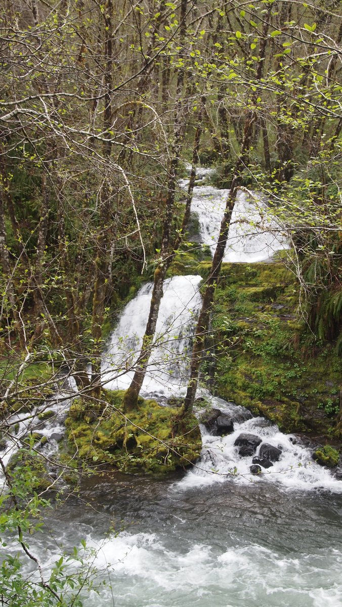
April 20 – April 22, 2013

Multnomah Falls and Beyond
8.5 miles of hiking • 1750' elevation gain •
One of my friends is recovering from a knee injury and wanted to still get an easy hike in, so seven humans and three dogs set out today for a wee little adventure in the Gorge. We wandered up the Multnomah Falls trail and continued along, finding the Christmas Ornament trail unexpectedly and hanging out for lunch under cover of one of the porches at Nesika Lodge. The temperature at Nesika Lodge was about 15 degrees cooler than down at the falls...we didn't stay long. There was also sign of recent snow, though nothing to be worried about...just a few sprinkles here and there. It started raining as we headed back up the trail...however the sun decided to show itself by the time we got back to Multnomah Falls. All in all, a great day of hiking, even though I forgot my camera!
April 13, 2013

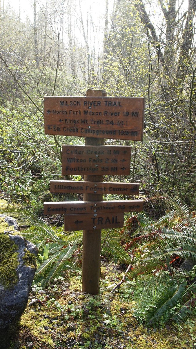
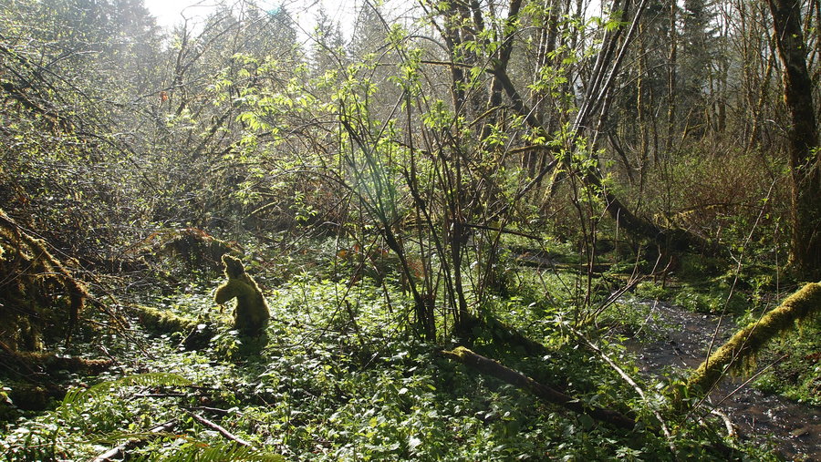
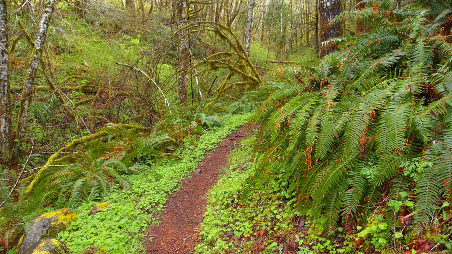
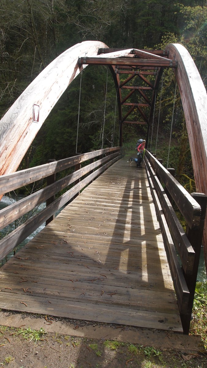
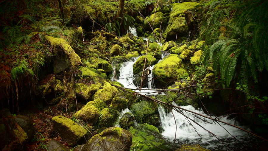
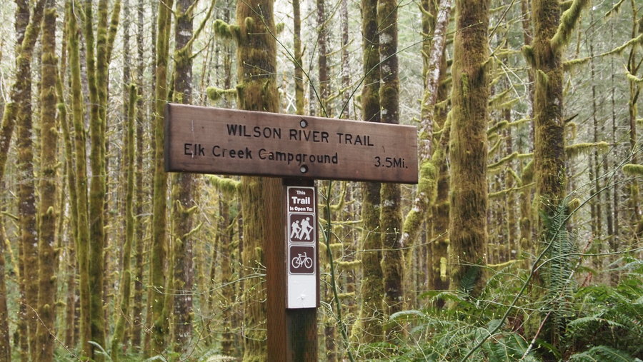
Wilson River Trail: Jones Creek TH to Elk Creek CG
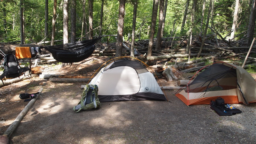
16 miles of hiking • 2000' elevation gain • 1 night
I have been wanting to do this trail for a long time. My original hope was to do a thru-hike with car shuttle but I was only able to get one friend to go with me, so we picked the Jones Creek to Elk Creek section with the intention to do an in-n-out backpack, camping at the Elk Creek Campground for the night.
We hit the trail around 9:30a and knocked out the first 7.5 miles (to the Kings Mt. Trailhead) around 12:30-1p and stopped for lunch. I really enjoyed the lush green environment. I felt like I was in the Olympic NP/NF walking through some of the woods and crossing some of the creeks. I didn't have a good map for this area (actually, I had a PDF file I had printed out with distances and that was about it) and had no idea what the elevation gains were going to be, aside from what I had read on portlandhikers.org. The first 7.5 miles was mostly going up, then gradually coming down to the Kings Mt. TH, where we again spent the final 3.5 miles going up, up and more up, before a nice steep drop into the Elk Creek CG.
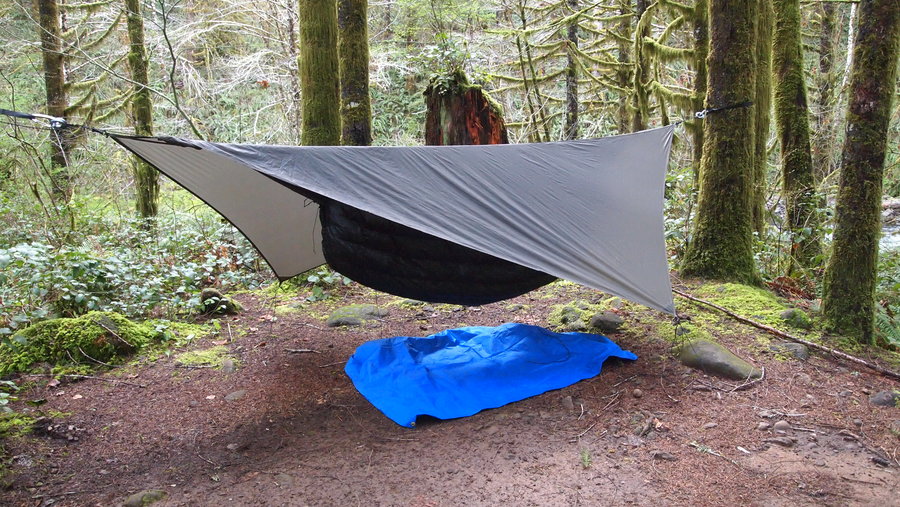
This trip was designed to be "easy" so we could test out new gear. I had a new Hennessy Hyperlite hammock, a new Enlightened 20 degree top quilt, and a new MicroRocket canister stove. My friend was also trying out a new air mattress and a JetBoil stove.
We set up camp and I realized I definitely need to change out my suspension on my hammock. The stock suspension is not ideal, so I had some fun practicing my knots and getting it to work. I brought my hex tarp just in case it looked like rain but the weather looked like it was going to hold, so I used the stock tarp instead.
We cooked up dinner, got water from the river, and basically enjoyed some down time at camp. 11 miles in one day is the most I have backpacked (not the most I have walked...but that's another story!) and once we stopped, I realized that my outer ankle on the right foot was really sore. I have had this happen before but thought I would be fine in the morning.
I slept like a baby in the new hammock, only had to adjust the tarp and underquilt once. No cold butt syndrome, and it never rained, so I feel like I got pretty lucky. We made breakfast and got all packed up in the morning. I tried walking and my ankle was very "upset". This was not good. There was no way I was going to be able to limp back the 11 miles to our car.
Lucky for me I had set this trip up to have an exit plan...aka the "walk of shame" on Hwy. 6. It was 11 miles by trail to the car, but only 5 miles and on fairly level road (my ankle was having problems with a lot of the up/down and side to side movement on the trail). I knew I could make it 5 miles and so we set off, walking carefully on the shoulder of the road. Having walked 500 miles on the Camino de Santiago, some of it very similar to this situation, I sucked it up and pretended I was in Spain walking the Camino. :)
While I was severely disappointed in not returning the way we came, I look at the trip as a success and a learning experience. We had a great time and I am looking forward to doing the other section of the trail.
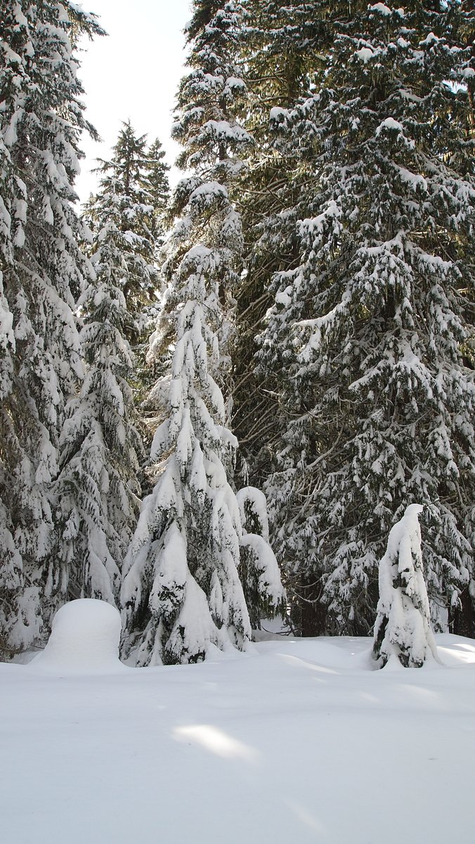
April 8 – April 9, 2013

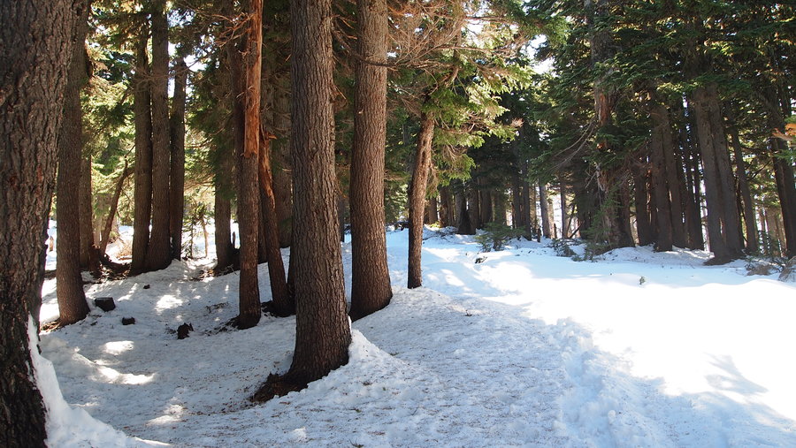
Trillium Lake & Veda Lake Snowshoe
17 miles of hiking • 2500' elevation gain • 1 night
This was an insane two days of snowshoeing around Trillium Lake and an attempt to get to Veda Lake. We snowshoed from the sno-park at Govy to Trillium Lake, then snowshoed around the lake. The next day, we attempted to get to Veda Lake, but were unsuccessful in following the trail. The skies were blue and the free of clouds. We couldn't have asked for better weather!
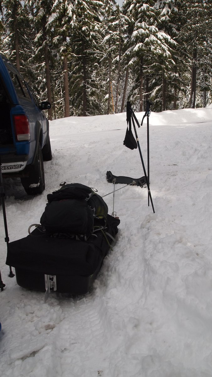
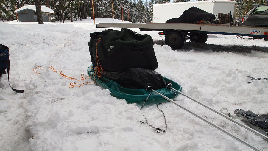
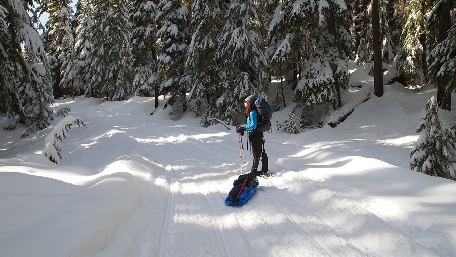
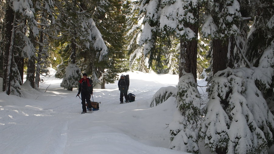
March 24 – March 25, 2013

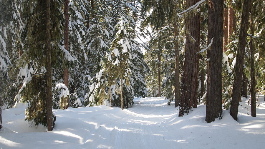
Clear Lake Backpack/Snowshoe
3.5 miles of hiking • 500' elevation gain • 1 night
After spending a night up here just before Christmas, I thought it would be fun to go back with some friends. We picked a Sunday night to avoid crowds and lots of snowmobilers since the trail we took was a snowmobile trail. It's about 1.7 miles along this beautiful groomed trail to the campground. I used my brand new snow pulk and my friends made makeshift pulks out of plastic sleds.
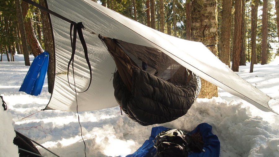
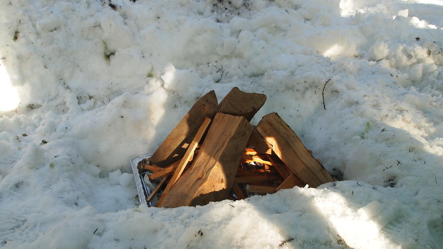
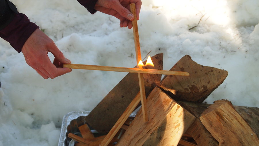
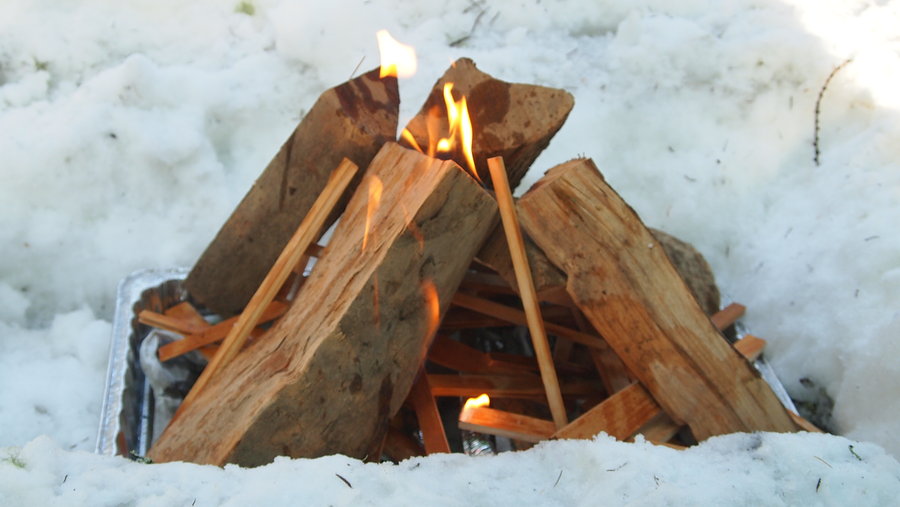
We started late, probably around 11a and took our time on our snowshoes and getting used to pulling the weight of our pulks. We had a bunch of dry firewood, plus a few luxury items since we had the space! Upon arrival to the campground, we found a site to our liking that would allow shelter from the winds of the lake, as well as trees for hanging my hammock. It was also close to the pit toilets which were open. We made quick work of getting ourselves situated with tents being pitched, hammock being hung, fire pit being dug out, and setting up a covered eating area. Once we got everything set it was close to dinner time. I put a pork tenderloin wrapped in foil on the fire, and cooked up some coconut ginger chicken soup with rice. We also had fresh bread and fruit salad. Everything was washed down with hot apple cider mixed with apricot brandy. Super delicious!
I spent the night in my Hennessy hammock with a 20 degree underquilt and 15 degree sleeping bag for a top quilt . It was pretty cold but I stayed fairly warm. At one point I woke up to a cold butt and realized my underquilt had come out from underneath me. I hadn't been happy with my technique hanging my hammock this time and I think that had something to do with my issue with the underquilt. I put it back in place and slept soundly until waking around 8a. The wind and snow picked up around 2a and we woke to about 6 inches of fresh powder.
Breakfast was quickly cooked...chicken apple sausages over the morning fire and cheesy garlic grits with coffee to wash it all down. We broke up camp and headed back to our cars and stopped at Dairy Queen on our way back for celebratory ice cream. It was my third snow camping trip of the season and for everyone else it was their first time. A good time was had by all!
February 24 – February 25, 2013

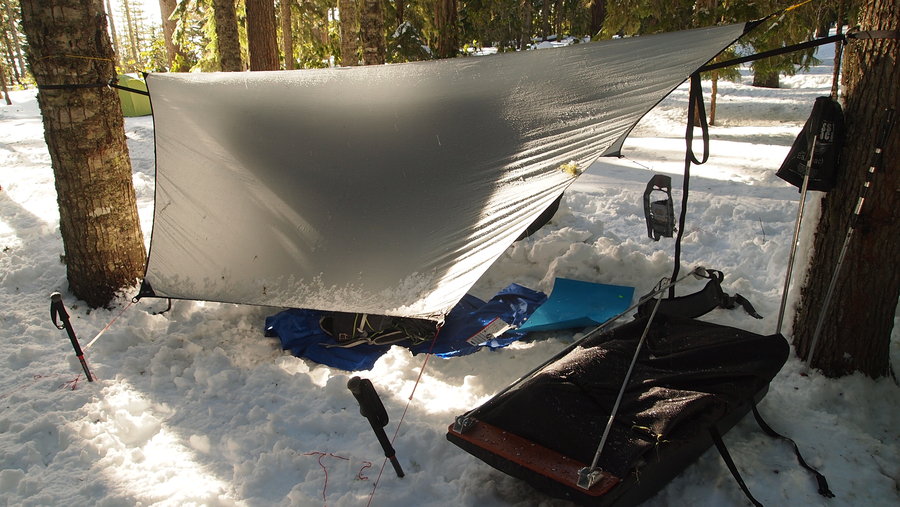

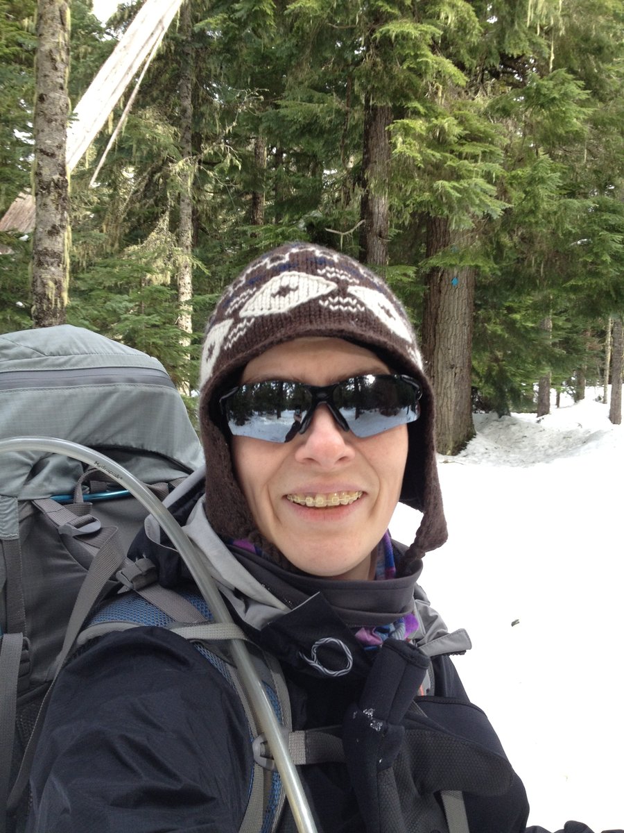
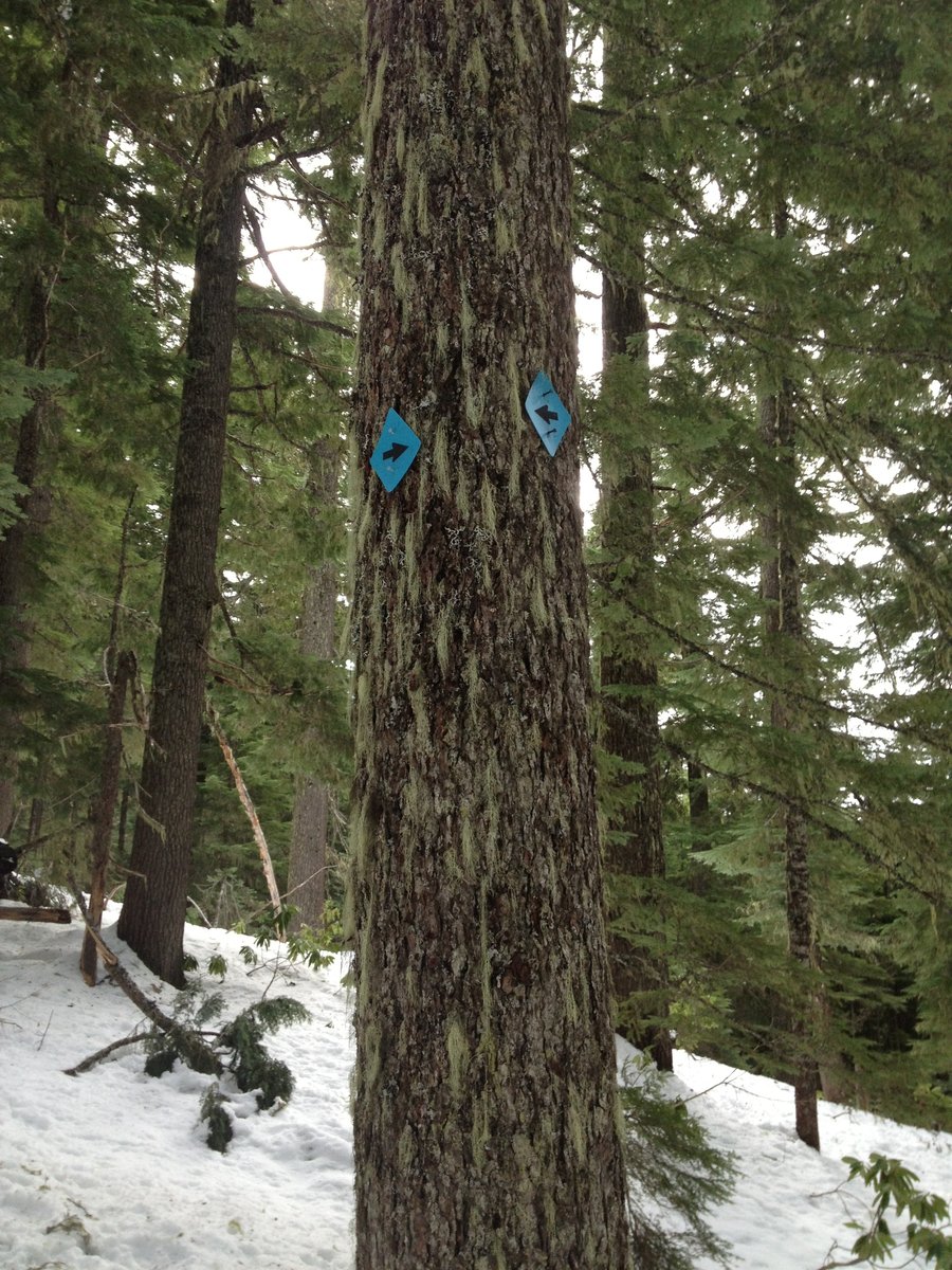
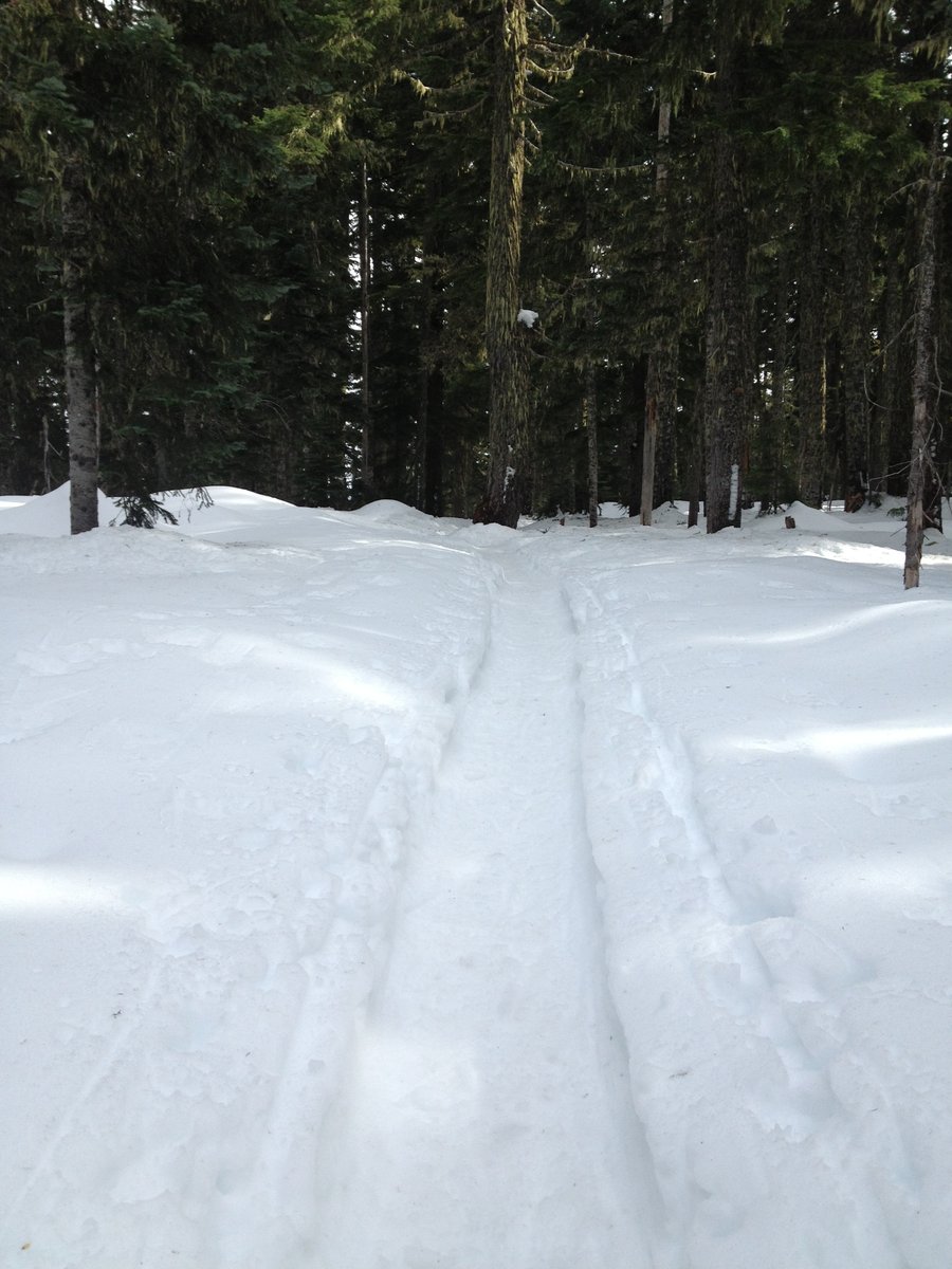
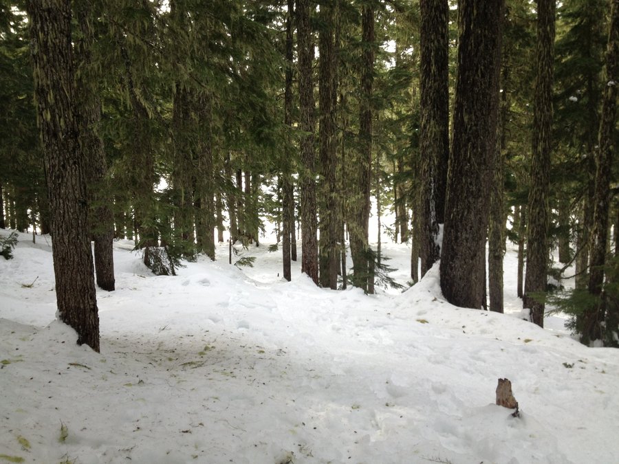
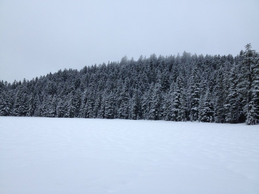
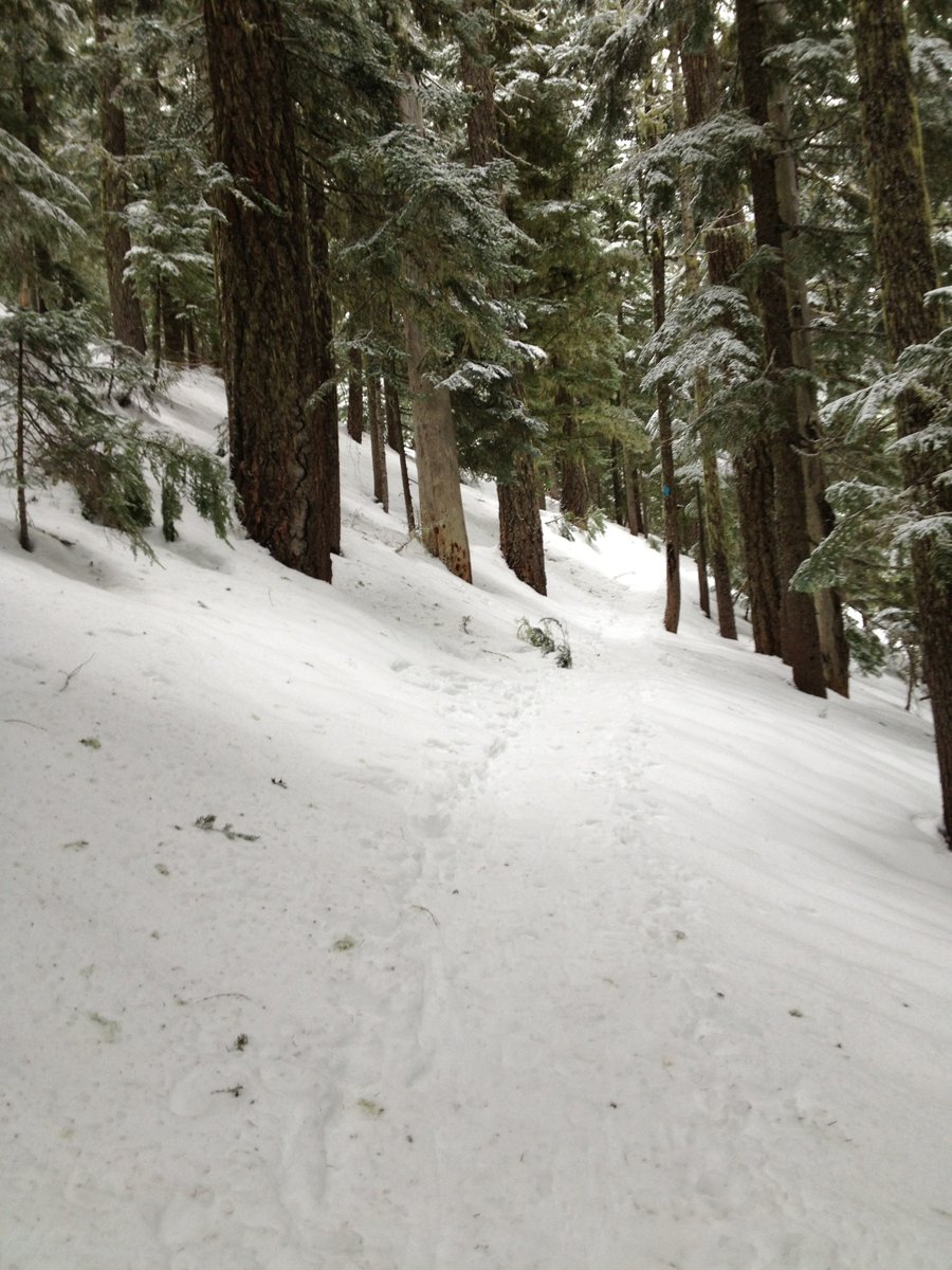
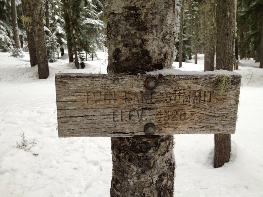
Twin Lakes Mt. Hood Solo Backpack
6 miles of hiking • 1500' elevation gain • 1 night
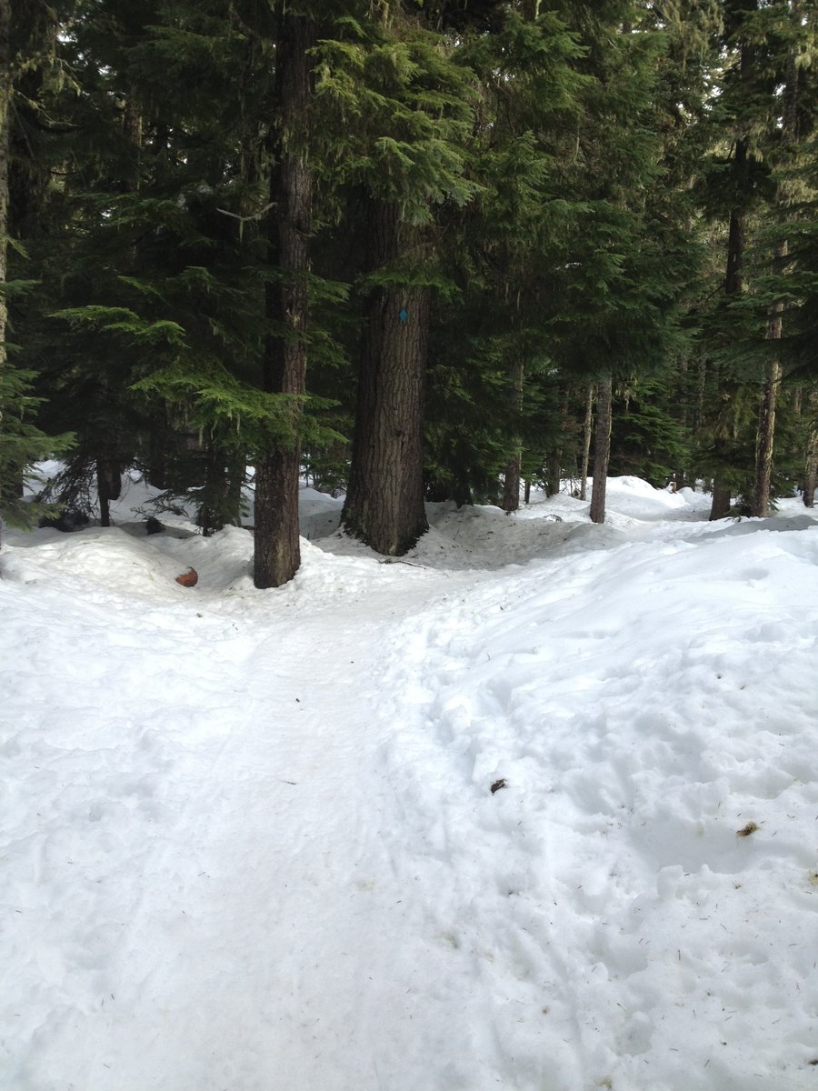
I've been itching to get out for a while so I decided to head up to the mountain for a solo backpack trip. I've only done one before with my sister's dog and this would be my first completely by myself. I stopped at the Zig Zag Ranger Station and decided on Twin Lakes since it's a winter trail with appropriate markers (blue diamonds) so my chances of getting lost were slim. I also decided to go to the Upper Twin Lake because I had to work the next night and needed to make sure I got home in time to get a nap in before my night shift.
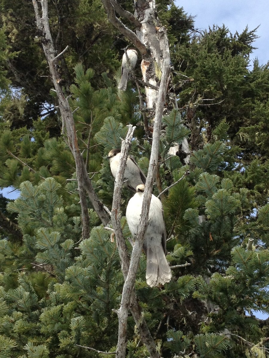
I hit the trail around 11:30a and made good time, getting to my chosen campsite on the northern end of the lake around 1:00p. I attracted the attention of three cute white/brown birds who I still need to ID, but they were quite friendly and I thought for sure they'd land on my hand if I had fed them something. But I didn't! I had recently bought two alcohol stoves and thought this trip would be a good test of their capabilities. I had already tested them at home to somewhat mediocre results and was willing to take the risk for a quick overnight. I set up my Hennessy Hammock first, then started to work on collecting snow to melt for water for my dinner. Let's just say I abandoned the alcohol stove and used my emergency stash of Esbit tabs to get enough water for dinner (mac and cheese with hamburger ala Kraft singles!) and some coffee/hot cocoa mix. Next time I'm bringing my Simmerlite or Pocket Rocket. Thankfully, I had plenty of time to wait around for the water to boil and melt. I had an early dinner and retired to the hammock to do some reading. I fell asleep and then had one of many "creepy critter" moments of the night. Some of this, I am sure is due to my own vivid imagination. But I swear that something actually walked under my hammock and made contact with me! It growled and I growled back at it. And then it left. It freaked me out. I made sure to move around a lot when I would hear things, and much to my chagrin, when I awoke in the morning, there was a good two inches of powder covering any tracks there may have been. :( I'm still curious what it was, but I guess I will never know.
It started snowing around 7a and I got up and at it around 8:30a, decided to skip a warm breakfast after the stove fiasco the night before, grabbed a ProBar out of my pack and quickly set about to tearing camp down. I was on the trail by 9:40a, back to the trailhead at Frog Lake Sno-Park by 11:10a.
All in all, a truly successful experience and I can't wait to get back out there again!
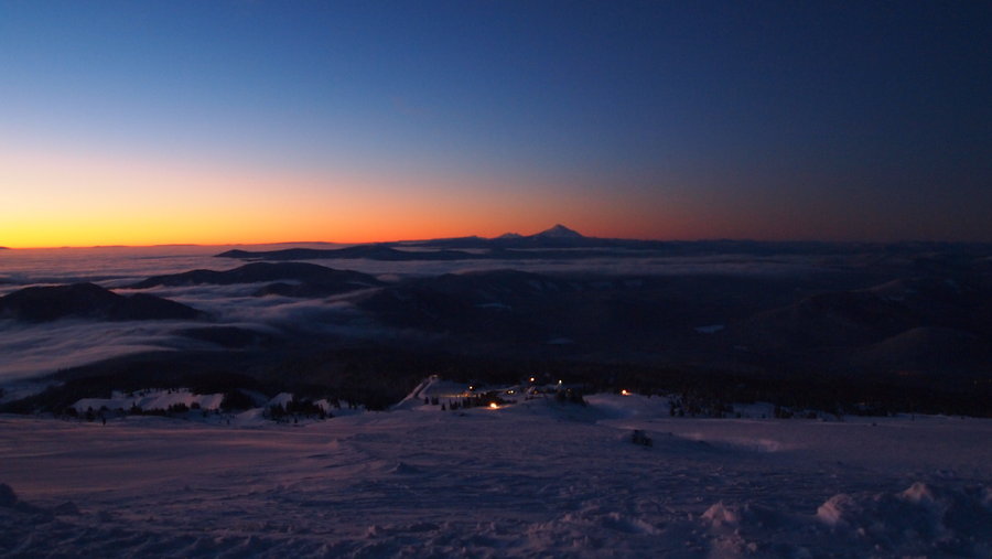
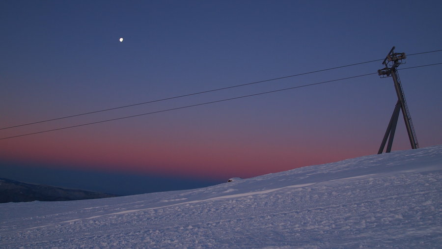
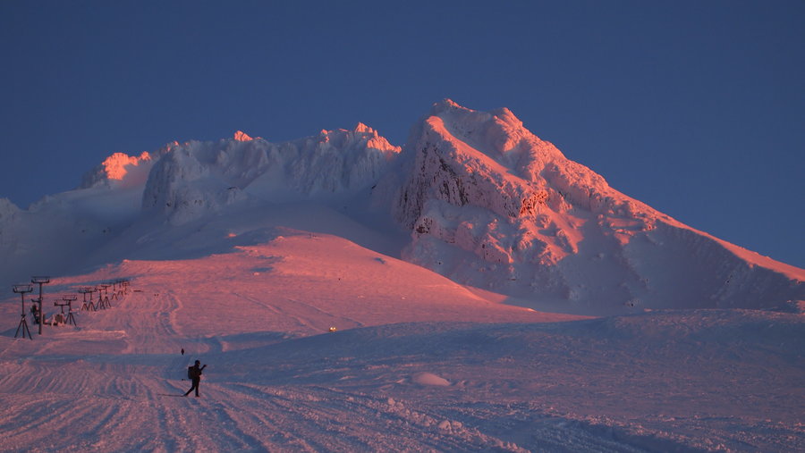
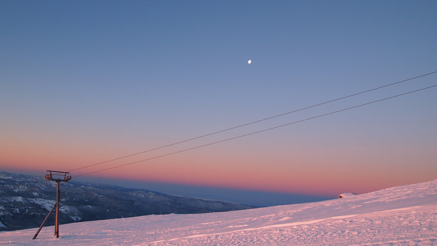
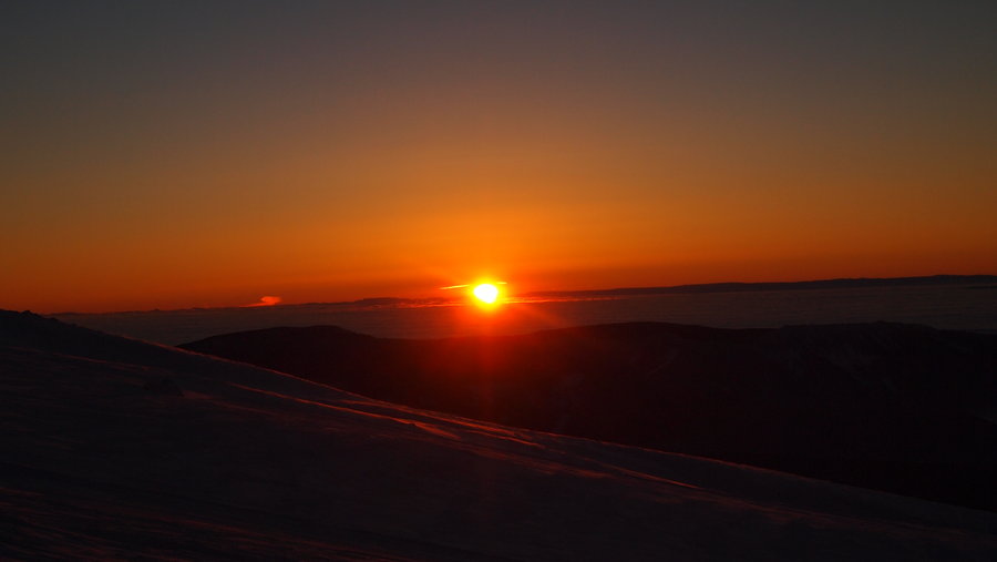
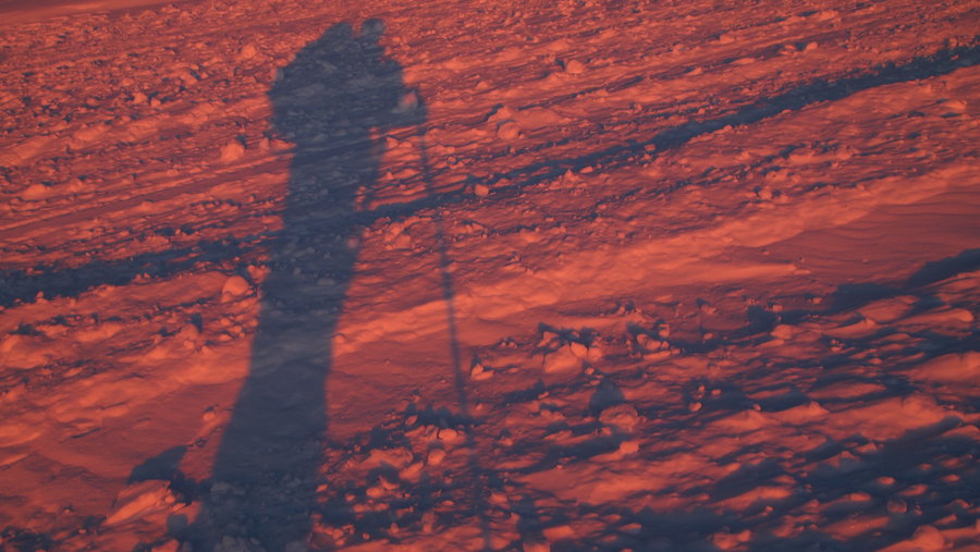
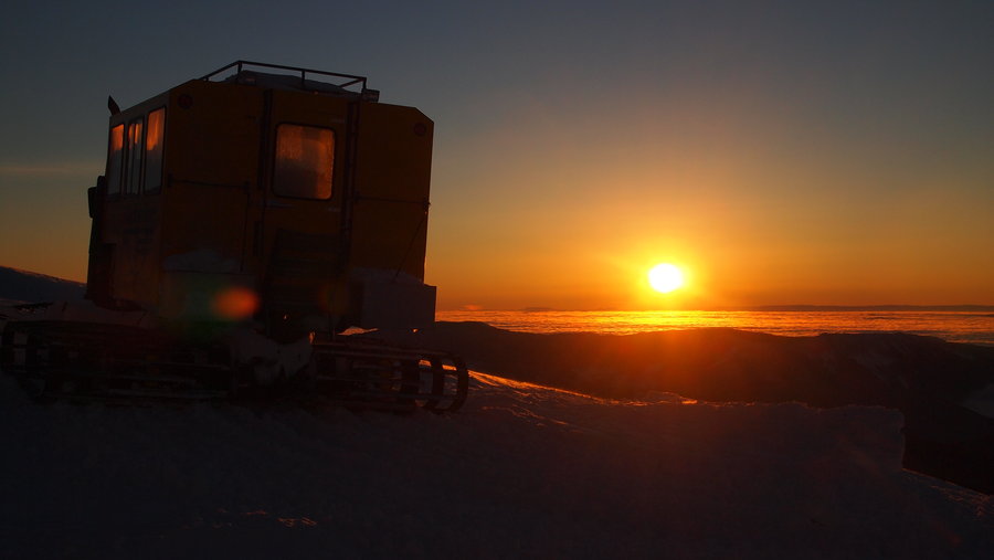
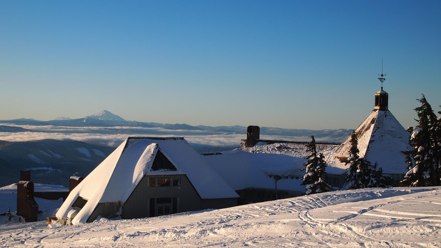
February 4 – February 5, 2013


 7
7
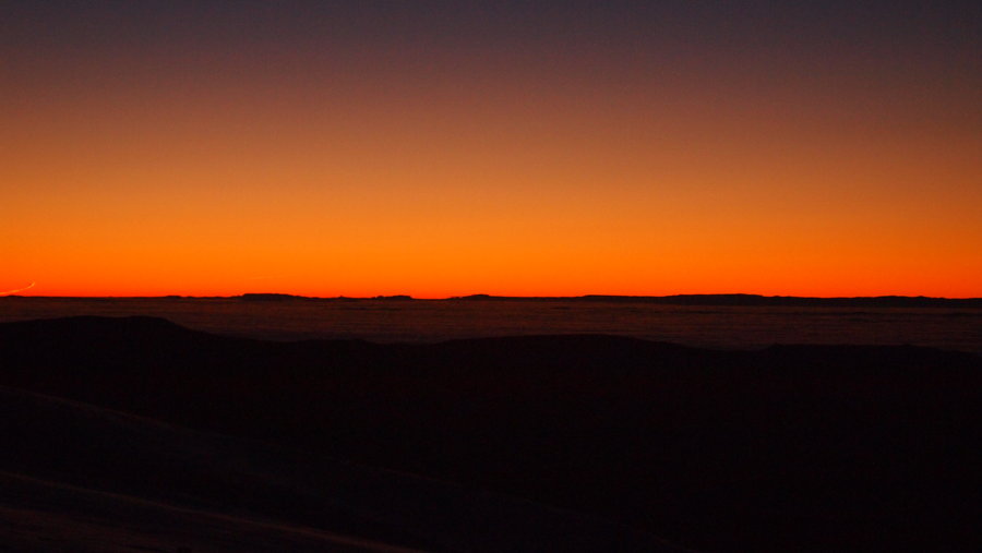
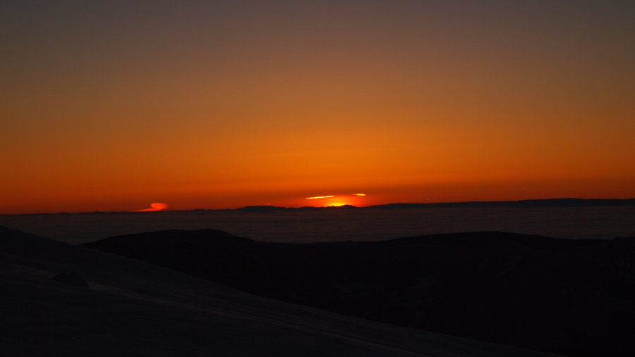
Timberline Lodge to Palmer Glacier
2 miles of hiking • 1250' elevation gain •
My Meetup group thought we would ring in the new year right with a hike to Palmer Glacier for the sunrise. While I didn't make it all the way to the top of Palmer, I did make it past Silcox Hut for my first hike in this area. We started at 6:10a and arrived at Silcox an hour later. I continued past the hut for a bit before my cold fingers got the best of me and I turned around so I could watch the amazing sunrise. The wind was not too bad and we started walking in the moonlight with clear skies and stars as far as the eye could see. My fear of the mountain lessened on this trip and I hope to get back up there again to finally get to the top of Palmer.
January 1, 2013