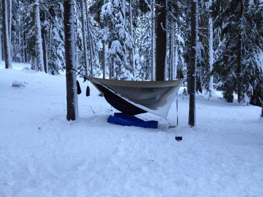
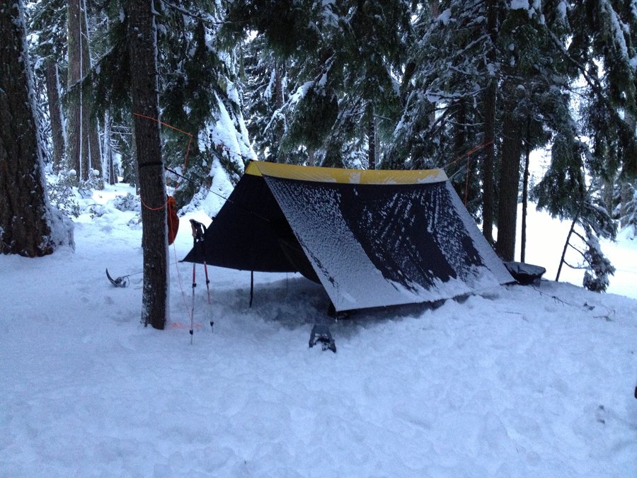
2012 Trips


Clear Lake Snowshoe/Backpack/Hang
7.5 miles of hiking • 0' elevation gain • 1 night
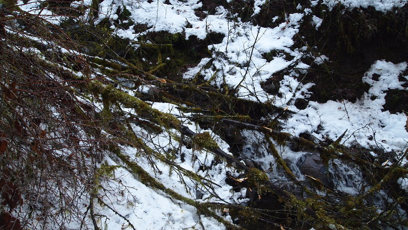
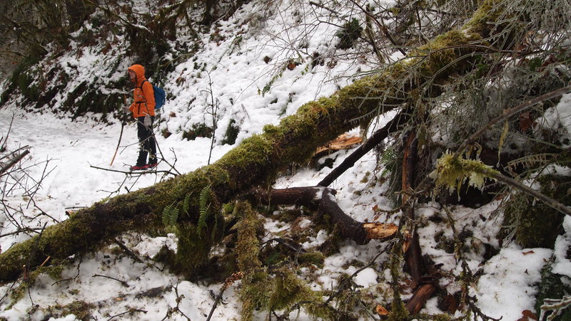
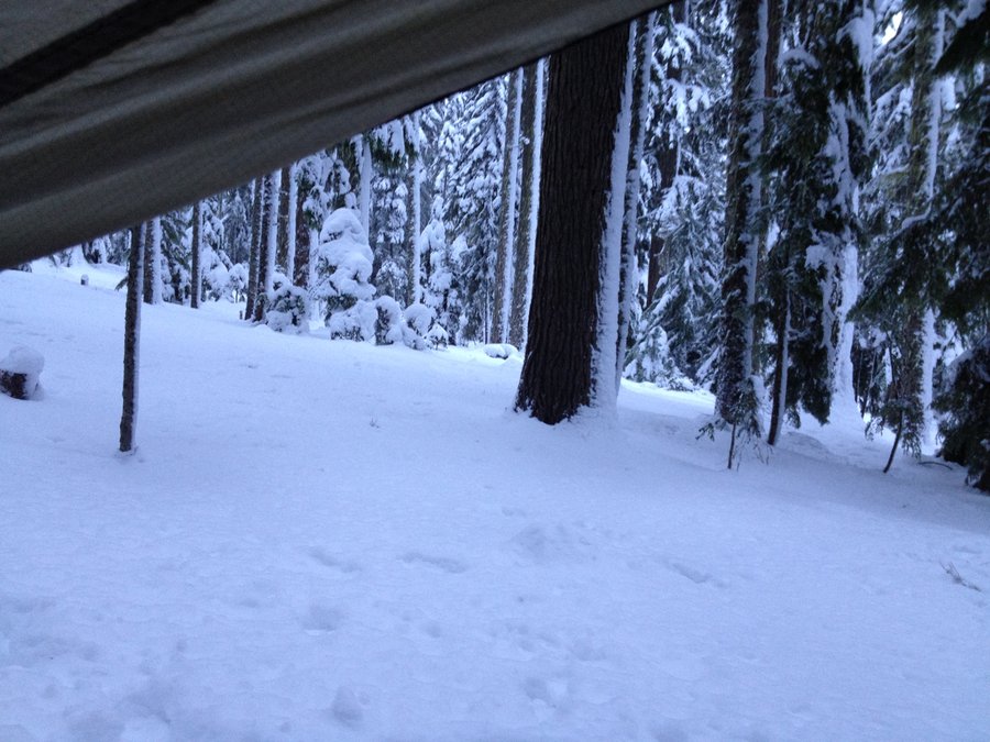
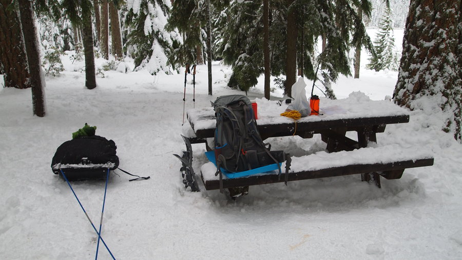
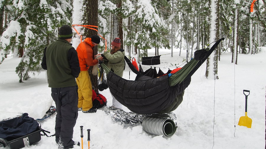
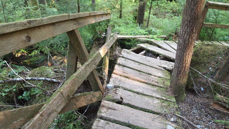
We set out from the Skyline Sno Park with four of us, two towing pulks with much of our gear. Our fearless leader had the GPS coordinates for the Clear Lake Campground and we set off in the general direction of Clear Lake, staying mostly on the snowmobile tracks before finally cutting into the woods and making a bee-line for the lake. We got to the campground just after dark and quickly setup our hammocks, started a campfire (we carried in two bundles of firewood) and set about making our dinner. After dinner, I lasted a short while before turning in for the night.
I am not sure what the nighttime temperature was but we did get a light dusting of snow, so my guess is somewhere in the high 20s/low 30s. I stayed nice and warm and slept very well. My bladder got the best of me in the morning, though, and I was up around 7:30a. We cooked a quick breakfast, tore down our camp and set off back to the sno-park.
Our route back to the sno-park was a little more direct, using one of the roads in the campground, before again going off-trail and finding a logging road which lead us back to the main road to the sno-park. By the time we got back, it was snowing pretty heavily, so we were pretty happy to make it back to the car and get inside with the heater on full blast!
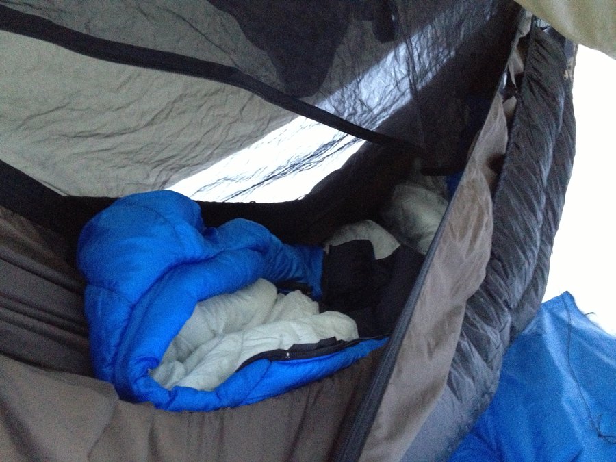
This was my first winter backpack/snowshoe/hang and I came prepared with my new 20 degree Hammock Gear UQ to keep me warm. I used a 15 degree MH Ultralamina sleeping bag as a TQ and was toasty in my Hennessy Hammock. I bought some winter boots before we left town, a pair of Columbia Bugaboo Electric boots. They kept my toes warm once we stopped moving around and my feet didn't get too hot when we were snowshoeing. I recently picked up a pair of MSR Evo snowshoes and they performed flawlessly as well. This trip was definitely an experiment in trying out new gear and I am happy to report it all turned out well.

December 22 – December 23, 2012


Camino Portuguese (Porto to Santiago de Compostela)
130 miles of hiking • 500' elevation gain • 10 nights
I spent 11 days walking along the Camino Portuguese, spending the first 4 days on the Orla Litoral/Caminho do Costa route before taking a train inland to rejoin the Central route. I walked a total of 209.1 km (best guess) or 130 miles. Here is my itinerary:
Day 1: Matosinhos to Azurara, 22km Day 2: Azurara to Fao, 21.5km Day 3: Fao to Viana do Castelo, 27.5km Day 4: Viana do Castelo to Ancora, 18.6km Day 5: Train to Valenca, then Valenca to Tui, 2.5km Day 6: Tui to O Porrino, 18km Day 7: O Porrino to Redondela, 15km Day 8: Redondela to Pontevedra, 18km Day 9: Pontevedra to Caldas de Reis, 23km Day 10: Caldas de Reis to Padron, 18km Day 11: Padron to Santiago de Compostela, 25km
October 9 – October 19, 2012
 1
1
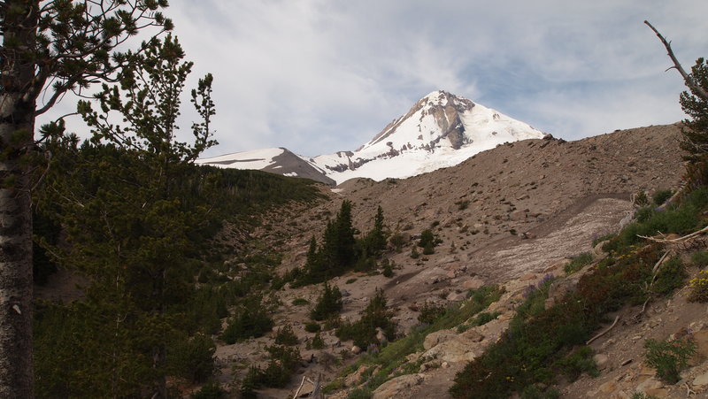
Cooper Spur (almost)
7 miles of hiking • 2750' elevation gain • 1 night
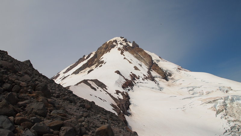
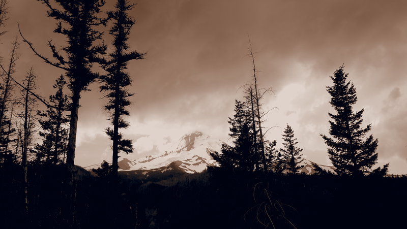
A friend of mine asked me to join her on this hike and I jumped at the chance to get up on the East side of Mt. Hood for a hike. I've heard this one was a lot of fun and we were not disappointed!
We headed out on Wednesday and parked our vehicles by the Cloud Cap Inn, where I hear the Crag Rats use it as a SAR base during SAR operations. The parking lot has a perfect view of Mt. Hood and I slept in the bed of my truck with my bivy sack and looked at the stars for a while. I even saw a couple shooting stars! It was so warm up there, I had to lose some layers halfway through the night because my 15 degree sleeping bag was a wee bit too warm.
We got up early Thursday morning and after breakfast and packing up our car camping stuff, we hit the trail shortly after 8a. There was one other fellow there doing a day hike, and another fellow with snow blades and his dog planning to do some snow blading. Otherwise, there wasn't anyone else up there.
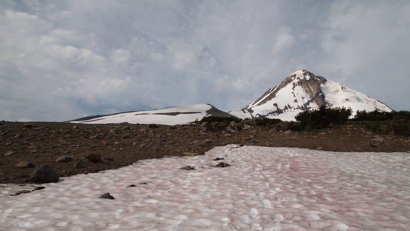
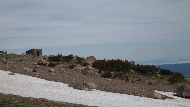
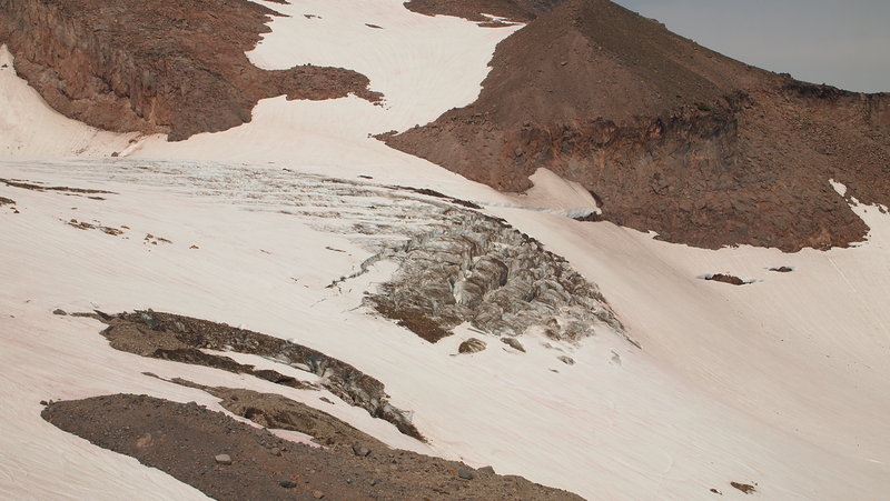
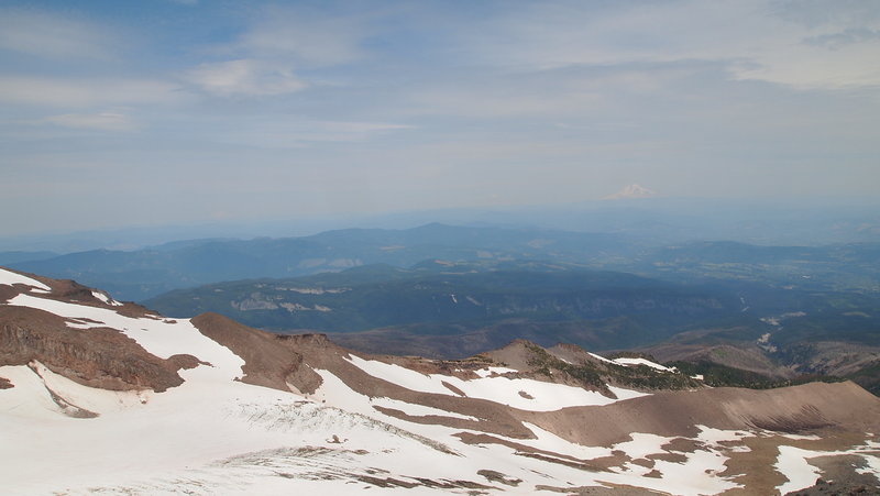
We made good time getting up to where the snow fields started (just before the shelter) and that's where the fun began. I brought my microspikes with me and used them to create a trail for my hiking partner. We continued up past the shelter, crossing snow fields every so often and following the zigs and zags of the trail as best as we could. We got to about 500ft from the top of Cooper Spur before finally turning around. The trail was buried under a huge snowfield and we determined it really wasn't safe to continue. My motto is "Safety first. I don't want to be listed on the news as an 'experienced hiker'. :)".
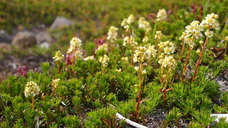
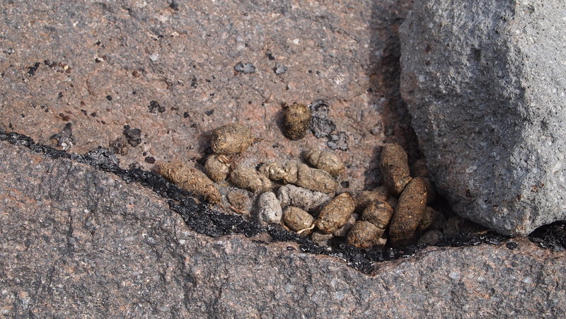
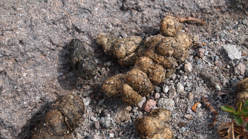
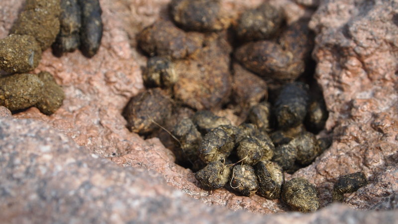
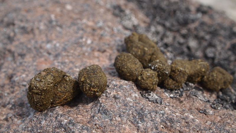
I will add that part way up we found a rock that was COVERED in various kinds of scat. It was almost like it was an outhouse for the local animals. I took a few pictures and if anyone has any ideas of what kind of animal created the scat, please let me know! It was so fascinating and I forgot to take a picture of the rock to show how covered it was.
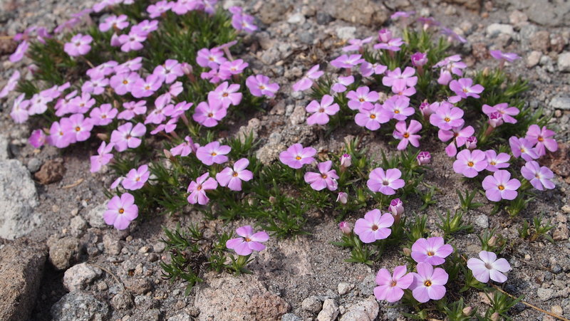
Even though we didn't go all the way to the top, the views were stunning. At one point I was just quietly looking at the Mountain and taking it all in, and the next thing I know I hear the glacier moving. Super cool!!! I almost thought there was going to be an avalanche...we had heard one the night before but weren't able to see it.
We stopped at the shelter on the way down for a late lunch. That's a pretty cool place. When we left the shelter, we got turned around a bit with the snowfields and started unknowingly down the Tilly Jane Trail. We figured it out soon enough after consulting the map, my GPS and my iPhone AllTrails app. It was confirmed by asking a couple of hikers we saw if they had come from Cloud Cap and we got back on the right track. We lost the trail again shortly after that and there were some less than helpful snowboarders too busy with building a jump than to help a couple of ladies out on finding the trail. I found it while my hiking partner was trying to get a straight answer out of the snowboarders. After that, we hit the area of the trail where I feel like I'm on the moon with all the ash and moon-like rocks. It was easy going after that with just a couple more snowfields to cross before getting back onto the trail for good.
We made it back to the trailhead a little after 3p and headed home to Portland.
Lessons learned: 1) Green Trails maps suck. There were more trails than on the map and it was difficult to find what we were looking at in the detail we needed. I think I need to look at other map options. 2) Listen to your gut. I listened to my gut after we went down the Tilly Jane Trail and I realized it didn't look familiar. It sucked having to go back up the hill, but in the end we got where we were supposed to be. It wouldn't have been a bad thing to go that way, it just would have added a half mile to our return hike as both trails end close to each other. Stopping and looking around and consulting your map and/or GPS are always a good thing if you aren't sure of where you are. 3) I really need to learn how to navigate better in the snow and in general. I need to look into taking a detailed class on map, compass and navigation. 4) I really, really loved going up there. I've shied away from mountain hikes where you are having to do trail finding and whatnot. I think I am going to do this more often, as the weather permits and as my skill level grows.
All in all, a great experience and I might go back in August after more of the snow melts to try it again!
July 18 – July 19, 2012

North Fork Skokomish River-Olympic NP
25.5 miles of hiking • 4000' elevation gain • 6 nights
This was actually a trip I took as a volunteer adult mentor with Big City Mountaineers. Five adults, five teens. All women. For the teens, many of them had never been hiking, much less backpacking, before.
We camped our first night at the Staircase Campground, then spent 4 nights in the backcountry (2 @ Big Log, 2 @ Nine Streams) and one more night at Millersylvania SP Campground.
Our first day, we awoke to pouring down rain. Not a great way to start but everyone was in good spirits. We hit the trail and slowly made our way the almost 6 miles to Big Log Camp where we had the site to ourselves. I slept in a huge cedar tree trunk and awoke around 1a to the sensation of mice scampering across my head. Good times!
Day two, we continued up to Nine Streams where we stayed for two nights. On the third day, the kids had their summit day and we traveled across snow fields, which began just around Two Bear. We made it to First Divide, took a few pictures, then headed back to camp for the night.
Day four, had us returning to Big Log Camp, where we had less than ideal conditions due to several large groups of backpackers. We made the best of it and backpacked out the next day, where we spent the night in a very crowded campground at Millersylvania SP. Quite the shock to our system!
Aside from the rain the first day, the weather actually was amazing. Sunny, clear blue skies and virtually no bugs.
We saw bear, elk, deer, mountain goat signs as well as actual sightings of grouse, squirrel, chipmunk and a frog.
July 2 – July 8, 2012
 1
1
Eagle Creek ->Wahtum Lake ->PCT ->Ruckel
27 miles of hiking • 4000' elevation gain • 2 nights
Originally, the plan was to go on the Eagle Creek Trail to 7 1/2 mile Camp for the first night, Wahtum Lake for the second night and Hunters Camp for the third night...basically Eagle Creek Trail to Wahtum Lake to PCT to Ruckel Creek Trail....all was going well, but I am getting ahead of myself!
So, we headed up to Eagle Creek on Friday and hit the trail around 9a, and there were already quite a few backpackers on the trail. We made it as far as the campsite at 6 1/2 mile marker (I had mistakenly been told this was 7 1/2 mile Camp, but if I had read my map, I would have noticed my error...) and set up camp there. After we set up our camp, I went for a walk and found the other campsites further up the trail and made a mental note for next time. We shared our campsite with a couple we had passed earlier in the day. It was their first backpack trip and we hung out a bit, even spending about an hour together trying to get a campfire started. We gave up eventually, and I was in bed by dark. Switching from night shift to days is always a struggle.
On Saturday morning, we got on the trail again around 9a and I was worried because I had read that the trail had a 2300 elevation gain and it was a steep trail. I'm not a fan of steep inclines...I usually go rather slow. It was nothing of the sort. It was a nice, gradual grade and we made good time up to Wahtum Lake, even with multiple treacherous creek crossings and stopping to chat with people coming down the trail to get intel on what to expect. My favorite creek crossing involved two separate parts. I don't know the name of the creek, but it's a reverse fork...so there are two creeks dumping into one. It was insane. Lots of water and it was moving fast.
We made good time up to Wahtum Lake and found 2 to 4 feet of snow all around the lake, with melted patches here and there. We checked out the first campsite and it didn't look too promising. Lots of trees, not a lot of space, but I left my hiking partner there just in case the spaces were as limited as we feared due to the snow. I went a bit further and just where the trail junctions with the PCT, there were two campsites and one was empty! It was perfect. There was no snow at the site and it looked like it would be comfortable. There was plenty of room for our two one-person tents and it had a fire ring. Score!
We set up our camp and then wandered a bit to get water. Our next door neighbors were another couple with their dog who we had met earlier on the trail. We hung out at our campsite and watched as people continued to flow by looking for a campsite. We had walked up around the lake a bit and didn't see much, but knew there were some more campsites on the other side of the lake. A solo female hiker came through and we offered to share our space and found out she was a hammocker! I was excited because I've been looking into it myself. She went to look and see what else was there and ended up back at our site. Then another couple we had met the day before also came through and ended up at our site. There just wasn't a lot of empty, dry ground to choose from!
Eventually, the couple we had shared a space with the night before showed up but we had scouted out more of the area by then and directed them to a campsite up the PCT a bit. There was a steady flow of people, including at least one large group of 8 people, who we found out camped up near the parking lot.
Since we had created our little trail family, we took advantage of the fire pit and started to work on making a fire in the late afternoon after everyone had set up their camps. Fuel was everywhere, but not always dry. We experimented with many things...and after an hour of delicately coaxing the fire, we were able to keep it going! Each person collected wood from their campsites and contributed to the fire. We found lots of dry wood in the tree wells around where the snow was. My hiking partner was a true champion when it came to collecting firewood! She was relentless in her quest. We were able to keep the fire going into the late evening, finally retiring after 10p. We shared wine and fire and it was good!
Two things happened that we thought were odd. One, around 8:30p, three guys walked by and all of them were in cotton t-shirts, with one in basketball shorts and two in jeans hiking in sneakers (not trail runners, but actual basketball shoes). They didn't look very well-prepared but we never saw them again. Weird.
Then, around 1a, I heard footsteps going past our campsite and saw head lamp lights. Weird. What are people doing out on the trail this late? Didn't think much of it until I heard footsteps again...going the opposite direction and then again going back up the trail...this happened for a while and there were at least three or more people, based on the LOUDNESS of their voices, as well as the LIGHT of their head lamps. This went on until at least 2:30a!!! They were carrying on trying to find a campsite, finally settling on a very small piece of open dirt across from our site. I was sooooo irritated. They woke up three of the five of us at our campsite. (I found out today, they did the same thing to other people along the trail....)
Our original plan was to continue on Sunday down the PCT and head towards Benson Plateau to Hunter's Camp. We managed to speak to some people who had come that way and while it sounded passable, it seemed like there were still some areas with snow and difficult trail finding. Neither of us were up for that, so we made the decision to just head back the way we came.
So, this morning we woke up after a night of light rain, and hoofed it back down to Eagle Creek. We made great time and were back in town in time to have a late afternoon lunch at Burgerville in Gresham on our way home.
I'd really like to head back up there sometime this summer when the weather cooperates a little bit better! No pictures at this time...I took some, but how many pictures of this trail does one really need to see?
May 25 – May 27, 2012
 3
3
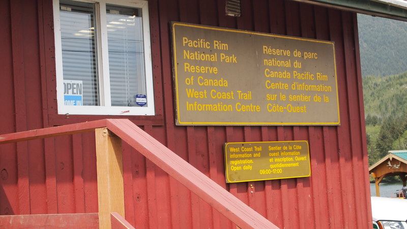
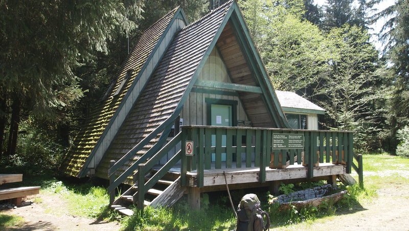
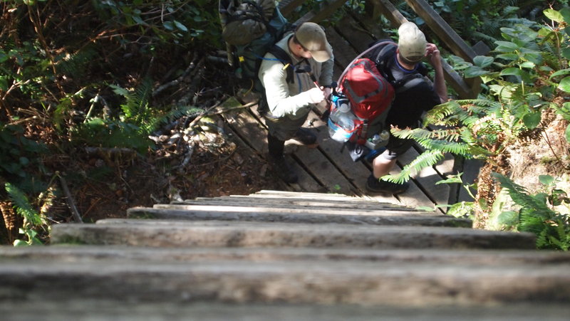
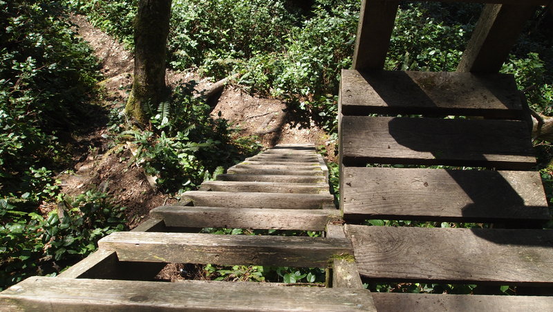
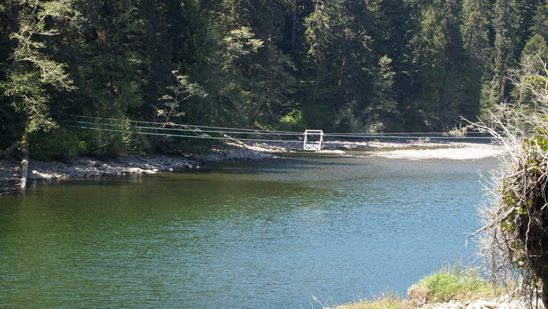
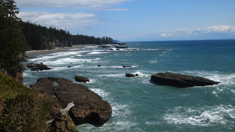
West Coast Trail Backpack
47 miles of hiking • 500' elevation gain • 5 nights
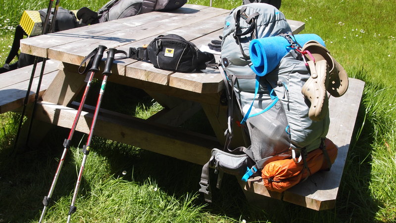
This was a 5 night/6 day backpack trip, starting at Bamfield/Pachena Bay in the north and heading south to Gordon River/Port Renfrew.
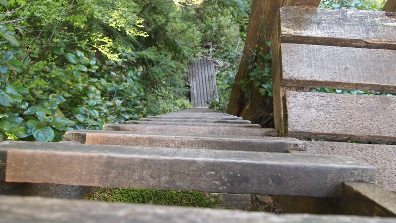
Day 1: Pachena Bay to Darling River, 14km We arrived to the Pachena Bay Trailhead around Noon via the West Coast Trail Bus. We checked in with the ranger, having done our orientation the night before in Port Renfrew. This section of the trail runs through the woods, so we set off at a nice pace, before encountering our first sets of ladders. These are wooden ladders ranging in length from a meter or two, all the way to several stories high. We made a stop at the Pachena Lighthouse about 10km in, which is one of the last WOODEN lighthouses still standing in the world. It also has it's original Fresnel lens in it. While we were looking around, Norby, the lightkeeper came out and chatted with us. He answered a bunch of our questions about some of the many things we saw. It was fascinating to see how self-sufficient they are, including a small garden for fresh produce, as well as how they get their supplies via boat. Even with our stop at the lighthouse, we still made good time to Darling River and set up our camp. There were quite a few northbound hikers too. It was fun chatting with people and getting information on the trail up ahead.
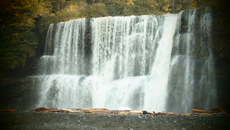
Day 2: Darling River to Tsusiat Falls, 11km We continued along the trail in the woods, thinking this was the best way to go, avoiding the sand on the beach until we absolutely had to. Later, we had no choice but to take the beach route and we realized that it actually was much easier, especially when we could walk on the shelf with the tidal pools. This was also our first cable car experience! Lots of fun and I was so thankful to have two other people with me, I can't imagine doing this alone. We had to take some insane ladders to the campsite, but it was sooooo worth it! Tsusiat Falls was amazing. I can see why so many people like to camp there. The only downside was the compost toilets are on the other side of the creek, and it was nearly impossible to get over there during higher tides. This was not fun. I had to get a little creative with a tarp, my trowel, and some bushes, considering the campsites were all around us. Probably TMI, but when you're out in the woods, it really doesn't matter does it?! Basic needs must get met. :)
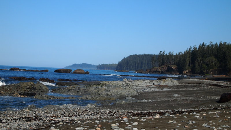
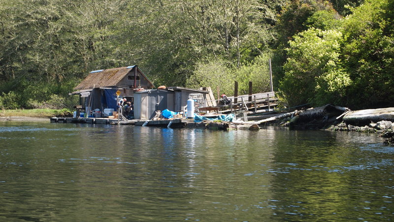
Day 3: Tsusiat Falls to Cribbs Creek, 16km This was our longest day so far. But it also was one of our best ones because we had our first ferry crossing at the Nitinat Narrows. The guy who runs the "ferry" (really, it's a boat that transports hikers from one side to the other) will make you fresh crab or salmon and a potato if you ask. He also sells beer, soda, candy bars and other snacks...for a price. I had the salmon/potato for $25 and it was delicious! We did a bunch of beach walking, which we realized is sooooo much easier on our legs, not to mention, we don't have to battle tree limbs, mud bogs, and boardwalks with missing boards. We saw a bald eagle, and at the 30km mark, we found some bear scat. Cribbs Creek was an awesome camp spot. There was plenty of room to spread out and we also saw whales off the coast in the late evening.
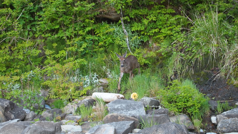
Day 4: Cribbs Creek to Cullite Creek, 17km I think this was the longest day for us. So many things went wrong...and so many things went right too! We started early to get to Chez Monique's for breakfast. We walked along the beach and were heading up our first set of ladders to get off the beach and up to the Carmanah Lighthouse when I saw something in the bushes. It was a Columbian Black-Tailed Deer!!! It was a buck with small little antlers starting to sprout. He was pretty friendly, but obviously trying to figure out "what" we were.
We continued up the ladders, and wandered around the lighthouse a bit, then continued with Chez Monique's in our sights. On arrival, we put our orders in...I went with the eggs, bacon, hashbrowns and toast for $15 plus some coffee, another $2.50. Chez Monique's is run by WWOOFers and she had just gotten a new batch in the day before. They didn't know the kitchen very well and it took almost 2 hours for our food to arrive! It was okay because we were enjoying ourselves, the view and chatting with other hikers. Once we got back on the trail, we walked the rest of the day on the beach until we hit Walbran Creek, which had the option of using the cable car or just crossing the creek. We chose to cross the creek, heading to the most shallow part and crossing with no problems. It was my first creek crossing!
This is where the fun began. The trail went back into the woods...aka PURE HELL. The trail was loaded with mud bogs, tree roots and all kinds of fun terrain. We had a few more obstacles to overcome, including a suspension bridge at Logan Creek, ladders that went DOWN and then back UP, and then back DOWN and then back UP again! Even the cable car at Cullite Creek involved ladders that made me question my own sanity. I ran out of water about 2km before we found the campsite, which was not fun. We finally made it to the campsite at Cullite Creek and found ourselves to be the only ones, since most of our fellow hikers had stayed at Walbran Creek for the night. Eventually, four German guys showed up, but we still enjoyed camping next to a nice creek with good water.
Day 5: Cullite Creek to Thrasher Cove, 13km This was another challenging day for us. Our first 4km took FOUR HOURS to walk! The section between Cullite Creek and Camper Creek were brutal. Because it took us so long to get to Camper, we weren't able to take advantage of the beach walking due to the tide. We entertained the idea of camping somewhere along the trail, but my energy was pretty good, as was everyone else, so we trudged along and made it to Thrasher Cove late in the evening. The trail was difficult in some spots, but as we got closer to Thrasher, it actually got better. It was a long day, but we knew the end was in sight.
Day 6: Thrasher Cove to Gordon River, 6km I left at 8:30a because I heard the last (or first) 5km is the worst part of the trail. This could not have been further from the truth for us. I walked the 1km from Thrasher Cove to the trail junction for Gordon River in less than 40 minutes, which is not bad considering it was straight up and there were some really challenging parts of the trail. I continued along and kept a pretty decent pace of about 3km/hr until I got to another area where there were lots of ladders going up and down again. We reached the trailhead at Gordon River at 12:15p, with our last hiking partner finishing at 12:45p. We had been told it would take 1km/hr to walk the 6km, but I think that's for the people just starting out with 60lb packs!
We signaled for the ferry boat to come get us, checked in with the ranger and waited for our ride back to our truck, where a hot shower and clean clothes were waiting for us!
This was my first big backpacking trip and it was a smashing success. The sun shined for six days, no one was hurt or injured seriously, and we saw some of the most amazing views of the west coast of Vancouver Island. I saw bald eagles, mice, osprey, whales, seals, deer and many other signs of wildlife. I actually want to go back and do it again, only I want to add a day/night to split up some of the longer days so I can enjoy myself a little bit more.
May 8 – May 13, 2012

Catherine Creek to Coyote Wall
8.5 miles of hiking • 1750' elevation gain •
I think our actual mileage was a little longer than this, but I'm going to go with what portlandhikers has listed. I haven't spent a lot of time on the Washington side of the Gorge, but this trail is definitely one I want to go back and explore more. There are lots of options for hiking from the Catherine Creek trailhead and we had a great day of no rain to do this hike!
It's a pretty steady incline for the first two or three miles, then you reach the ridge and it's pretty level, meandering along until you get to the "labyrinth" where the trail descends rather quickly through a bunch of rock formations and oak trees. Be very careful, there is a lot of poison oak!
We ended up at the end of the trail on the road about a mile or so from the trailhead and walked back. I'm looking forward to going back sometime to explore more of the area around there.
April 25, 2012

Indian Point Loop
8.5 miles of hiking • 2750' elevation gain •
What started out as a foggy morning in Portland, turned into a beautiful sunny day in the Gorge. We did the entire 8.4 mile loop (the portlandhikers link lists a different mileage than the book I used), which in retrospect, I would just go to Indian Point and go back the same way. Doing the loop is an insane elevation drop along Nick Eaton Ridge that made me want to scream for my knees and toes! It's basically 2 miles of straight down with a few switchbacks to help ease the pain a bit.
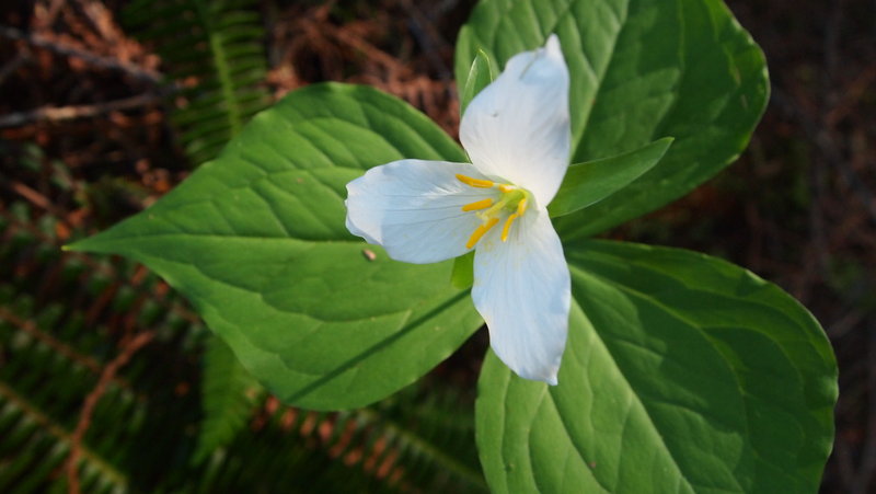
We stopped at Indian Point for lunch then continued along the loop. There were early signs of wildflowers blooming. Still a few trilliums along the trail.
It was a great day for a lovely hike.
April 21, 2012
 1
1
Eagle Creek Trail to 7 1/2 Mile Camp
15 miles of hiking • 1750' elevation gain •
This was my fourth and final attempt to get to Tunnel Falls on Eagle Creek. I've had all kinds of challenges, the most recent being a few feet of snow in January on the trail!
We made good time, leaving the trailhead around 9a and getting to 7 1/2 Mile Camp around 12p, where we stopped for a nice lunch break before heading back, passing Twister Falls, Tunnel Falls and the rest of the landmarks on the trail.
It was a great day to be outdoors, with lots of dayhikers and backpackers.
April 15, 2012

Lower Macleay to Pittock Mansion to Japanese Garden Loop
8.5 miles of hiking • 1000' elevation gain •
Originally we started out just wanting to do the trail to Pittock Mansion. I did it a two years ago when training for the Camino de Santiago and thought it would be a nice hike to do after the Next Adventure Warehouse Sale.
We got up to Pittock Mansion and felt like we could walk some more, so we went down to the Japanese Gardens, stopped for lunch and then headed back to the car. It was pretty uneventful. It didn't rain much, there were a lot of people on the trail and it was quite muddy.
For some strange reason I didn't bring my camera, so no pictures of this hike!
March 31, 2012
 1
1
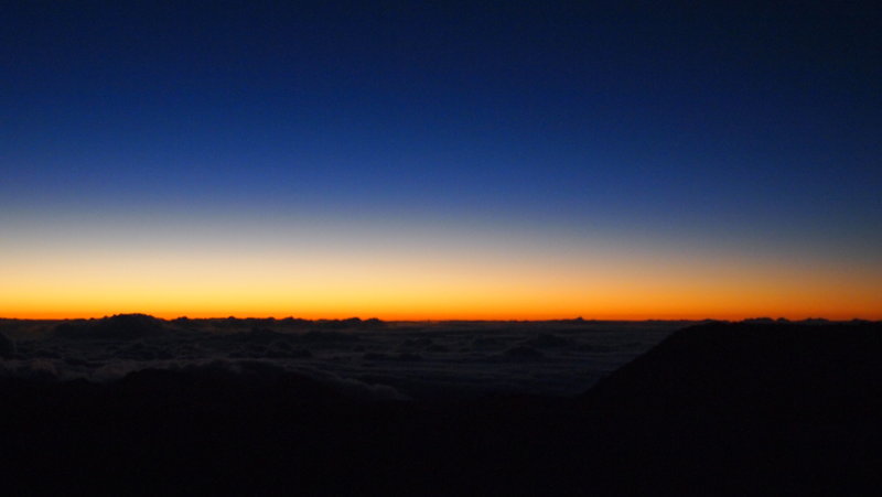
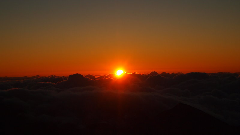
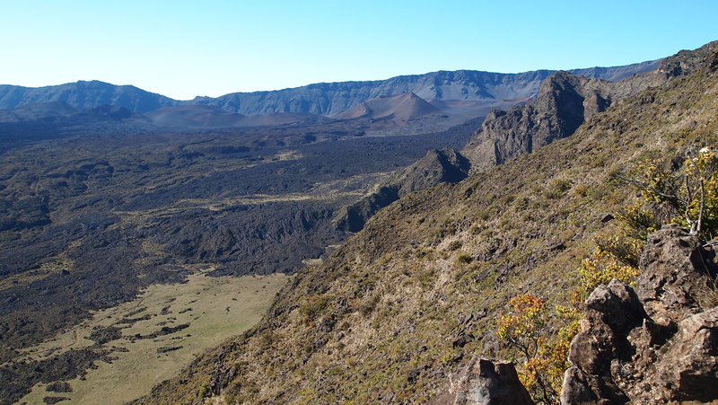
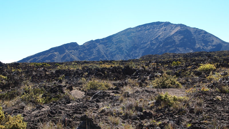
Halemauu Trail-Haleakala NP
8 miles of hiking • 1000' elevation gain •
I'm a little bit behind on this trip report. I was on vacation in Maui and planned to do a few hikes while I was there. We woke up at 3a to drive from Makena to Haleakala NP to watch the sunrise. It was fabulous, but very much overcrowded with unprepared tourists who didn't get the memo that the top of the park is at 10K and the wind gusts up to 50mph. It was cold and windy! We came prepared with long pants, wool socks and hiking shoes, lots of top layers, a rain shell and a hat. Others were wrapped up in hotel towels and comforters...yeah.
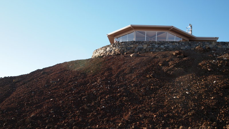
After the sunrise, we ate breakfast in the car and went to the visitor center to speak with a park ranger about hiking options for the day. The first question was, "How much water do you have?". There are no places to get water in the visitor center, so we made sure to bring 3L with us. Based on our water count, she recommended two trails. Sliding Sands and Halemauu. We chose Halemauu because it seemed more interesting.
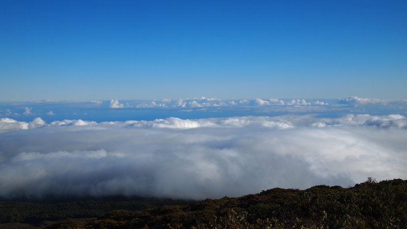
We drove down the road to about 8000' and parked the car at the trailhead. The trail meanders down about a mile and a half to a rocky outcropping where you can see into the crater area and if we weren't above the clouds, on a clear day, you could probably see down to Kihei.
Once you get past the rocky outcropping, the trail turns into a series of switchbacks that have you doubting how long it is going to take to get down to the bottom of the hill!!! We ran into very few people, but did come across three local guys who had camped at the campsite near the Holua Cabin. Once you hit the bottom of the crater area, it's a straight mile from there to the Holua Cabin and the campsites near it. You can rent out the cabin for $60/night if you are lucky enough to get a permit! There are also primitive campsites just on the other side of the hill.
We stopped at the cabin where there were two more guys who had camped there for two nights. They were getting ready to leave when we arrived and we stopped for lunch before heading back up the hill.
It was very hot in the crater and we made good time getting back up the hill. Probably because we were not stopping to take pictures! All in all, I think it took about 5 hours total, including all the stops and our lunch break. It was beautiful and the pictures I have do not even remotely do it justice!
March 17, 2012

Wahkeena-Multnomah Falls Loop
5 miles of hiking • 1500' elevation gain •
We started at the Wahkeena Falls Trailhead and made our way up the trail past the paved part. It was a beautiful day, with some fog in the lower elevations, but once we got up a little higher, you could see clear, blue sky! There was also some snow along the ridge before you get to the Larch Mountain Trail. The temperatures also dropped a wee bit up there, but once we got closer to Multnomah Falls, it started to warm up.
All in all, a good day to be outside in the Gorge!
March 4, 2012
 2
2
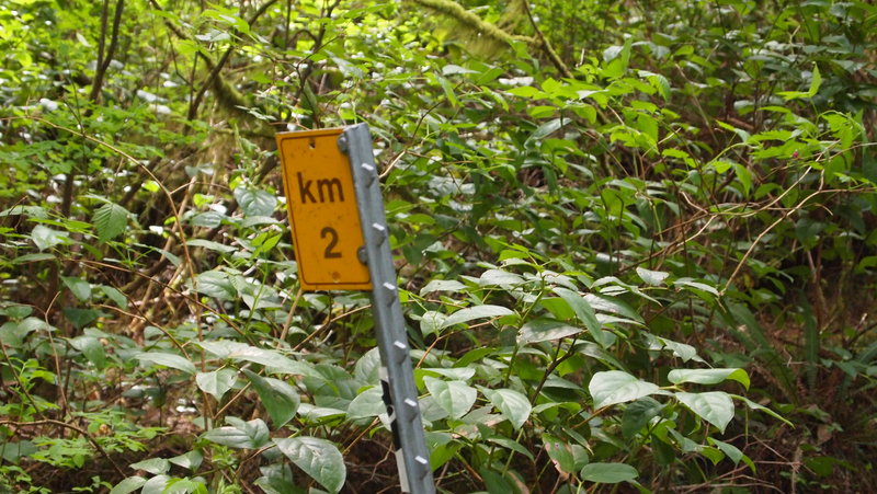
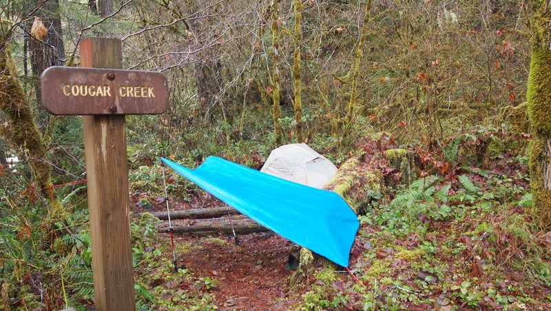
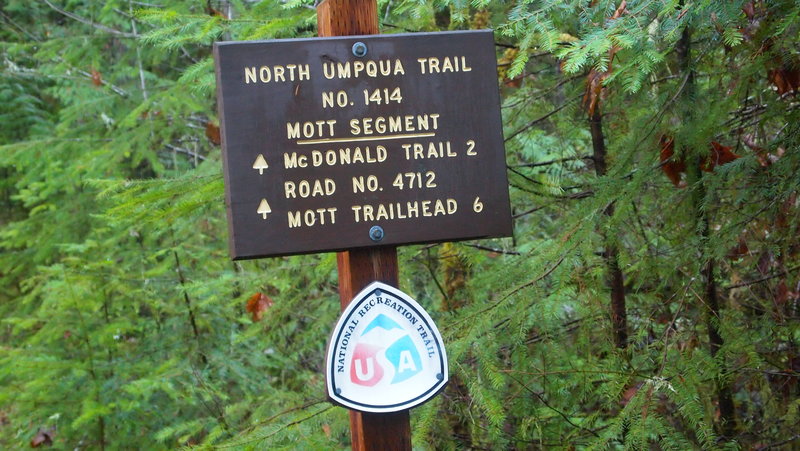
North Umpqua Trail: Mott Section
12 miles of hiking • 0' elevation gain • 2 nights
I originally set out to start at the Swiftwater Trailhead and see how far I could get over two nights/three days. I checked in a the BLM office in Roseburg to check on trail conditions and the super helpful staff there told me that there was a 90% chance of rain and the snow level was going to drop to 1000' over the weekend. While I was prepared for those kind of weather conditions, I really didn't feel like camping in snow. I changed my plan to start at the Wright Creek Trailhead instead, which had virtually no elevation gain, and hovered around 1000'.
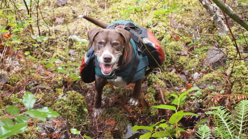
I arrived at the trailhead and hit the trail around 3p on Friday, February 17th. It was my first solo backpack (with dog), and I was excited to get out for my first backpack of 2012. I backpacked in about 2 miles to Cougar Creek where I found a small campsite just large enough for my tent and a separate tarp for cooking. There was also a fire pit, but I am not that good with starting fires in wet areas so I didn't use it.
I set up camp and was able to cook dinner before retiring to the tent for the evening. I brought my e-reader and was able to get some reading in while sipping on hot cocoa before going to bed. The dog and I cuddled up and got a decent night's sleep with rain showers periodically through the night.
On Saturday, February 18th, I slept in a bit, then made a quick breakfast before heading out on a day hike to the Mott Trailhead. I made quick time, maintaining a 2 mi/hr pace and for about the last 30 minutes, got poured on! Luckily, there was a nice covered outhouse at the trailhead so I used the facilities and then sat down for a quick lunch, waiting for the rain to stop. It finally stopped and I headed back to my campsite. I took a short nap before waking to cook dinner and do some more reading before retiring for the evening. Because of the rain, I decided to pack it in on Sunday morning, February 19th and head home. I would have liked to have done more hiking but the weather just wasn't cooperating.
Here are my pros/cons for this trail:
Pros: The first 11 miles is BLM land, then the rest is USFS land. Neither require fees to park or use the area. BONUS! Also, the staff at the BLM are top notch and super helpful. Minimal elevation gains on some sections of the trail. Major elevation gains on other sections of the trail. You decide! Not a lot of people out this time of the year. I encountered a family of three hunting hedgehog mushrooms on the first day, and three steelhead fishermen on the second day. Other than the squatters at the trailhead, I didn't see signs of anyone. Seriously, this is one of the most beautiful parts of Oregon!!! I "think" I saw a bald eagle, even. Not 100% sure, but it was a raptor with a white tail....
Cons: This section of the trail is close to the river and close to the road. So, you will hear and see cars. I didn't mind the noise, but depending on what section you choose to hike, you may deal with car noise. It is probably quite busy during the high season. *Not a lot of primitive camp sites, so you might have to get creative.
February 17 – February 19, 2012

 2
2
Eagle Creek and Latourell Falls
3.5 miles of hiking • 1000' elevation gain •
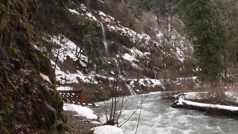
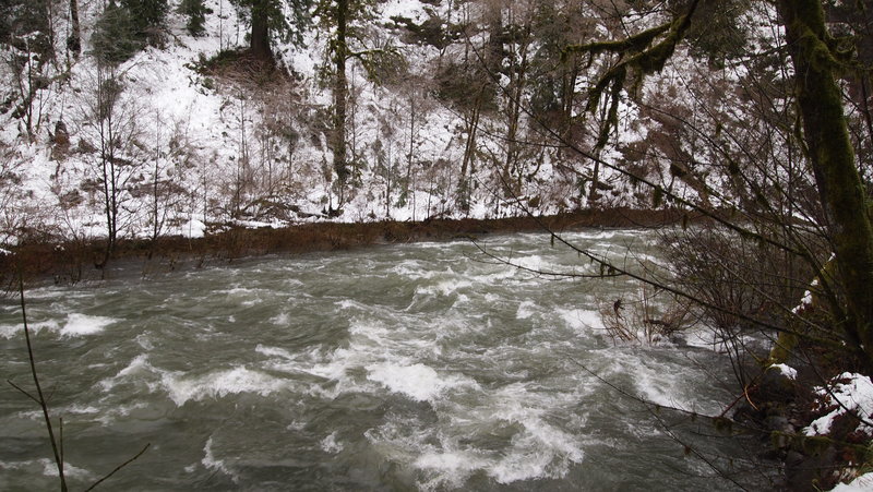
We started the day with the intention of hiking Eagle Creek trail to Tunnel Falls. We arrived at the trail head around 8:00a and found about a foot of snow around the area. We were the only cars at the parking lot. Nothing too difficult to navigate and since I had just bought some Kahtoola micro spikes, I felt comfortable hiking the trail in them. My hiking partner and I both agreed to give it a go and see how far we could get.
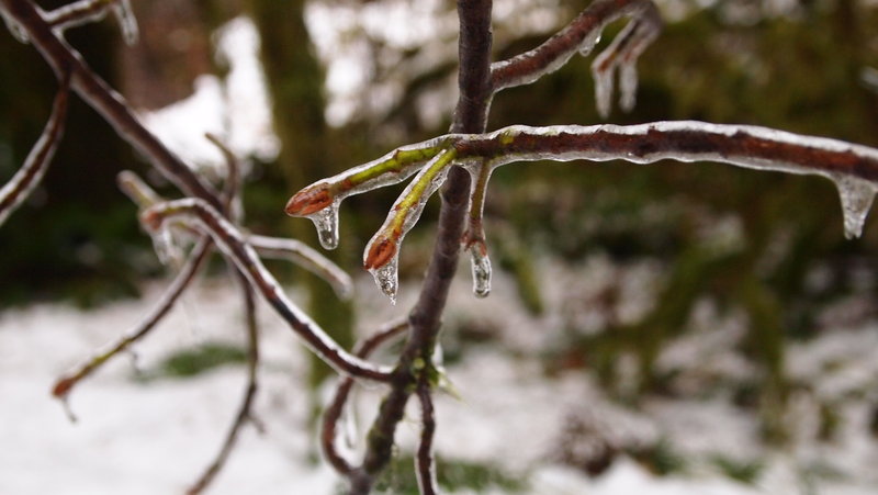
We started on the trail and I have to say, I don't know how I lived without micro spikes before! They made such a huge difference in traction and comfort. There was probably a foot of snow around the trail head area and once on the trail it was about 6 inches deep in some places, with some bare trail as well. There was lots of ice on the trees and plants, which made for some fun pictures.
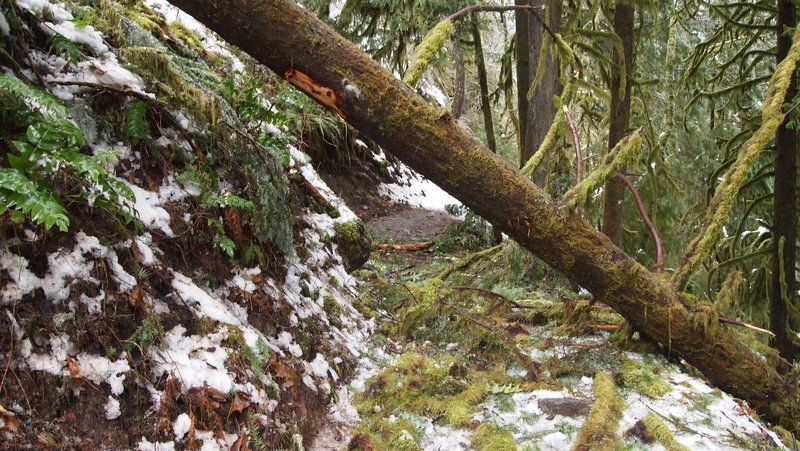
We encountered a lot of blow down (or ice down, as the case may be) but managed to get around most of it. Finally, it was a waterfall blocking the trail which finally made us turn around. There just wasn't a good way behind or around it without getting really wet or being really dangerous.
So we turned around and went to Latourell Falls instead. We did the 2.3 mile loop and called it a day.
Complete photo album can be found here: https://plus.google.com/photos/101714777096523333671/albums/5700516513290544129?authkey=COvi6Zzlg8O-RA
January 21, 2012