

2011 Trips


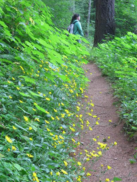
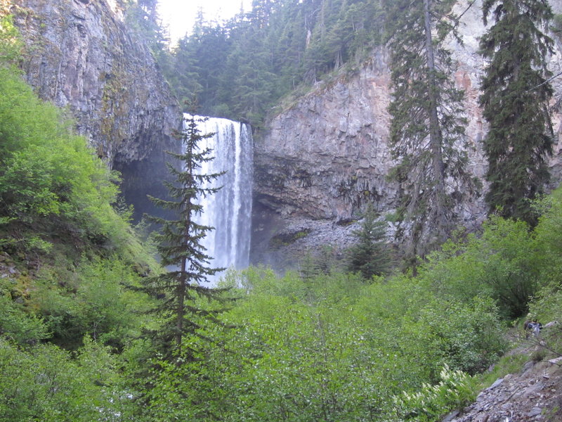
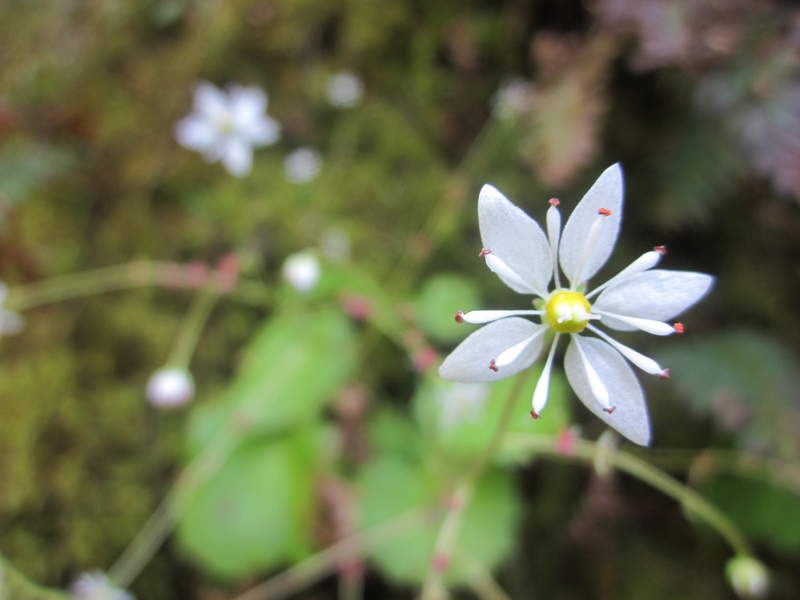
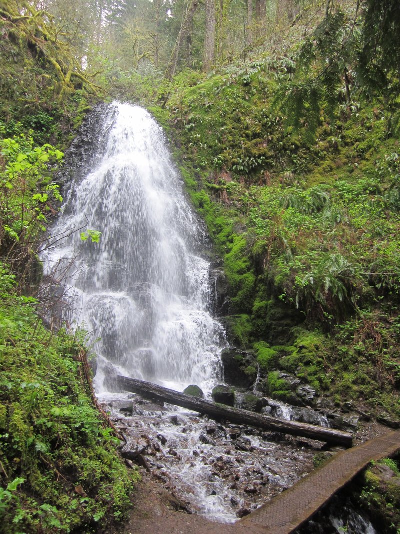
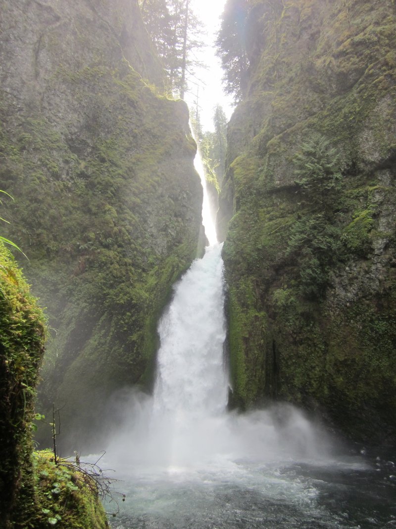
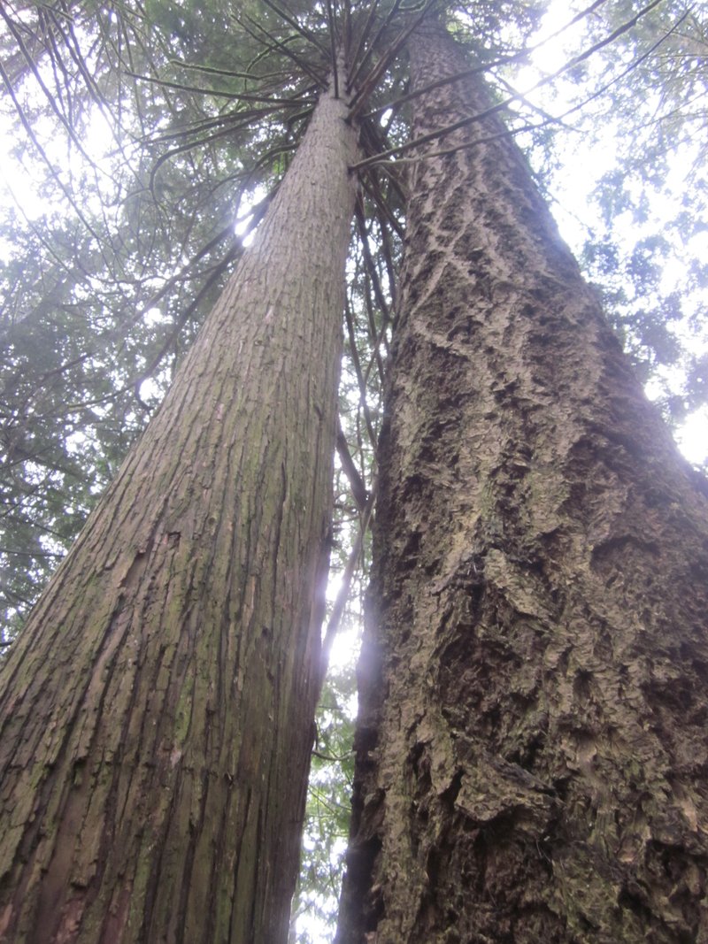
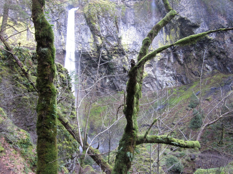
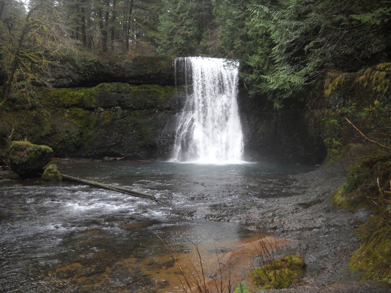
Tamanawas Falls
4 miles of hiking • 500' elevation gain •
Nice hike we did at the start of the summer. (sorry for late post)

June 14, 2011

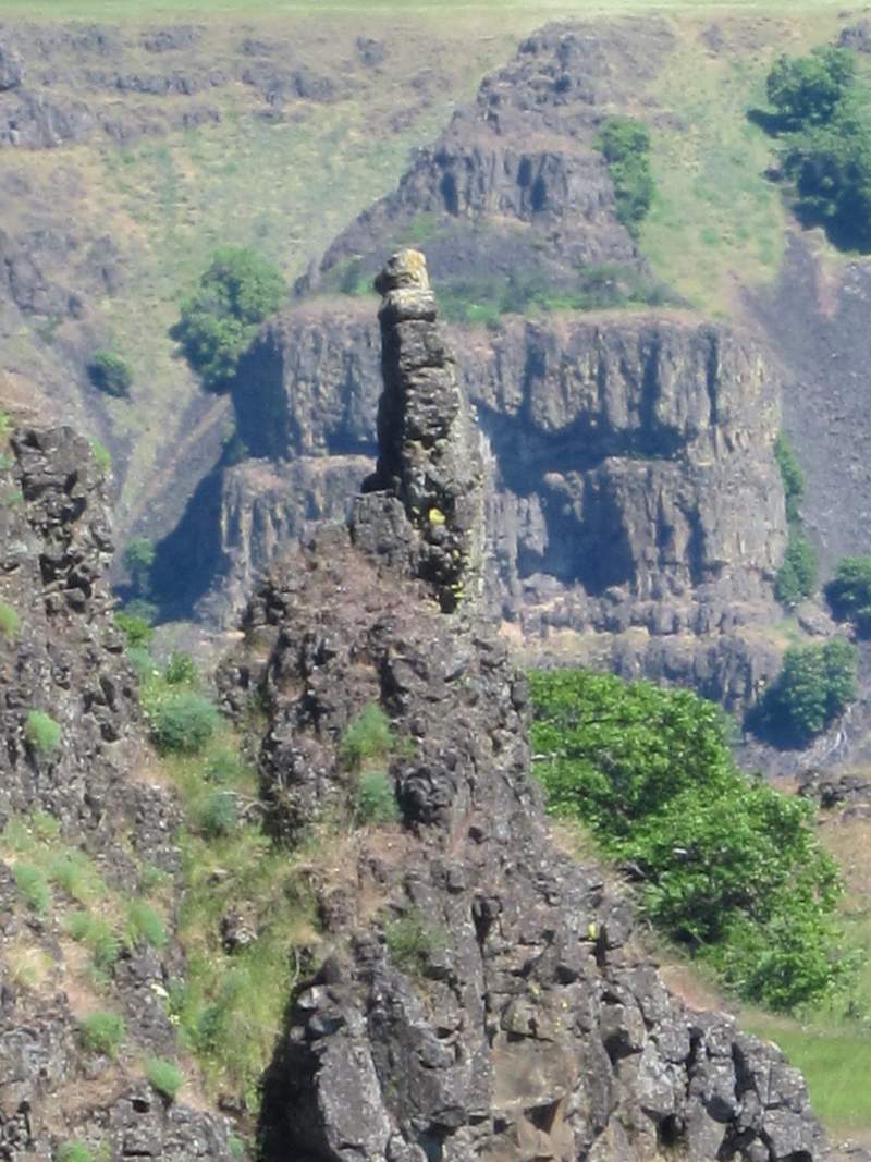
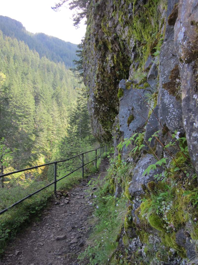
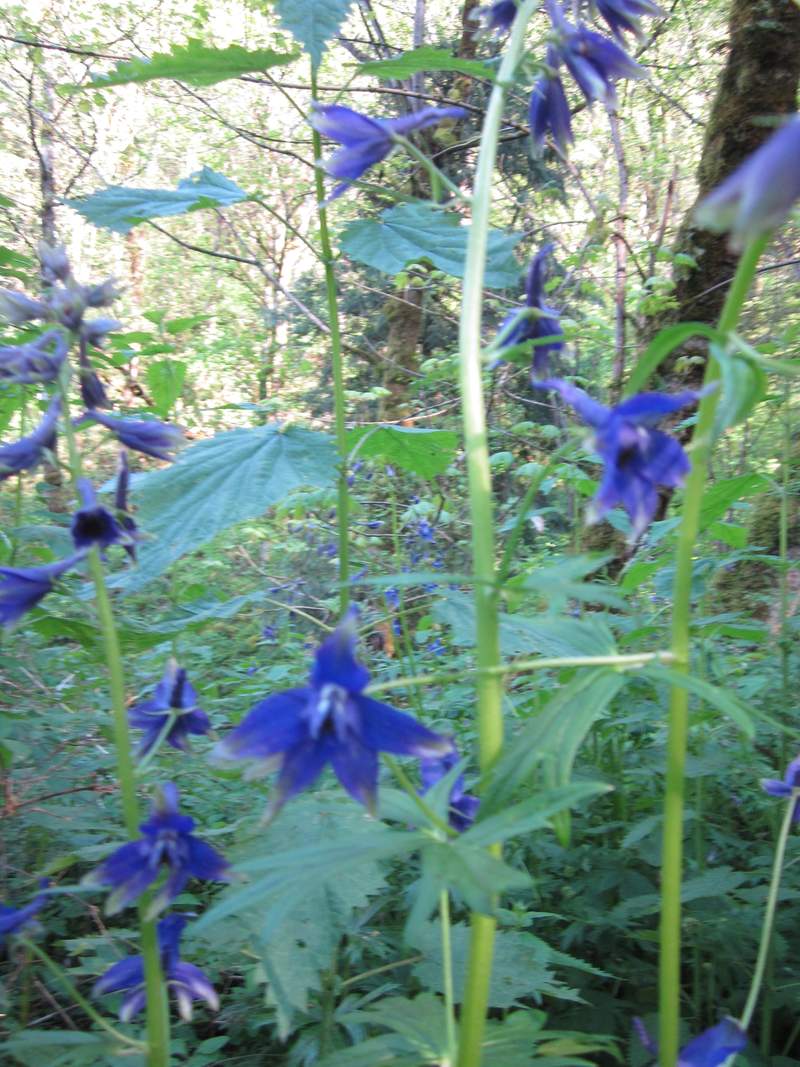
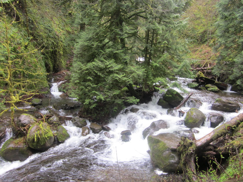
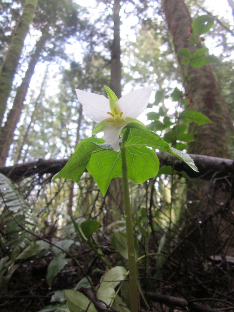
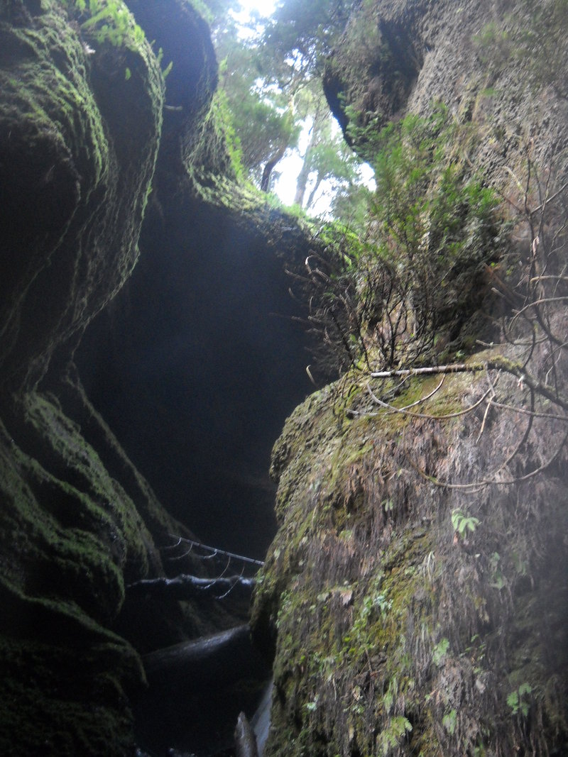
Horsethief Butte, Dalles Mountain Ranch, Catherine creek arch and Starvation creek waterfalls
12 miles of hiking • 3000' elevation gain •
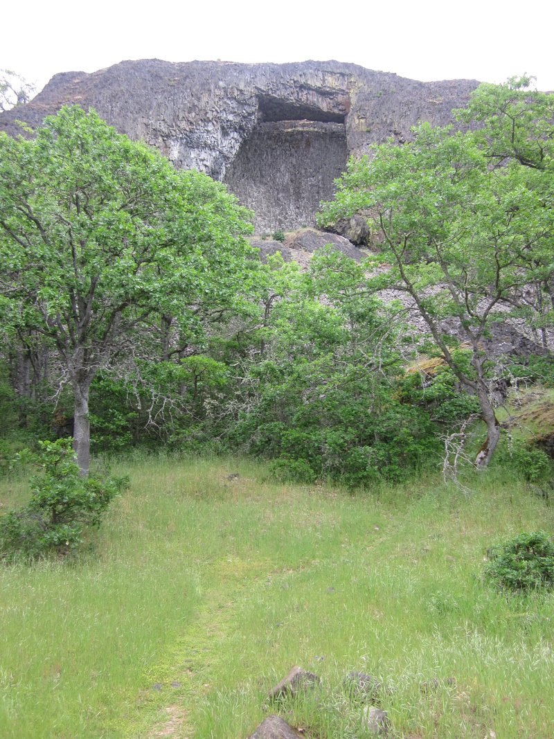
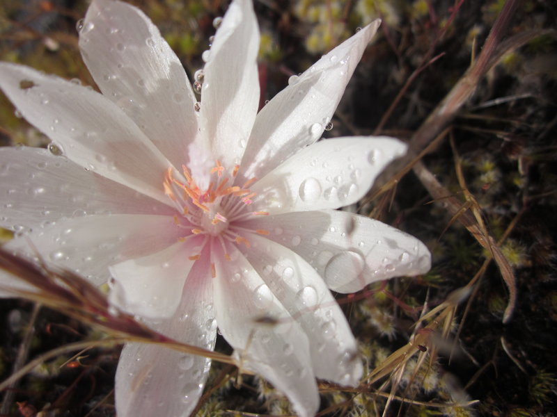
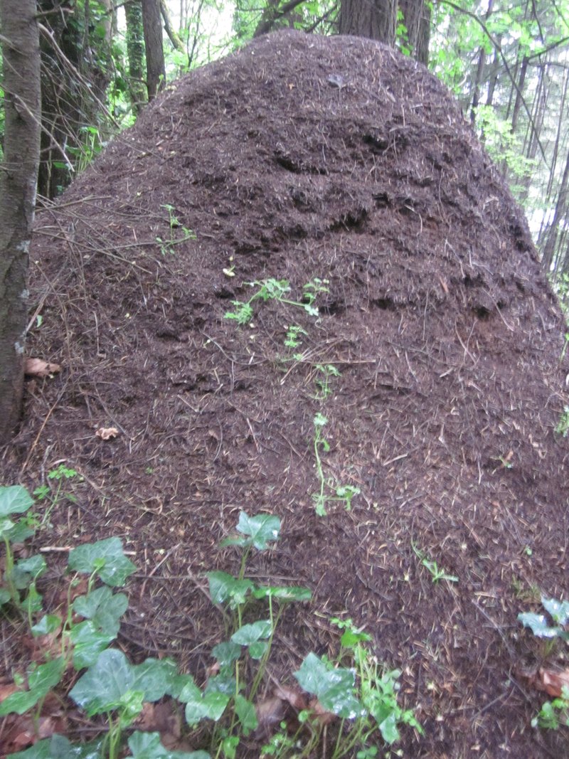
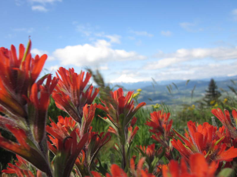
Left PDX at 6 am and drove to Horsetheif butte in search of the flower broomrape. We did indeed find some and this was a very beautiful area. Next we drove to Dalles Mountain Ranch and hiked up to Stacker Butte. We saw 4 deer, tons of birds, tons of flowers and zero people on this hike. Next was Catherine Creek to check out the Arch and to find some Bitterroot flowers. We had sun almost the whole time and a few sprinkles but decent temps. Once we got to Starvation creek the rain was coming on very steady but we checked out all three waterfalls the massive ant hill I have I have somehow missed every time I have been here. We then headed back to portland to checkout the new McMenamins downtown to wrap the day up with a friends band and some Ruby : )
May 25, 2011

%20of%20Picture%20005.jpg)
 1
1
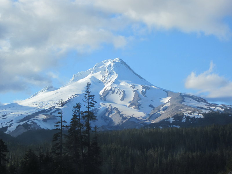
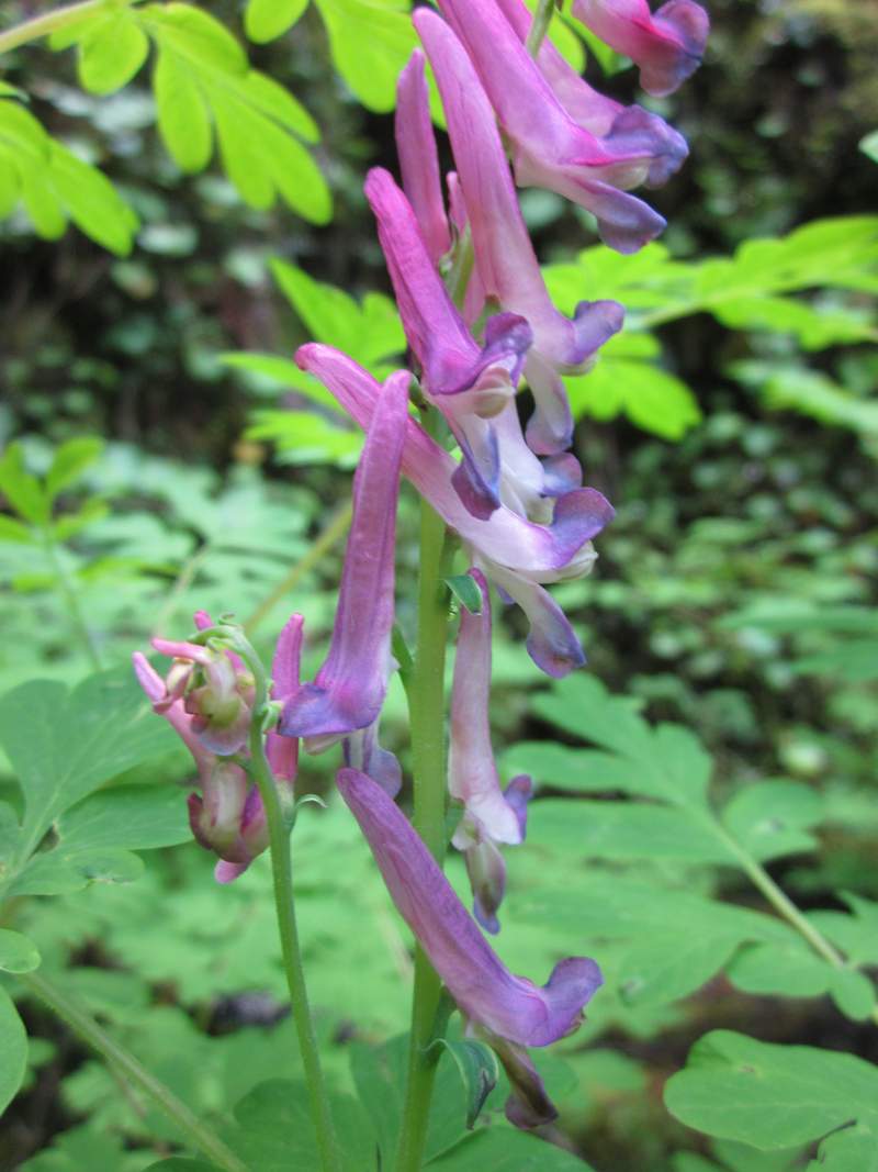
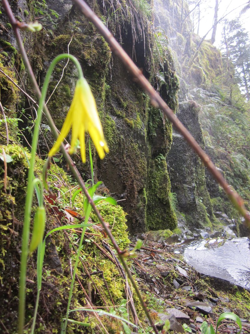
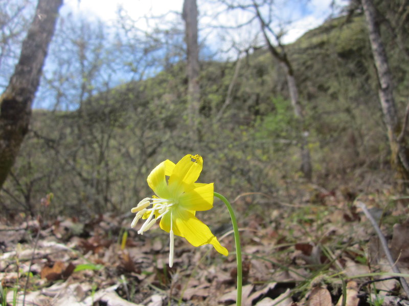
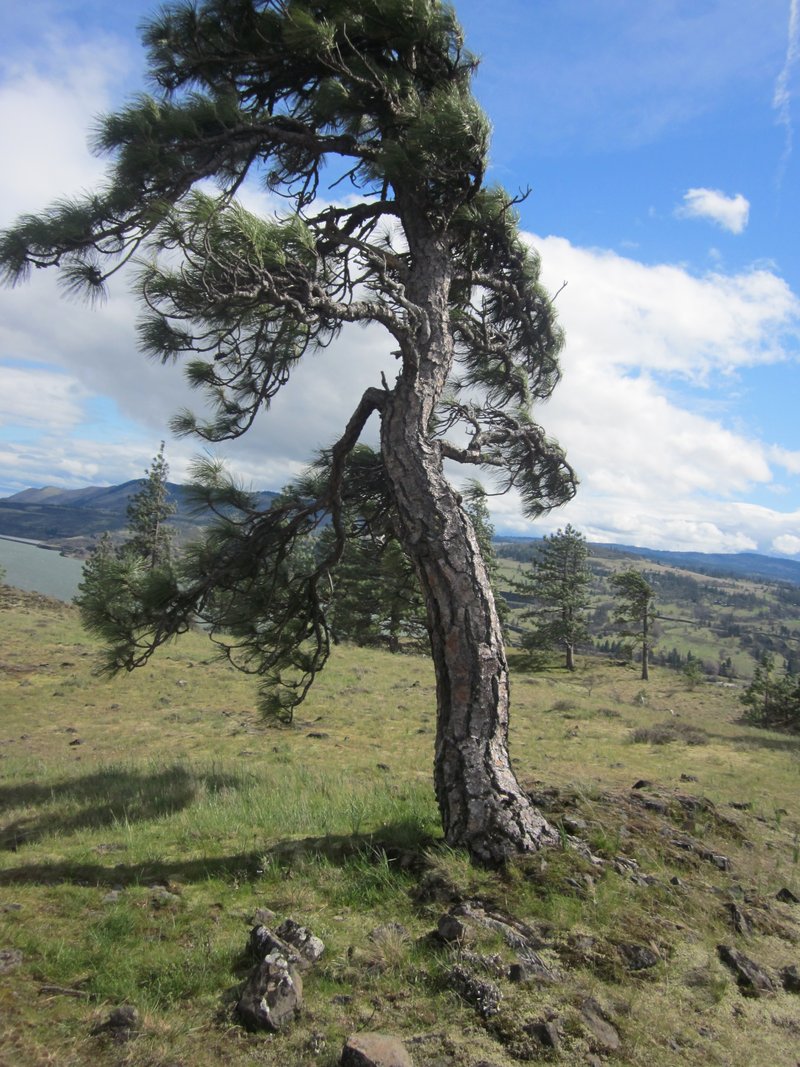
Hood River Mountain/ Rowena Crest/ Oneonta Gorge
8 miles of hiking • 1000' elevation gain •
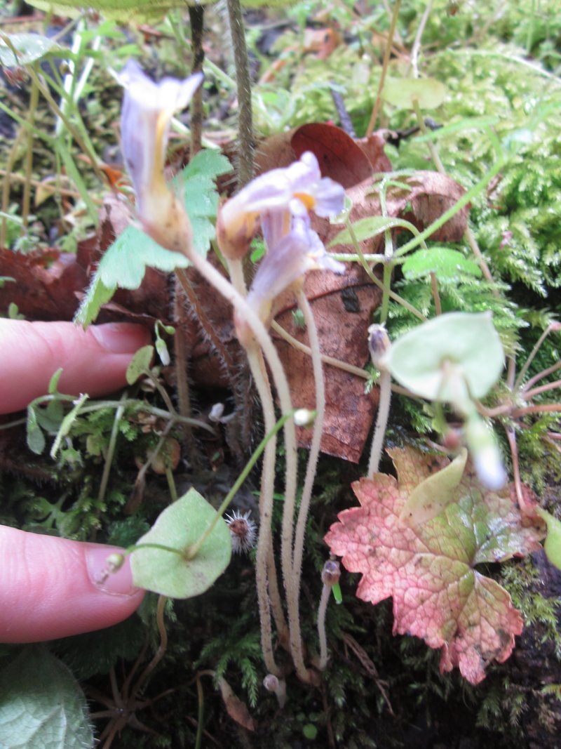
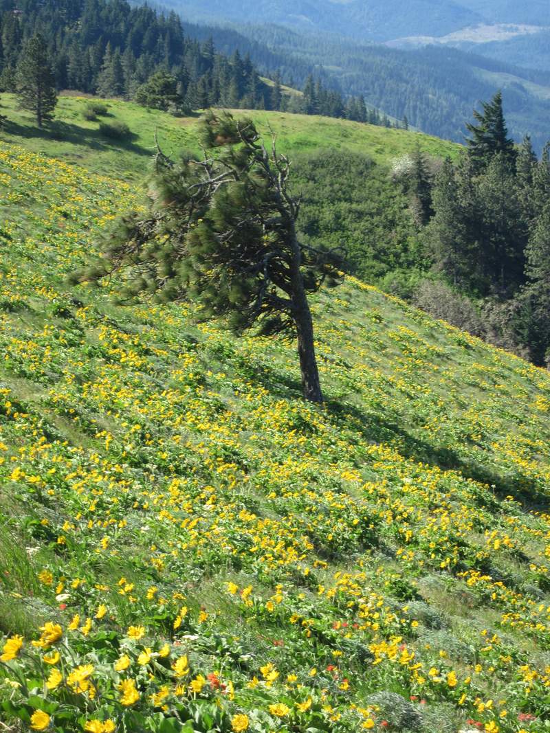
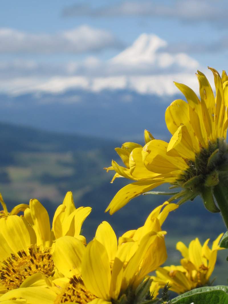
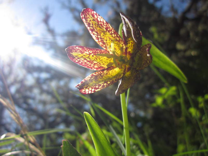
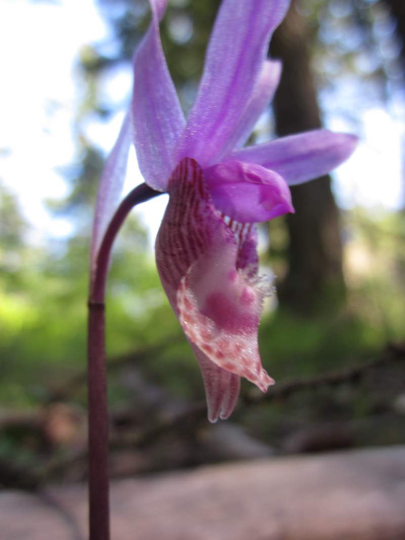
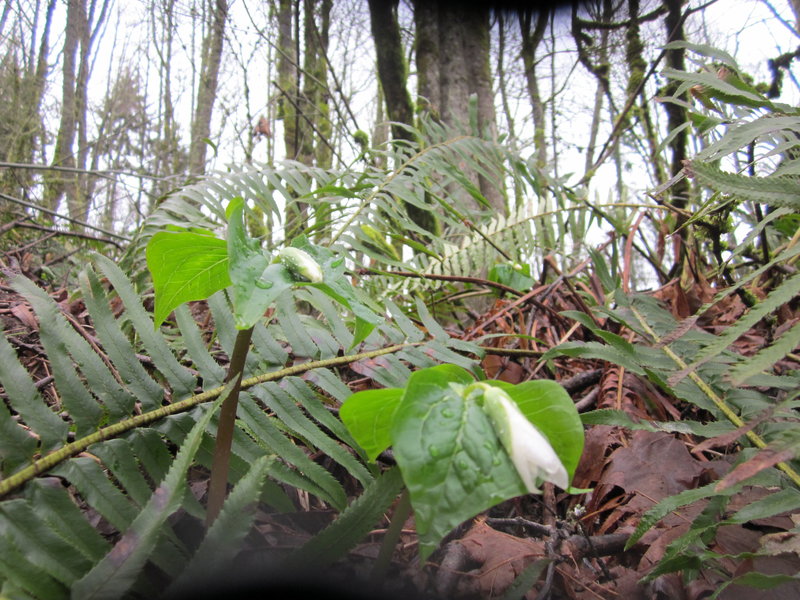
We left SE Portland at 6 am and headed down 26 until 35 to get to hood river ( I know long way but we had never been on hwy 35). First we went up to Hood River Mountain and it was very rad, saw my first fairy slipper orchid and chocolate lilly! Once near the top the views were amazing and the hills were covered with paintbrush and balsamroot sadly the lupine was only just starting. Next we went to Rowena and poked around. Lots of poison oak and I even found a tick on me! Nice day and weather overall : )
May 23, 2011

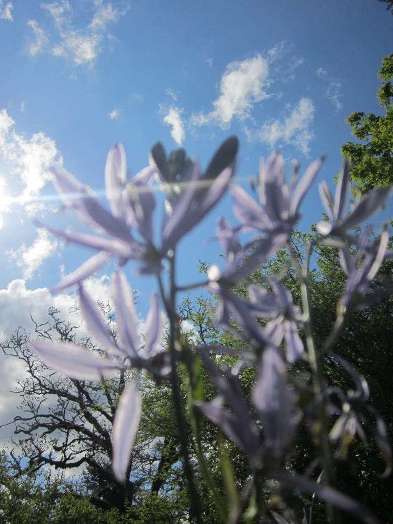
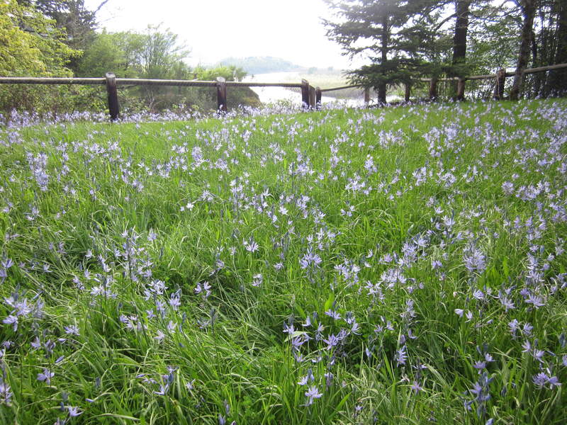
Upper McCord Creek, Latourell Falls and Bridal Veil camas fields!
6 miles of hiking • 1000' elevation gain •
Went a huntin' for wildflower and we found them! I have been waiting all year to see the Camas at Bridal Veil State Park and I was not disappointed!
May 11, 2011

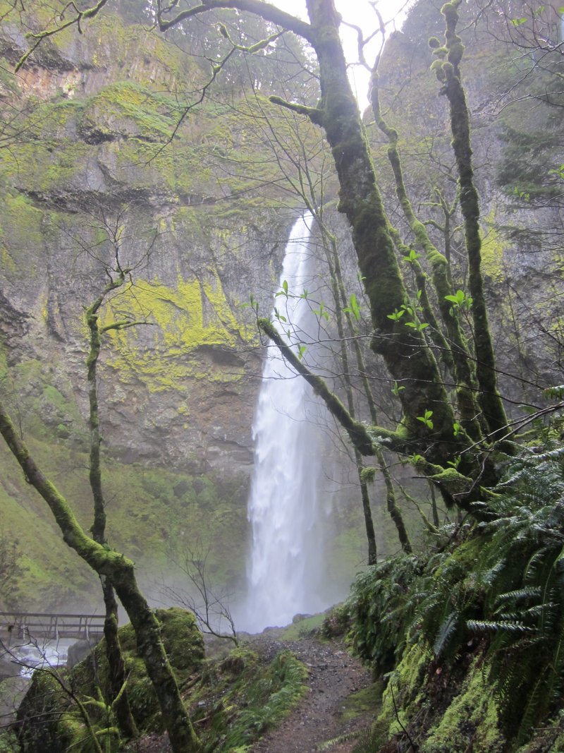
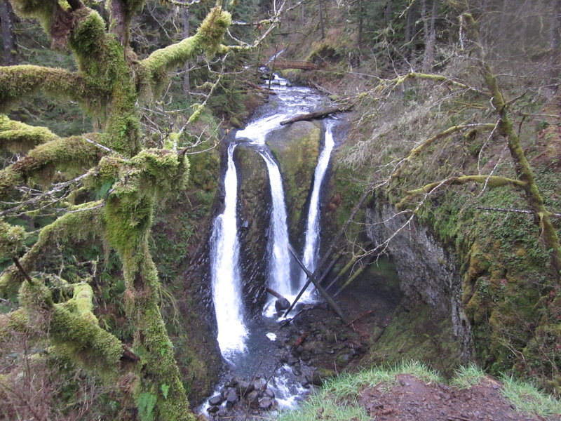
Wahkeena falls loop to Multnomah Falls
5 miles of hiking • 1500' elevation gain •
Nice loop starting at Multnomah falls parking lot and headed over to Wahkeena. The springs were roaring and we didn't see anyone until the connecting trail with Larch mnt. Nice hike but I can only be on the Multnomah trail once a year because I get so mad when I see all the garbage.
April 27, 2011

Horsetail Falls
2.5 miles of hiking • 500' elevation gain •
Took some friends on this nice hike. Lot's of people and parents not watching their kids on the cliffy areas almost gave me a heart attack!
April 9, 2011

Wahclella
2.5 miles of hiking • 250' elevation gain •
Another gem of the Gorge and she was a roaring!!!!!
April 6, 2011

Elowa Falls
2 miles of hiking • 250' elevation gain •
Went to see Elowa today and it was just as nice as always : )
April 6, 2011

Hole in the Park-Forest Park
6 miles of hiking • 1000' elevation gain •
Second hike I have done for the Forest Park Challenge. This was a nice hike, only saw one person (trail running), and the mud was not as bad as last time!
April 5, 2011

March 30, 2011

March 16, 2011

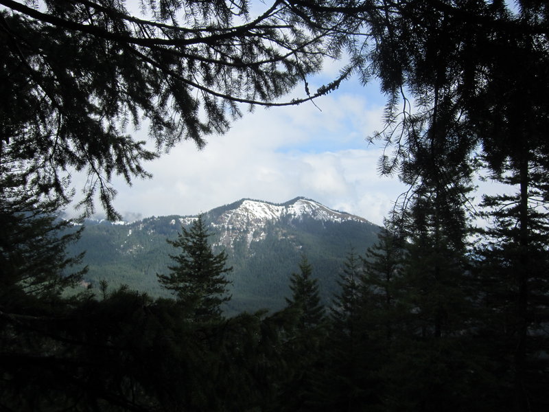
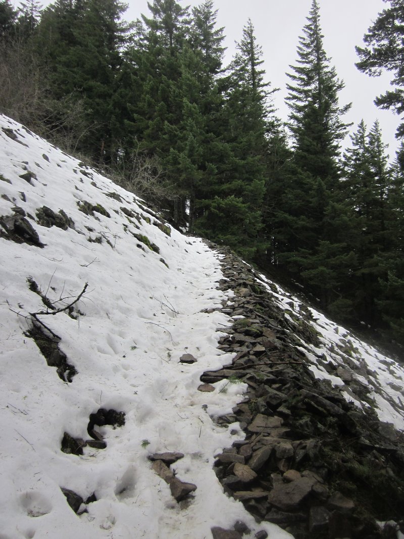
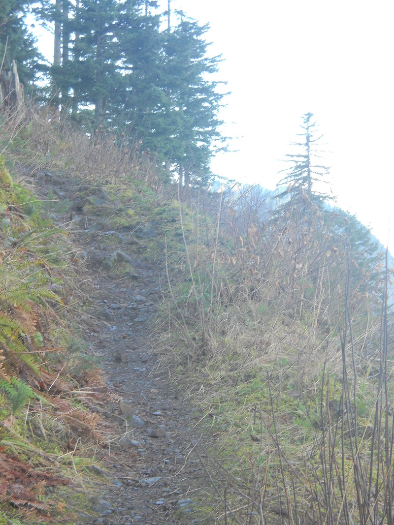
Wind Mountain
3 miles of hiking • 1000' elevation gain •
Steep hike but nice, I made it to the last talus crossing and stopped because of slippery snow and strong wind. Hope to get back there soon.
March 9, 2011

McCord Creek Falls/ Elowa Falls
5 miles of hiking • 500' elevation gain •
Nice hike but I freaked out on the cliff area near McCord Creek Falls. After seeing the two falls we hiked past Elowa to the Gorge 400 trail I think and we followed that for a ways.
March 6, 2011


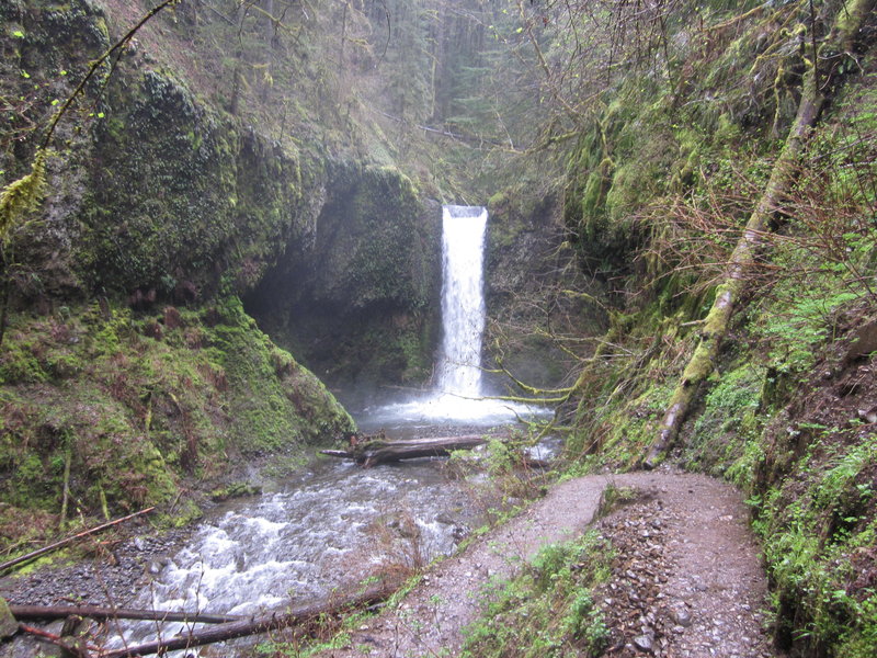
Triple Falls
4 miles of hiking • 750' elevation gain •
Started at Horsetail Falls and went up to Triple Falls.
February 13, 2011

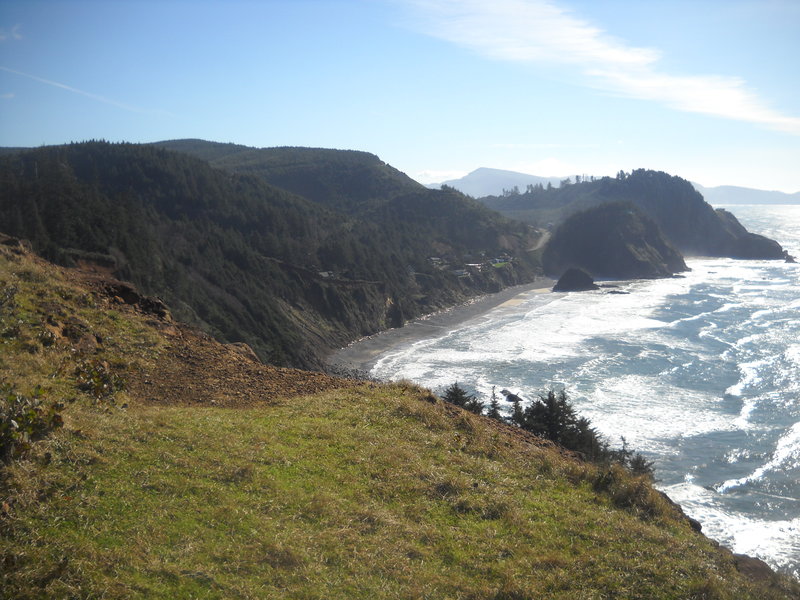
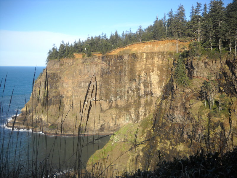
Cape Mears
2 miles of hiking • 250' elevation gain •
side trip to Cape Mears for Cape Lookout, and we got nice weather!
February 8, 2011

February 2, 2011

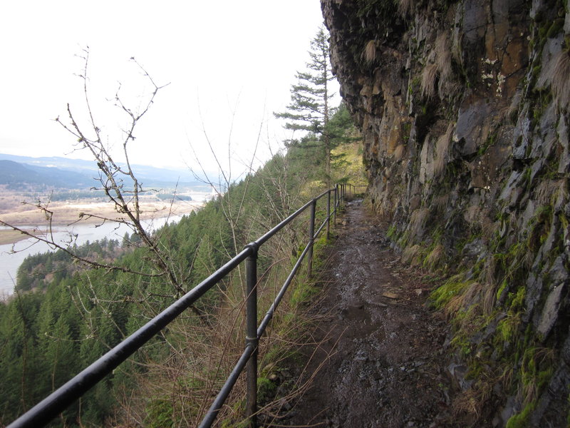
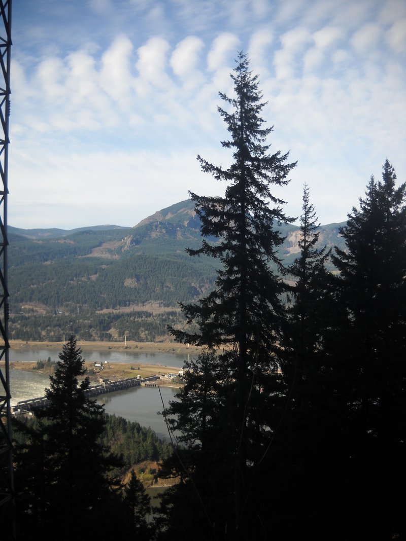
Wauna Viewpoint
4 miles of hiking • 1000' elevation gain •
Did all of this hike but the last 30ish feet because the sound of the power lines were freaking me out, went with BertMoss.
January 26, 2011

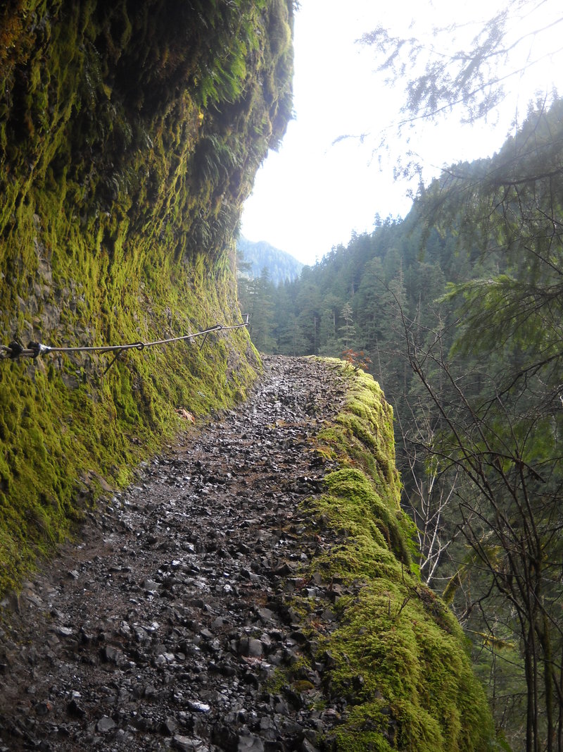
Eagle Creek
3 miles of hiking • 250' elevation gain •
This was my second attemp to hike Eagle Creek, I failed again and only got to the second cliff area where you can hold onto the cable. I really really want to hike to high bridge but my fear of heights has not allowed me as of yet. Poor BertMoss she has been with me both times when I freaked out so she hasn't been able to get farther either.
January 26, 2011

Pool of the Winds
3 miles of hiking • 750' elevation gain •
Hiked late afternoon with BertMoss to Pool of the WInds.
January 25, 2011

Pacific Crest trail at Cascade Locks to Herman Creek Pinnacles
10 miles of hiking • 750' elevation gain •
BertMoss and I started below the Bridge of the Gods and we hiked the Pacific Crest Trail to the Herman Creek trail and from there to the pinnacles then we back tracked to the bridge and we attempted to find Dry Creek Falls but we went the wrong direction : )
January 18, 2011


Mt Talbert
3 miles of hiking • 250' elevation gain •
Easy hike around a public park, hiked with BertMoss
January 5, 2011


View trips from: 2012