

2017 Trips


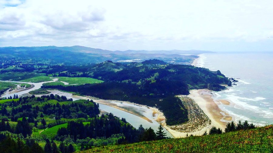
Cascade Head
7 miles of hiking • 1250' elevation gain •
beautiful sunny day at the oregon coast, with clear skies all the way to the horizon. pleasant breeze at the top of the hike, with a great view of the coastline and beaches below. quite a bit of effort to make the upper viewpoint with a full pack, but well worth the effort and need the training time :).

April 30, 2017

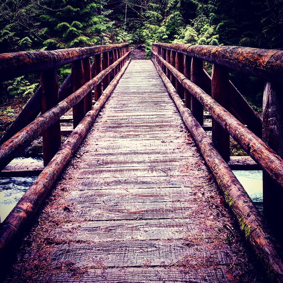
Drift Creek Falls
3 miles of hiking • 500' elevation gain •
nice quick jot with lots of scenery. the bridge is remarkable and the falls is in full glory this time of year. well-groomed trails, and a busy, but not overly-full parking lot. saw maybe a dozen other folks on the trail.
April 30, 2017


Opal Pool - Cedar Creek
10.5 miles of hiking • 1250' elevation gain •
Rainy rainy rainy, and absolutely gorgeous clear water and rushing falls. Hopped a lot of creeks crossing the trail, got well and truly damp, but made it out before the worst of the downpour. Loads of cars in the lot, but oddly few people encountered on the trail relative to the car count. Jawbone flats is a super cool ghost-town on the way back. Very pleasant, flat hike. Will definitely do again!
April 23, 2017

 1
1
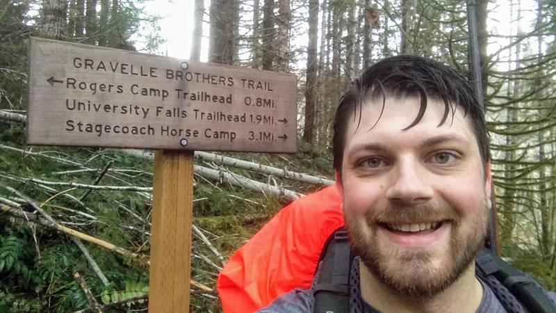
Tillamook Historic Hiking Loop
11.5 miles of hiking • 1750' elevation gain • 1 night
Wet and luscious hike through the Tillamook Forest, lots of deadfall made some trails near impassable and plenty of early-season mud. Parked at Rogers Camp, hiked Nels Roger to Wilson River Wagon Rd Trail to Sidestep. Camped overnight at Stagecoach Horse Camp, Hiked back out Sidestep, up to University Falls, then back out on the Gravelle Brothers Trail along the Wilson River. Saw lots of Elk sign, but few actual creatures. Very solitary trek, not another soul on the trails over the entire hike.
March 31 – April 1, 2017

View trips from: 2017