Zoom

2011 Trips Subscribe via RSS

Heart_bw

Nesmith Point

9 miles of hiking • 3500' elevation gain •

Comment 0 comments

November 20, 2011

Staticmap?size=254x125&zoom=4&maptype=terrain&markers=icon:http%3a%2f%2fwenthiking.com%2fimages%2fmarkersmall.png&key=aizasydt2ewyqnn42qqnrpazuysi2dtyerccchw&center=45.6228,-121
Heart_bw

Horseshoe Meadow/Lookinglass Lake

15 miles of hiking • 2500' elevation gain • 2 nights

Comment 0 comments

September 30 – October 2, 2011

Staticmap?size=254x125&zoom=4&maptype=terrain&markers=icon:http%3a%2f%2fwenthiking.com%2fimages%2fmarkersmall.png&key=aizasydt2ewyqnn42qqnrpazuysi2dtyerccchw&center=46.1698,-121
Heart_bw

Eagle Creek-Estacada 2.0

6 miles of hiking • 750' elevation gain • 1 night

Quick after work overnighter ...

Comment 0 comments

July 15 – July 16, 2011

Staticmap?size=254x125&zoom=4&maptype=terrain&markers=icon:http%3a%2f%2fwenthiking.com%2fimages%2fmarkersmall.png&key=aizasydt2ewyqnn42qqnrpazuysi2dtyerccchw&center=45.3014,-122
Heart_bw

Herman Creek

8.5 miles of hiking • 1750' elevation gain • 1 night

Amazing little overnighter.

Comment 0 comments

July 3 – July 4, 2011
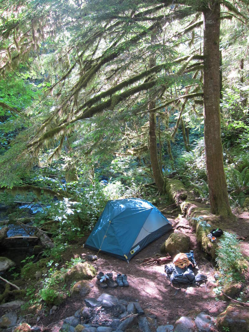
Staticmap?size=254x125&zoom=4&maptype=terrain&markers=icon:http%3a%2f%2fwenthiking.com%2fimages%2fmarkersmall.png&key=aizasydt2ewyqnn42qqnrpazuysi2dtyerccchw&center=45.68,-121
Heart_bw

Gillette Lake

6 miles of hiking • 500' elevation gain • 1 night

Comment 0 comments

June 17 – June 18, 2011

Staticmap?size=254x125&zoom=4&maptype=terrain&markers=icon:http%3a%2f%2fwenthiking.com%2fimages%2fmarkersmall.png&key=aizasydt2ewyqnn42qqnrpazuysi2dtyerccchw&center=45.6685,-121
Heart_bw

Herman Creek

9 miles of hiking • 2000' elevation gain • 1 night

Great quick overnight on Herman Creek trail. Casey Creek makes a great camp for a larger group. The weather was perfect.

Comment 0 comments

May 20 – May 21, 2011

Staticmap?size=254x125&zoom=4&maptype=terrain&markers=icon:http%3a%2f%2fwenthiking.com%2fimages%2fmarkersmall.png&key=aizasydt2ewyqnn42qqnrpazuysi2dtyerccchw&center=45.6555,-121
Heart_bw

Saddle Mountain

5.5 miles of hiking • 1500' elevation gain •

Wait for a clear day, the views will pay off.

Comment 0 comments

May 15, 2011

Staticmap?size=254x125&zoom=4&maptype=terrain&markers=icon:http%3a%2f%2fwenthiking.com%2fimages%2fmarkersmall.png&key=aizasydt2ewyqnn42qqnrpazuysi2dtyerccchw&center=45.9718,-123
Heart_bw

Elevator Shaft 2.0

7.5 miles of hiking • 2000' elevation gain •

Comment 0 comments

May 11, 2011

Staticmap?size=254x125&zoom=4&maptype=terrain&markers=icon:http%3a%2f%2fwenthiking.com%2fimages%2fmarkersmall.png&key=aizasydt2ewyqnn42qqnrpazuysi2dtyerccchw&center=45.5783,-122
Heart_bw

Eagle Creek-Estacada

9.5 miles of hiking • 1250' elevation gain • 1 night

Comment 0 comments

April 23 – April 24, 2011

Staticmap?size=254x125&zoom=4&maptype=terrain&markers=icon:http%3a%2f%2fwenthiking.com%2fimages%2fmarkersmall.png&key=aizasydt2ewyqnn42qqnrpazuysi2dtyerccchw&center=45.2775,-122
Heart_bw

Hamilton Mt.

7 miles of hiking • 2250' elevation gain •

Comment 0 comments

April 22, 2011

Staticmap?size=254x125&zoom=4&maptype=terrain&markers=icon:http%3a%2f%2fwenthiking.com%2fimages%2fmarkersmall.png&key=aizasydt2ewyqnn42qqnrpazuysi2dtyerccchw&center=45.6505,-122
Heart_bw

Starvation Ridge to Warren Lake

12.5 miles of hiking • 4000' elevation gain •

Wanted to get in a snowshoe starting from the base of the gorge before it was too late in the season. It was my first time up Starvation Ridge. Amazing hike overall. I didn't have a map so once I was snowshoeing I was forced to follow tracks of former snowshoers. Did some exploring all around Warren Lake before I decided to head back down. I wish I'd brought a map because it ends up I was only about a mile from the summit at the point I turned around.........Mt. Defiance will have to wait a few more months.

Comment 0 comments

April 2, 2011

Staticmap?size=254x125&zoom=4&maptype=terrain&markers=icon:http%3a%2f%2fwenthiking.com%2fimages%2fmarkersmall.png&key=aizasydt2ewyqnn42qqnrpazuysi2dtyerccchw&center=45.6882,-121
Heart_bw

Larch Mountain Trail Exploration

6 miles of hiking • 1750' elevation gain •

Got out of work early and decided to head up Mult. Falls on the Larch Mountain Trail. The water was the highest I've seen before. Despite a lot of rain it was a great way to spend the afternoon.

Comment 0 comments

March 29, 2011

Staticmap?size=254x125&zoom=4&maptype=terrain&markers=icon:http%3a%2f%2fwenthiking.com%2fimages%2fmarkersmall.png&key=aizasydt2ewyqnn42qqnrpazuysi2dtyerccchw&center=45.577,-122
Heart_bw

Cougar Rock via Elevator Shaft

7 miles of hiking • 1750' elevation gain •

The Elevator Shaft was amazing. Great Hike. Only wish I had more time at the top of Cougar Rock. Trip Report on portlandhikers.org was a great resource.

Comment 0 comments

March 11, 2011

Staticmap?size=254x125&zoom=4&maptype=terrain&markers=icon:http%3a%2f%2fwenthiking.com%2fimages%2fmarkersmall.png&key=aizasydt2ewyqnn42qqnrpazuysi2dtyerccchw&center=45.5776,-122
Heart_bw

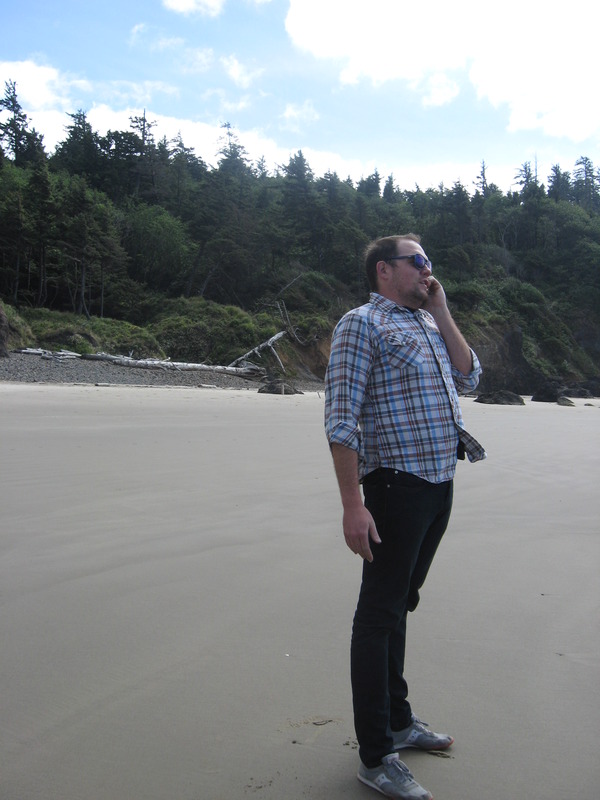
North Neahkahnie Mt at Oswald West State Park

6.5 miles of hiking • 1250' elevation gain •

Oswald West is my favorite place on the coast. Made it way past the snow line. Really windy out of the tree cover. Great day hike.

Comment 0 comments

February 25, 2011

Staticmap?size=254x125&zoom=4&maptype=terrain&markers=icon:http%3a%2f%2fwenthiking.com%2fimages%2fmarkersmall.png&key=aizasydt2ewyqnn42qqnrpazuysi2dtyerccchw&center=45.7639,-123
Heart_bw

Lower Deschutes River

22.5 miles of hiking • 500' elevation gain • 1 night

Comment 0 comments

February 18 – February 19, 2011

Staticmap?size=254x125&zoom=4&maptype=terrain&markers=icon:http%3a%2f%2fwenthiking.com%2fimages%2fmarkersmall.png&key=aizasydt2ewyqnn42qqnrpazuysi2dtyerccchw&center=45.622,-120

View trips from: 2012