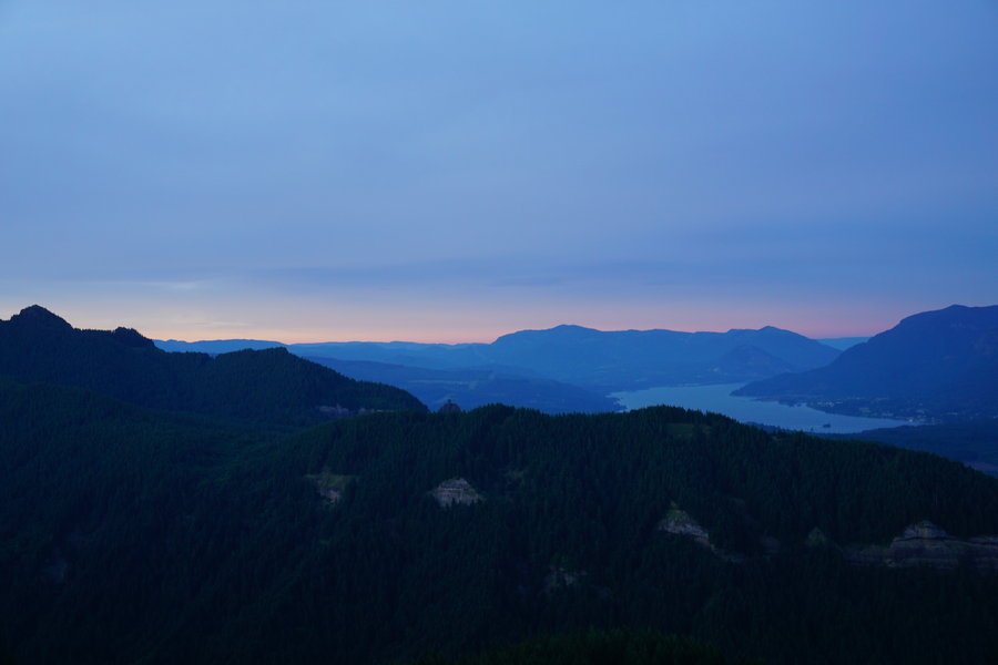
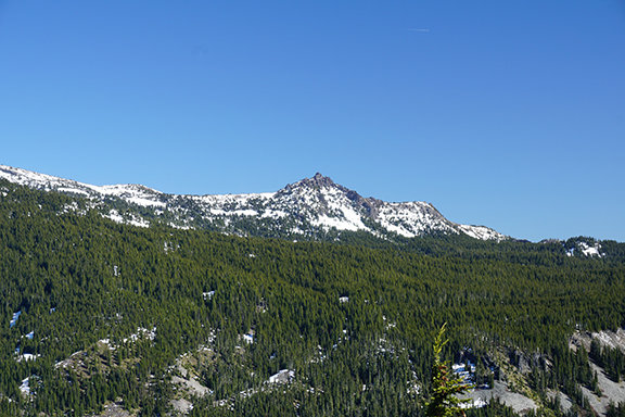
2015 Trips

 1
1

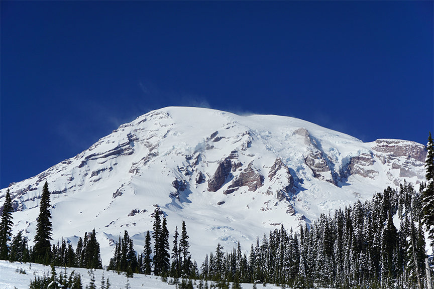
December 19, 2015
 3
3
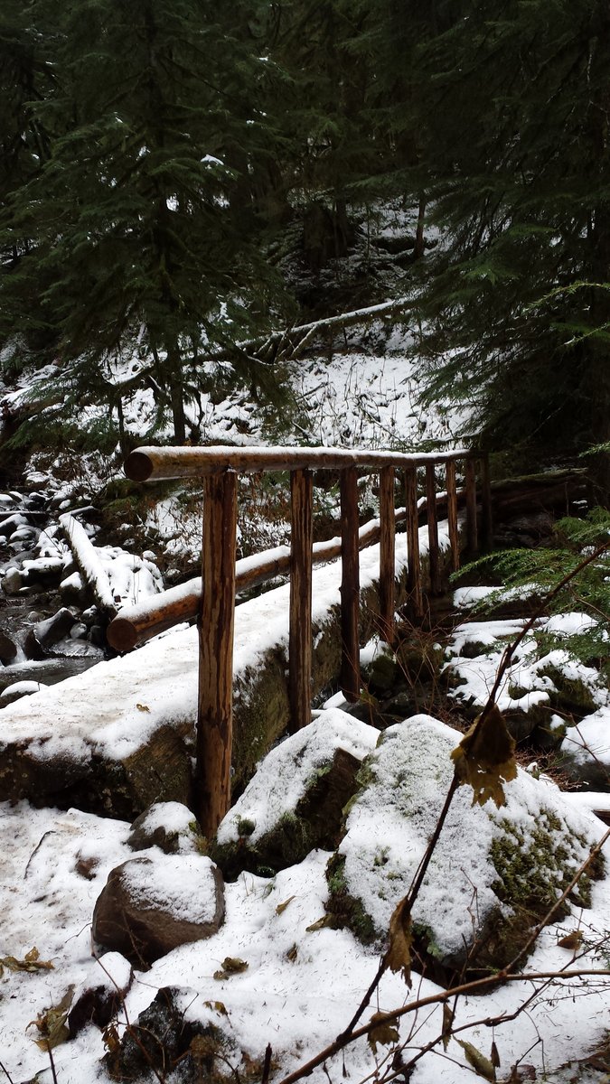
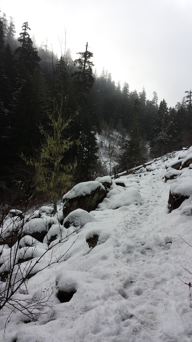
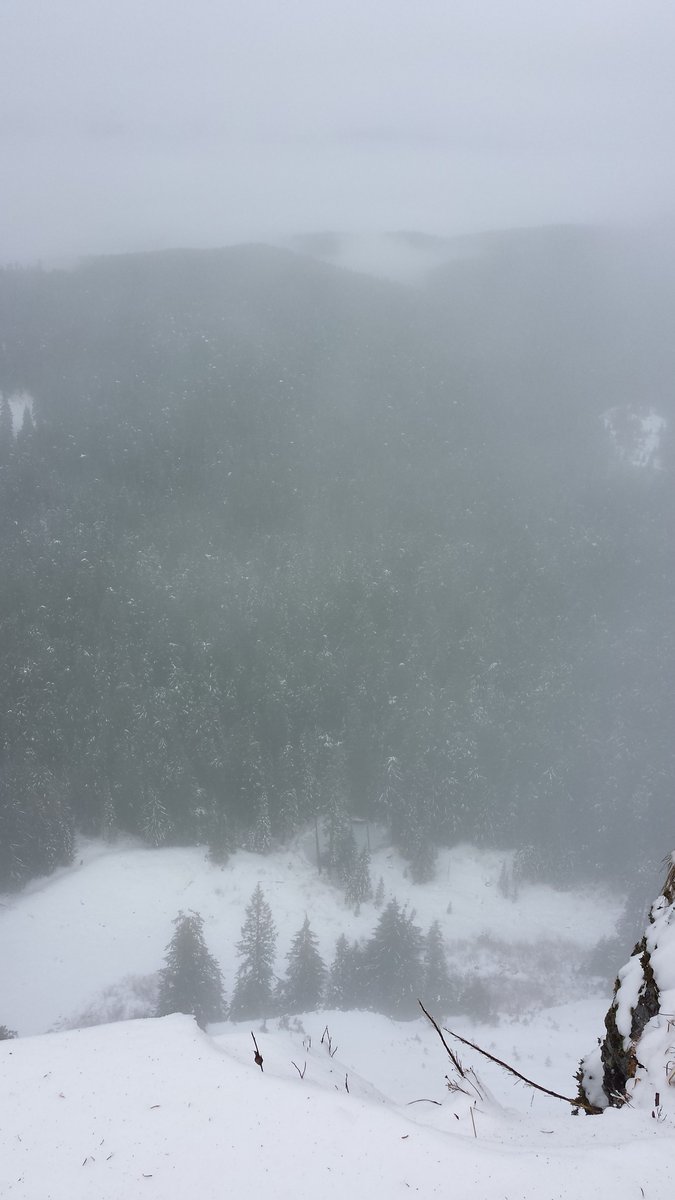
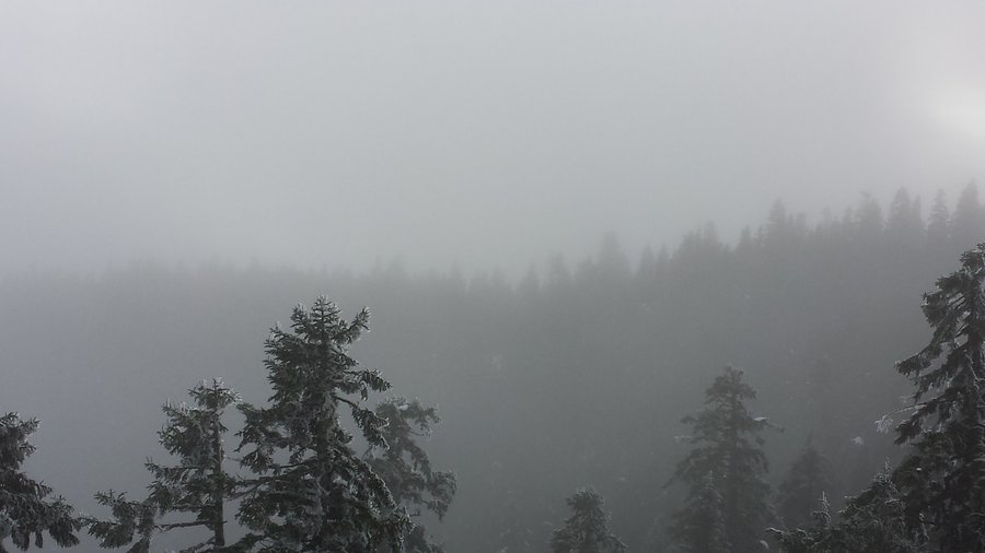
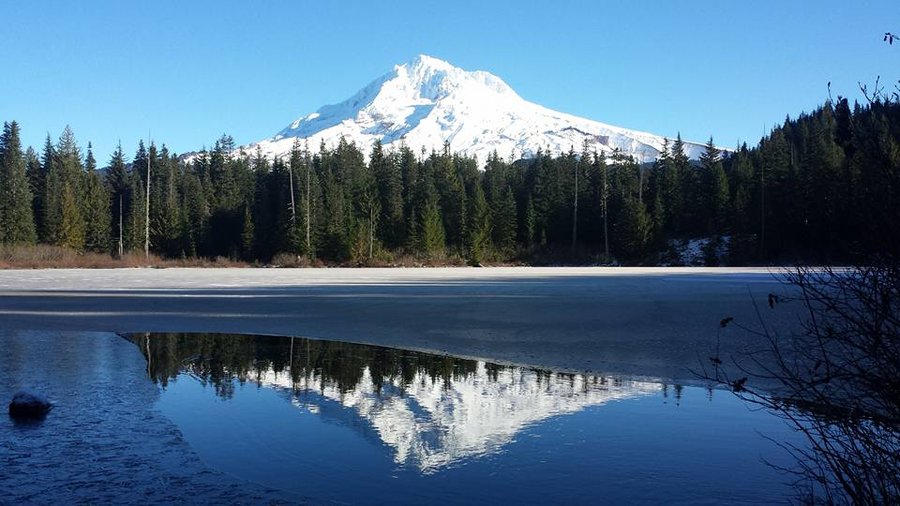
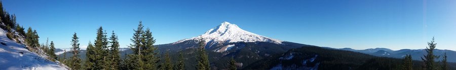
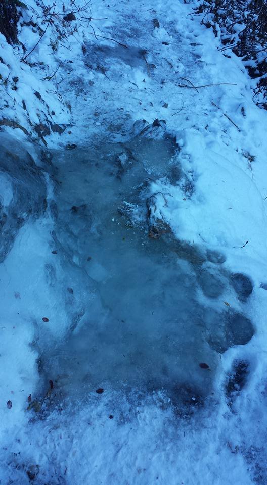
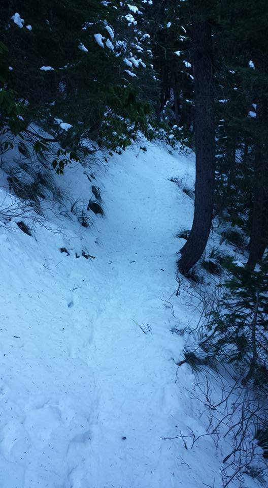
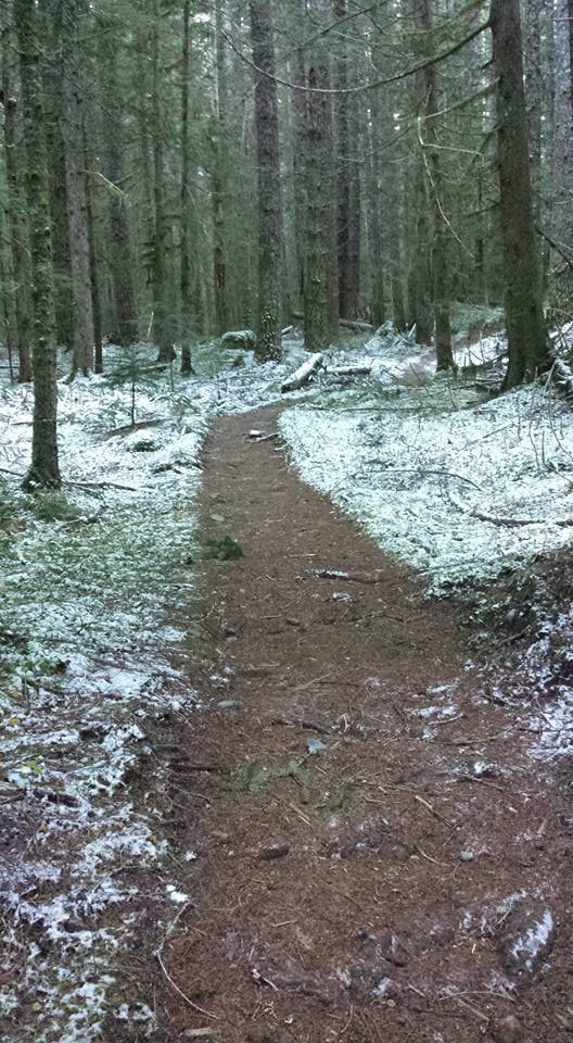
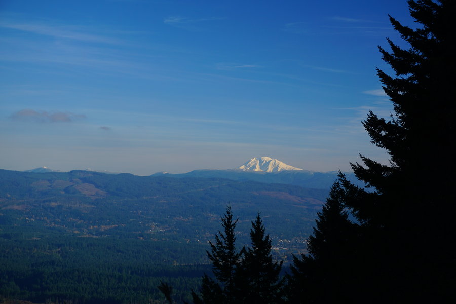
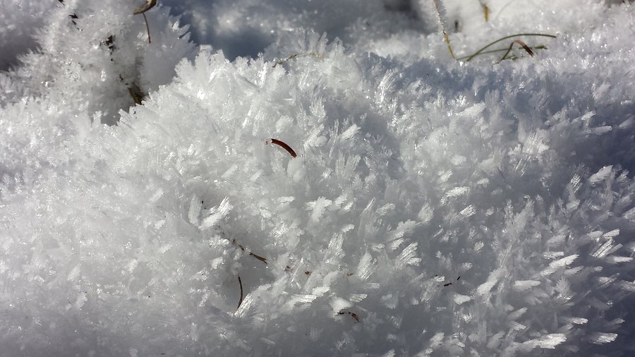
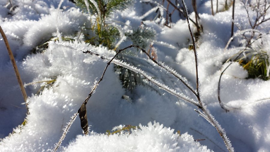
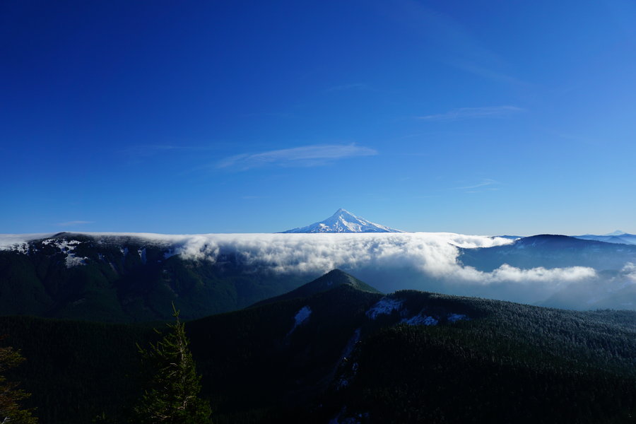
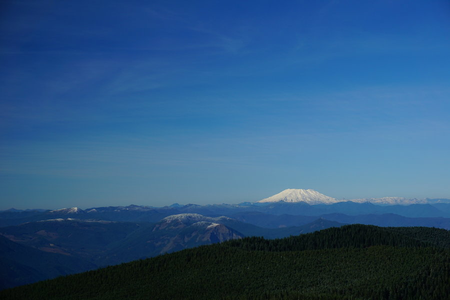
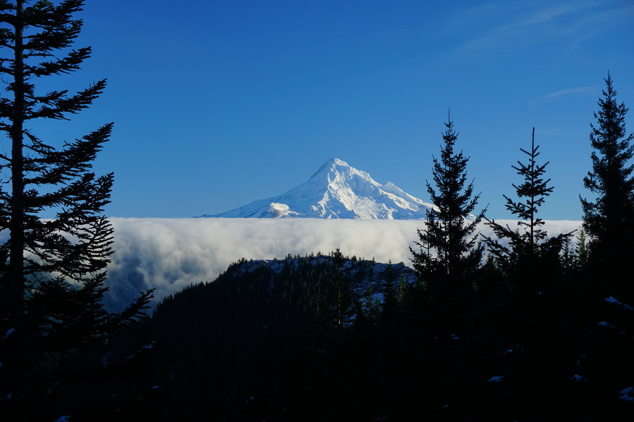
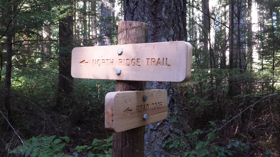
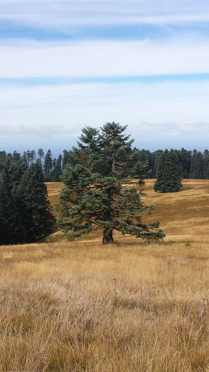
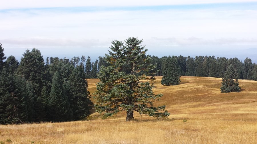
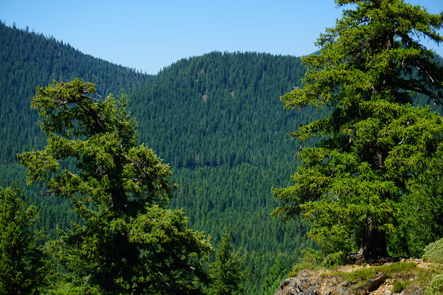
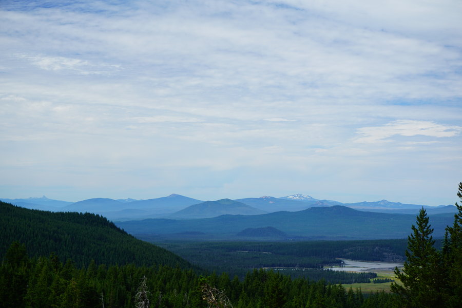
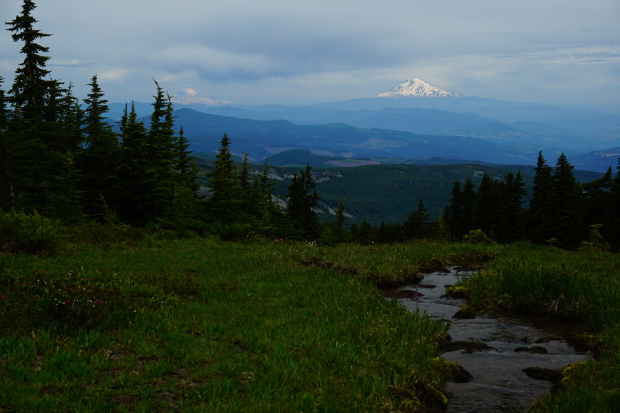
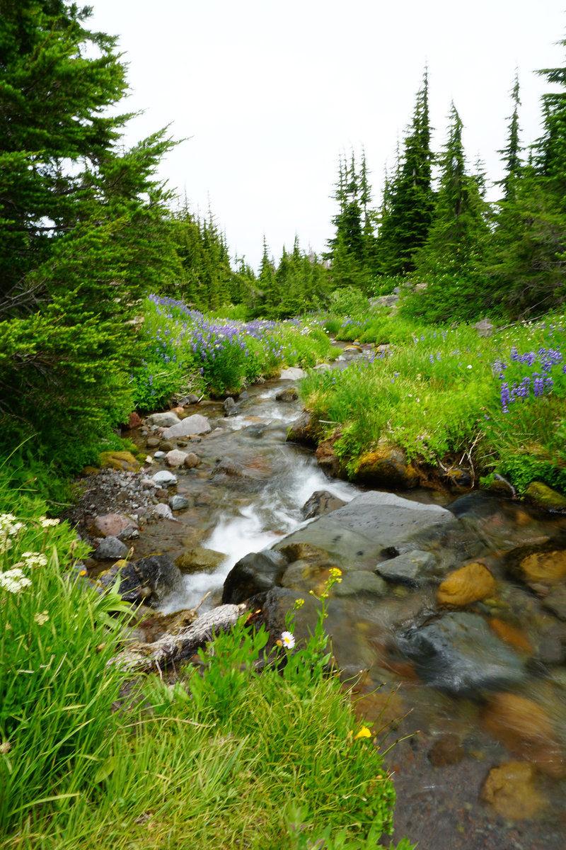
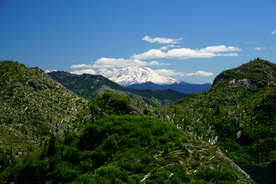
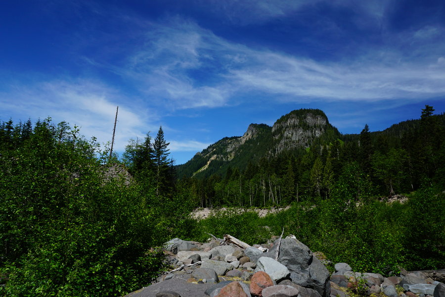
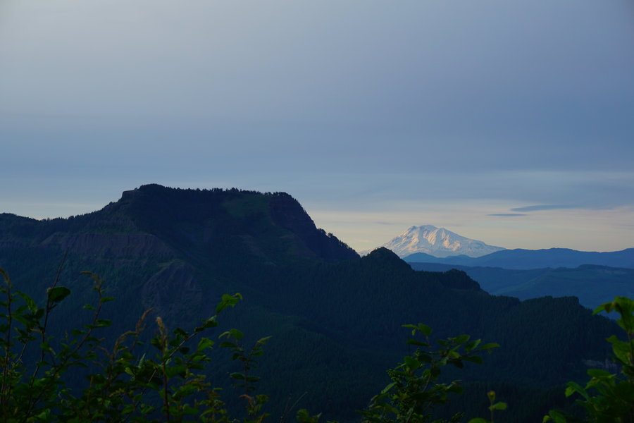
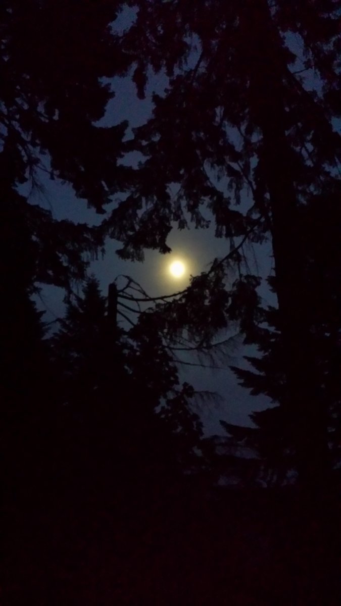
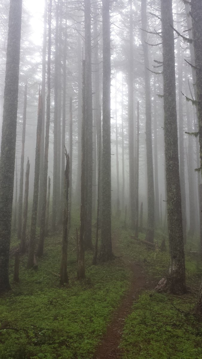
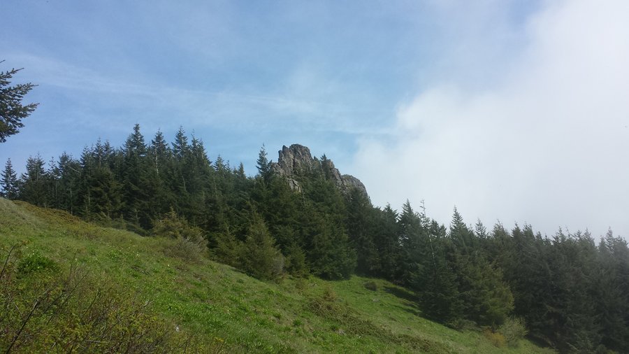
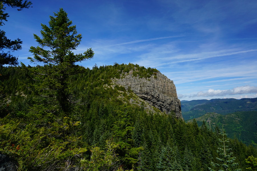
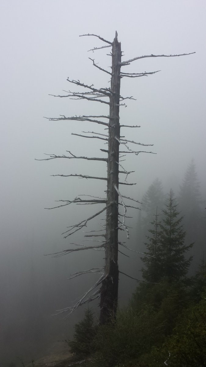
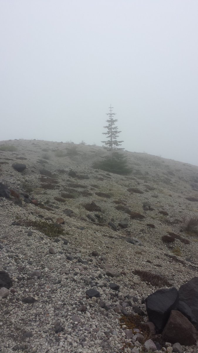
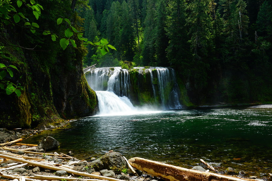
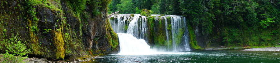
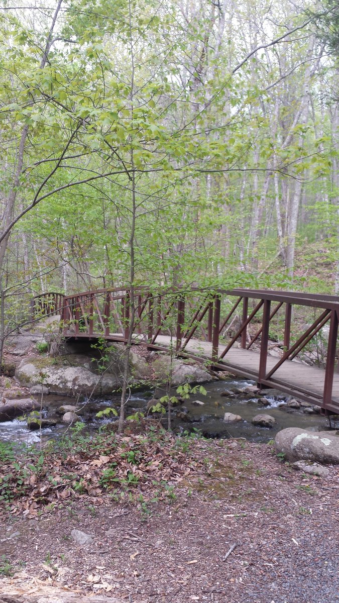
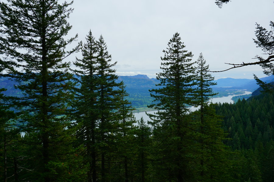
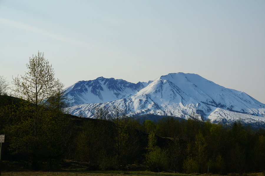
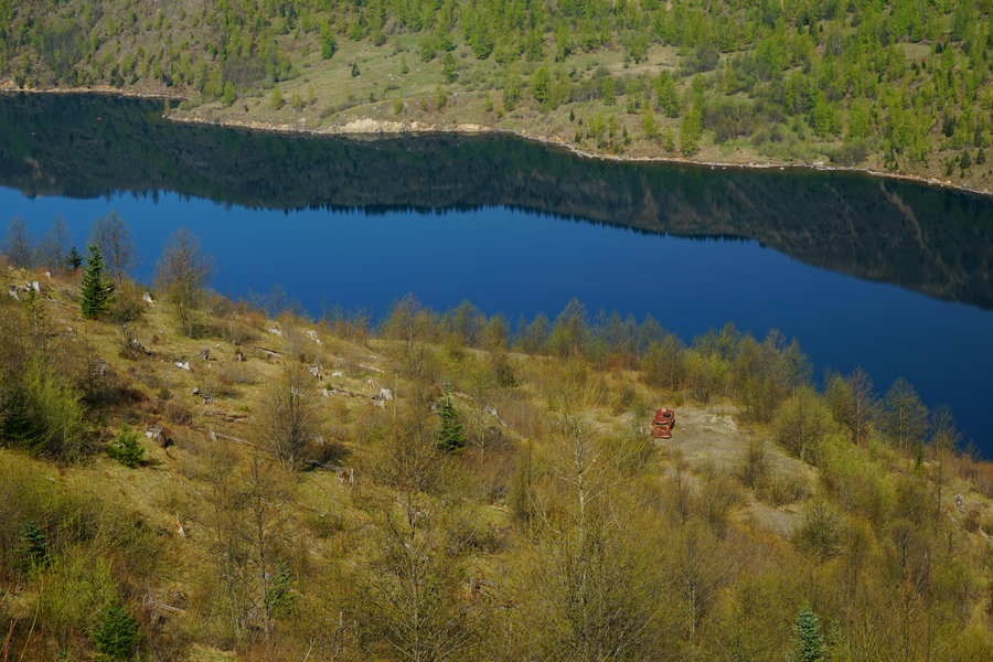
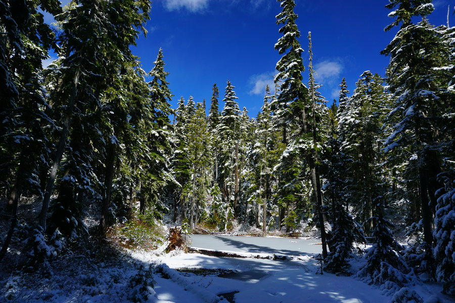
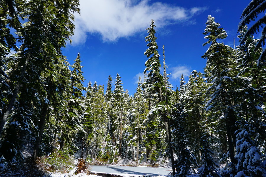
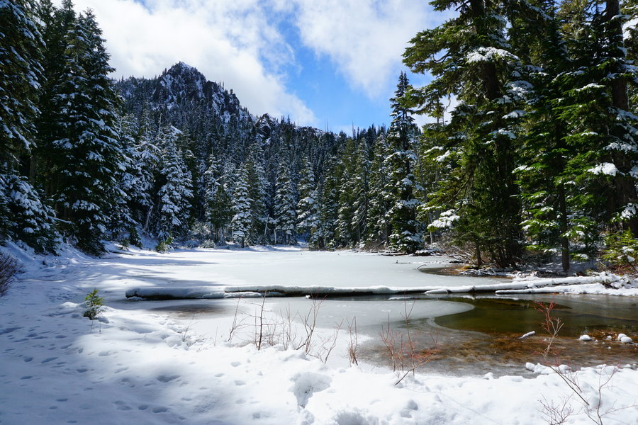
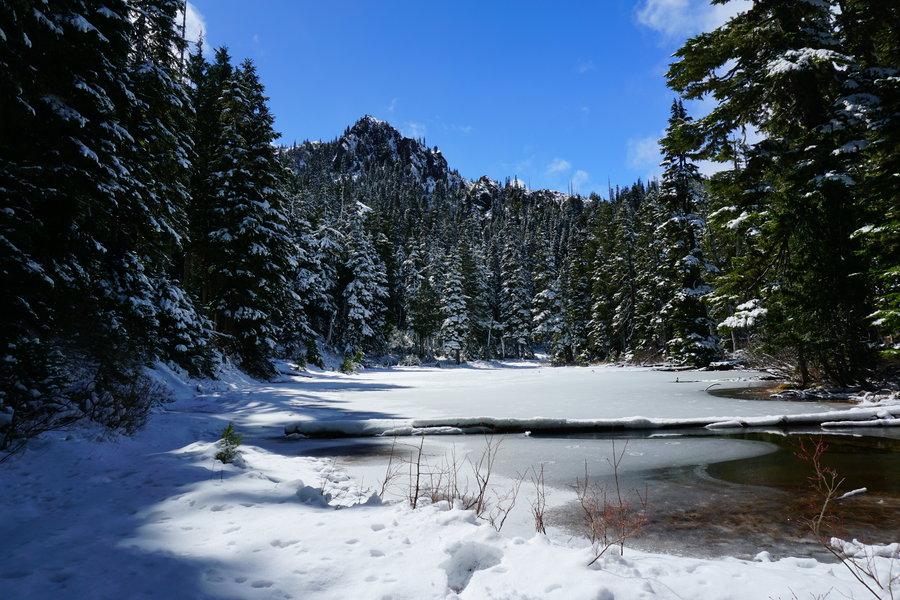
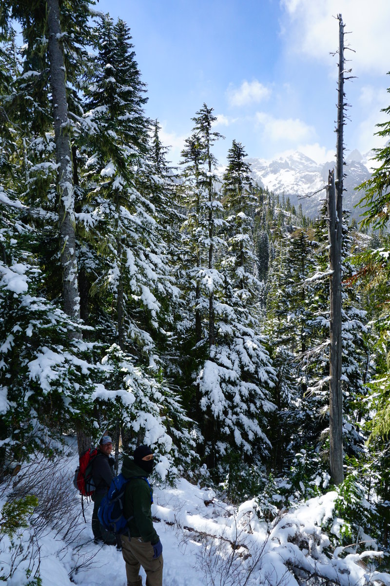
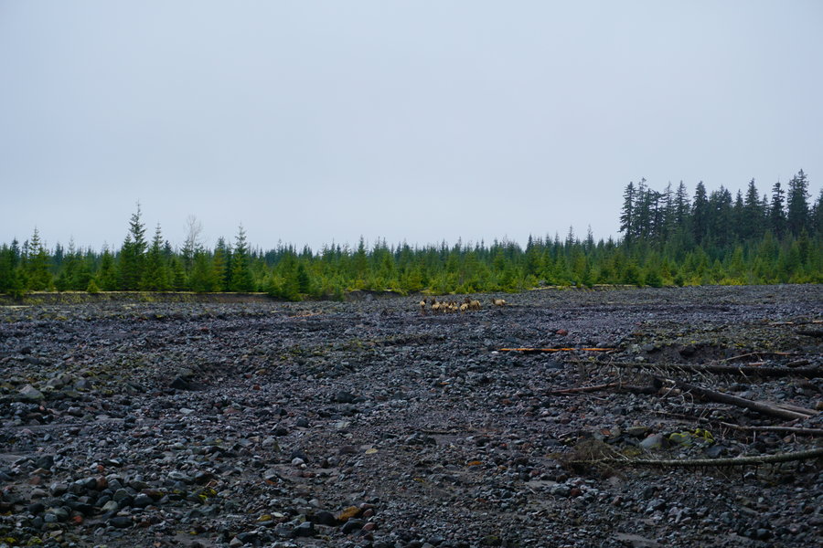
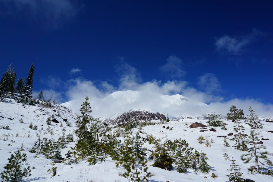
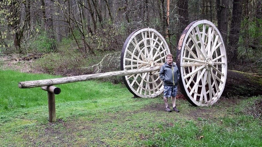
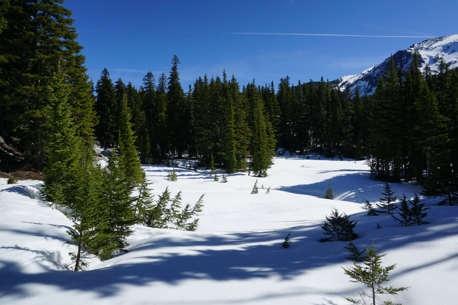
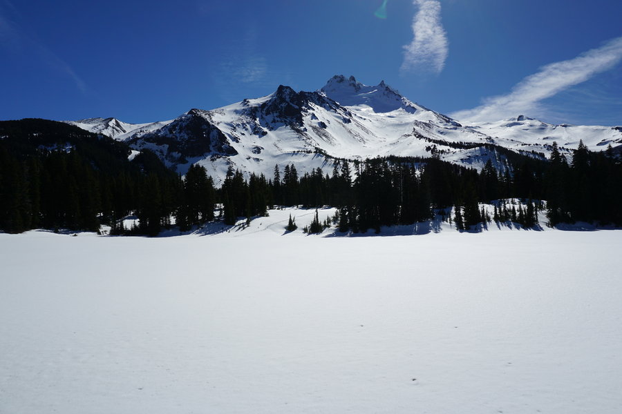
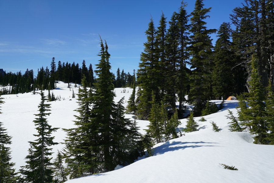
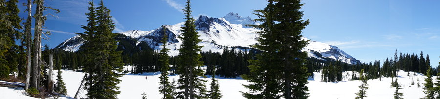
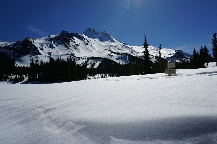
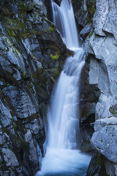
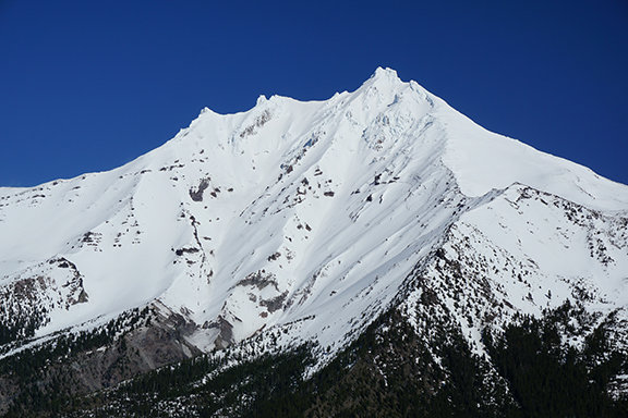
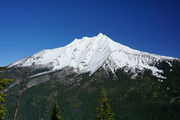
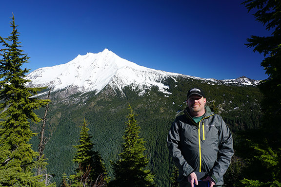
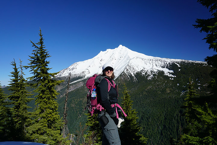
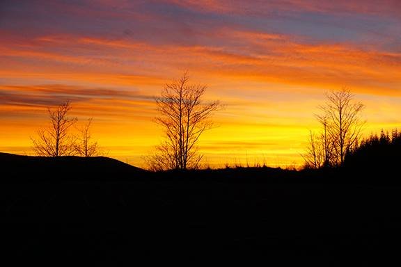
Zig Zag via Burnt Lake
12 miles of hiking • 2750' elevation gain •
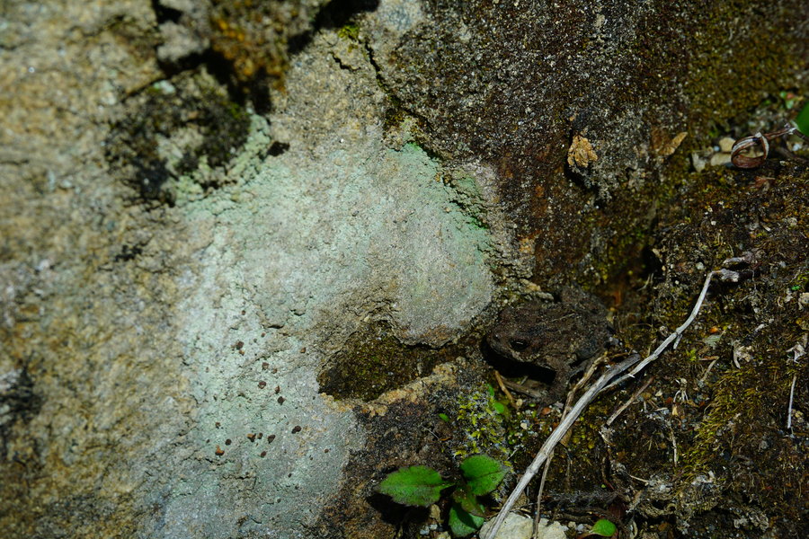
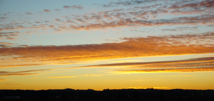
Went to Zig Zag via Burnt Lake today. It was a brisk 19 degrees at the trail head but warmed as we climbed. Trail was anywhere from dry and clear to patchy snow and ice up to Burnt Lake. There was one nasty section of ice to maneuver through but manageable with spikes. Once we headed up to Zig Zag, it became all snow, anywhere from just a few inches to around maybe 10. Nice powdery snow up higher. Saw a handful of people throughout the day but not a ton. Clear sunny skies the entire day and almost no wind, couldn't ask for better conditions up there. Sadly I noticed a sign on the sandy bridge when we left. Looks like they are closing the gates tomorrow on 11/30.
November 29, 2015

.jpg)
 2
2
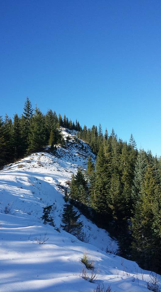
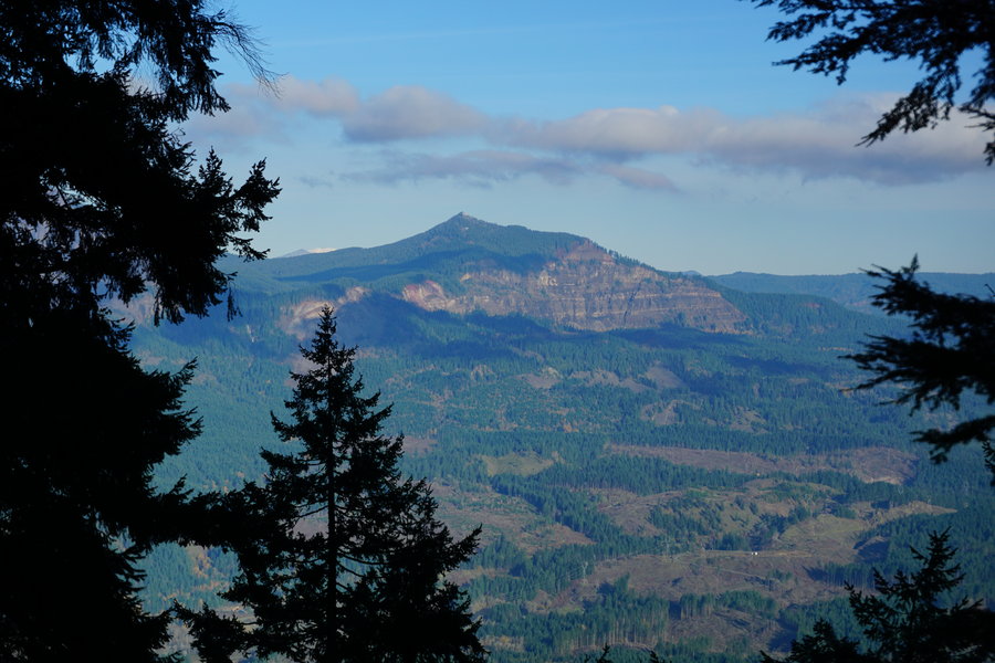
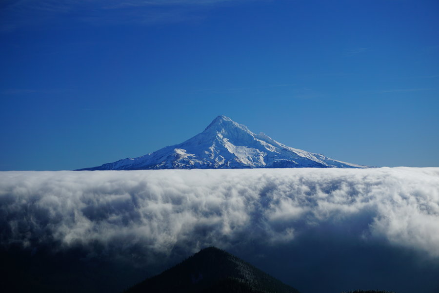
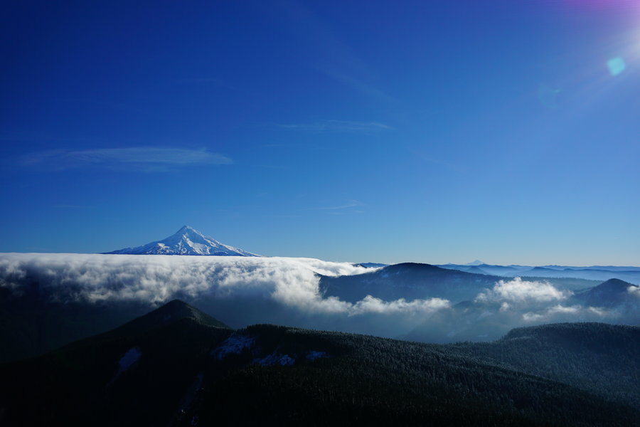
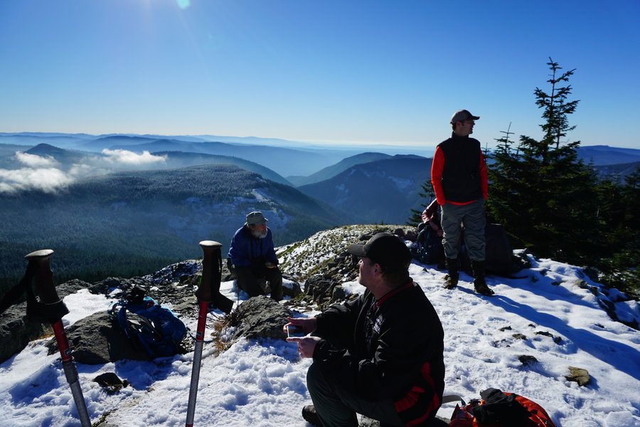
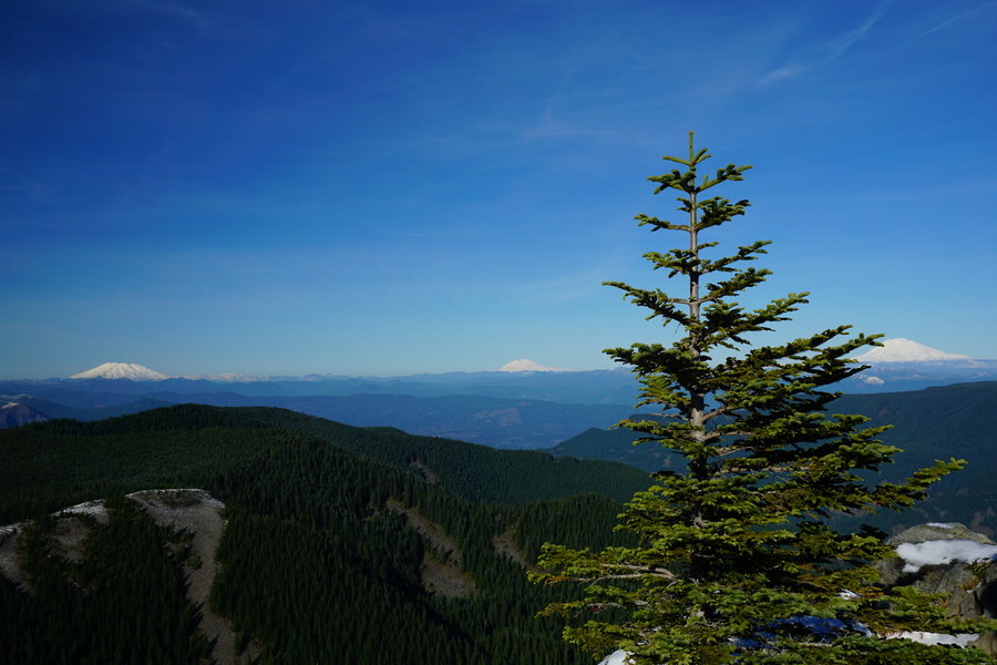
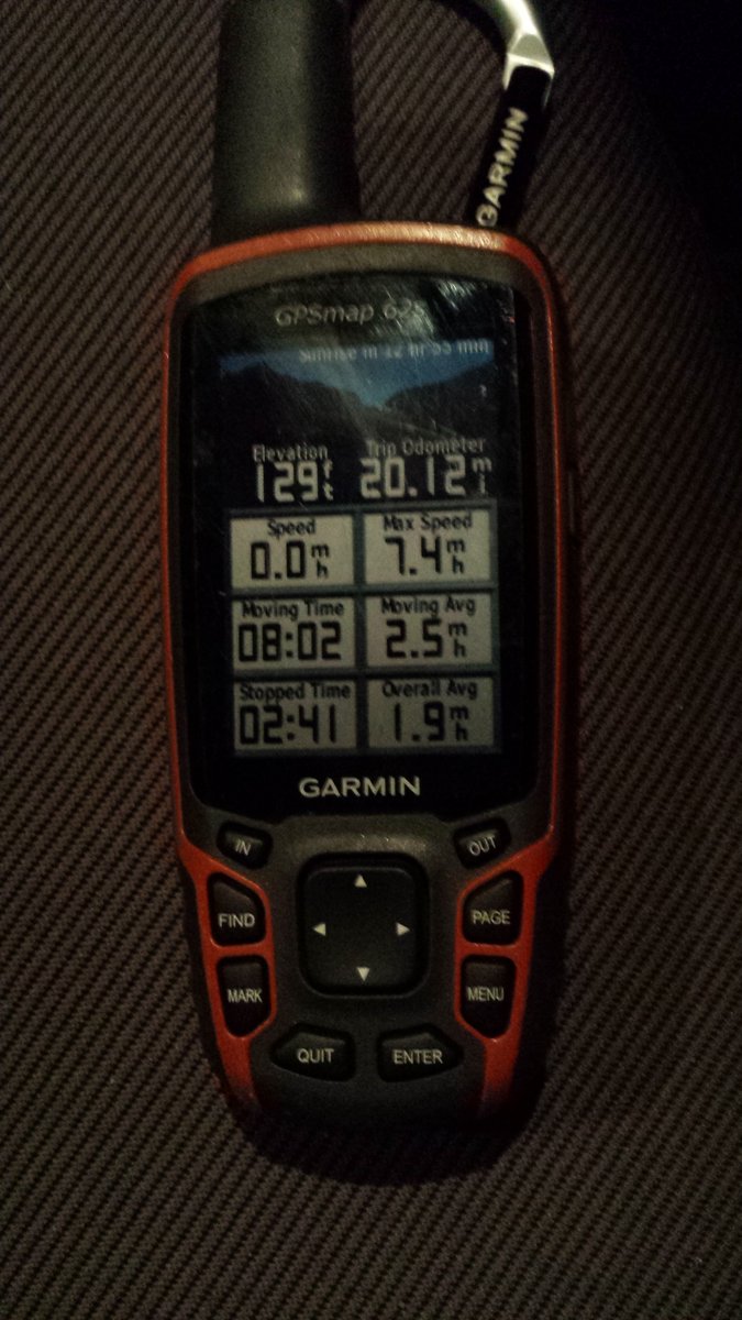
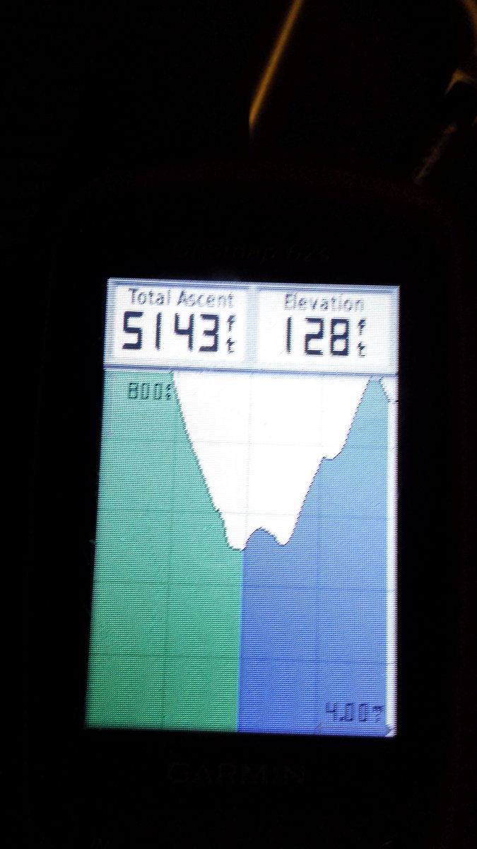
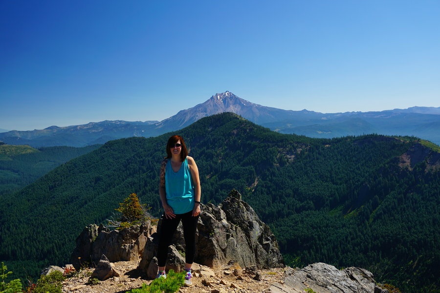
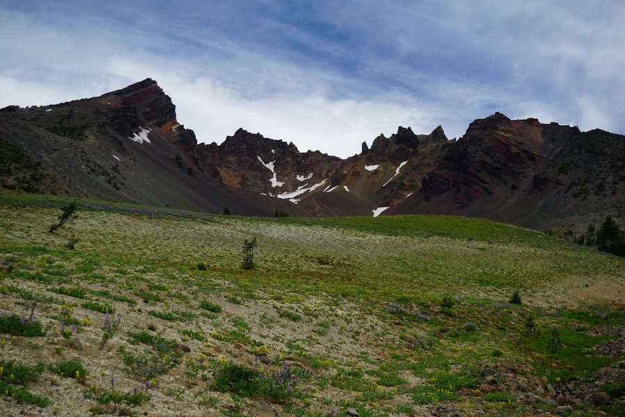
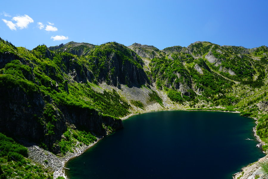
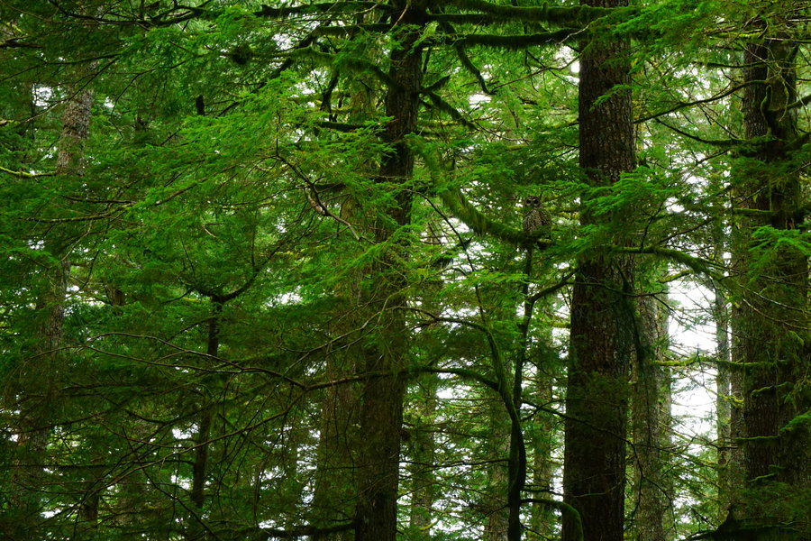
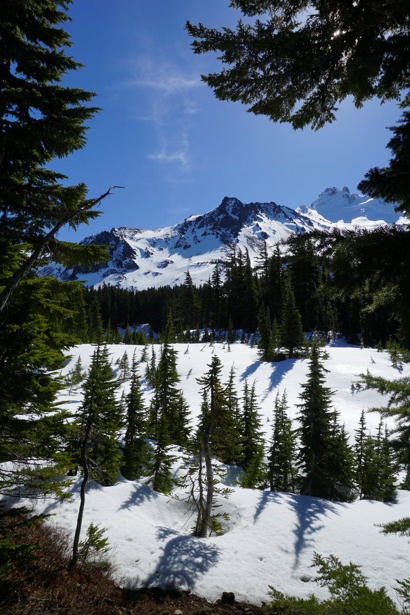
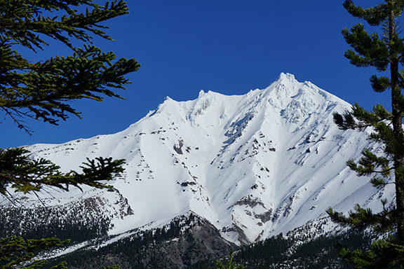
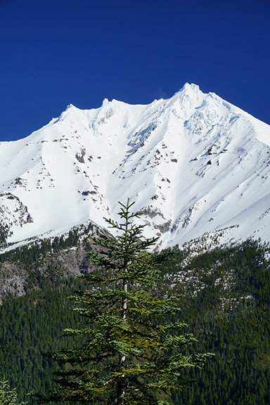
The Tanner's Tackle Tanner Butte
20 miles of hiking • 5250' elevation gain •
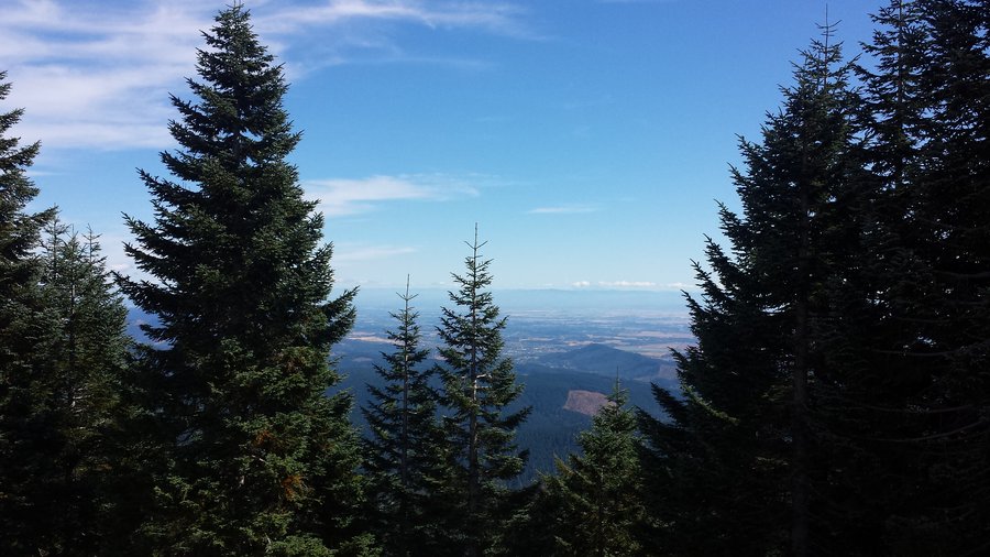
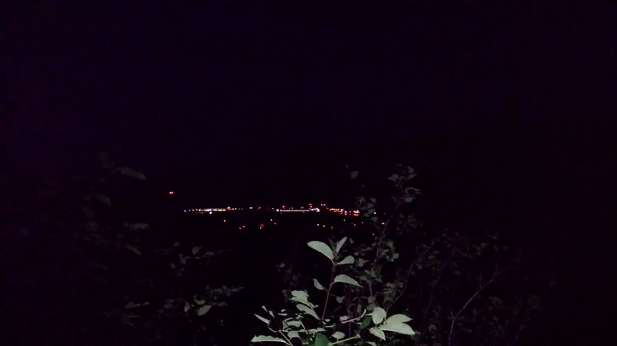
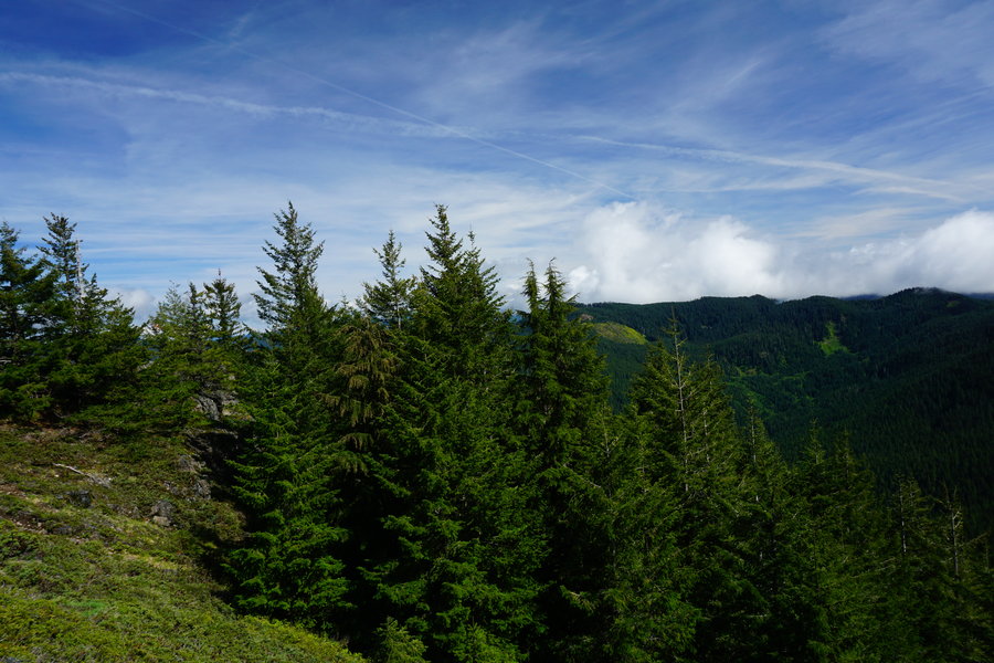
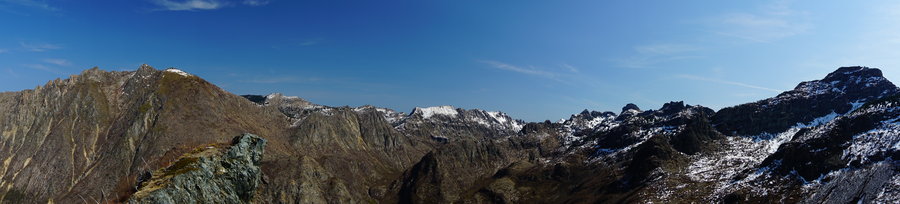
We have done it! We have completed our first ever 20+mile hike this past Saturday and we did it on none other than Tanner Butte. Fitting huh? Karl planted the idea a few weeks back when we had a conversation about wanting to get our first twenty under our belt before the end of the year. We sat around and waited for the perfect weekend weather report and once it happened, we started making plans for a Saturday hike. We were even happier that some trail friends both old and new decided to join us. We started out around 7:30 in the morning at the Eagle Creek TH and made our way up to the Butte. The temps were pretty chilly all day never really reaching much above 35 or so except for on top of the Butte, I believe we reached a balmy 42 degrees! There was some storm debris early on but nothing we couldn’t maneuver around. We did an off trail (correct me if I am wrong on this Karl), grueling 1600 foot elevation gain mile early on that had me silently questioning my whole plan, but that didn’t linger long. The views we got by doing that off trail were fantastic and well worth the calf pain. We had fabulous company, the forest was calming as always, got a little bit of snow off and on starting about 3000 ft, and OMG the view from the top, words can’t even describe what we saw. So stunning! We lingered at the top as long as we dared to. It was so hard to leave. There was no wind, it was pretty warm with the sun, and the views just made you want to pull up a chair and spend the day just staring at them. We begrudgingly begun the trip down around 2 pm and made it pretty far before darkness settled in. I think we only had to go the last couple of miles with headlamps on and we came out about 6:15 pm. Worn but exhilarated by completing our first twenty mile hike and doing so with a great bunch of people. Karl it was fantastic to hike with you again. Kathy, Brett, and Jim it was a pleasure to meet and hike with all of you and we look forward to getting the opportunity again. Thank you all for joining us on our first 20 mile hike!
Group photo and photo of myself and Mark courtesy of Karl P
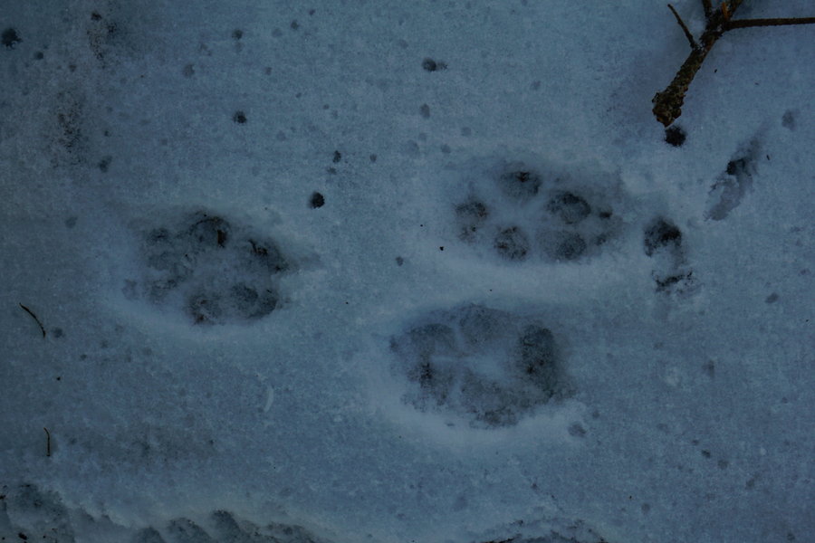
November 21, 2015


 1
1
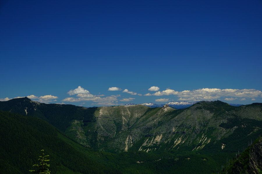
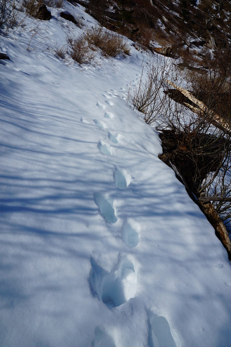
PCT (Lolo Pass) short stroll towards Mt Hood
3 miles of hiking • 1000' elevation gain •
Goal of the day. See some snow. Had snow at the trail head. Well icy snow. strolled about a mile and half up and then headed back down. We have a large full day hike planned tomorrow and didn't want to tire ourselves on on slippery, icy snow. Saw several tracks including fresh bear prints. Fresh as in 20 minutes fresh. Wasn't there when we went by and 20 minutes later on way back down, nice pretty tracks in the snow.
November 20, 2015
 1
1
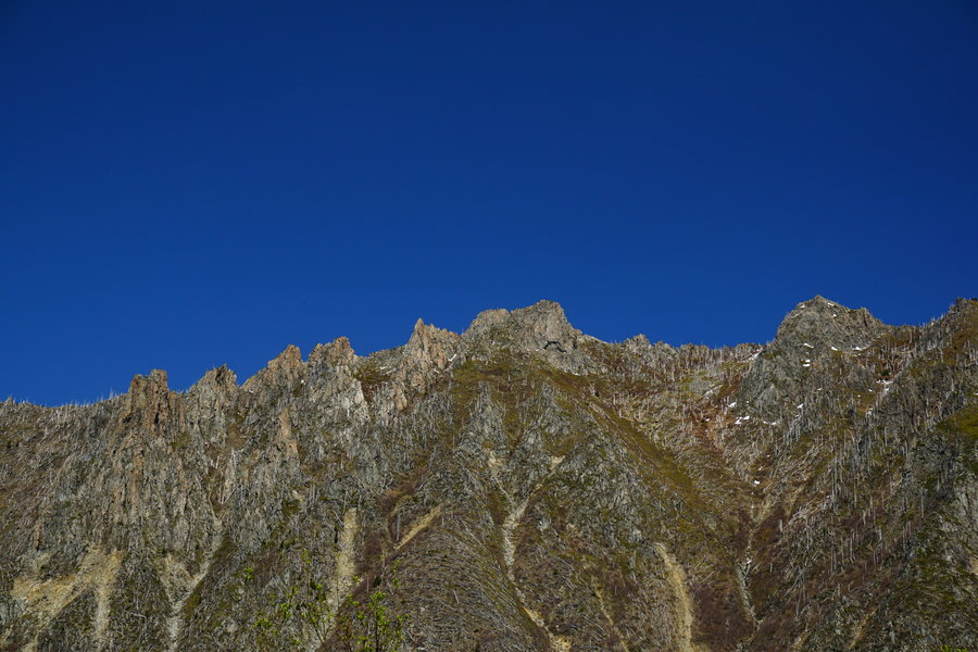
Little North Santiam Stroll
4 miles of hiking • 1000' elevation gain •
Did a quick 4 mile stroll on the Little North Santiam trail. Hadn't been here before and really enjoyed it. It was raining really good so we opted not to do the full 9 miles today but will go back on a drier day and finish it up.
November 15, 2015

Eagle Creek
15 miles of hiking • 1750' elevation gain •
Took a Saturday jaunt up to Twister Falls. Wasn't too crowded going up, but coming down it was packed. I think we had to have passed well over 50 people going in on our way out.
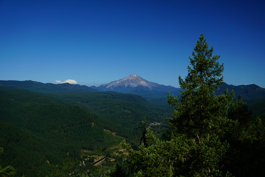
October 24, 2015
 2
2
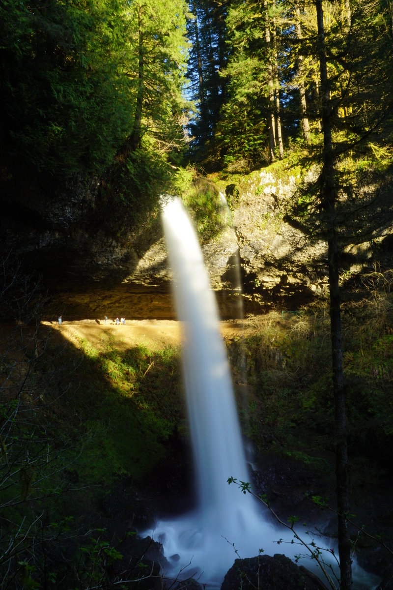
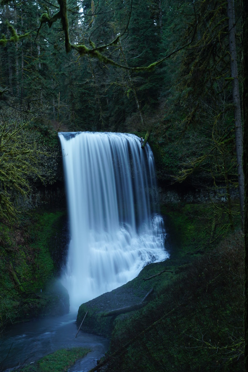
October 3, 2015

Silver Creek Falls Trail of Ten Falls
8 miles of hiking • 1000' elevation gain •
Did the 8 mile loop out at Silver Creek Falls today with a long lost cousin. Was a nice relaxing hike and had a great day catching up with him.
September 27, 2015
 1
1
Indian Heaven Wilderness Blue Lake via Thomas Lake TH
8.5 miles of hiking • 1250' elevation gain •
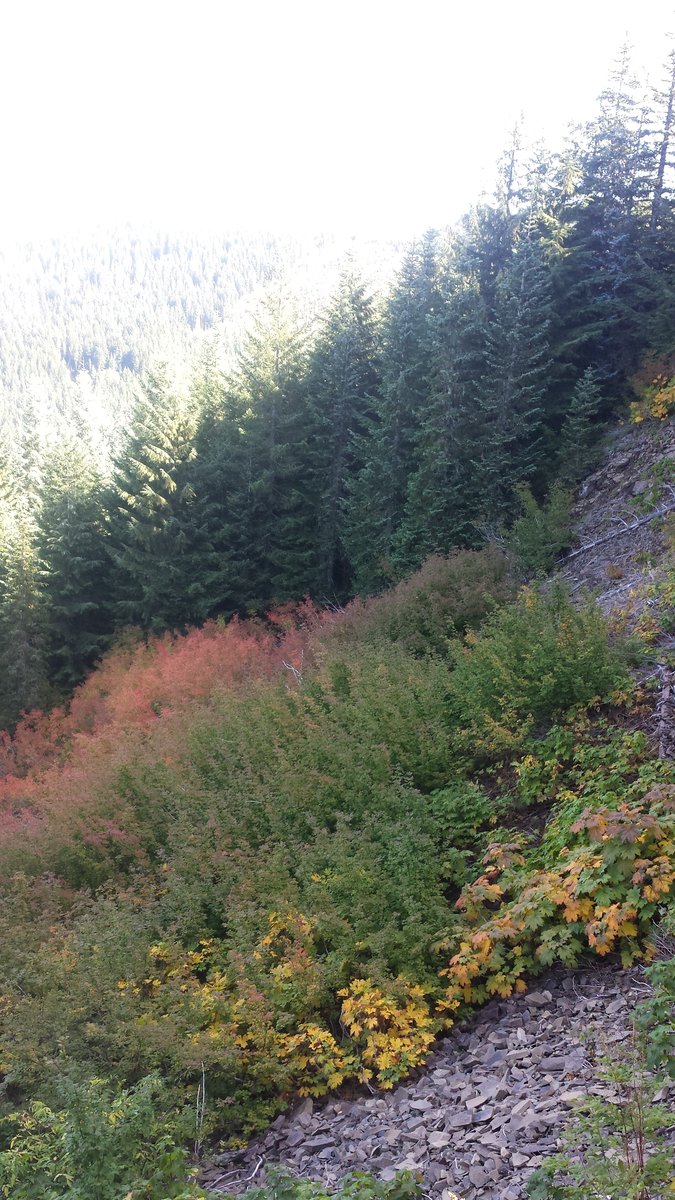
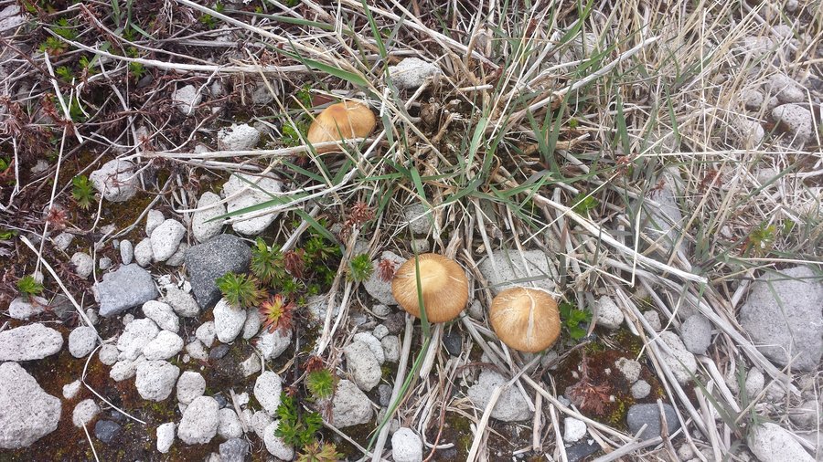
Took my first but definitely not last trip to the Indian Heaven Wilderness today. Day was overcast and it was lightly raining by 130 as we were leaving but I have to say seeing all the fall colors out there was amazing. The pictures I got did not do it justice at all.
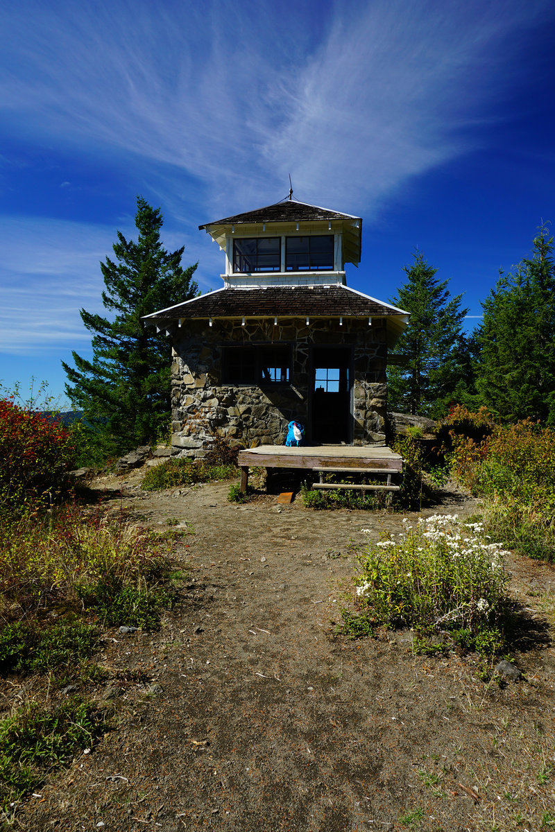
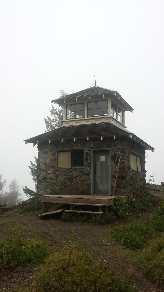
September 20, 2015

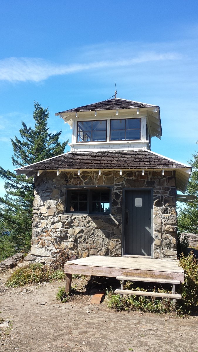
Pechuck Lookout
6 miles of hiking • 2000' elevation gain •
Had a day to myself so went a solo stroll to Pechuck Lookout. Beautiful blue skies and perfect temperatures. Hiked much slower than normal and just enjoyed the time alone. Had a lazy lunch at the lookout and lounged for a couple hours and then headed out. Just in time to, ran into a couple of backpackers coming in and then two sets of dayhikers as i wandered out.
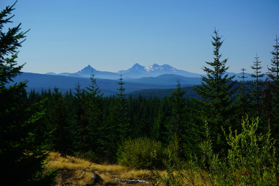
September 19, 2015


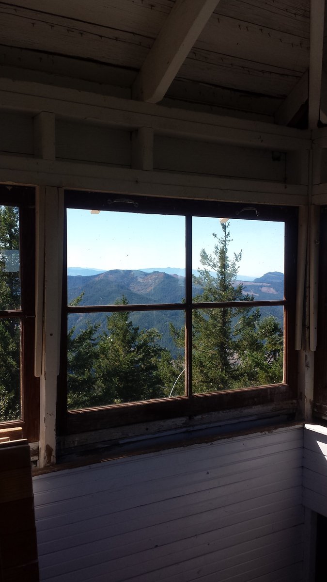
Mary's Peak via the North Trailhead
11.5 miles of hiking • 2750' elevation gain •
Took a trip to Mary's Peak. It was our first time there and we came in via the North trailhead so we could get a little mileage as well. We've had a busy few weeks and haven't hike since late August so the elevation gain was kind of grueling today but we pushed through and made decent time. We have been adding some trail running on our trips out especially on the out and back trips. This is becoming one of my favorites things to do. I wouldn't run in or maybe not on loop hikes because too much to see but on out and backs when I've already seen it, i find I am loving the cardio I get from it and the balance training I get bounding in between things.
September 13, 2015


.jpg)

Lopez Hill Trip 2
3.5 miles of hiking • 500' elevation gain •
A secondary trip to Lopez Hill to do the largest loop and get some more practice trail running in.
August 23, 2015

Lopez Hill Trip 1
2.5 miles of hiking • 500' elevation gain •
Quick afternoon jaunt while out on Lopez Island this past weekend.
August 22, 2015
 1
1
Whitewater Trail to Triangulation Peak
15.5 miles of hiking • 3000' elevation gain •
Was curious what the mileage would be for this trip so decided this past Wednesday to check it out. Once your past the Whitewater trail and on the Triangulation trail, it's obvious this area doesn't get much love. While the trail is easy to follow it is overgrown in areas and we even came across a wasp nest practically on the trail itself. Highly recommend long pant and boots for this trek. I was in running capris and trail runners and came out with scratches on any exposed area of lower leg.
August 19, 2015

Independence Rock (Marion Forks)
2 miles of hiking • 500' elevation gain •
On our way back from Coffin Mountain we stopped and did a quick run up to Independence Rock per the advice of the Lookout staff back at Coffin Mountain. This was a quick but nice jaunt up with a great view of the Marion Creek area!
August 16, 2015


Coffin Mountain
3 miles of hiking • 1000' elevation gain •
Since our hiking time wasn't working out to do a long mile hike this weekend, we decided to do some shorter hikes near home. We had never been to Coffin Mountain before and I have to say for a 3 mile round trip hike, this hike gave us one of the best 360 views in all of our hikes. Impressive! The gal manning the lookout was friend and informative and gave us the idea for our second hike of the day at Independence Rock on our way home. We had decided that Bachelor Mountain wasn't what we wanted to do after such an amazing, but warm hike. I can't recommend this hike enough. If you are camping in the area or passing through, it's well worth checking it out.
August 16, 2015


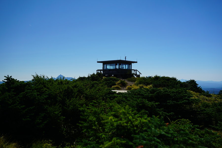
 1
1
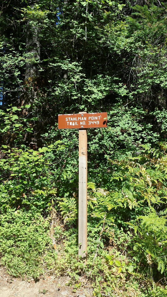
Stahlman Point
4.5 miles of hiking • 1500' elevation gain •
Our hiking time was short for Saturday so we took a quick trip to Stahlman Point. We had never been here before and I have to say I really enjoyed it. The views up top were amazing! I did my first ever trail run back down to the car and I loved it. 6 months ago I wouldn't have been able to run even a tenth of what I did. Love how hiking among some added weekly cardio has improved my stamina and overall health!
August 15, 2015


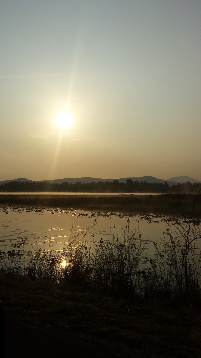
Duffy, Santiam, and Mowich Lakes
14 miles of hiking • 2000' elevation gain •
What a great hike to do on a cloudy day. Never been up here before and we enjoyed it quite a bit. Want to go back when it's clearer out and explore some more of the area. Pictures to come...
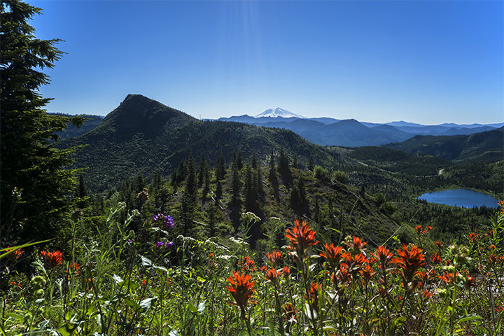
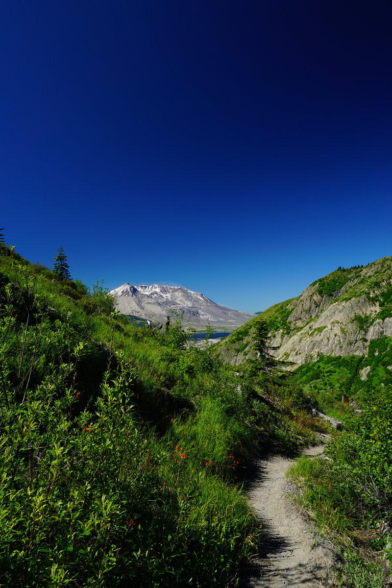
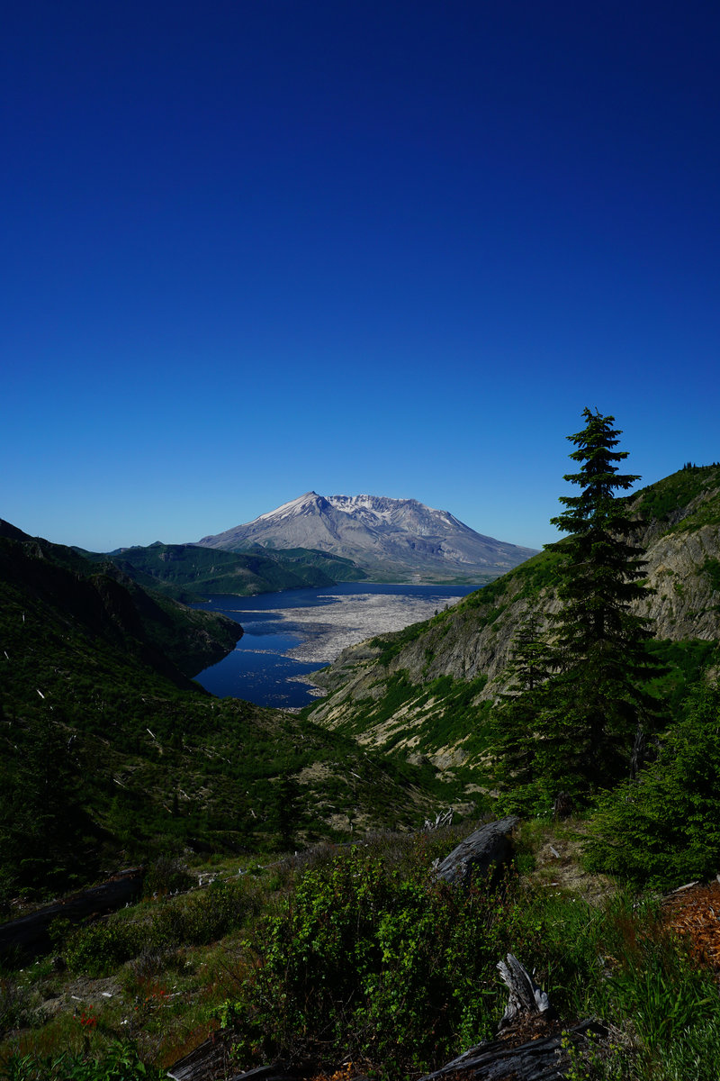
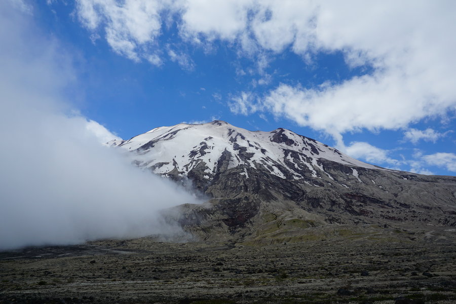
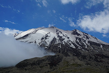
July 26, 2015

Rained Out Mount St. Helens
4 miles of hiking • 1000' elevation gain •
Had permits to climb this past Saturday. Go figure no measurable rain in two months until the day of my permit. Made to end of treeline and it was too wet, cold, and windy. Several other climbers called it quit this day. Miserable day to attempt it.
July 25, 2015

Mississippi Head
13.5 miles of hiking • 5500' elevation gain •
Took our first trip to Mississippi Head. I have to admit it was a lot harder than I anticipated and we had our 17 yr old who doesn't hike with us much, on this hike as well. We definitely took this one much slower than planned. Ran into a few PortlandHikers throughout the day which is always a treat! Long, taxing day but what a hike!
July 19, 2015


 2
2
Goat Rocks
13.5 miles of hiking • 3000' elevation gain •
Took our first trip to Goat Rocks. Fell in love! We dealt with clouds most of our trip but it did not take away from the beauty of this area! Can not wait to go back.
July 13, 2015
 2
2
Brokentop Area
9.5 miles of hiking • 1500' elevation gain •
So my 4th did not go entirely as planned. I had watched the weather all week for South Sister and It was looking pretty good so we decided that it what we would do on Saturday. Woke up Friday with a scratchy throat, not a good sign but I was hoping it was just a fluke and we headed out anyway. Woke up at 4:30 am on Saturday with plugged ears and swollen sinus passages and I knew my hopes of doing my first South Sister climb was not in the cards for the day. Didn't want to head home with no hike in so we went out to Todd Lake and took a slow, leisurely hike 5 miles into the Brokentop area. My ears were bugging me so we did not push it. So yesterday's hike was a backup plan and other than being disappointed I had to bail on my original plan, the day turned out to be okay. I mean who can be upset when they have all those beautiful mountains in view?
July 4, 2015


Pamelia Lake and beyond
10 miles of hiking • 1250' elevation gain •
Took a trip up to Pamelia Lake with the intent of going into Hunts Cove. It was supposed to be well over 90 that day so we dressed in shorts etc. Day started off pretty good, ran into quite a few backpackers coming out. We were shocked when we got to the lake. The water level had dropped dramatically in the last two months, it appeared nearly empty! Ranger was out and about checking permits but we didn't see him until later on. We headed out towards Hunts Cove. We had never hiked into there and wasn't sure what to expect. What I didn't expect was dense some of the brush around the trail would be. Wasn't too much of an issue until we got a rain shower. That tiny rain shower was all it took to completely soak me from head to toe as we pushed through all that brush. I think about mile 5 I said I had enough. Pants were cold, wet and sticking to me and I was done lol. Ran into the ranger on our way out and he checked our permit, etc. Chatted with him for a bit and then finished the hike out. Outside of getting soaked, it was a great, mild hike!
June 28, 2015


 1
1
Vista Ridge to Elk Cove
9 miles of hiking • 2000' elevation gain •
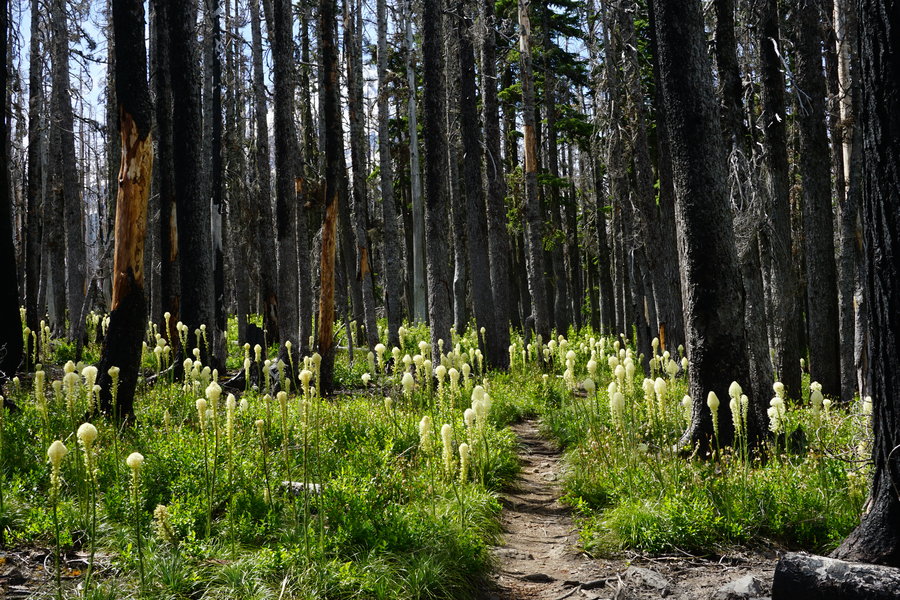
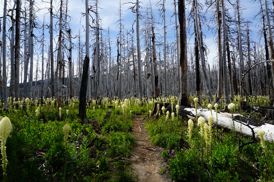
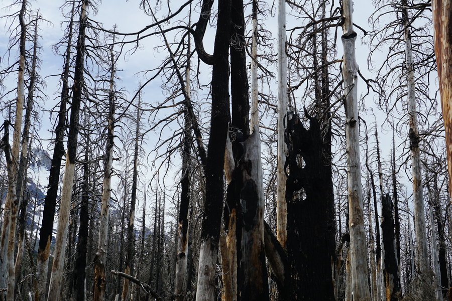
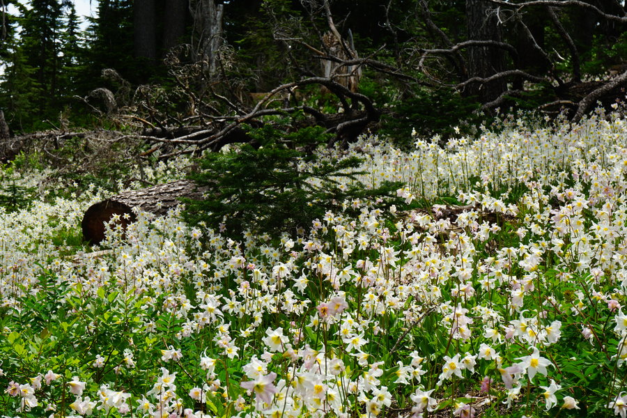
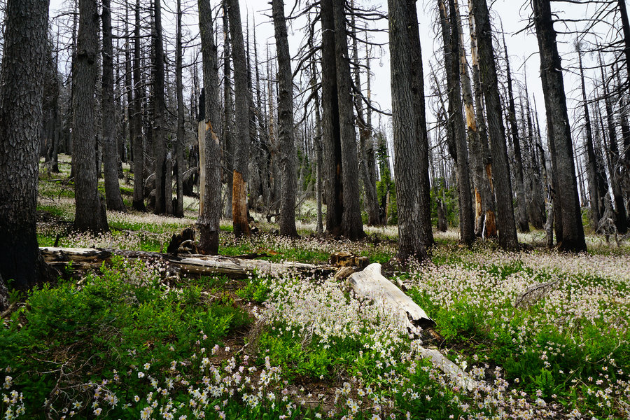
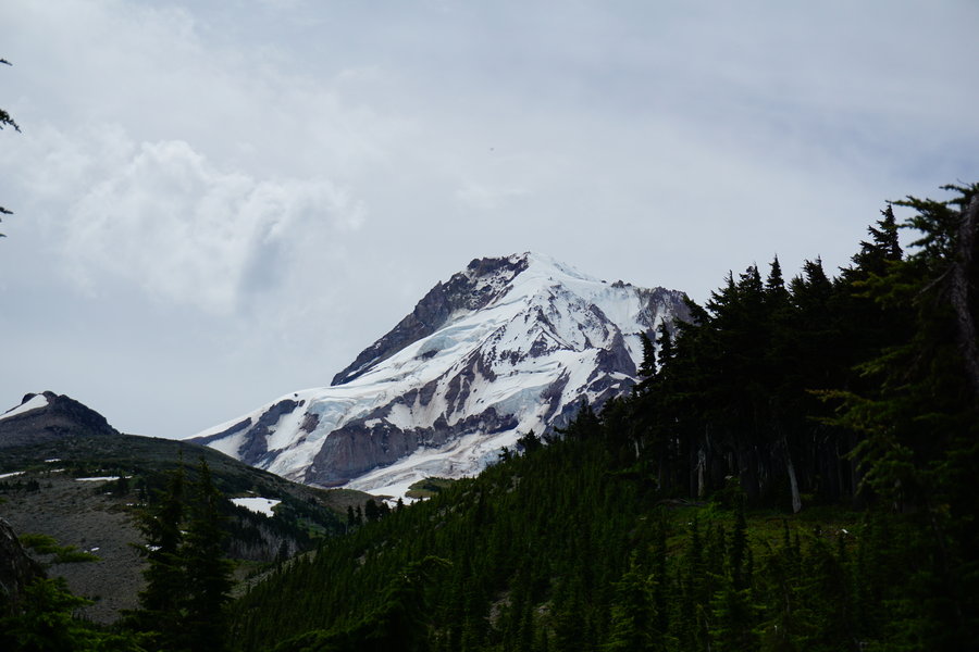
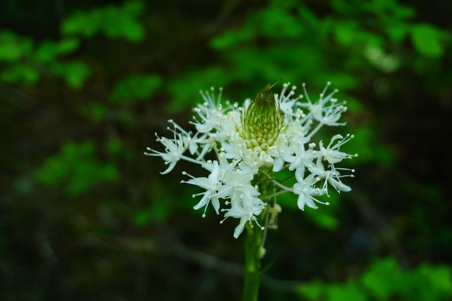
Decided to head out to Mt.Hood and do a new to us hike and head into Elk Cove via the Vista Ridge Trail. Started off kind of late for us and got to the TH at 10 am. Ton of cars already there. We headed up the ridge and noted the lily extravaganza had passed but oh my it was the Bear grass' turn to shine. Bear grass was everywhere and I really enjoyed the contrast between the burnt trees and the flowering growth beneath them. So pretty! As we got near the cutoff with the T600 there were still a few patches of lillies and numerous other flowers as well. We made our way to Elk Cove. Once we got there, we had lunch right by the stream with all the flowers around and the mountain the background. I have to admit It was so scenic there, I didn't want to leave. We turned around at this point and headed back out. Saw people off and on but after the opal creek hoards we passed by yesterday, it wasn't too bad. Chatted with a few lovely people along the way and left my map printout and hike directions with a couple that needed them more than I did. Best thing about this hike, I met my yearly goal 5 1/2 months early. Last year I hiked under 200 miles, so for this year i set the goal of making 300 miles which I hit on this hike. Seems I did not give myself enough of a goal so it's time for a new goal. 500 miles it is!
June 21, 2015


Opal Creek
7.5 miles of hiking • 750' elevation gain •
Took a late afternoon hike with the family to Jawbone Flats. So many people. Not a fan of the summertime crowds.
June 20, 2015

Willamette Mission State Park
5.5 miles of hiking • 0' elevation gain •
Took a quick hike with the family around the park.
June 14, 2015

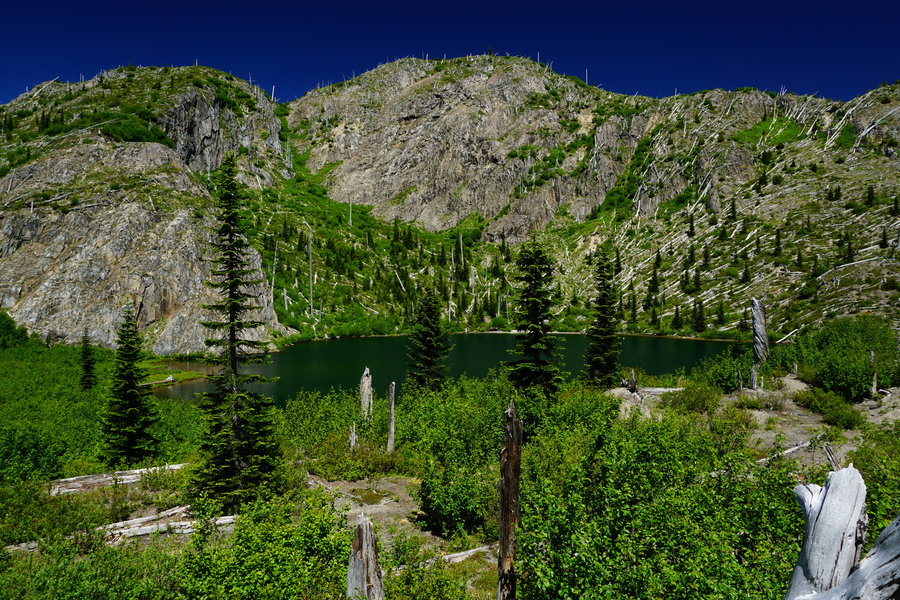
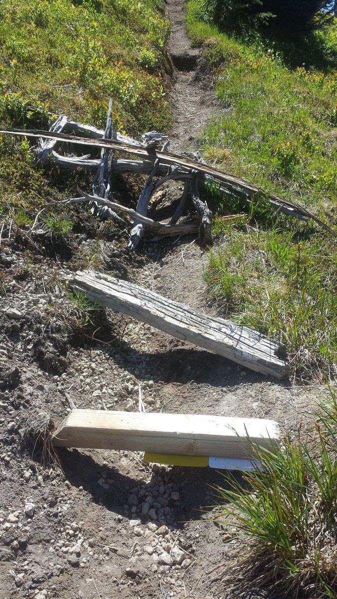
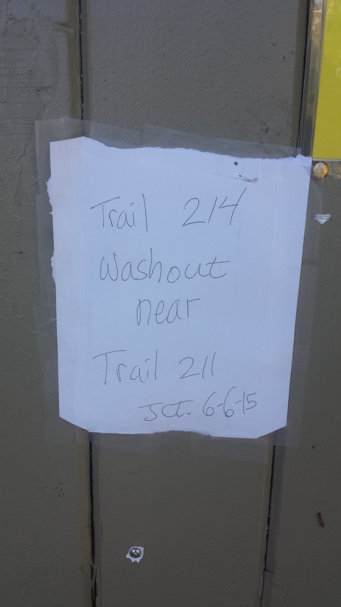
Norway Pass, Lakes Trail
17 miles of hiking • 4250' elevation gain •
We planned this hike with the intent of doing a Whittier loop. Have not done this before and it's high on my wish list. Started the day at Norway Pass, also a first, and began the climb up. I was having hamstring issues from the get go but hoped to walk them out. Got a couple of miles in and rounded the bend to the most scenic spot of Mount St. Helens I think I've seen to date. So amazingly beautiful! Stopped for a few pictures and headed on up to Bear Pass and then started down the Lakes trail. Another first for me. So this trail isn't my favorites of my adventures to date but the lakes back here are amazing. We knew from the Norway Pass TH there was a washout near the junction of Whittier and the Lakes trail, but decided to forge forward and see if it was passable. Here is where my research fell a tad short. we got there and the trail had stuff on the ground blocking it, but we went around to "check things out". Did not do us any good however because the trail was incredibly steep and hard to say if there was a washout, where it was. Decided to error on the side of caution and turn around and come back another day. I had tracks of this loop in my gps to help assist with navigation once we got to Whittier but for whatever reason I didn't think to stop and look at them, if i had I would've noticed both of them took off in another direction off the normal trail bypassing said washout :) That will teach me not to pay closer attention. There will be a next time however. This is a must hike goal of mine that will be accomplished. we retraced our route back out the lakes trail and ended the day with a bit of a let down on the Whittier angle but had a great day out in the backcountry!
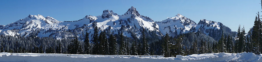
June 13, 2015


 4
4
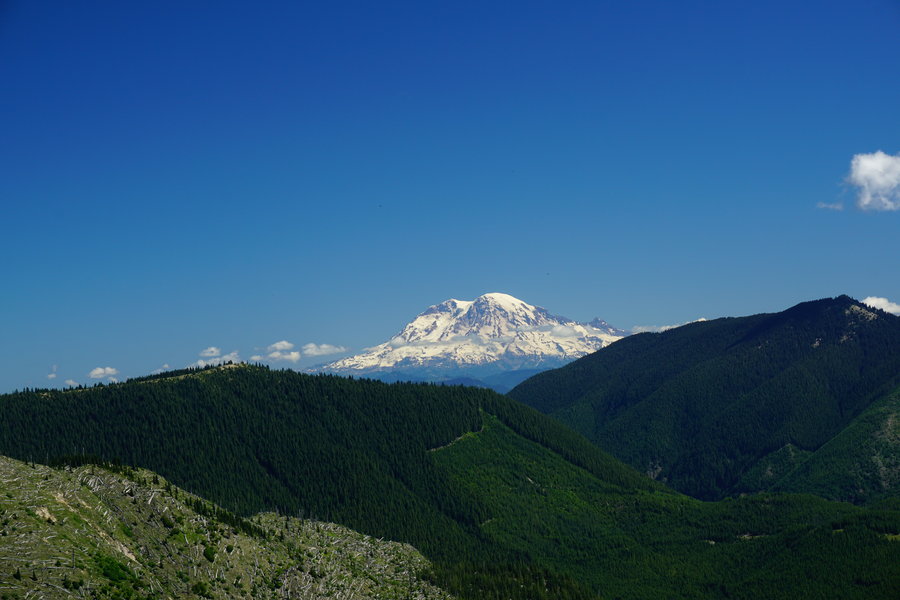
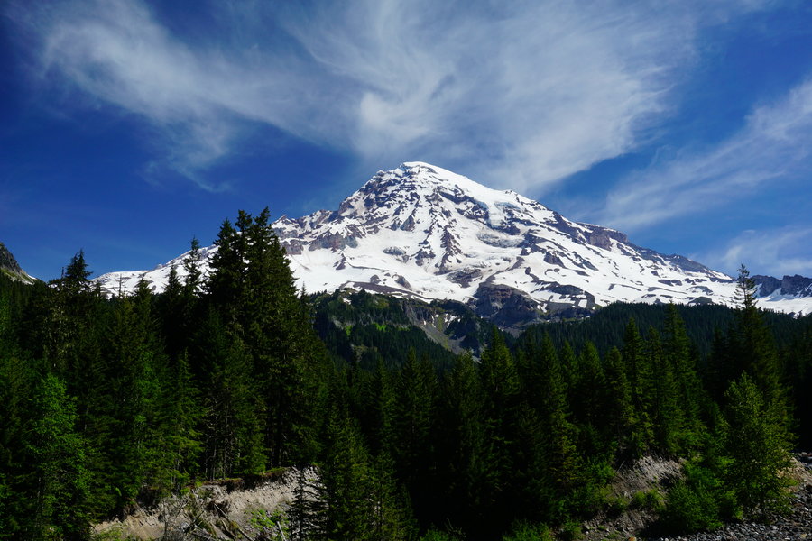
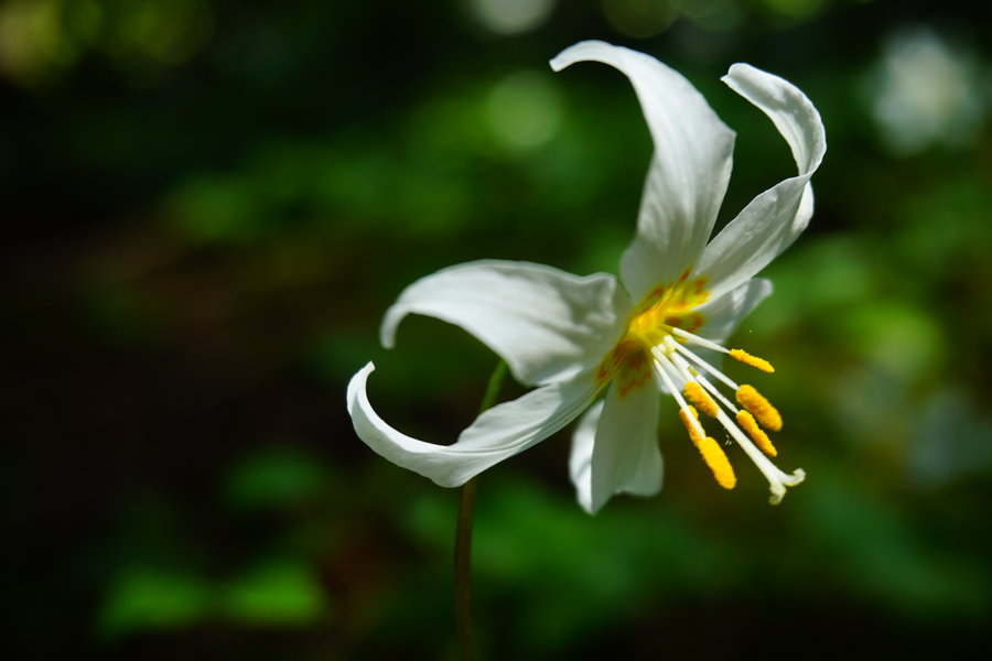
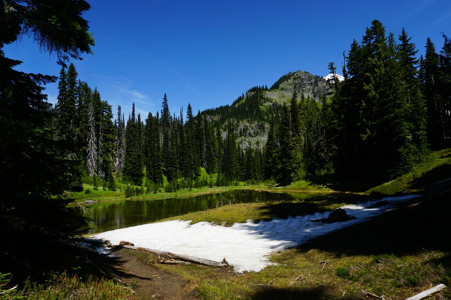
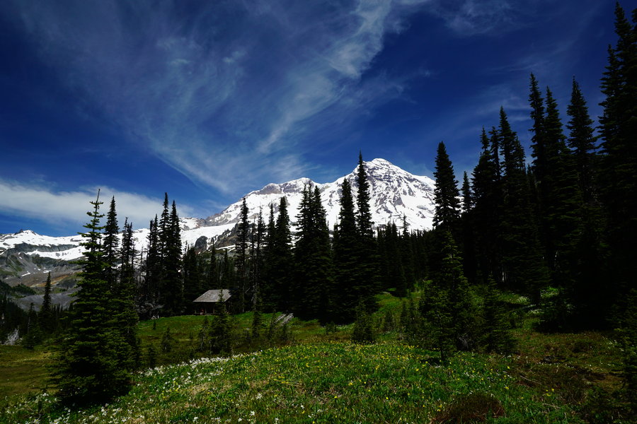
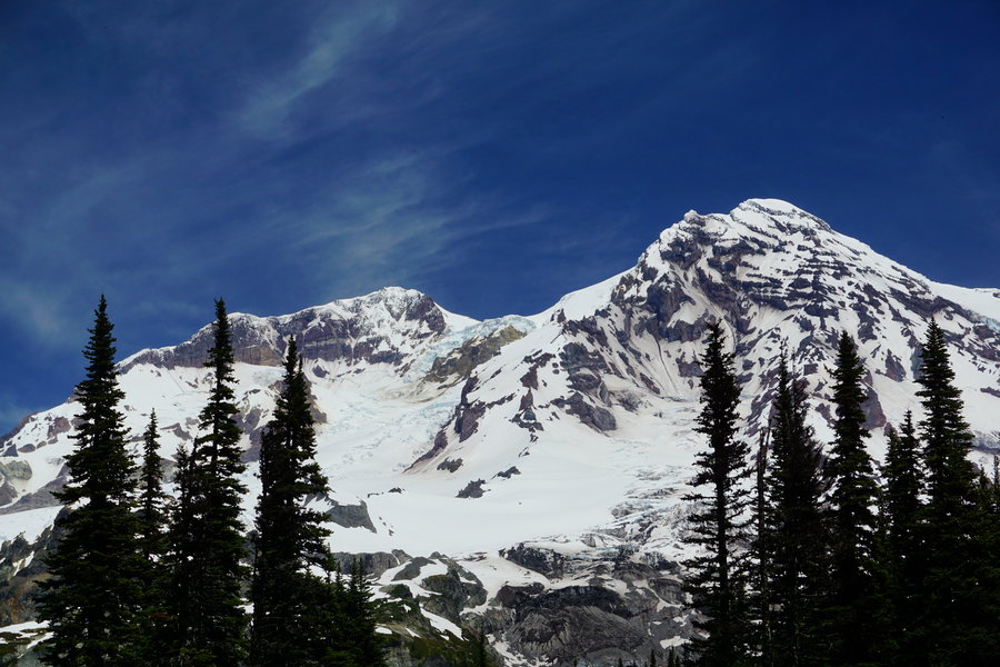
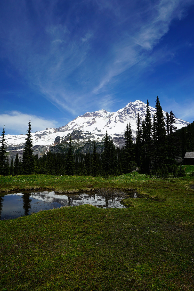
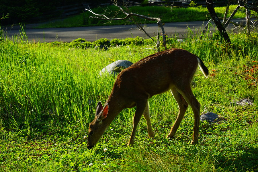
Indian Henry's via Longmire (coming out at Rampart's Ridge)
18 miles of hiking • 4000' elevation gain •
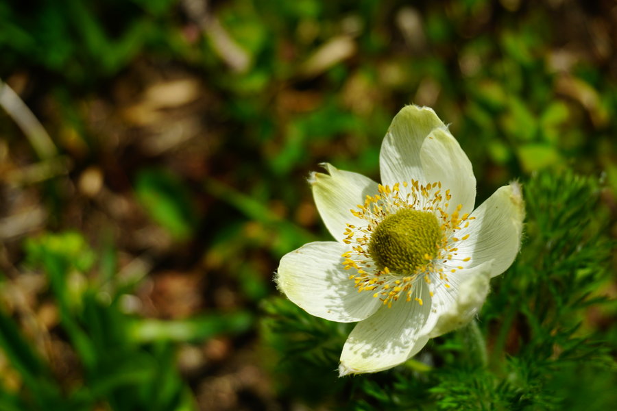
With the expected heat this weekend, we decided to head somewhere that would be a bit cooler but still be beautiful and sunny. We decided to give Indian Henry's on Mt. Rainier a try. What an amazing hike! We started around 8:30 am. The sun was shining bright and it was a balmy 55 degrees out. Perfect weather! We headed out on the Wonederland trail and made our way to the Rampart Ridge cut off. We decided then we'd take that on the way out and make a tiny loop of our day. We continued on and made our way over and down and back up again to Devil's Dream camp. This was my first time in this area and its a great camp setup. Not one camper there however. The lillies however were there in abundance! Everywhere you looked were fields of Avalanche Lillies! So pretty. It was starting to warm up a bit at this point and we continued to climb up the final section to the hunting grounds. After Devil's Dream, you mostly leave the wooded part of the hike and it opens up. We finally came into a wonderful meadow and this is the only spot where there was any snow at all on the trail. A 5-6 foot section at best. There were patches up in the surrounding area, but only this spot on the trail. Another mile or so and we finally made our destination. Wow!! I can see why it's so popular. The meadows full of flowers and the cabin all nestled back in the tree line with Mt. Rainier looming behind. So picturesque!! There were people milling about and down at the cabin but not nearly as bad as I thought there would be on Saturday. We had lunch at the cabin and then made our trip out. My daughter came with on this hike and she did really wonderful considering she only hikes once every blue moon with me. We made our way back to the Rampart cutoff and headed out and then finished the trip off with the little scenic loop at the end and then got a great treat as we finished. A deer was just meandering in front of the Longmire Inn having a little snack. Did not seem to care that people were standing 5 feet away taking pictures. Grabbed a few myself and then headed out for a long 3 hour drive home. Don't think it ever got much above 70 the whole day. Fantastic Day! Oh and we all set personal records for miles hiked in one day yesterday! One other thing WTA and the signs at Mt. Rainier have the distance off on this hike. WTA said 12.6 miles roundtrip from Longmire and the signs there showed 13.8 roundtrip . We clocked 8.62 from l Longmire to the cabin itself one way which would have put it approximately 16 to 17 miles round trip had we just did the out and back. Also bugs are out. Mosquitoes were a nuisance at the cabin.
June 6, 2015


 2
2
Hamilton Mountain Evening Hike
9 miles of hiking • 2500' elevation gain •
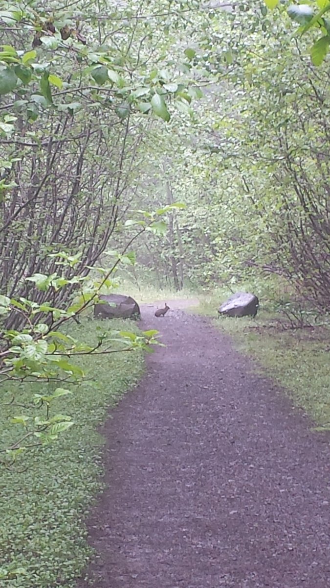
I was on call this weekend so no day hiking for me, but it was too nice of a day not to get out so after work, we took a quick trip up to Hamilton Mountain for an evening hike. This was my second time doing this hike. The first time was just about 11 months ago. took us 6 hours last time to do this loop. This time it only took 3.5 hours. We nearly cut our time in half. Just goes to show how much our hiking endurance has improved this past year. We only saw 3 small groups of people heading out as we were headed in about 6:30 pm. After that, not another soul other than the 2 bunnies we saw on the way down. There was a sign at the TH mentioning that 2 cougars were seen at mile 2.7 on 5/22/15. Thankfully we did not come across those in our trip. We made it to the summit right before sunset and the final few miles were via headlamp. We made it back to the car at 10:05 pm. I'm still in shock with how quickly we made the trip considering the first two miles of this trip make my calves want to scream and beg me to stop lol. What a fantastic way to spend a Saturday night in the Pacific Northwest!
May 30, 2015


Minto Brown Part 2
8.5 miles of hiking • 0' elevation gain •
The weather was too nice to sit inside after work so took a long walk at our local park.
May 27, 2015

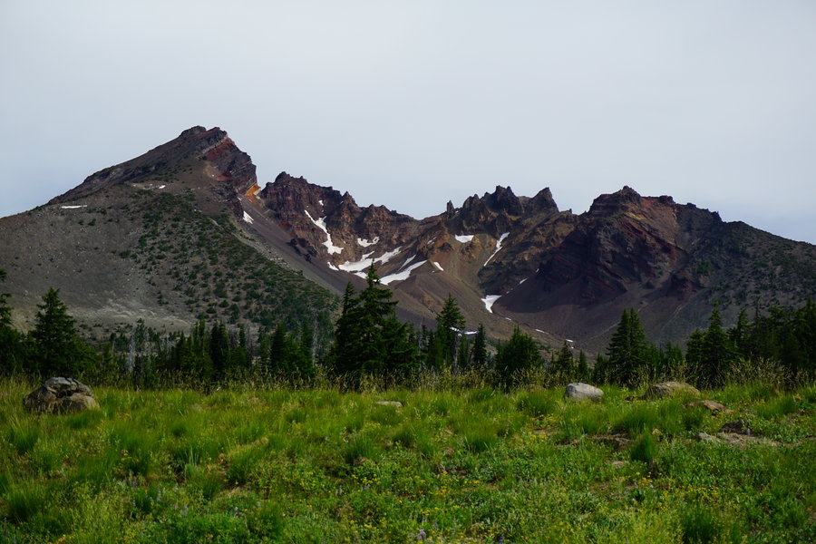
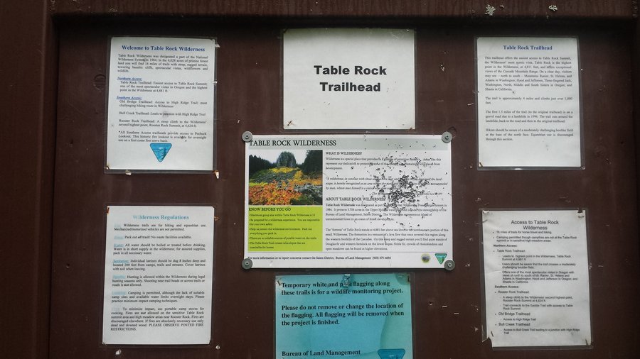
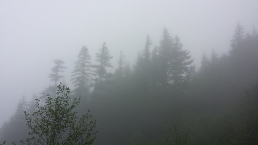
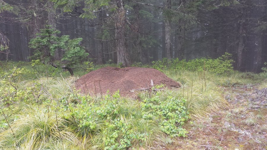
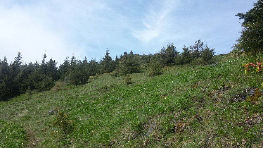
Table Rock Wilderness
17 miles of hiking • 4500' elevation gain •
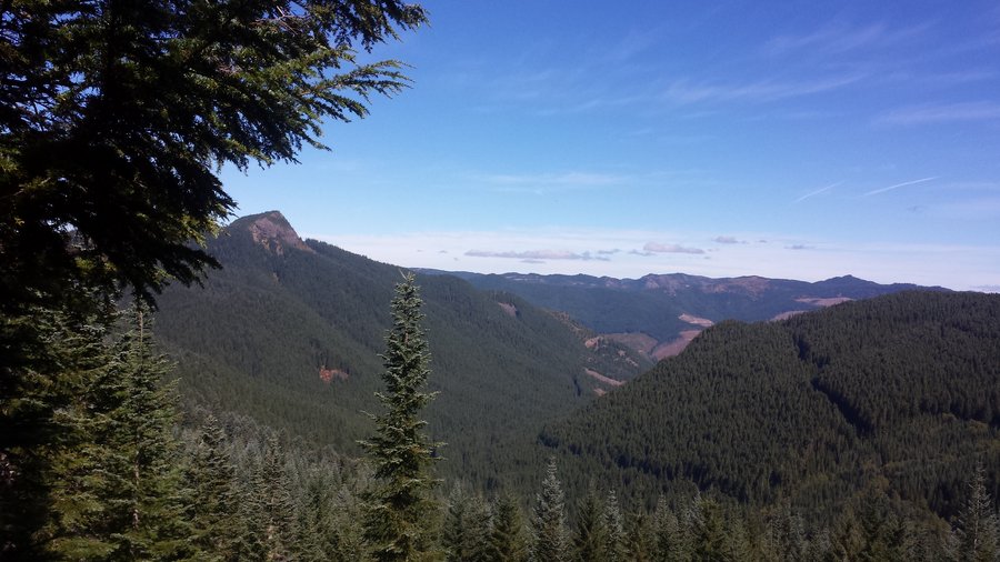
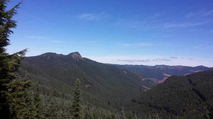
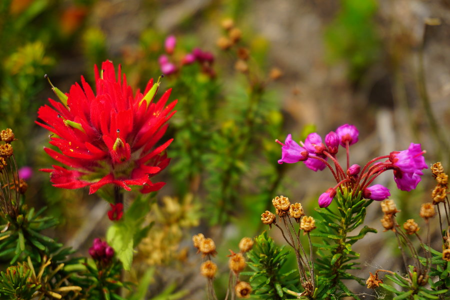
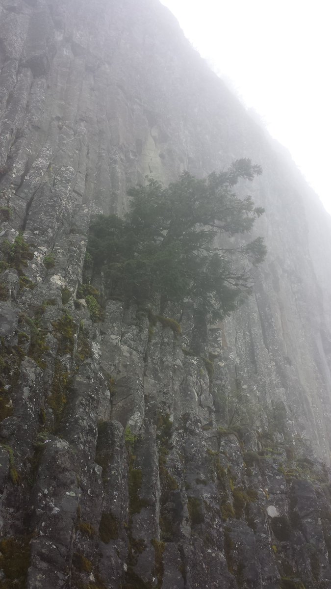
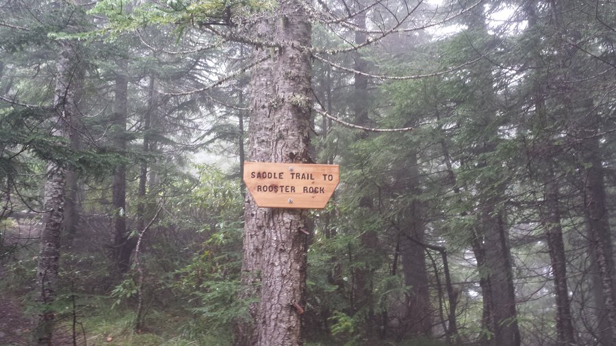
Sunday we decided to go wander around the Table Rock Wilderness. I had found a gps track we were going to go by and include Table Rock and Pechuck Lookout in the days activities. The morning was cloudy and drizzly like yesterday. We started off at the Table Rock TH and headed out into the clouds. We got the the Table Rock summit junction fairly quickly but decided to do that on the way out in hopes that the clouds would burn off so we had a view. We took off towards the "saddle" and I have to say if this is a saddle then the horses back is broke. This was more like a steep ravine. We had a steep descent down to a short semi flat stroll through massive anthills. Biggest I have ever seen! Then we had yet another semi steep descent down under Rooster Rock where we were greeted with a crazy steep incline up the hill and ended up in the meadow by Rooster Rock. From there we still had no visibility and we headed out to Pechuck Lookout. We made decent time there and was surprised to find it empty. Took a relaxing lunch break all the while wishing we had a view. up until now we had seen no one all day long. Started getting chilly so we geared back up and headed out. Ran into our first people as we were heading down from Pechuck and then shortly afterwards ran into a second set of people heading up to the lookout. We soon learned on the way back the track i was going by had off trail sections. I don't have an issue with off trailing but would rather do it in an area I am comfortable in so we took the "long" way back and retraced out steps back to the meadow which I am kind of glad we did because the clouds finally started opening up and we got to see Rooster Rock. Back down through the gully and up to the "ravine from hell" and we finally made it back to the Table Rock summit TH. Coming back through that saddle slowed us way down and I have to admit I had to talk myself into making the final Table Rock summit climb lol but I had yet to do that summit so i trudge my way up, and oddly it was probably the nicest of the climbs of the day, very mild really. I'm glad we save the Table Rock summit for the last because we had great views by then. When it was all said and done my 13.5 mile expected trip was nearly 17 miles and a tad over 4500 ft of elevation gained under our belts. It was a great hike but very grueling at times.
May 24, 2015


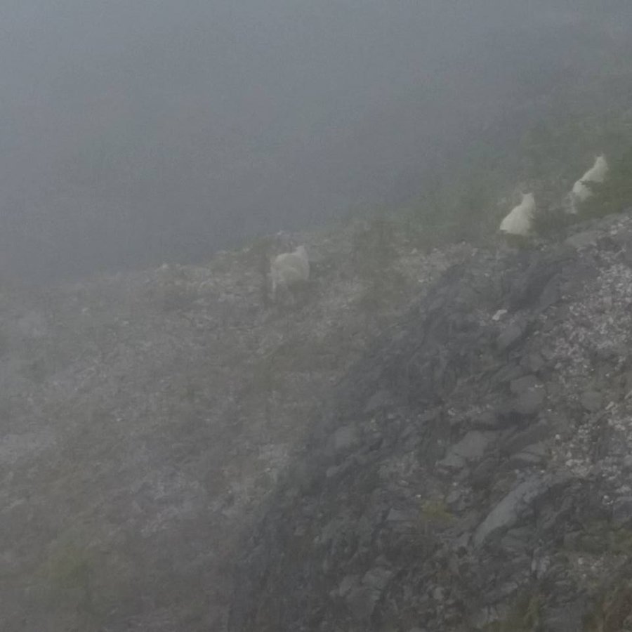
Ape Canyon to Plains of Abraham
14 miles of hiking • 2500' elevation gain •
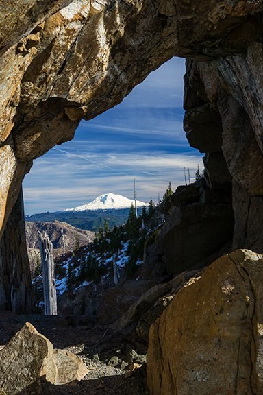
Saturday I took my best friend to Ape Canyon up to the Plains of Abraham. The day was cloudy and drizzly and there was not much in the way of views, but I had a great time! While up on the Plains we got about a 20 minute window of the perfect mountain views. What an absolute treat! She had never been up there before or that close to the wonder that is St. Helens and it was awesome to watch her see it for the first time. We wandered around for a bit and then on the way back down we stopped at the rock ledge by the canyon itself and low and behold right below us was 3 mountain goats! My first time seeing mountain goats and they were amazing. only got a picture or two as they took off, but what a way to start our hike back down the canyon.
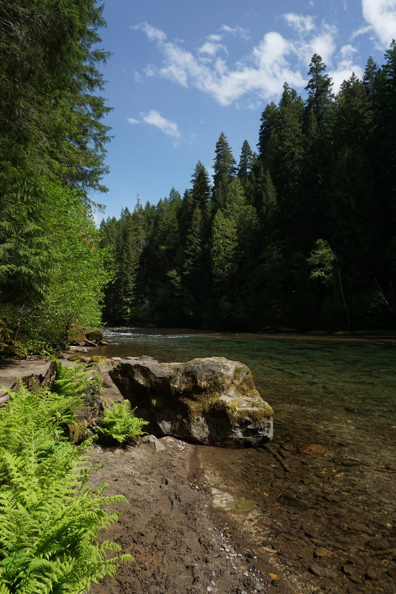
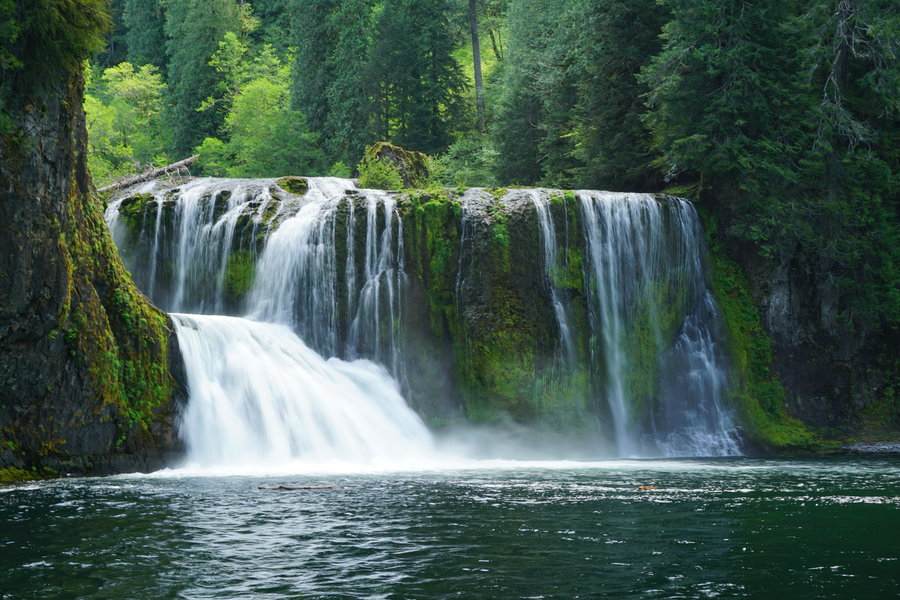
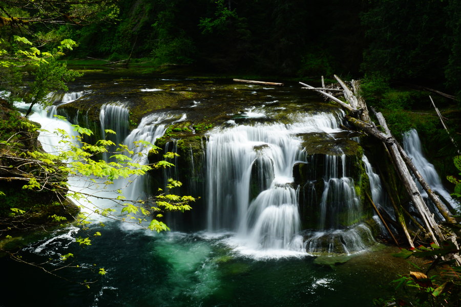
May 23, 2015

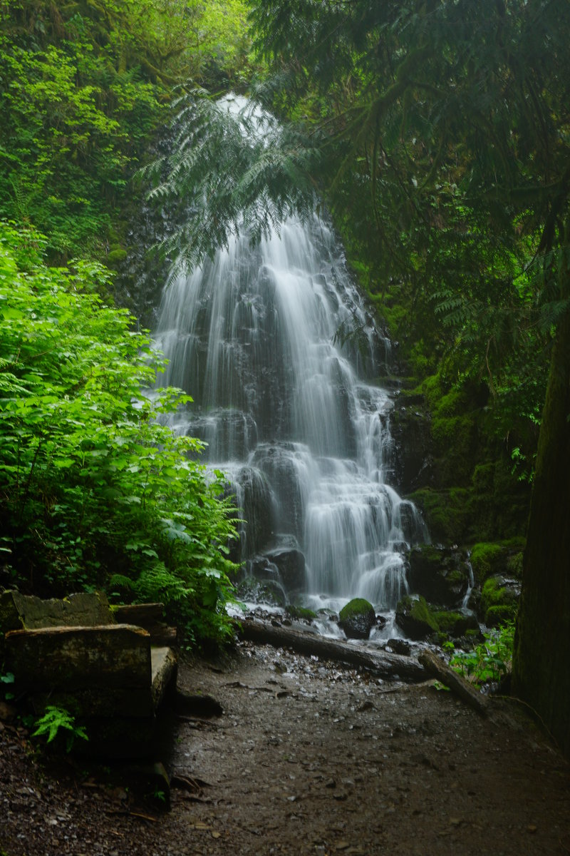
Lewis River
7 miles of hiking • 750' elevation gain •
Our hiking plans got changed at the last moment and we decided to do a quick trip to the Lewis River Waterfalls. We had never been before so figured we'd check them out. We were not let down. They are very beautiful! We had the whole hike to ourselves from the Lower Falls to the Upper Falls however coming back we ran into people off an on all the way back. Not a bad way to spend a Sunday however.
May 17, 2015

 1
1
Multnomah/Wahkeena/Nesika Loop
11 miles of hiking • 2500' elevation gain •
My best friend wanted to go on a hike with me and I thought a Multnomah loop out to Nesika would be the perfect hike to introduce her to the world of hiking. Nesika was opened up and the people up there were wonderful! They fed us yummy goodies and warm drinks and sent us out to the lookout to enjoy them. The trails weren't terribly crowded for once, always a plus. It might have been a grey, cloudy day out but it might as well have been sunny and 80. It was just one of those perfect hikes!
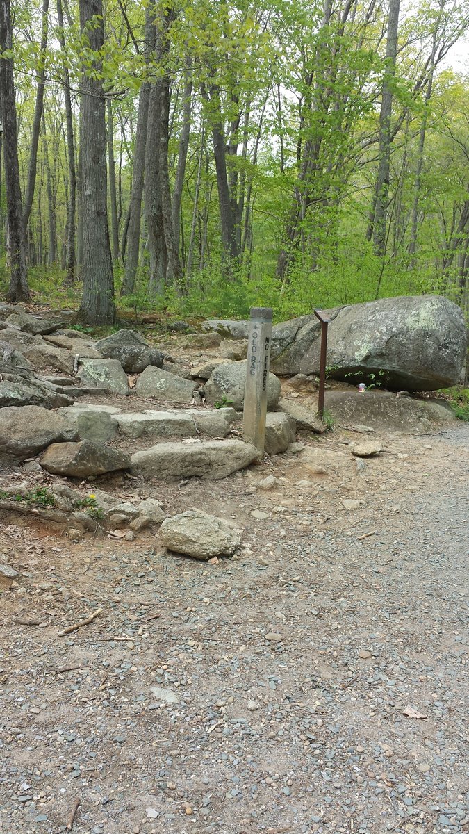
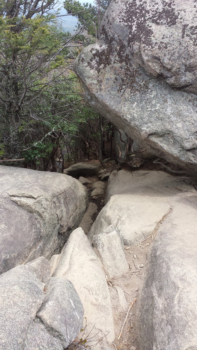
May 16, 2015

 2
2
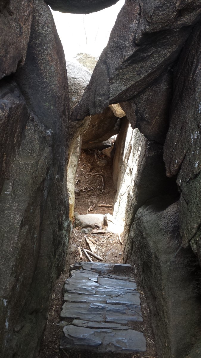
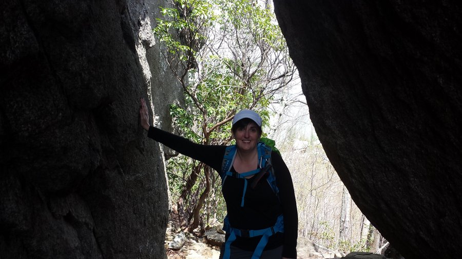
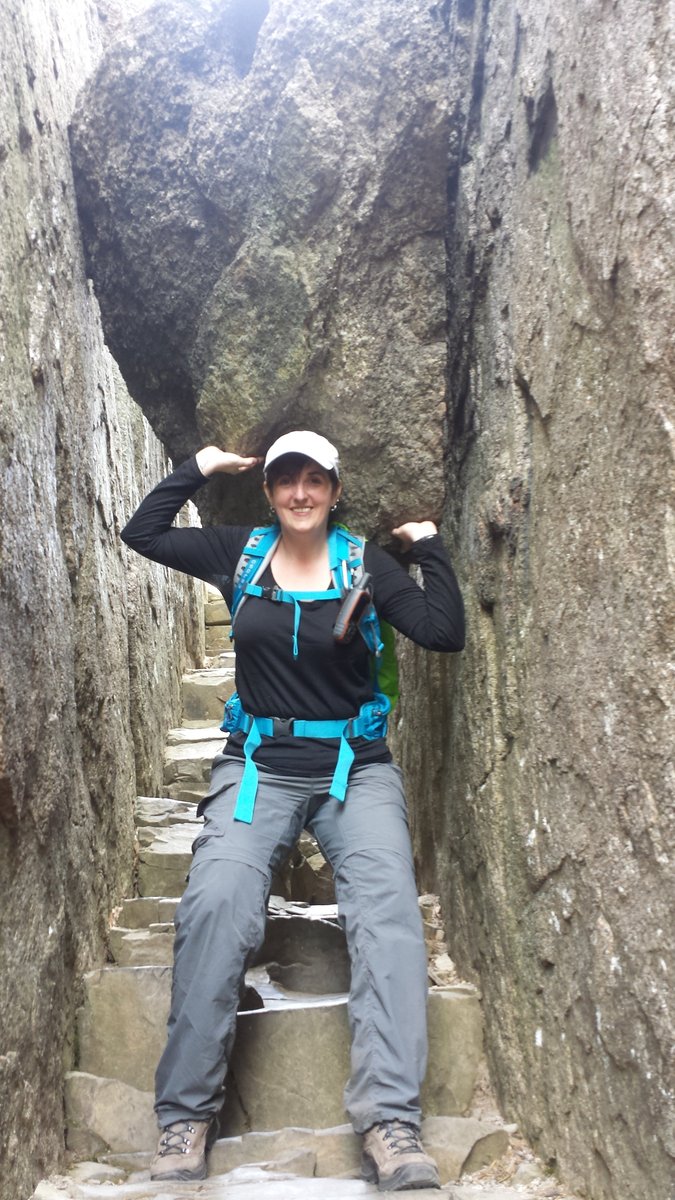
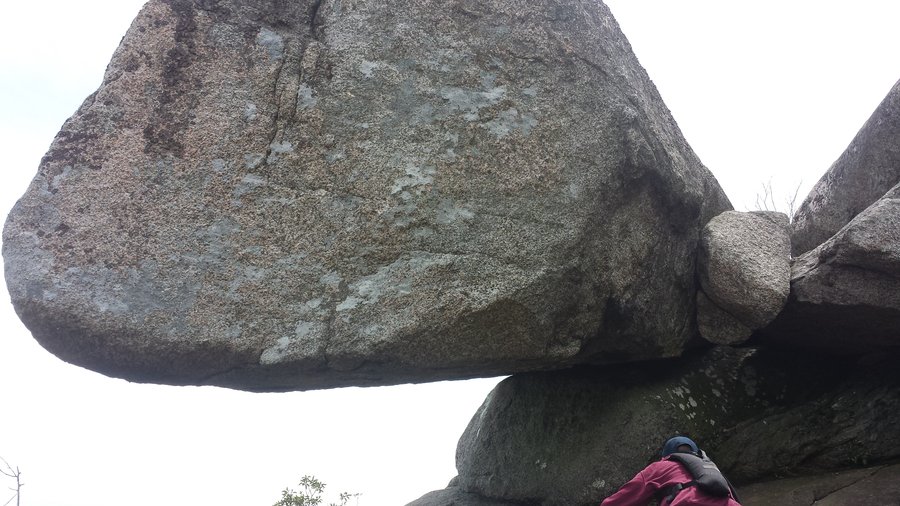
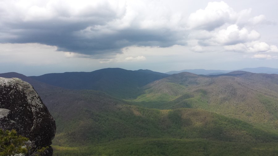
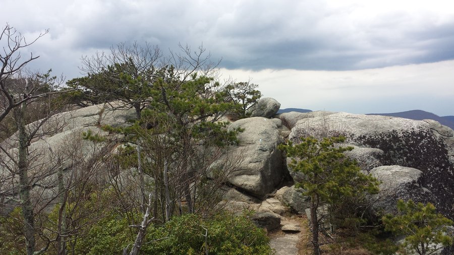
Old Rag - Shenandoah National Park Virginia
10.5 miles of hiking • 2500' elevation gain •
I went back east to Virginia to visit my son and he took me to hike this fabulous hike called "Old Rag" in the Shenandoah National Park. OMG I had so much fun on this hike! This is a hike/scramble type of hike. The first mile is a boring road walk and then the next two miles starts a steady climb up. Around mile 3, the scramble starts. You can see blue on the rocks in some of the pictures I added. That is how you find your way through the maze of boulders. You have to crawl, climb, shimmy up, down and around these humongous boulders on the ridge line. This goes on and up for the next two miles until you reach the summit which is around 3200 feet. Then its a steady decline down the mountain and back to the car. I've read this is one of the most popular hikes on the east coast and to go during the week if possible. We went on a Thursday and ran into one person coming down as we made it to the scramble section. After that we only saw one group of guys. We mostly had the entire day and hike to ourselves. Couldn't have been more perfect!
April 30, 2015


 1
1
Wahkeena/Multnomah Basin Trek
13.5 miles of hiking • 3250' elevation gain •
Today's hiking plan was a track I got off of Gpsfly. A trek up Wahkeena to Angel's Rest, on to Devil's rest and then back down Wahkeena. Somewhere along the way that plan got skewered. On the way to Angels' Rest, I decided to skip it and we headed up the Foxglove trail to Devil's Rest (which btw was super crowded and I'm not sure what the fascination is with it). On the way down Devil's Rest, I once again changed our route and headed over to Multnomah Basin Rd and took it down to the Larch Mountain trail. For the third and final time I changed our route again and decided it would be a shame to be so close to Nesika without making a quick pit stop there before heading out. Took a 10.5 mile trek and turned it into a 13.5 mile one. Did get a few sprinkles on us at the end but not enough to dampen the day. While my day did not go as originally planned, I had a fantastic day wandering around and avoiding the hordes of people as much as possible.
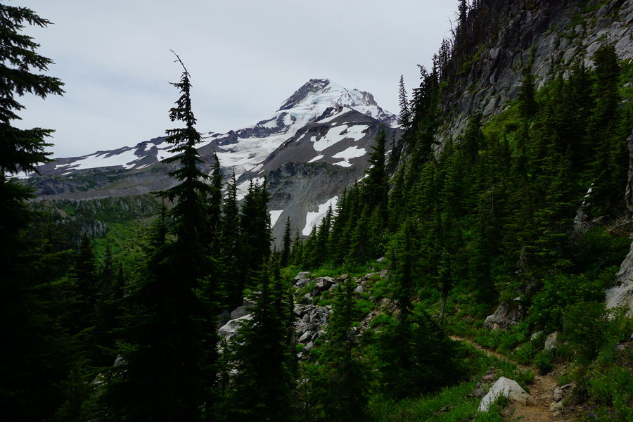
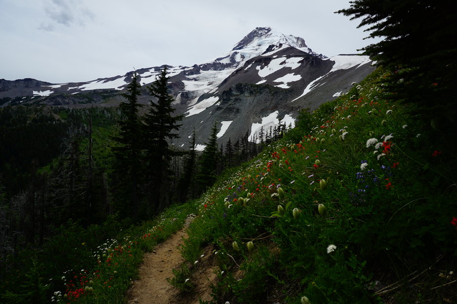
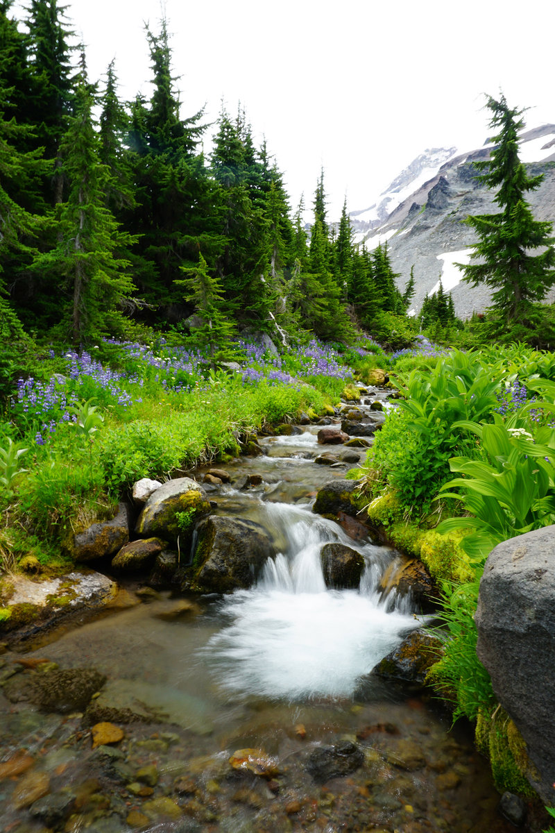
April 26, 2015


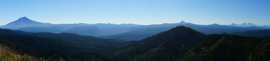
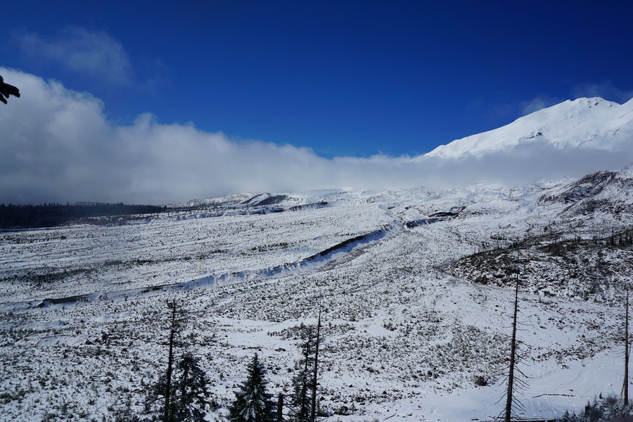
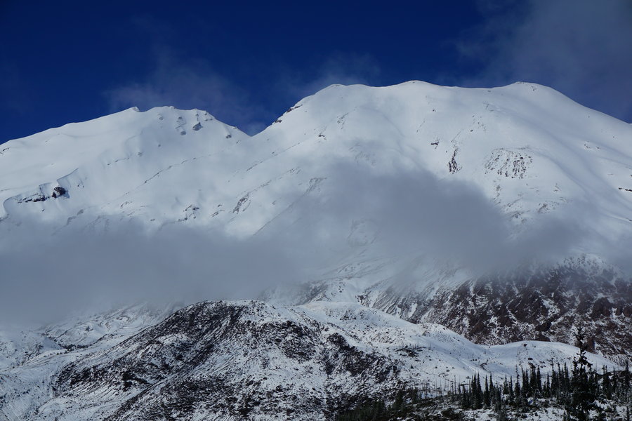
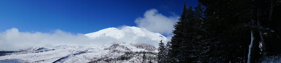
 3
3
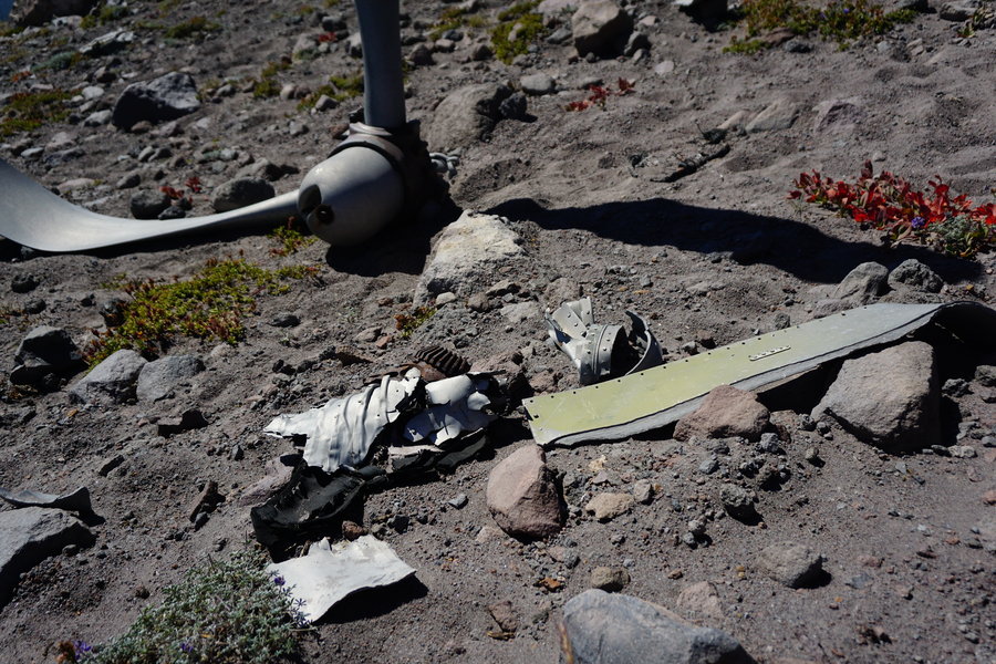
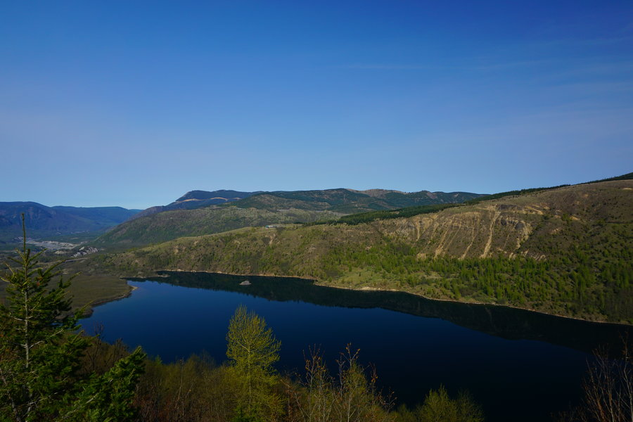
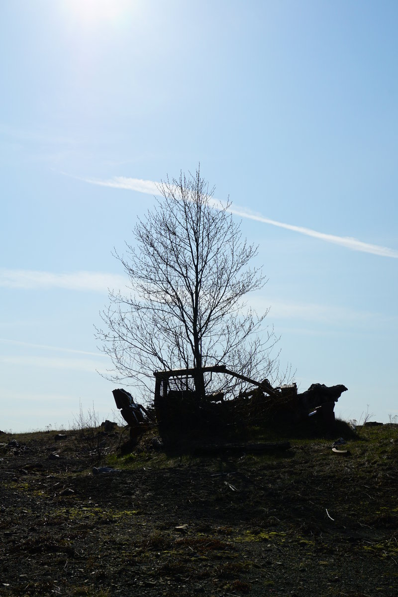
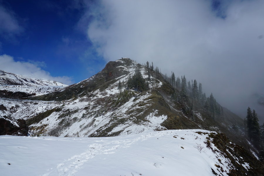
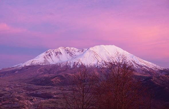
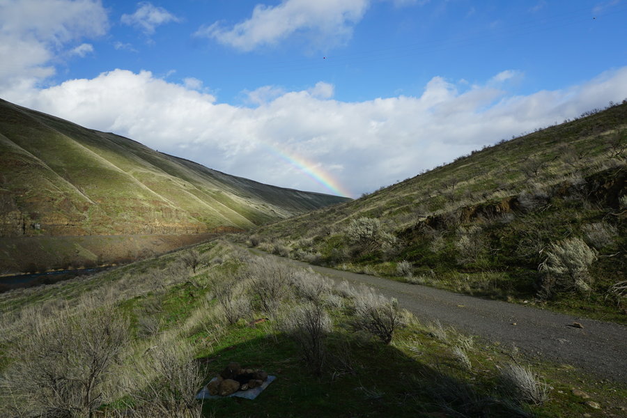
Coldwater Lake with extras
15 miles of hiking • 3000' elevation gain •
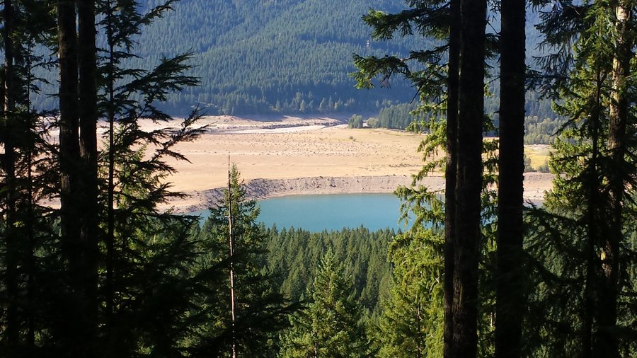
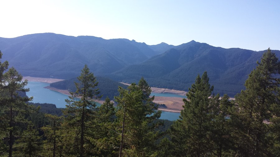
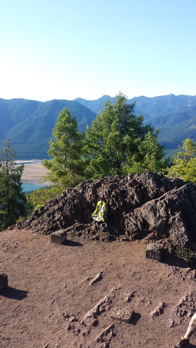
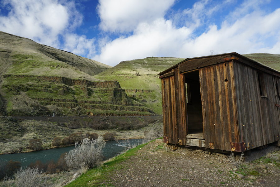
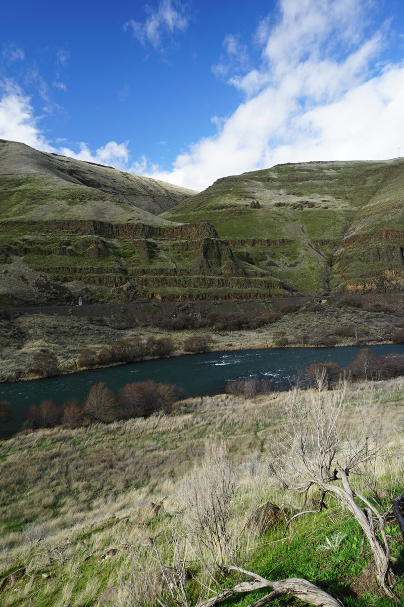
Spent the day out at Coldwater Lake yesterday. It was not our original destination however. We had planned to hike into Coldwater Peak and beyond if possible but ran into snow/snow drifts that bordered on unsafe and we turned around and just did the loop around Coldwater lake instead. It was our first lake loop and had a good time regardless of the unanticipated detour. We did find a cool relic that I hadn't seen before. A few hundred feet down the hill from the logging equipment, was a old truck left behind from the blast. Always fun to find/see something new!
There were 4 other cars at the Hummocks trail head when we arrived but only ran into one person all morning until we got down to the lower lake trail. Once on the lower lake trail, we ran into a few groups of people who had came in from the coldwater lake parking side.
The forecast was warmer than anticipated and the sun blazed down on us the entire day. Go figure it was the one time I did not have my sunscreen in my pack. note to self, my burned face and arms request that you remember the sunscreen next time.
April 19, 2015


Tunnel Creek (Eastern Olympics)
11 miles of hiking • 2750' elevation gain •
We took our friend who just moved to Seattle on a day trip up to the Eastern Olympics and hiked the Tunnel Creek trail. We have never been to the Olympics yet and since snow advisories were in the weekend forecast for all the cascades, we figured it was the best bet for the least amount of snow. All I can say...such a pretty hike! We did hit snow starting a bit past the Tunnel Creek shelter and the further up the trail we got, the more fresh snow we ran into. We stopped our hike almost at the 5050 ridge mostly because the snow was starting to get deeper and slippery. The snow was fresh powder and our micro-spikes weren't of much use so we called it a day. We passed by a couple of frozen bodies of water, Harrison lake and another I called, "On Frozen Pond". The only creatures we came across were a couple of deer on the road and some "snow squirrels" as our friend calls them. I had a fabulous day, it was so fun to see and watch our friend, who is from Hawaii, experience snow, frozen lakes, and the general beauty of the Pacific Northwest for the first time. It really makes you appreciate just how lucky we are to live where we do and to have all this at our doorsteps!
April 11, 2015


Minto Brown
5 miles of hiking • 0' elevation gain •
Needed out of the house so took a quick 5 mile jaunt to Minto Brown Park. Was sunny and cool out. Thankfully did not have the usual crowds like there are on the weekends.
April 9, 2015

 2
2
Ape Canyon
12 miles of hiking • 2500' elevation gain •
What a beautiful hike! Started the day in pretty foggy conditions with a fresh dusting of snow. Felt like wintertime for the first time in a couple of months. Saw about 10 people total through the day for the most part had the day to ourselves.Ended the day with sun and partly cloudy skies and melting snow as we made our way down the trail. Great day on the trail (minus my husband hurting his wrist)!
April 4, 2015


Silver Creek Falls Small Loop
5 miles of hiking • 750' elevation gain •
Did a quick 5 mile trip to Silver Creek Falls after work tonight. It was too beautiful of a day to pass up the opportunity to get out in the woods, even it was just a quick trip.
March 26, 2015


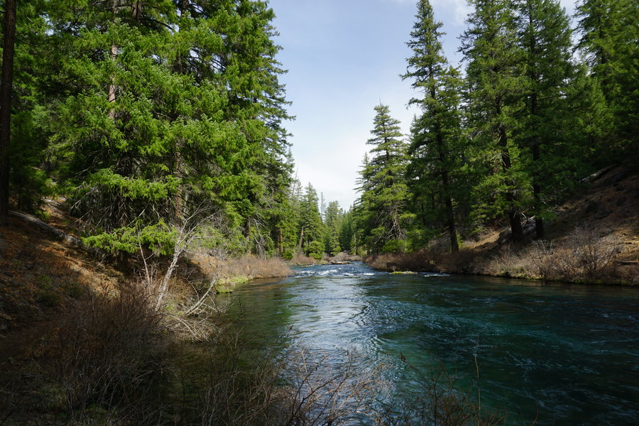
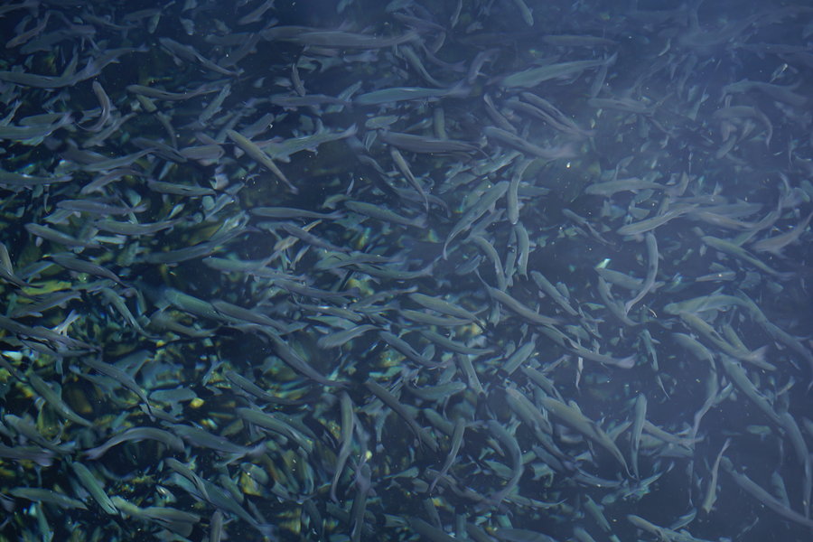
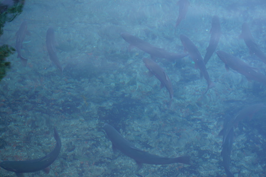
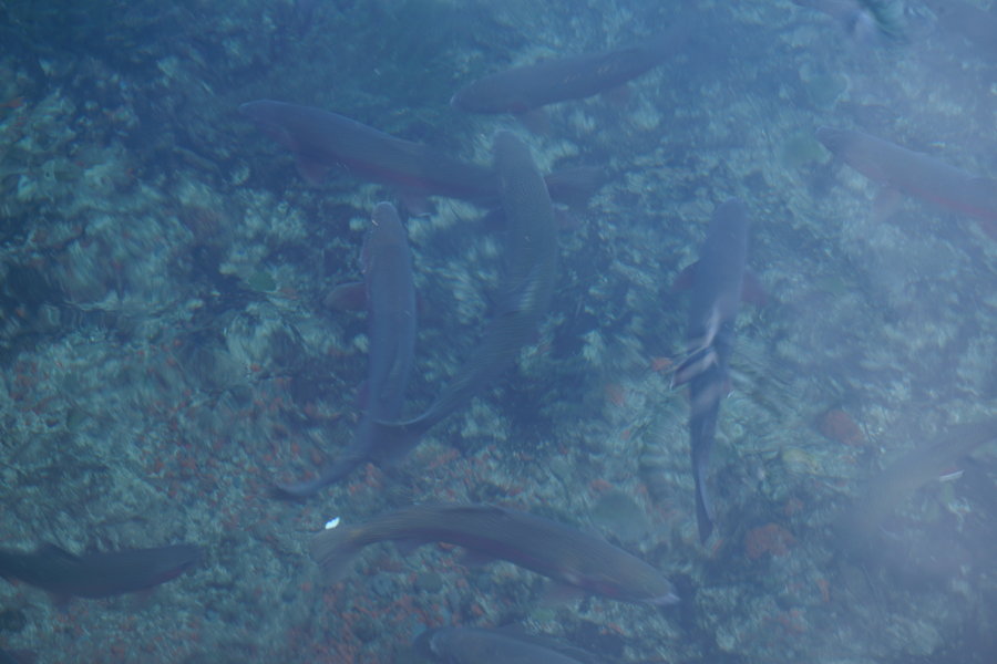
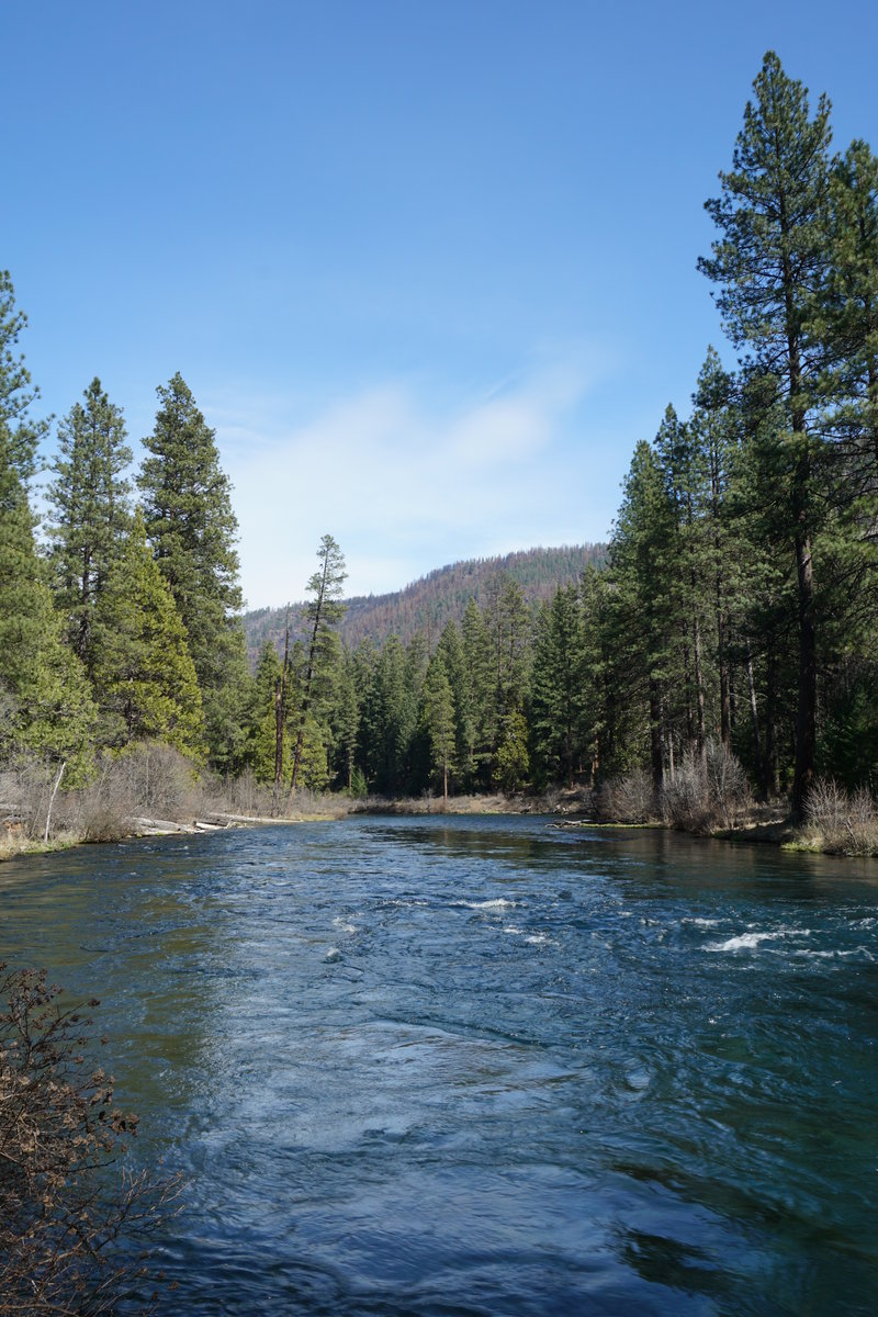
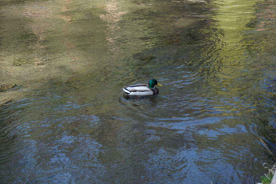
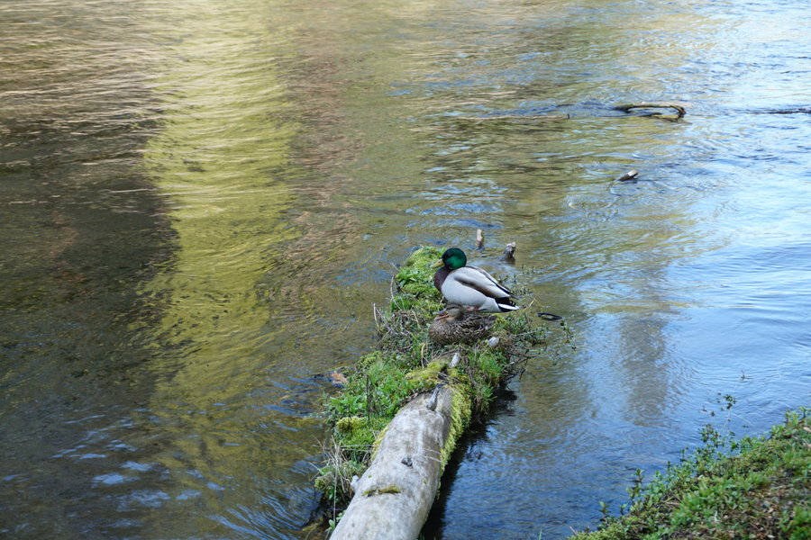
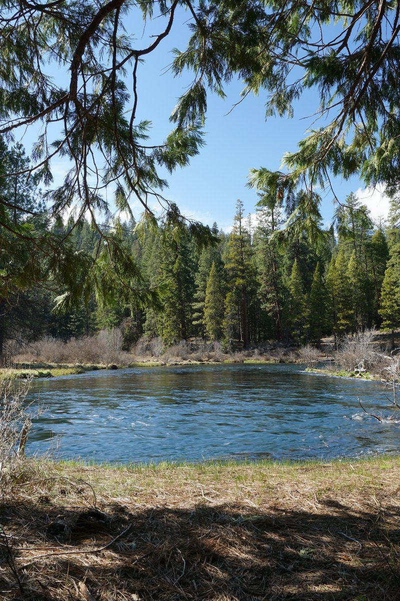
Metolius River Stroll
12.5 miles of hiking • 750' elevation gain •
Took a stroll on the Metolius River today. It was our first time there. Very pretty! The water was this fabulous shade of blue. Stopped and fed the fishes at the Wizard Falls Fish Hatchery. Continued on to the 99 bridge and then circled back on the eastside of the river until we got back to the hatchery, then worked our way back to the car for the ride home. All in all it was a nice day, nothing stressful and we just relaxed.
March 21, 2015


Peavy Arboretum
6 miles of hiking • 1250' elevation gain •
Took a trip to Peavy Arboretum for a quick hike. We have never been before today. It's a great place and will go back again. Just about 6 miles today, windy but not much rain. Perfect way to spend our Sunday!
March 15, 2015


Jefferson Park Via Whitewater TH
12 miles of hiking • 2000' elevation gain •
Took a fabulous stroll up to Jefferson Park this past Sunday. It was a clear, sunny day and I figured it would be crawling with people but we only saw and handful of people and most of them were on their way out. Snow was a little mushy and we sank quite a few times but well worth it as we had the most amazing views all day long. Couldn't have been a more perfect day. Snow patches on main trail in a few spots until you hit crossroads then moderate patches until you hit the creek. Crossing the snow/ice bridge was interesting but it held up just fine. mostly snow after that point anywhere from inches to 6 or so feet.
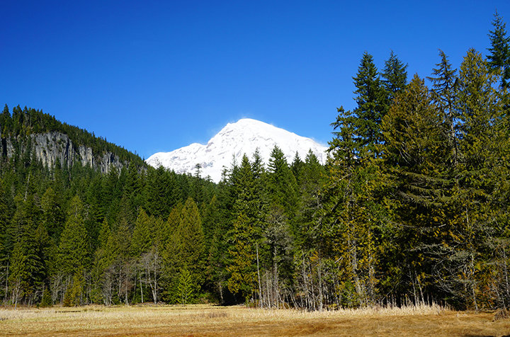
March 8, 2015


 2
2
Rampart Ridge
6.5 miles of hiking • 1500' elevation gain •
Had a great family day. Did a casual loop hike from Wonderland Trail and around Ramparts Ridge. Then spend rest of afternoon seeing the sights up to Paradise.
February 28, 2015


 1
1
Pamelia Lake to Grizzly Peak
12 miles of hiking • 3000' elevation gain •
Had planned to go to Pamelia Lake to Hunts Cove today but got waylaid by massive wind. The blow downs on the Hunts Cove trail covered the trail in so many places just at the beginning that we decided to backtrack and try Grizzly Peak instead. Grizzly Peak was the winner. There was debris about and some small blow downs but nothing like down at the lake. Hit snow about 5400 feet and there was probably 3-4 feet at the top. All compact, easy to walk on snow. Didn't need micro spikes, just had to be careful with stepping. Ended up being a great day. Had sites of Mt. Hood, Sisters, Three Fingered Jack, and the best view of Mt. Jefferson!
February 21, 2015


 2
2
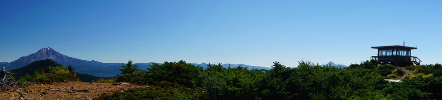
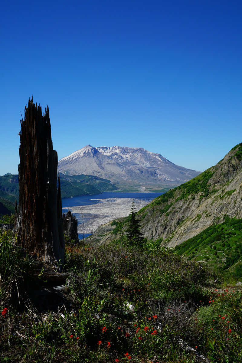
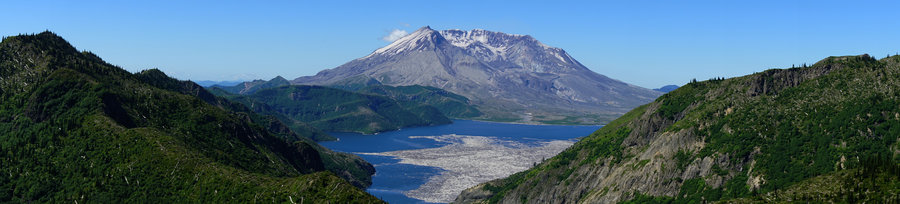
Saint Helens Lake Loop
17.5 miles of hiking • 4250' elevation gain •
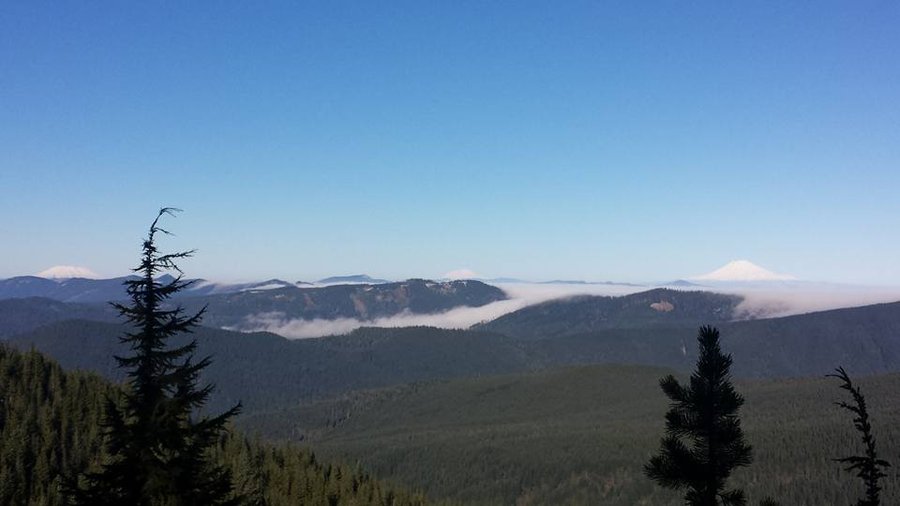
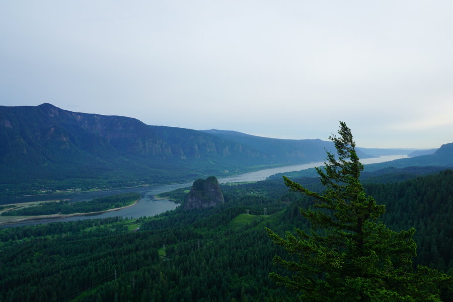
I headed out on a Saint Helens Lake Loop with a new hiking friend on Presidents Day. It was a beautiful, sunny day, even if the winds battered us all day long. We started at Hummocks and worked our way through the blast zone to JRO and past Harry's Ridge. We continued up to the Arch and around Coldwater Peak and finished the day on the Coldwater trail. We had amazing views the entire time and finished the day watching the mountain light up in the most amazing sunset as we headed out for home. Perfect way to spend an entire day!
February 16, 2015

Marion Lake
7 miles of hiking • 1250' elevation gain •
Had a nice family hike into Marion Lake and Marion Falls today. Not many out on the trail, but I did see a forest ranger for the first time on the trail as we were heading out. He was heading in with a ticket book in hand.
February 13, 2015
 1
1
Deschutes River Trail to Box Car
12.5 miles of hiking • 500' elevation gain •
We ran away from the rain this weekend and took a 12 mile stroll on the Deschutes River Trail to the box car. Only had showers the first 35 mins of walking and then it turned into beautiful sunshine. There was crazy wind from about mile 3.75 on. Didn't see another soul until on our way back. Ran into a small group around mile 8 and a couple more at mile 10. Once we got within one mile of the campground, then we found the hordes of people. Easily 15-20 in just that last mile. Can't complain we pretty much had our whole hike to ourselves.
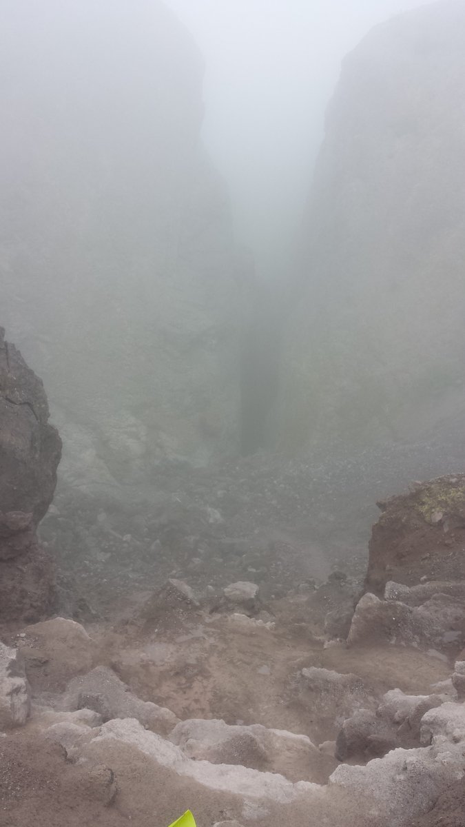
February 7, 2015

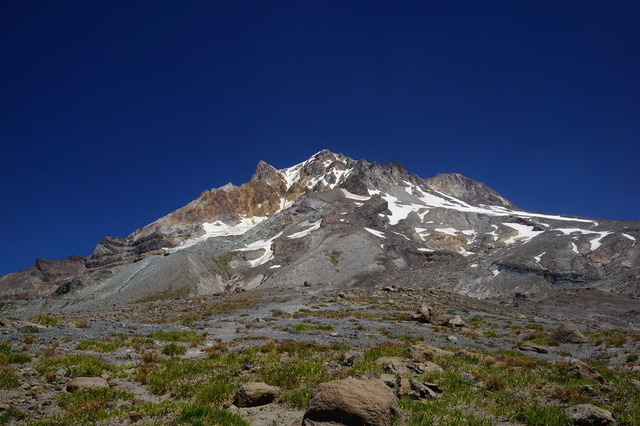
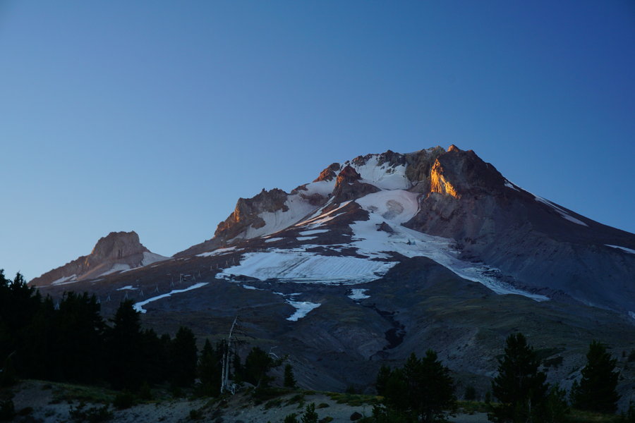
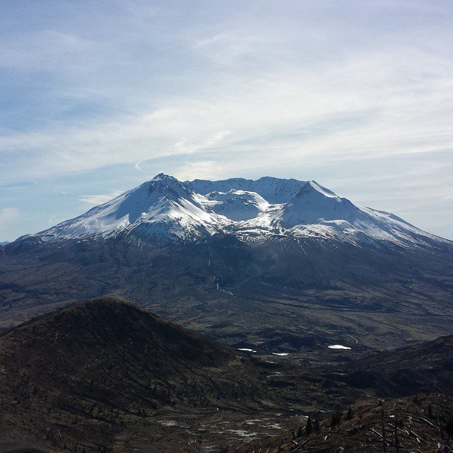
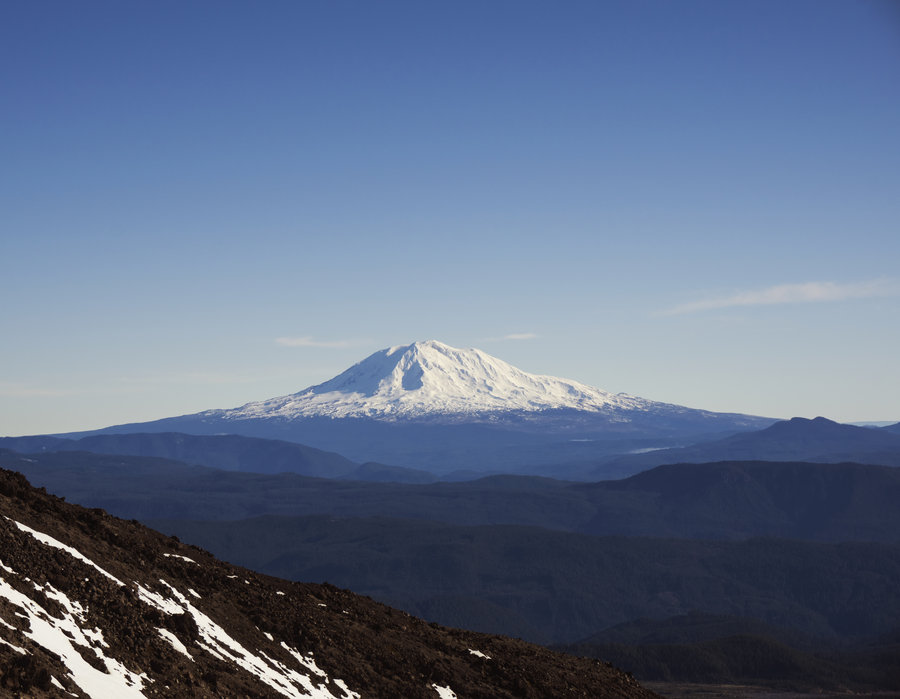
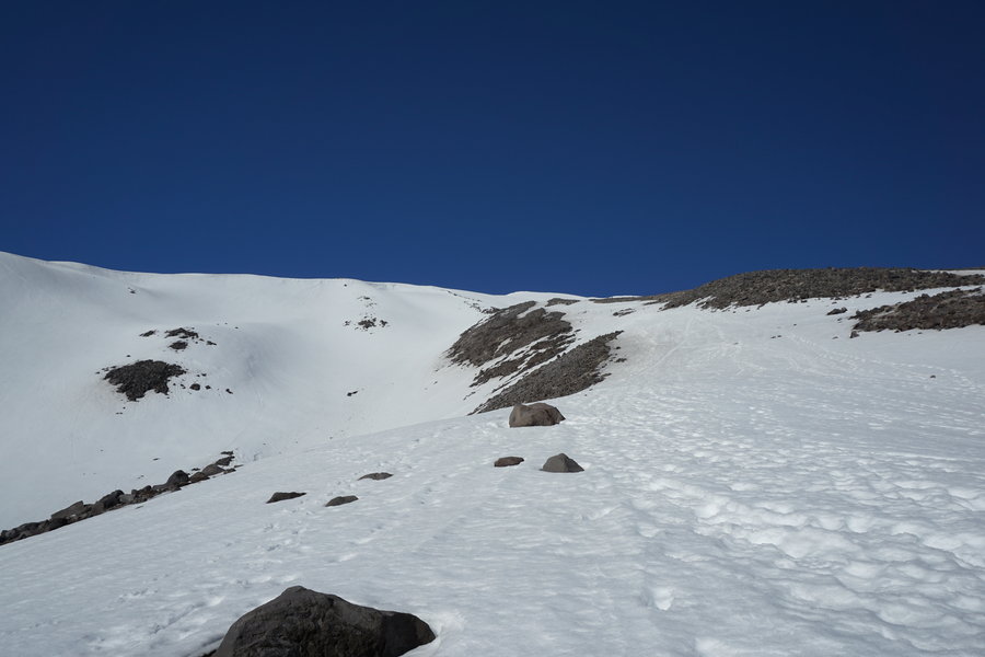
Mt. St. Helens
9.5 miles of hiking • 4000' elevation gain •
It was a beautiful day up on the mountain. Couldn't have picked a better day to go.
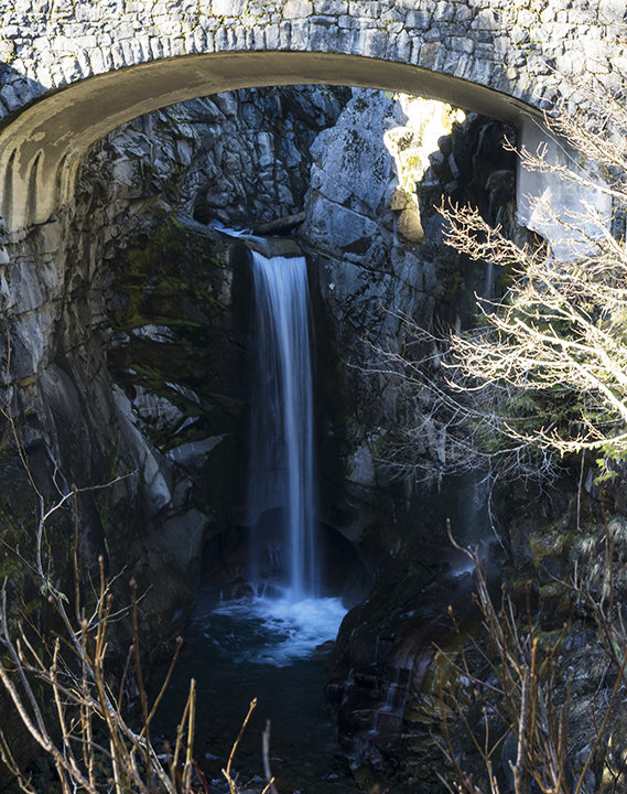
January 30, 2015

Larch Mountain Via Multnomah Falls
16 miles of hiking • 4250' elevation gain •
Hiked into Sherrard Point via Multnomah Falls. Was a great day dodging falling snow and ice from trees as we slowly made our way to the top. Great times! Snow did slow us way down and the hike took us a bit longer than expected.
January 3, 2015