

2013 Trips

 2
2
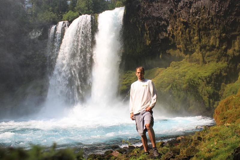
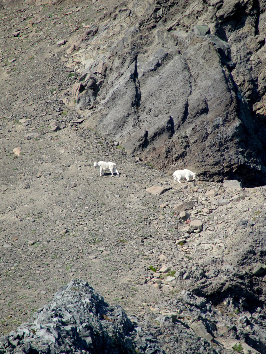
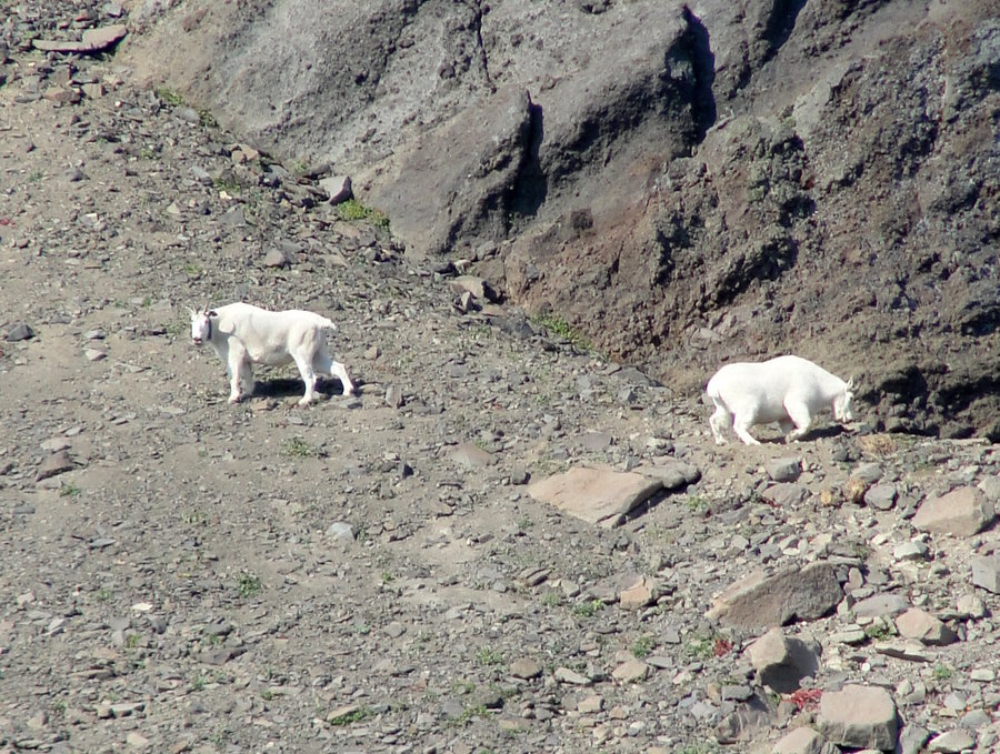
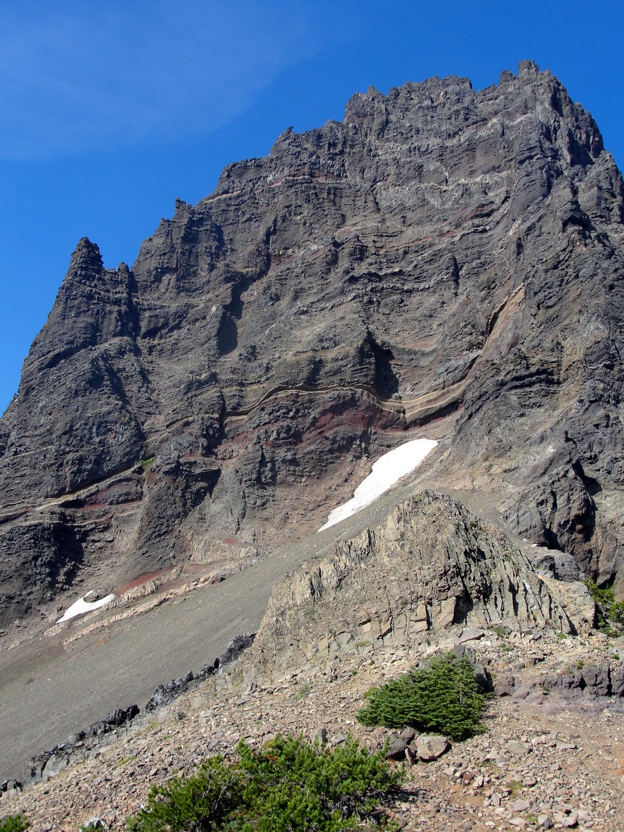
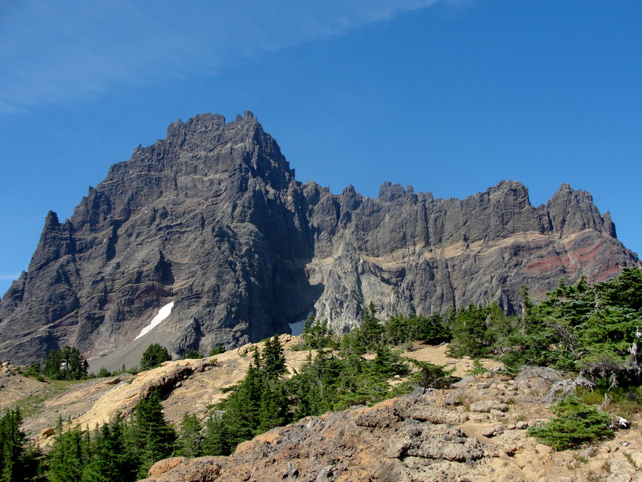
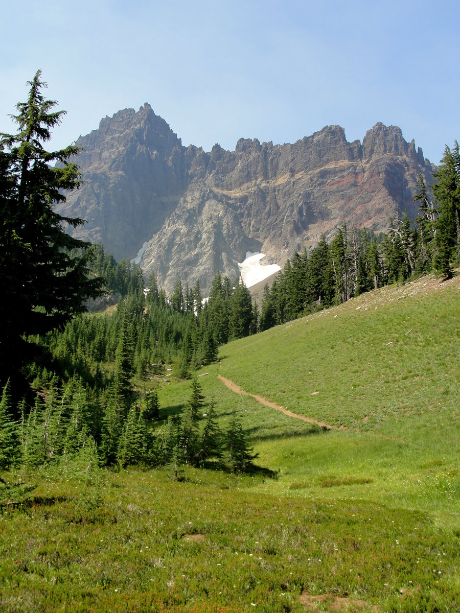
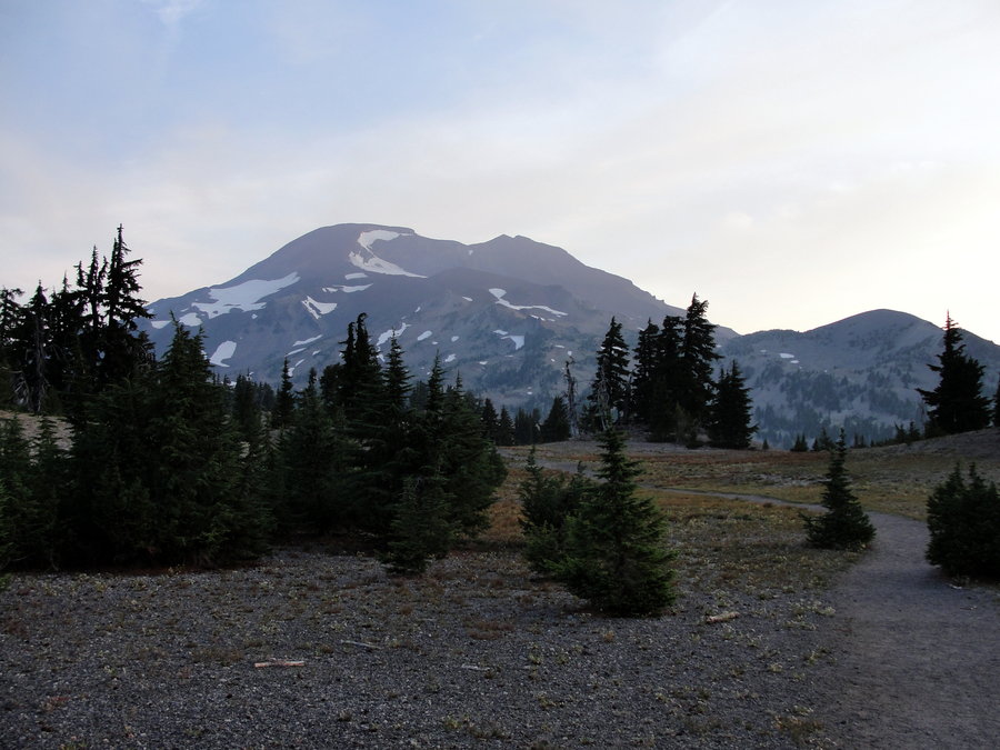
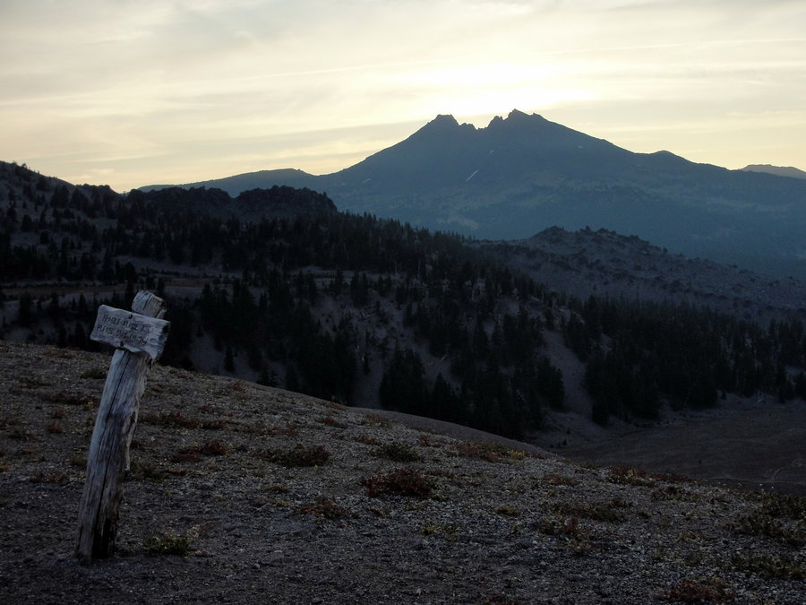
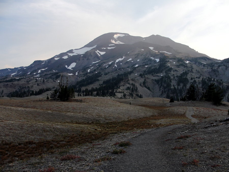
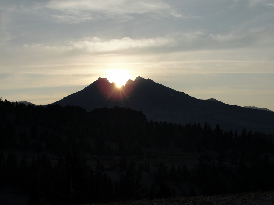
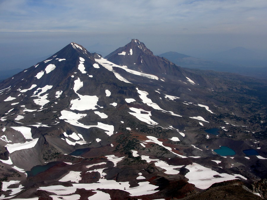
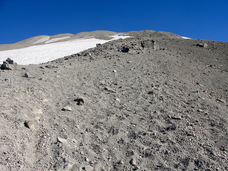
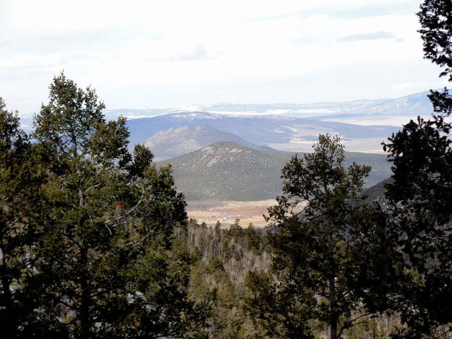
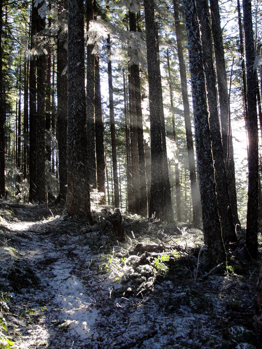
Canyon Creek Meadows w/ Off Trail
8.08 miles of hiking • 1750' elevation gain •
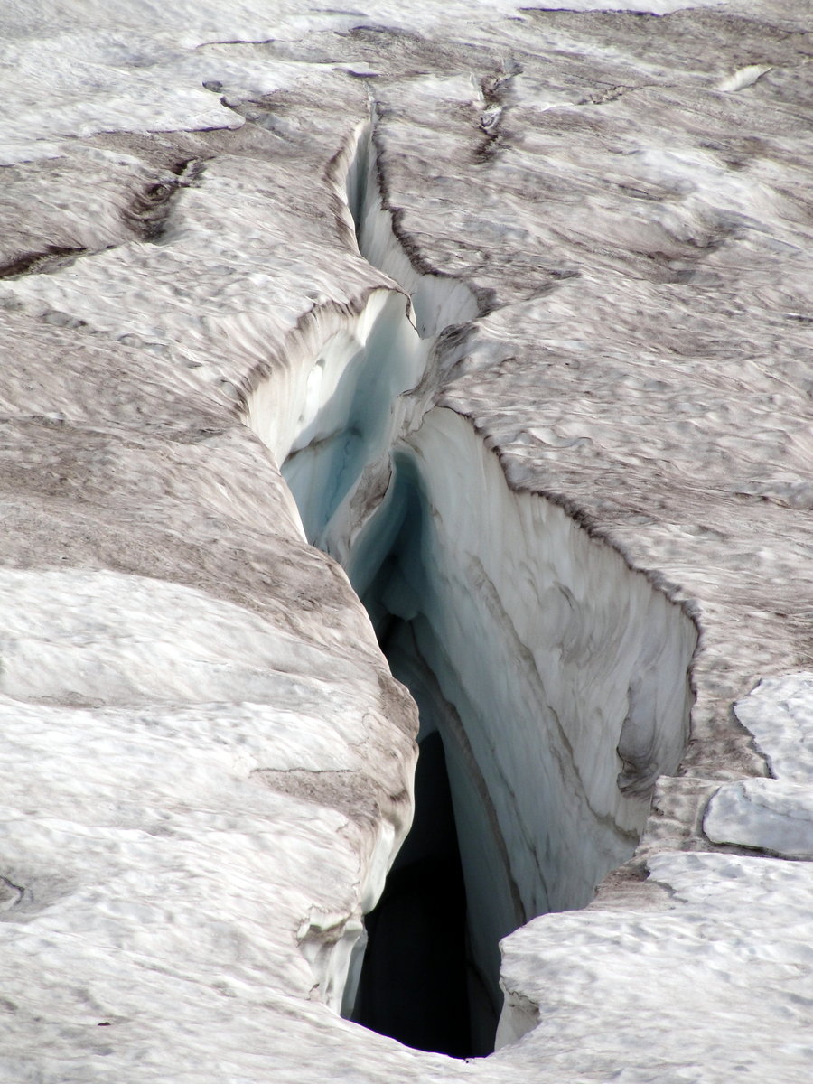
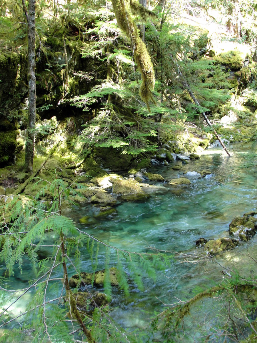
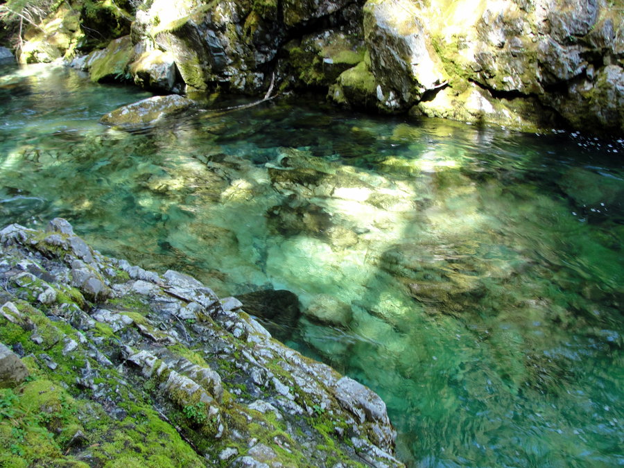
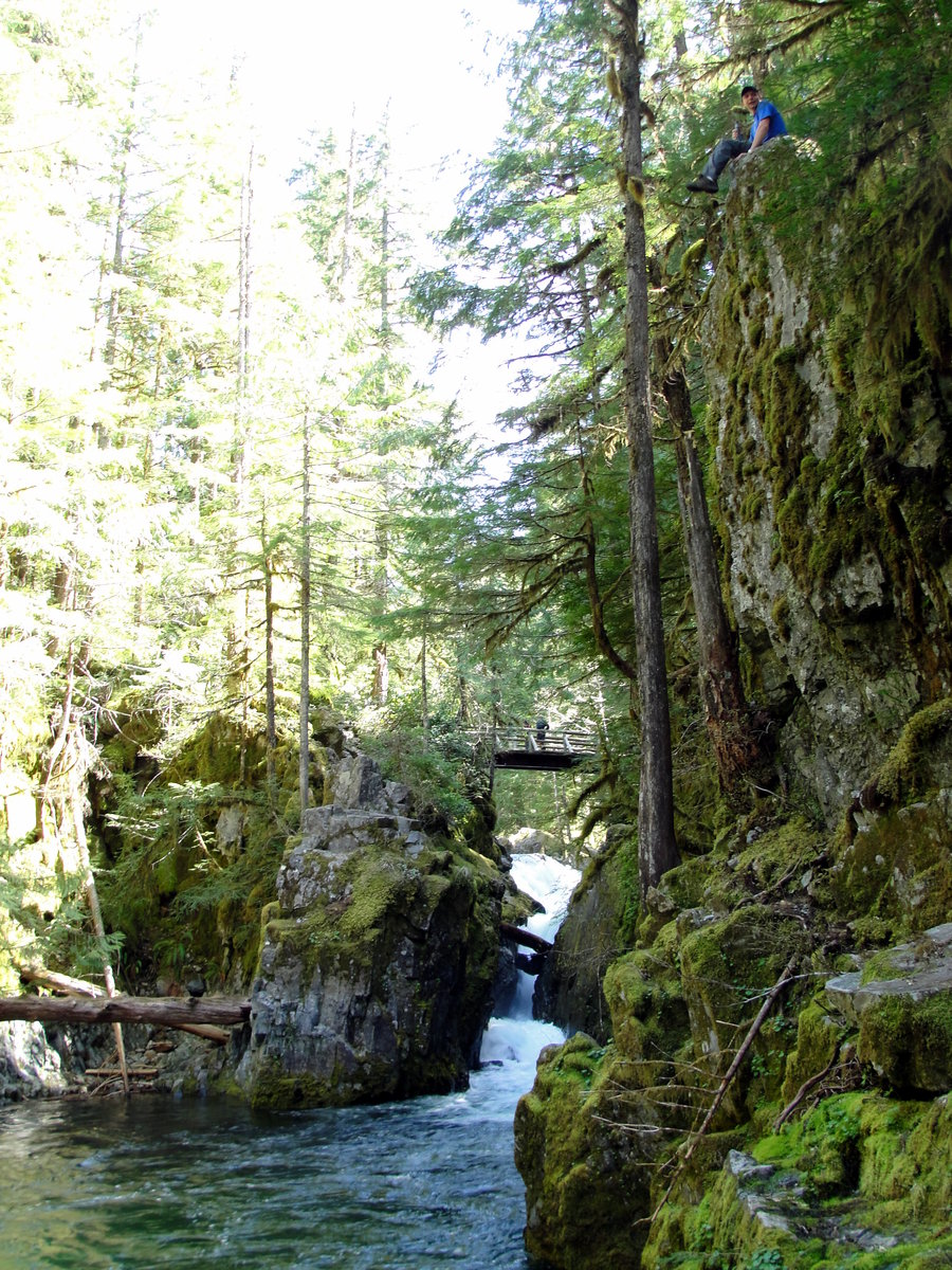
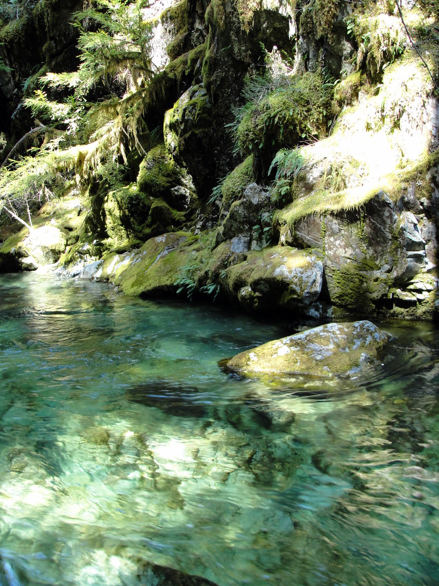
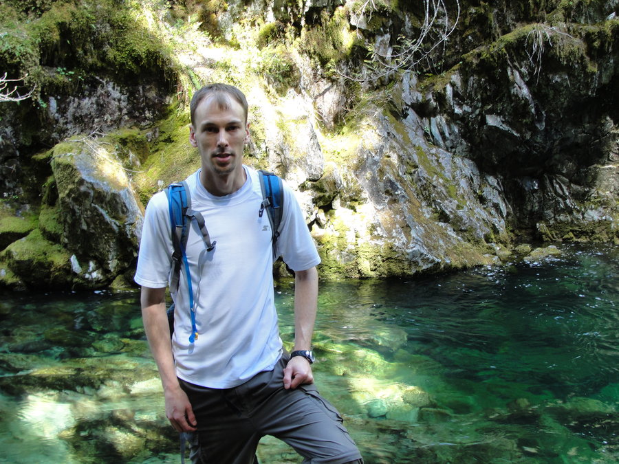
This was a case of the third time being a charm. The first time I had planned to do this hike was last. I had everything all ready to go and then there was the Pole Creek fire... The second time was this Tuesday. I hit the road after picking up some last minute supplies and realized the directions I had were outdated and that route was no longer a viable option. After driving around a bit trying to find an alternate route without a decent road map, I decided I would continue on to my next destination, South Sister. But the third time truly was a charm. I hiked up passed the second meadow and beyond to the lake and moraine and the base of 3FJ. I continued up and gained the ridge line to the south and followed it to the east. I enjoyed the views and some lunch and decided to off trail it back down to the trail.

August 16, 2013


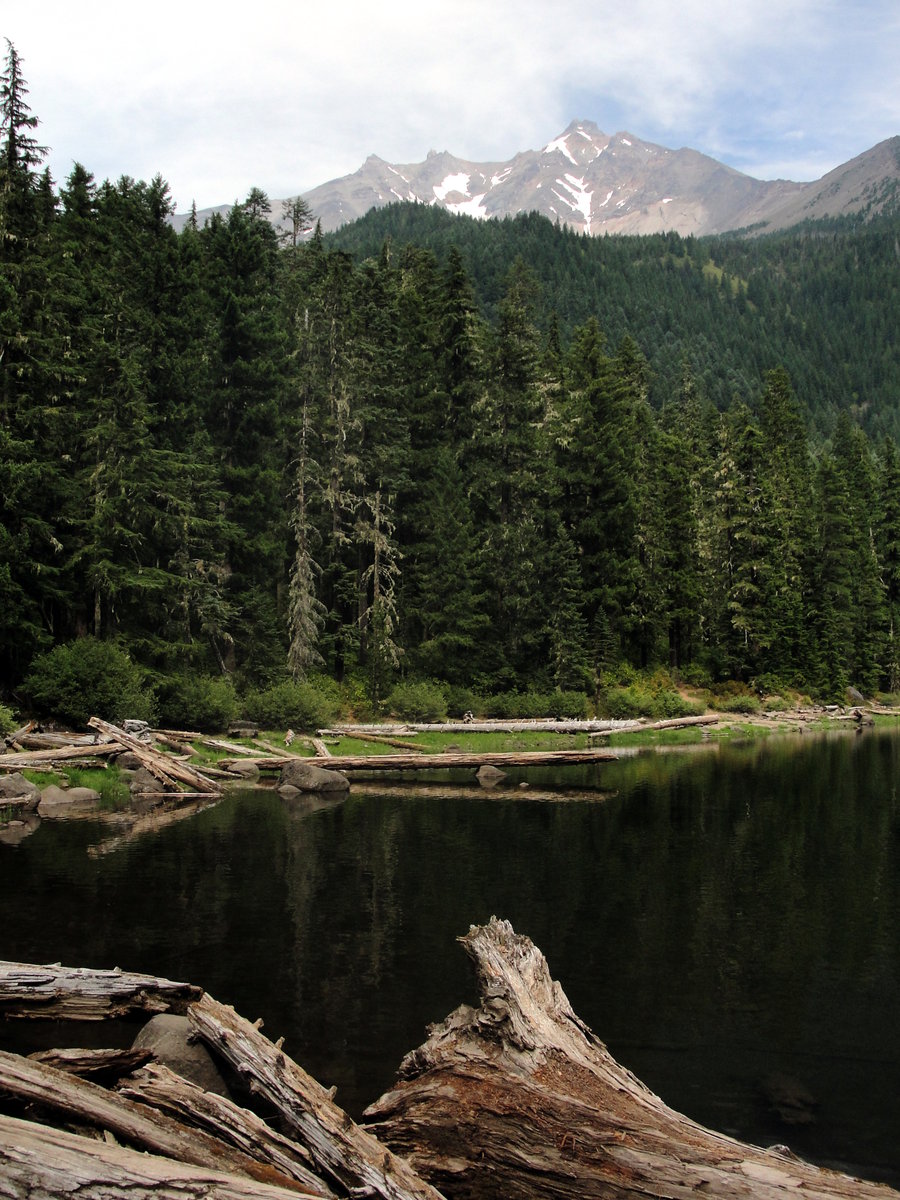
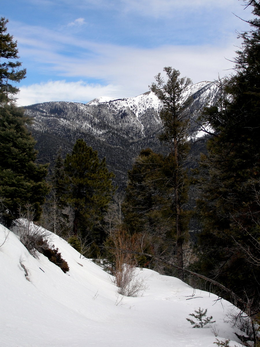
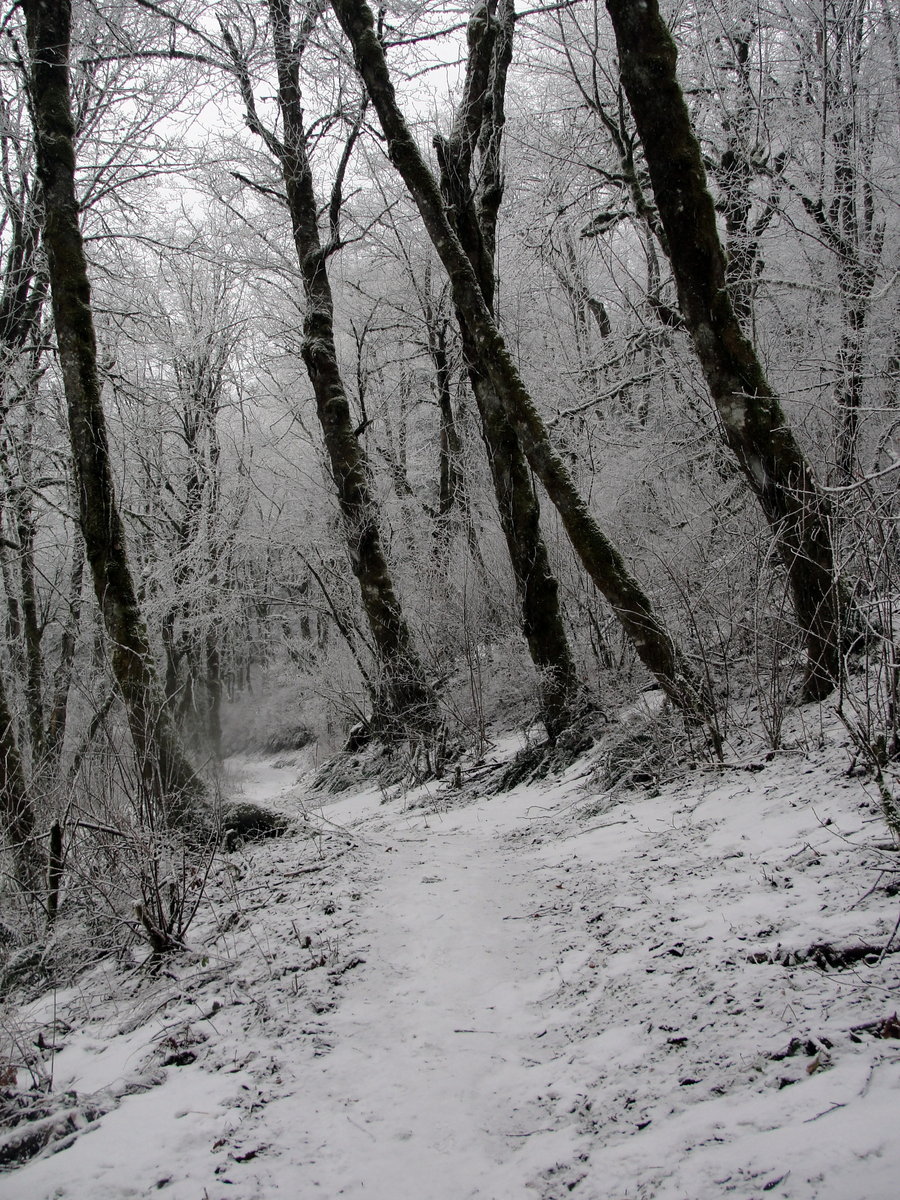
Pamelia Lake
4.49 miles of hiking • 1000' elevation gain •
I was in the area and had been wanting to check out Pamelia Lake.
August 16, 2013


 1
1
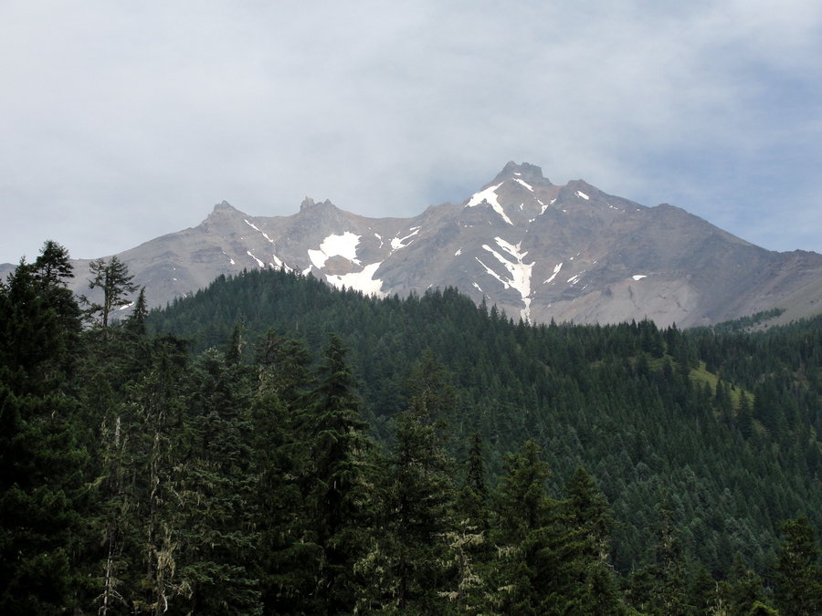
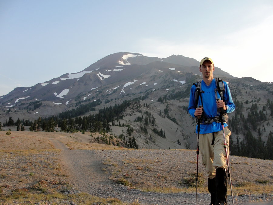
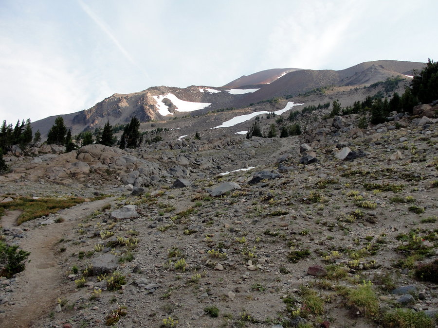
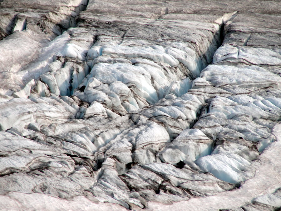
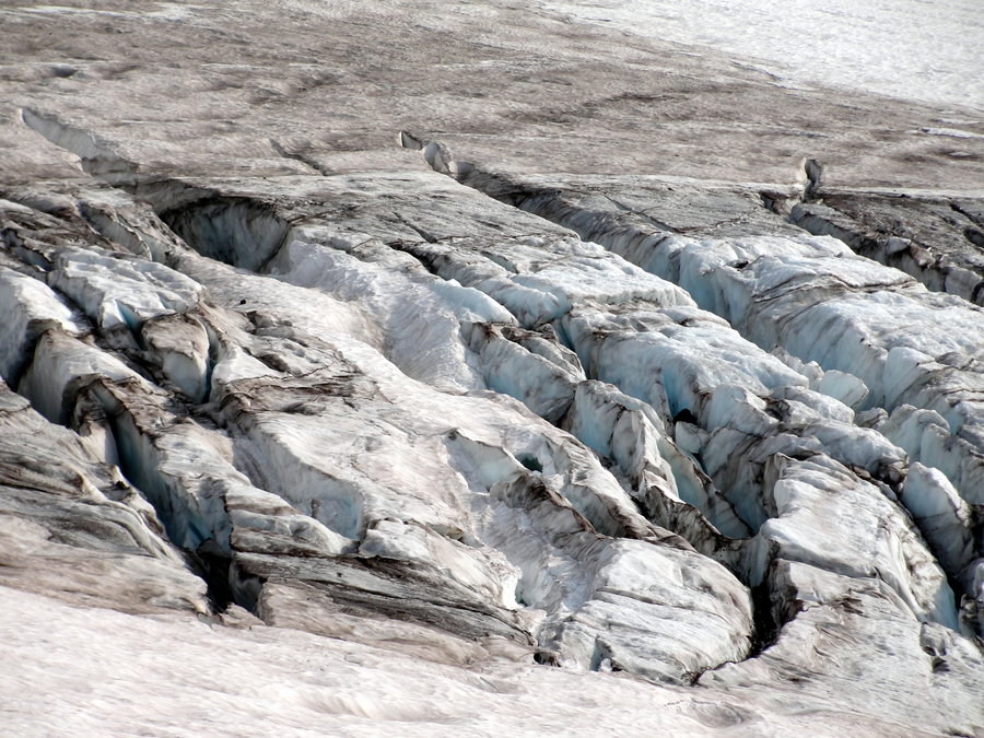
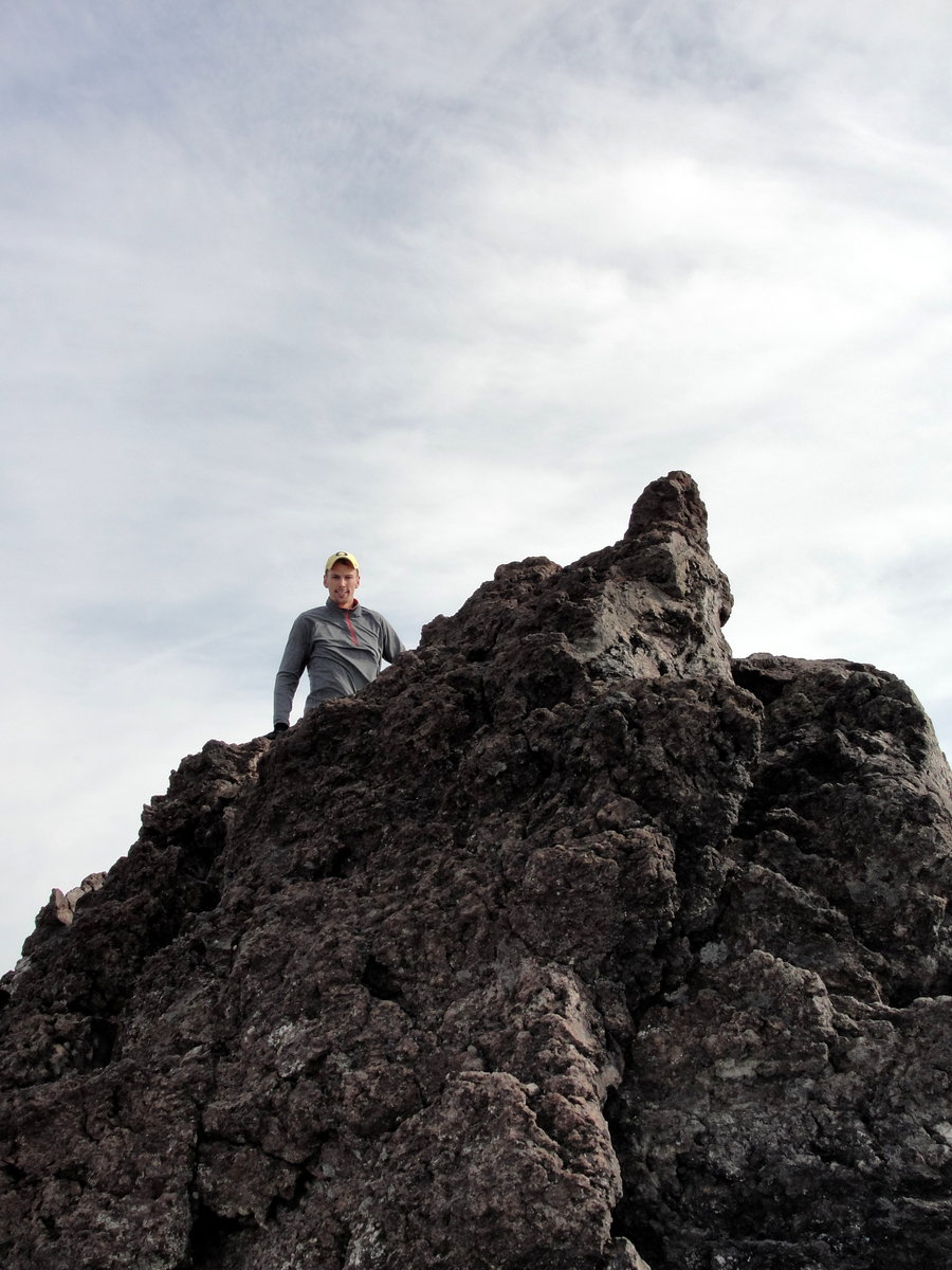
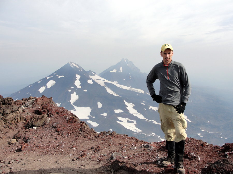
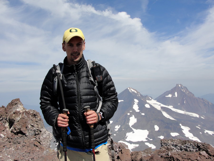
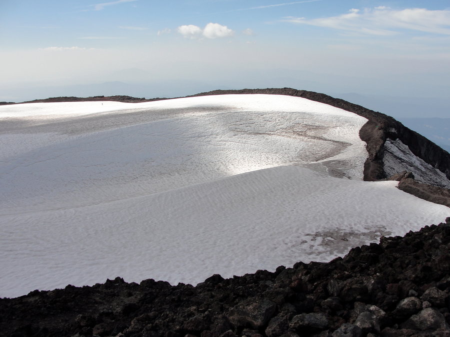
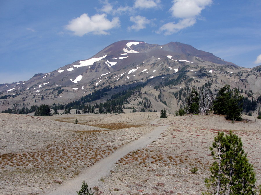
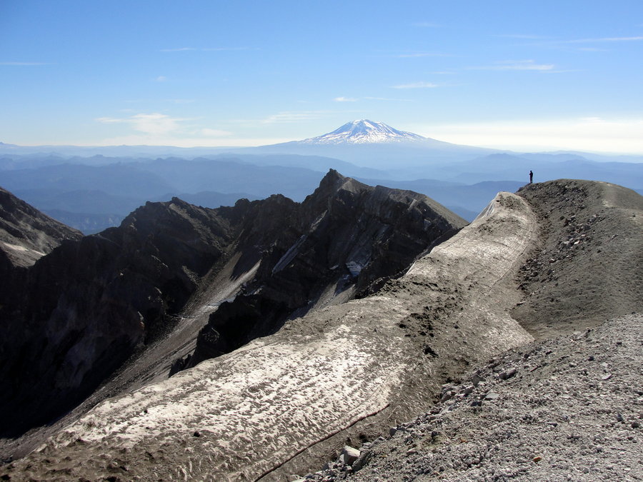
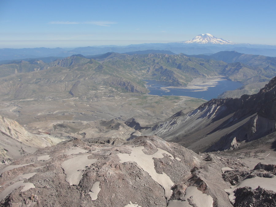
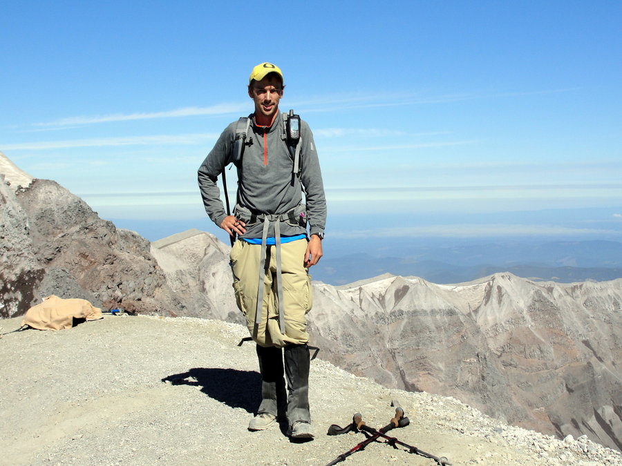
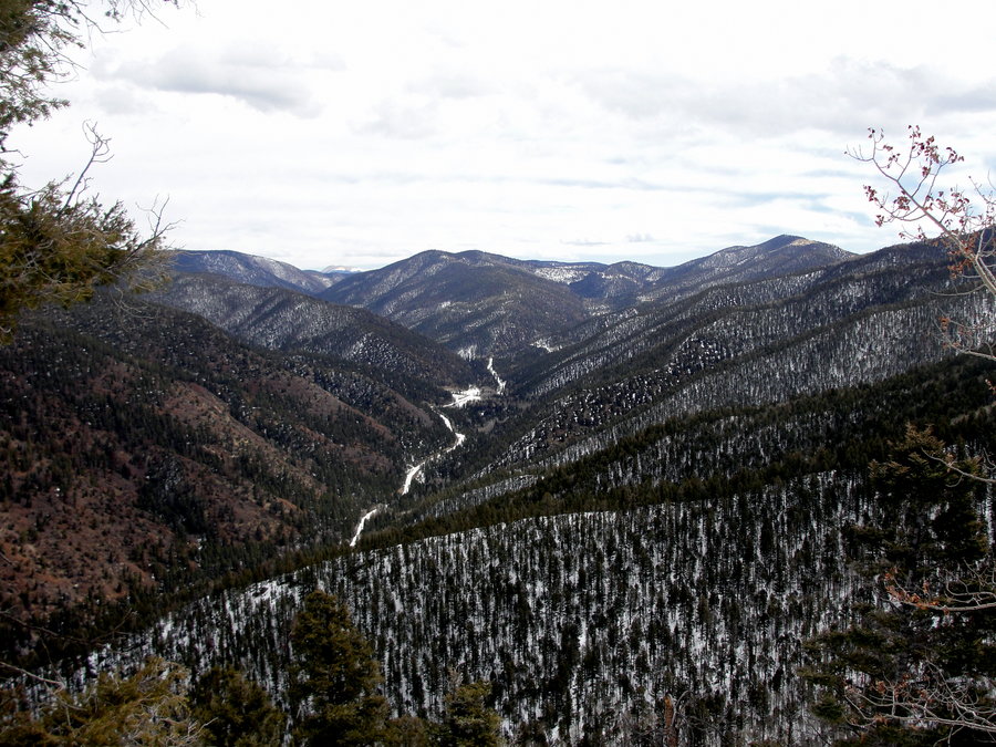
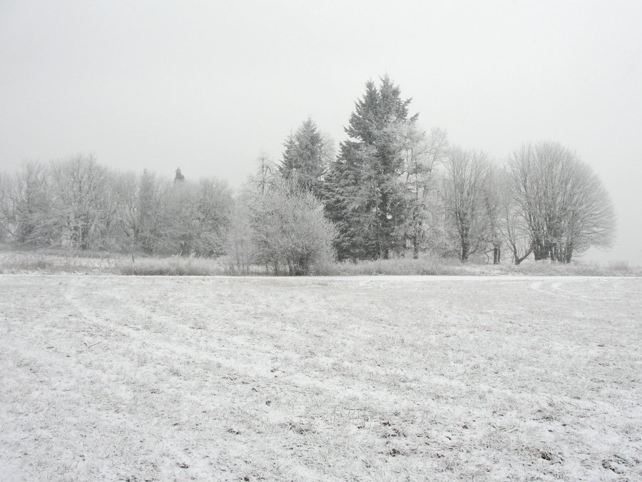
South Sister
12.44 miles of hiking • 5000' elevation gain •
I started under headlamp at 4:45am. I wasn't moving very quick, but had a great time and had the summit to myself for about 20 minutes. I met a really nice British family from Bristol as well as a couple nice guys from Bend. We shared some snacks and stories on the protected ledge facing to the east just below the summit. After some food, we all parted ways and continued our adventures. I looped around teardrop pool and made my way back towards Devil's Lake.
August 15, 2013


August 8, 2013

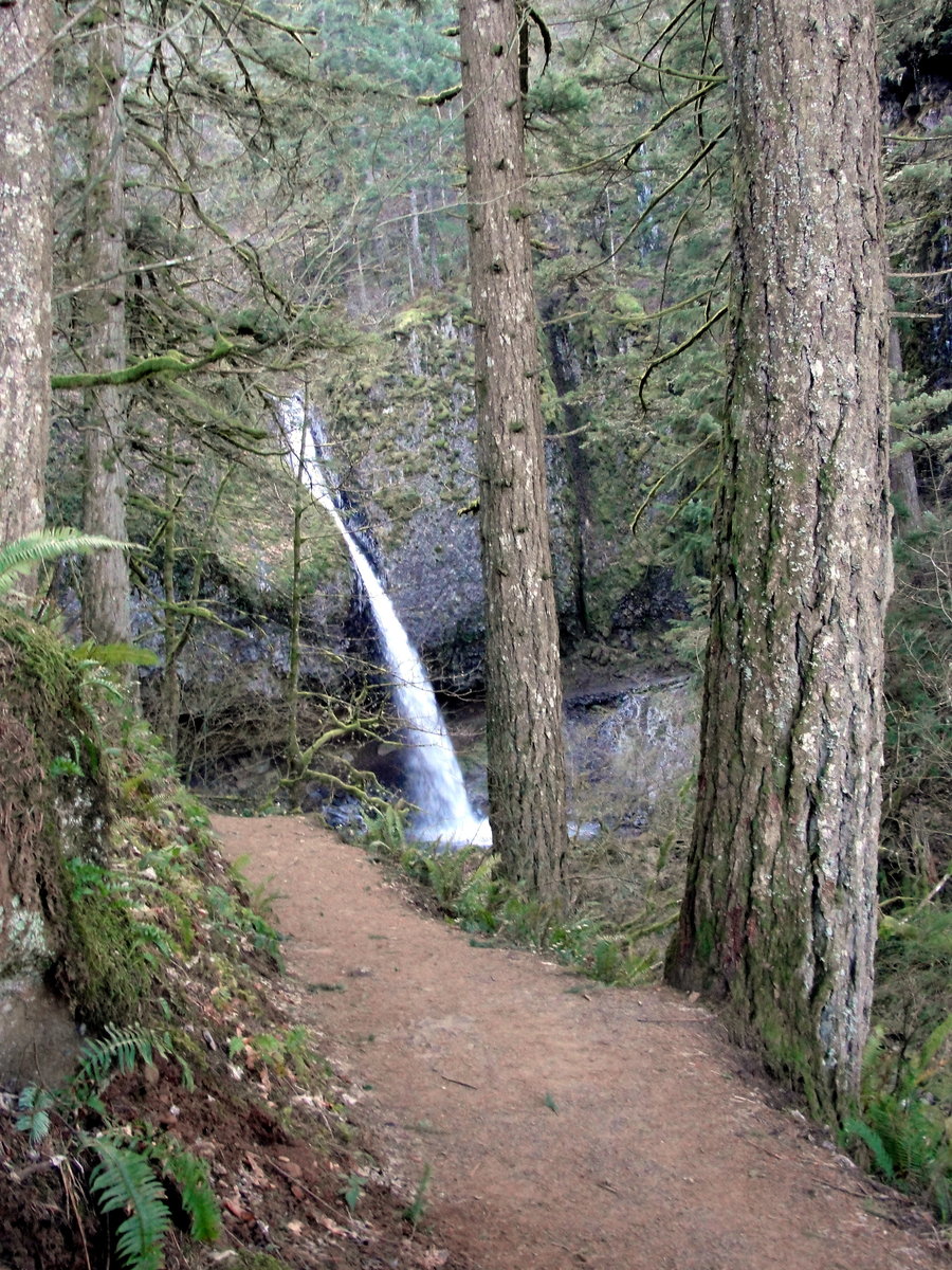
Latourell Falls
2.9 miles of hiking • 750' elevation gain •
Quick morning hike with some friends I haven't seen for a while.
August 4, 2013


July 21 – July 22, 2013


July 20, 2013


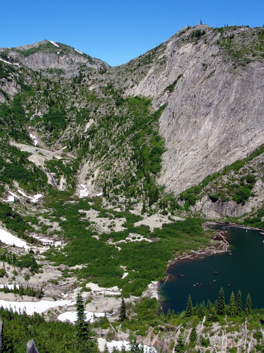
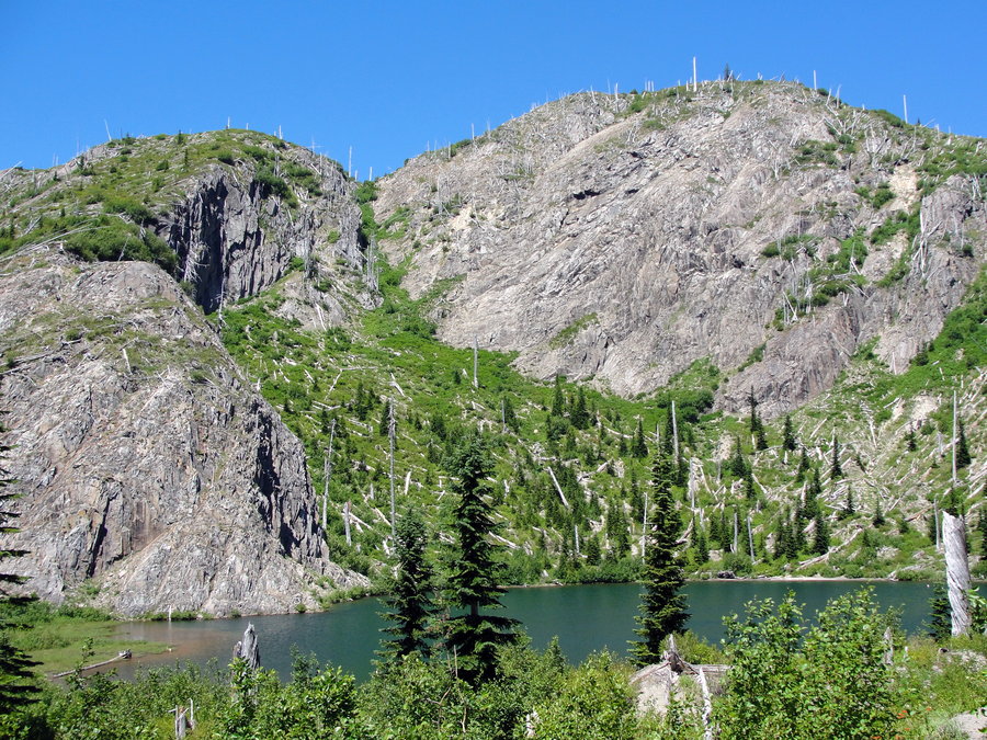
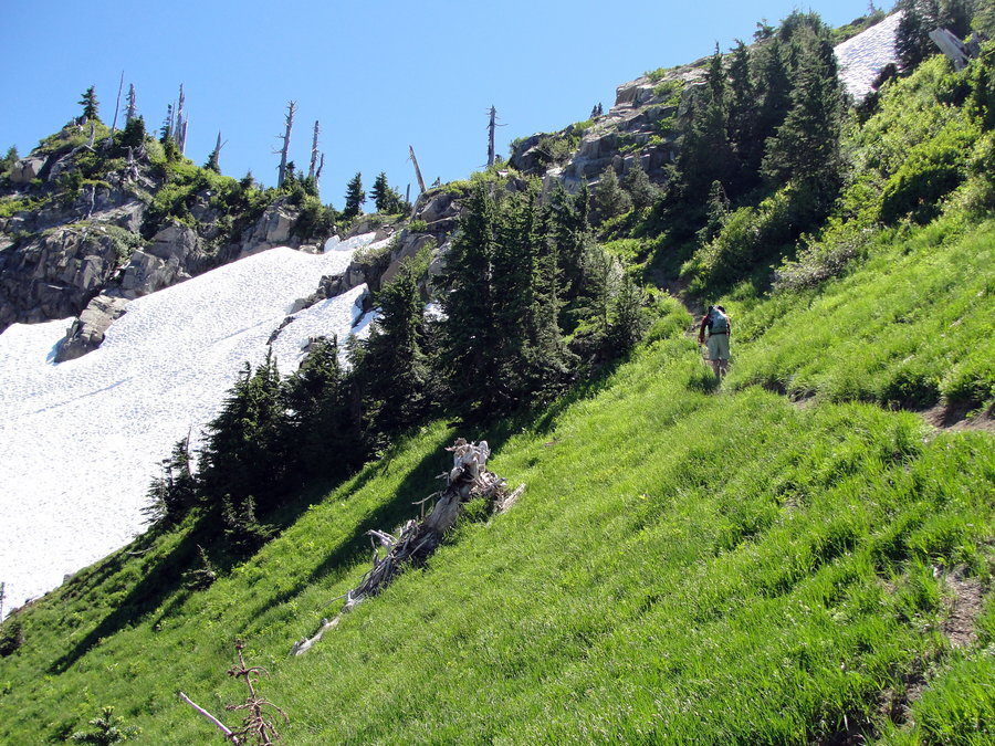
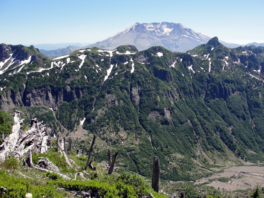
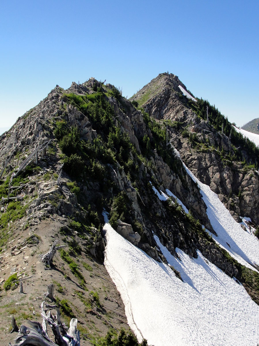

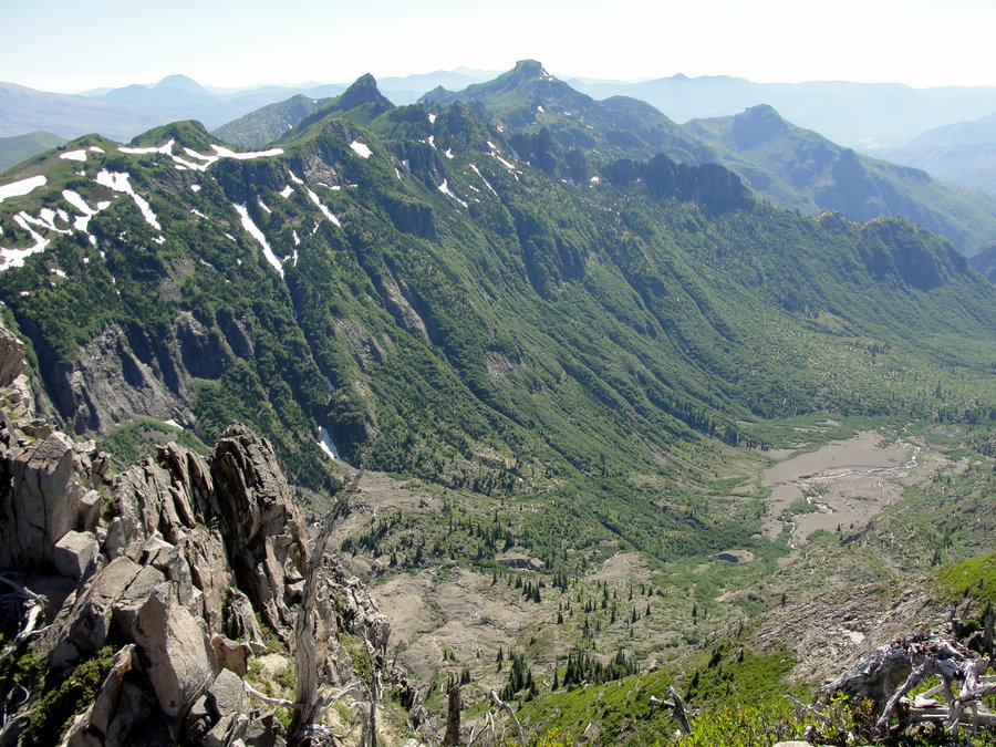
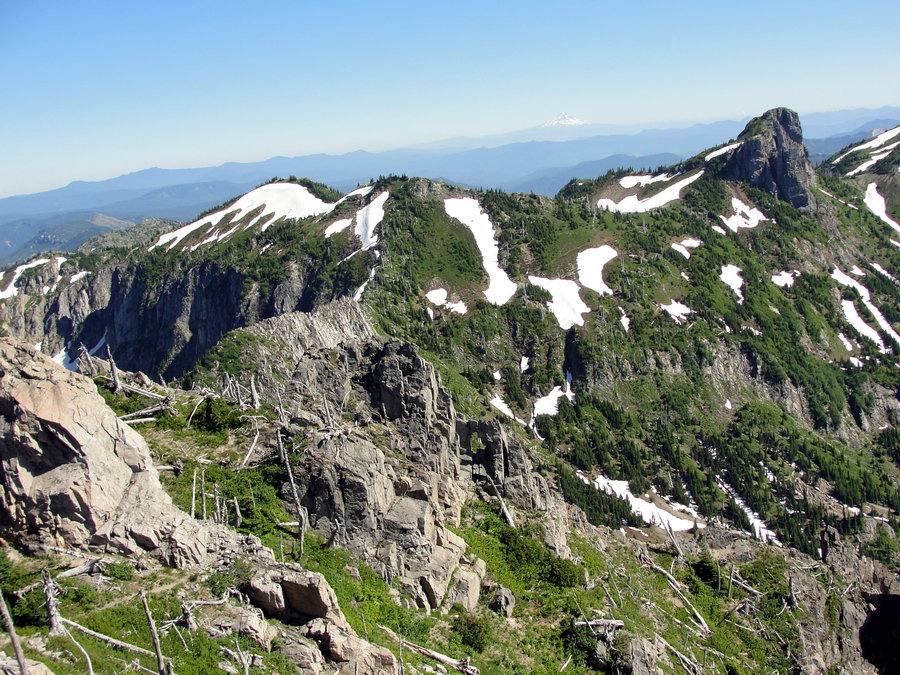


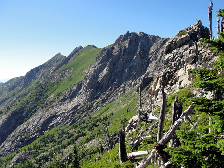
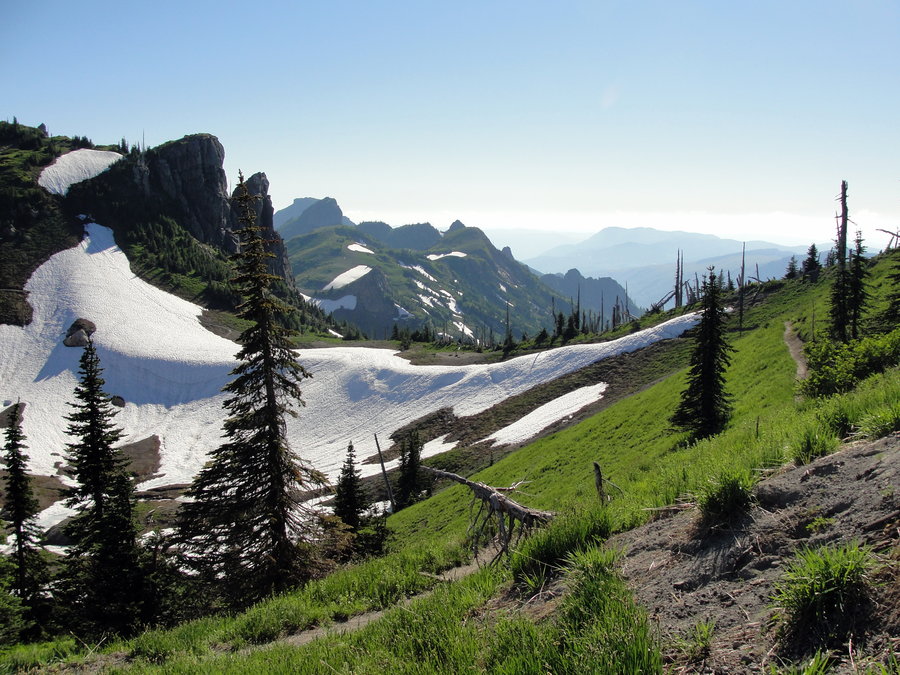
Table Mountain Loop
9.5 miles of hiking • 3500' elevation gain •
This was my first time up Table Mountain and what a treat it was! I started from the unofficial Aldrich Butte TH around 1pm. I took the Heartbreak Ridge trail up and explored around on top of Table Mountain for a bit and also took a little side trip for a ways on the North approach trail. It was much more primitive, but a lot of fun. I took the Westway Trail back down and met back up with the PCT for a short while and continued back to the rig.
July 15, 2013

July 13, 2013

Gilette Lake
7.2 miles of hiking • 1500' elevation gain •
I got a last minute invite to join some SAR buddies on a relaxing lunch hike to Gilette Lake. I hadn't done any of my own research on this particular trail so I was surprised and disappointed when I realized much of it was through clear cuts. But it's hard to beat a day on the trail with good people none the less, and lunch at the lake was peaceful. We continued on to a small pond about half mile past Gilette Lake and explored for a few before having to turn around to meet some dinner obligations for the evening. We had been following behind a couple by about 100 yards on the way back to the TH when we came around a corner and they were standing there. The guy asked if we had any bear spray or a gun. He had just seen a cougar less than 100 yards away. I never did get a glimpse of the furry feline, but I don't expect he stuck around that area for long. From there, it was a pretty uneventful, but enjoyed hike back to the TH.
July 6, 2013


Short Evening HIke
2.2 miles of hiking • 500' elevation gain •
Very short evening hike down the 424 and turned around at the junction with the 444 and return to the parking lot. Nice day for a short stroll, but I would have liked to have continued on.
June 27, 2013

Champoeg State Park
9.1 miles of hiking • 500' elevation gain •
I'm staying in the Wilsonville area for several months so I decided to do a quick hike over at Champoeg State Park. It was lazy hike, but it was nice to get outside none the less.
June 26, 2013

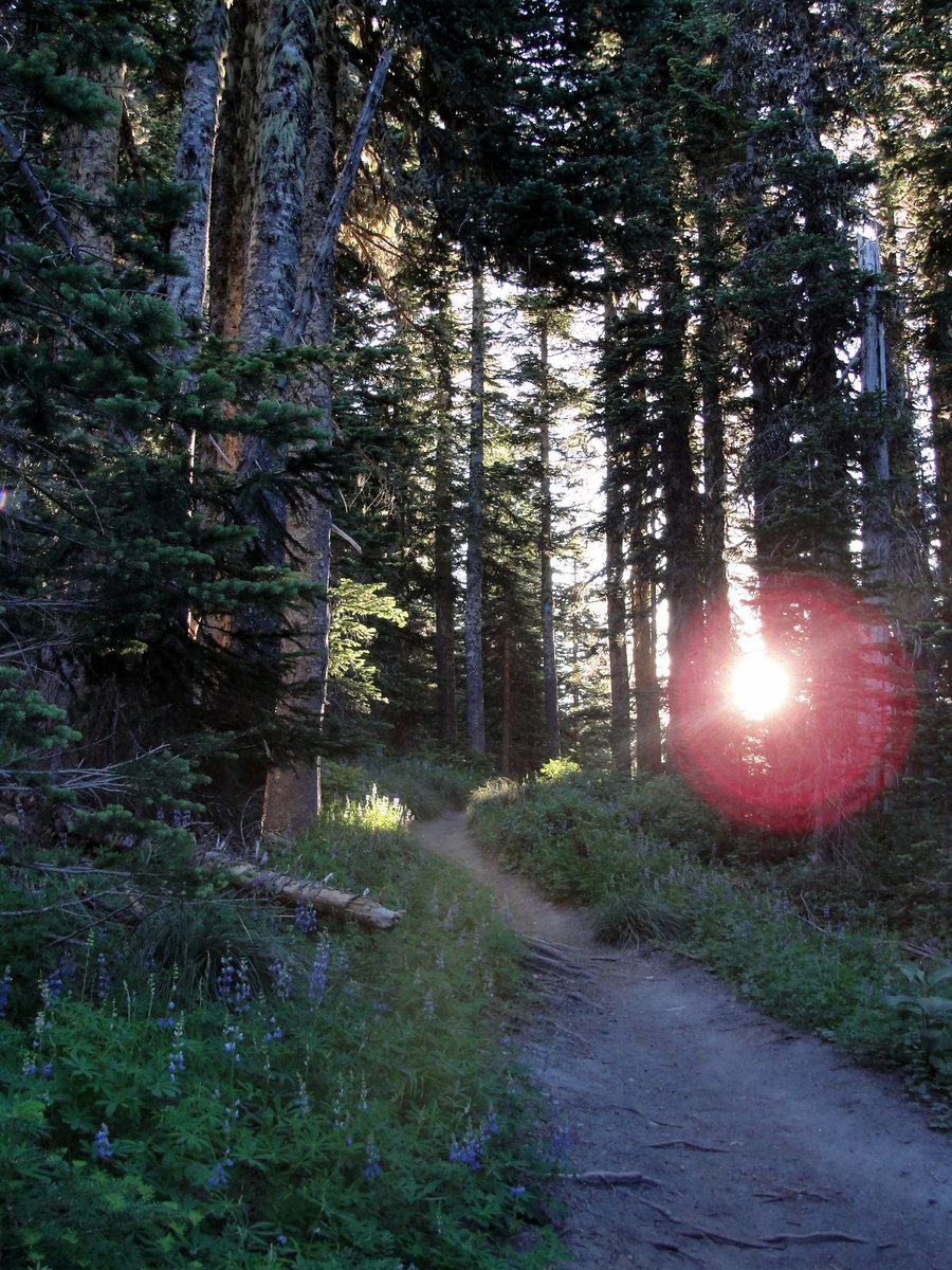
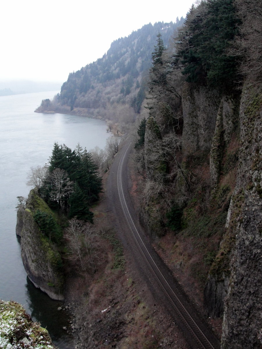
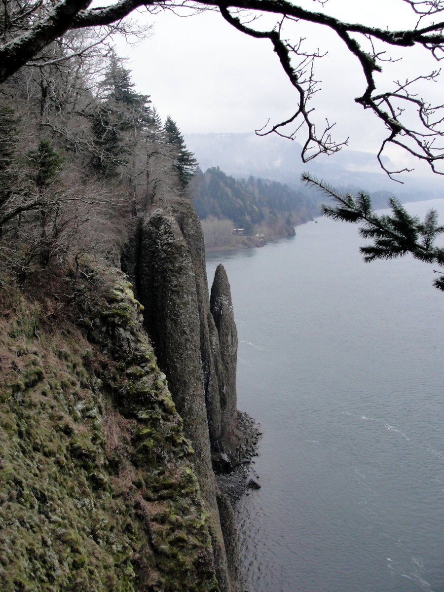
Eagle Creek - Tunnel Falls and Schwack
13.8 miles of hiking • 1750' elevation gain •
I left the house just before 6am and made a quick stop at Denny's for a quality pre-hike meal. I met a buddy just after 7am in troutdale and we were Eagle Creek bound. We were hoping to beat the masses of people out there this morning and at least have a quiet hike to Tunnel Falls. Apparently, everyone else had the same idea. Which really was no surprise on a nice Saturday in the middle of June, but who says one can't be hopeful! All and all, we had a great day hiking and playing around with a few different photo experiments, but we will have to return again soon and apply our lessons learned.
June 22, 2013

June 15, 2013

Marquam Trail - Wildwood Trail
9.6 miles of hiking • 2000' elevation gain •
I wasn't able to escape the city limit's, but an in town hike is better than no hike!
June 10, 2013

Falls Creek Falls - On and Off Trail
7.6 miles of hiking • 1500' elevation gain •
This was hike 1 of 2 for the day so I hit the trailhead early. When I arrived at 630, there was only one other car in the lot. It was a peaceful morning as I didn't see anyone until I was past the 5 mile mark of the hike and half way back to the rig. I really enjoyed the hike, although I thought the top part of the loop was less scenic then the lower loop that I took on the way in. I guess I should be more specific. The Top loop heading to the overlook above the falls was great, but the part from the primitive cut-off trail back to the trailhead is what I referring to. All and all, it was a great start to a great day on the trail.
June 8, 2013

Hamilton Mtn Loop
8 miles of hiking • 2500' elevation gain •
Hike 2 of 2 for the day. I took advantage of the exempt day for the Discovery Pass as I've yet to give in on that one. It will happen sooner or later though. Probably sooner rather than later actually. There are some great viewpoints along the way making the ascent seem easier.
June 8, 2013

Council Crest - Shoe Fail
3.4 miles of hiking • 750' elevation gain •
I didn't have time to escape the city today, so I settled for the nearby Council Crest. I set off at the Terwillger Boulevard Trailhead by about 3:45pm. Within a mile, I quickly realized that either the shoes or socks weren't going to cut it. Maybe both. At the 1.7 mile mark, I reluctantly turned back for the car. It was almost laughable to think I had to abort a Council Crest hike!?! But in the end, I knew I wanted my feet for the weekend. Saturday and Sunday are both exempt days for the Discovery Pass after all.
June 6, 2013

McIntyre Ridge to Wildcat Mountain and Beyond
8.5 miles of hiking • 1750' elevation gain •
June 2, 2013

Hardy Ridge Loop
8.5 miles of hiking • 2250' elevation gain •
I've been wanting to do Hardy Ridge for quite some time now but I haven't broke down and bought the Discovery Pass. So when I read that today was going to be a "exemption" day, I knew where I was heading. I was really glad to finally make it up there. I was surprised how few people I saw on the trail being a Saturday afternoon with nice weather. What a great day on the trail!
June 1, 2013

On and Around Multnomah Basin Road
6 miles of hiking • 1250' elevation gain • 2 nights
Spent two nights off Multnomah Basin Road.
May 19 – May 21, 2013

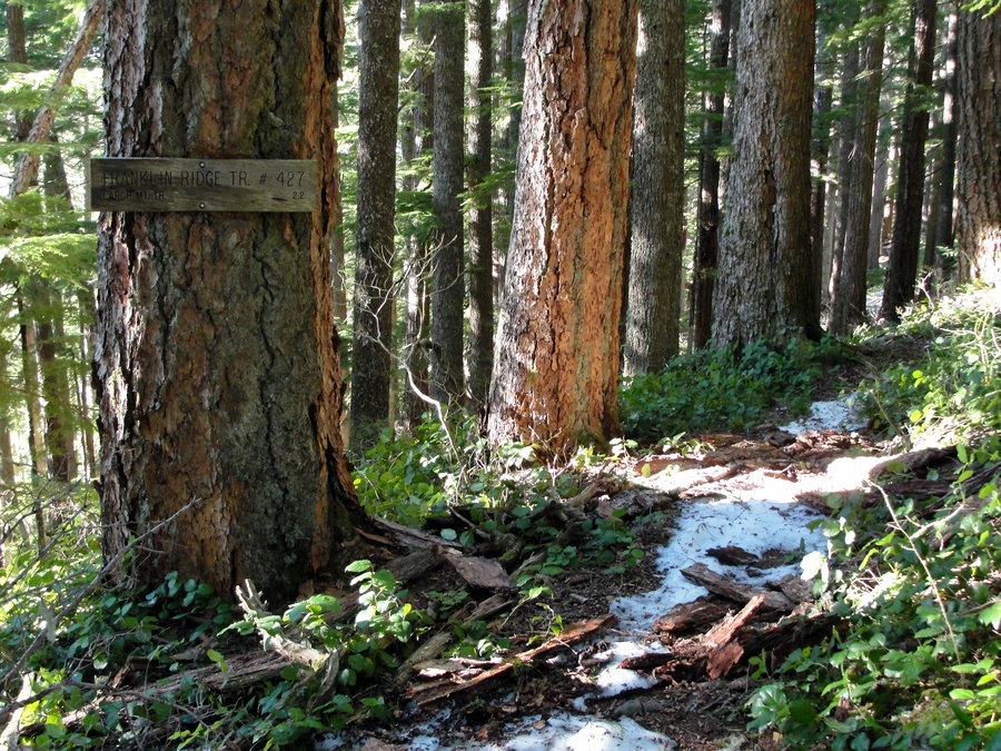
Larch Mountain From Multnomah Falls
15.75 miles of hiking • 4750' elevation gain •
I started towards Larch Mountain from Multnomah Falls at 1:30pm. My energy level was a bit on the low side all day, but I just took my time and made it to Sherrard Point. Its nice to have Sherrard all to yourself on a clear afternoon, something that is only possible before the snow gate is open. Speaking of snow... The parking lot still had several feet of snow but looked like it was melting quick. There were parts of the road right below the parking lot that had snow up to the guard rail, but then other parts had nearly melted out below that. So it shouldn't be long before the snow gate is opened up.
After having some snacks up on Sherrard, I decided I would drop down the Oneonta Trail and take Multnomah Creek Way and go through the crater. I heard two coyotes howling back and forth as I was about to climb back up the 100' to meet the Larch Mountain Trail again but never laid eyes on them. It was pretty uneventful but peaceful on the way back down to the Multnomah Basin and on to the car.
May 11, 2013
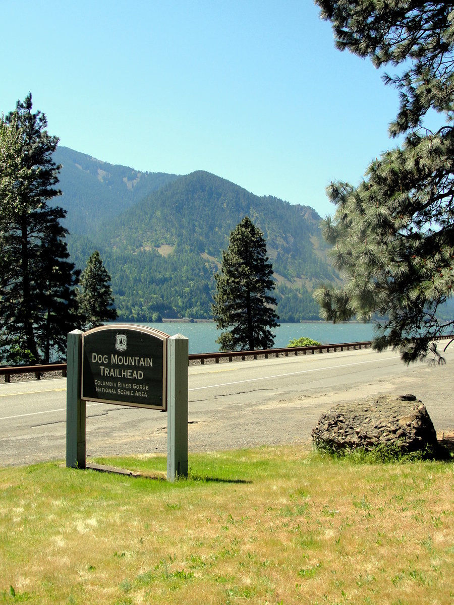
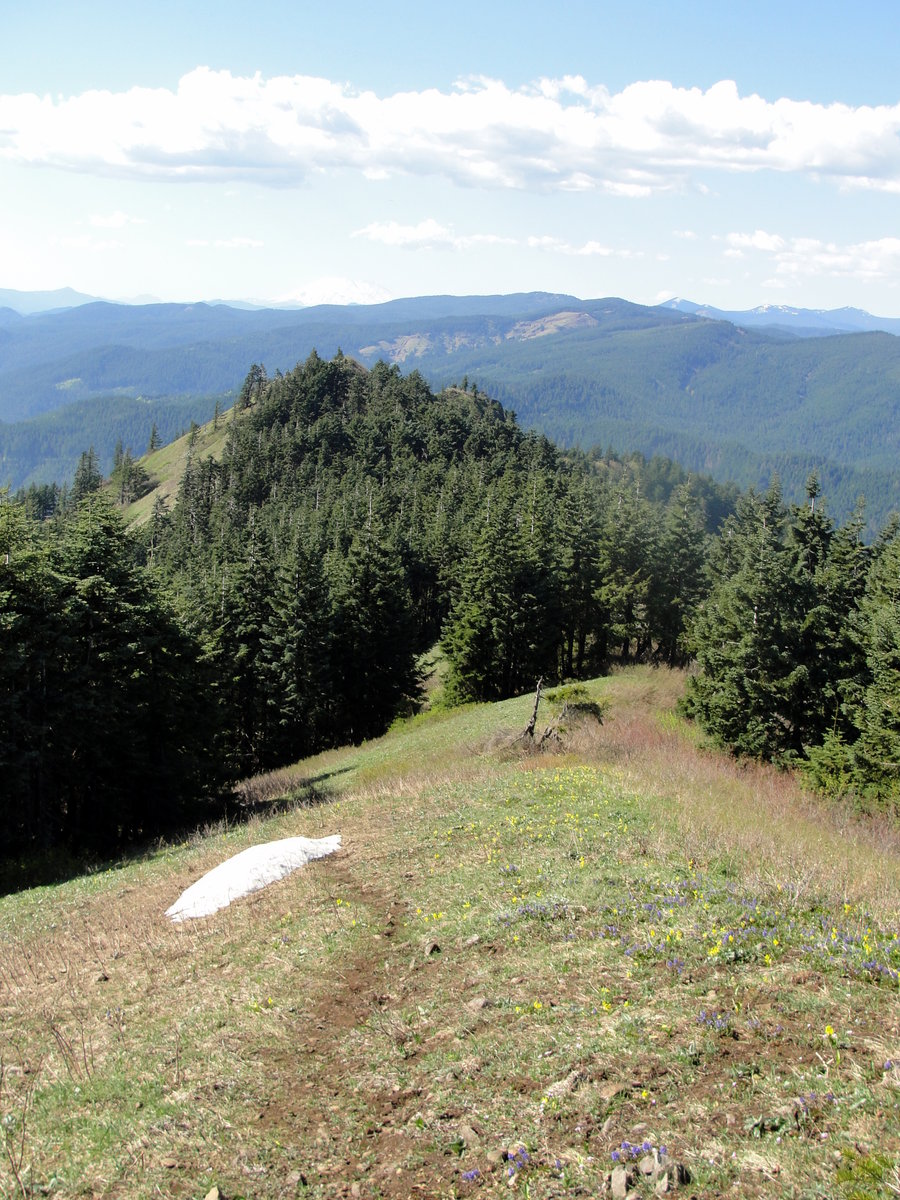
Augspurger Mountain
14.2 miles of hiking • 5500' elevation gain •
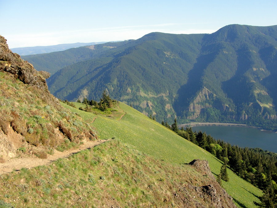
I decided to head for the often overlooked, Augspurger Mountain. I'm amazed that more people don't venture beyond the junction of Augspurger and Dog Mountain trails. But I'm not about to complain, I enjoy the serenity! I got a fairly late start, but with some extra layer's and headlamp in my pack, I wasn't concerned. I left the Dog Mountain trailhead at exactly 1pm. I opted to take the easier Augspurger trail to gently gain elevation up to the Augsurger/Dog Mountain trail junction. Here I dropped down several hundred feet before I began the ascent on the other side.
It was a steady 'climb' coming up the other side before I came to a four-way junction under the power lines. Shortly after this, I came to a hairpin in the road cutting back on it's self to the left. In the middle of the hairpin, there is a flagged trail on the right side of the road. I stayed right here on the flagged Augspurger trail. I continued up the eastern side of the ridge and switched back several times before reaching a nice open ridge-line with views of Mt. Hood, Mt. Defiance, Wind Mountain and the Gorge looking west. I took in some views here and continue on up to the forested summit. I continued just over a tenth of a mile back down the other side to a beautiful open ridge where I enjoyed a bite to eat.
After stuffing my face and taking some pictures of St. Helen's, Raininer, and Adams, I turned around and headed back for the junction of Augspurger/Dog Mountain trails. As I reached the junction, I decided I couldn't be this close to Dog Mountain without getting up there. So I decided to make a bit of a 'loop' out of the trip. I hiked up to the summit of Dog Mountain and took in the great, but still premature, wildflower display. After a quick stop at puppy dog, I was ready to get back to town and have me a greasy cheeseburger! As I arrived back at the trailhead at 8pm, my knee's were overjoyed to have a seat. But it was worth every second of it!
Note: Augspuger Mountain is best hiked in the Spring, just as the snow is melting off and before the trail get's overrun by the brush.
May 6, 2013


May 3, 2013

April 28, 2013


Angel's Rest - Devil's Rest - Wahkeena Loop
10.9 miles of hiking • 2750' elevation gain •
April 24, 2013


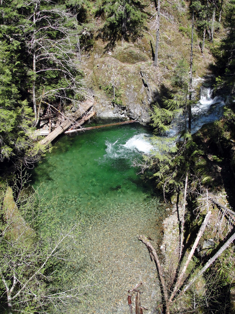
Wahclella Falls April Fool's
2 miles of hiking • 0' elevation gain •
I had planned on hiking up Hardy Ridge, but shortly before reaching the Bridge of the Gods, I remembered that a Discovery Pass is now required. So I decided to turn around in Cascade Locks and hopped on 84 heading westbound. As I was driving past the Eagle Creek exit, it dawned on me... It's Monday, maybe the hordes of people were at work!?! I decided to take the next exit and turn around for Eagle Creek. Just as I was about to hop back on 84 eastbound, I saw the trailhead for Wahclella Falls... I had been wanting to check it out, but it's very short hike. I thought about hiking this first and then heading over to Eagle Creek. Ahhhh what to do... I was beyond indecisive for some reason on this fine April fools day. So I decided a short peaceful hike may be the way to go. If I had decided to hike Eagle Creek, I would probably still be out there trying to decided on 'if this is the best spot to turn around.'
It may have been a short hike, but it was offered a heavy dose of scenery!
April 1, 2013


Angel's Rest from Brower Rd and Palmer Mill Rd
7.5 miles of hiking • 1500' elevation gain • 2 nights
March 17 – March 19, 2013

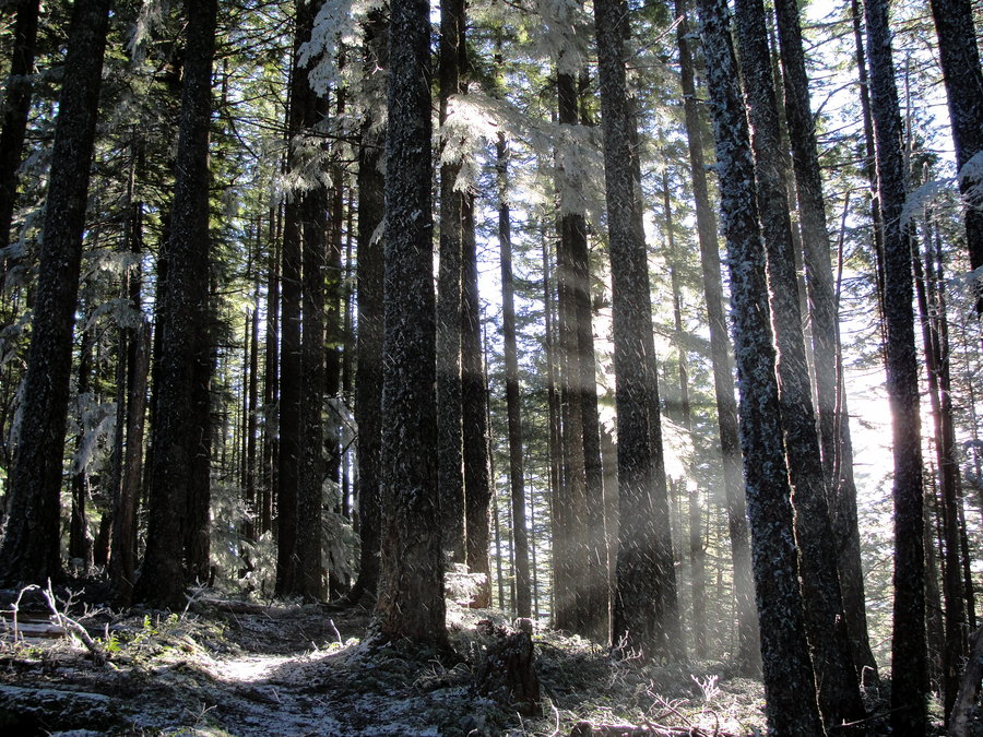
Peak 10812 - Sangre De Cristo Mountains
4 miles of hiking • 2000' elevation gain • 1 night
I took a road trip down to New Mexico to visit a really good friend. We managed to knock out 6 states (Oregon, Idaho, Utah, Wyoming, Colorado and New Mexico) in just under 30 hours with pit-stops. We had planned to take it a bit slower and enjoy some sites along the way, but the weather closed on us much quicker than anticipated. Fortunately, we were able to beat the road closures and made it safely to our destination.
After some rest and acclimation, it was time to load up the packs and get going! We decided to hit an unnamed trail that leads to several peaks behind my buddies house. It was very powdery snow and we didn't have any snowshoes... Bring on the post holing! Easy to say when your still at the trailhead in ankle deep snow... Within a half mile, it began getting a bit deeper and we would randomly sink in to our knee's. Within a mile, every step was to our knee's. Within a mile and a half, we would randomly start sinking to our waist. So, we pushed on just past the 2 mile mark and decided it was time call it. Nearly every step, half our body would disappear into the snow, and we just didn't want to risk any lower body injuries. So we pitched the tent at the next suitable site. We stuffed our faces with some good grub and got a nice fire going for the 10 degree night that would soon be upon us.
We awoke to a beautiful sunrise and quickly stoked the fire. After a nice warm breakfast, we got packed up and started down the mountain. With the help of gravity, our path from the previous day and the 'harder' packed morning snow, we made much better time heading down.
It was a wonderful trip and I look forward to visiting again in the Summer/Fall when the weather and trail conditions allow for some more exploring.
March 7 – March 8, 2013


Hoyt Arboretum
8 miles of hiking • 1000' elevation gain •
I was short on time, but decided to I would head to Hoyt Arboretum and make the most of the little time that I did have.
January 30, 2013

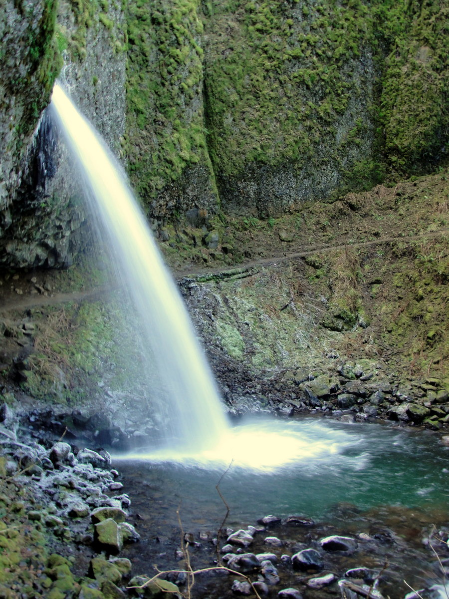
Horsetail Falls - Franklin Ridge - Multnomah Basin
12.8 miles of hiking • 2750' elevation gain •
January 21, 2013


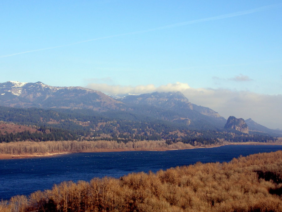

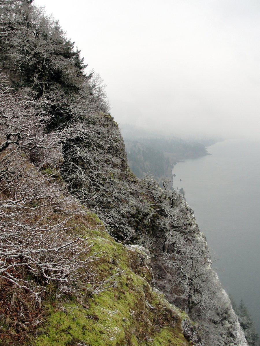
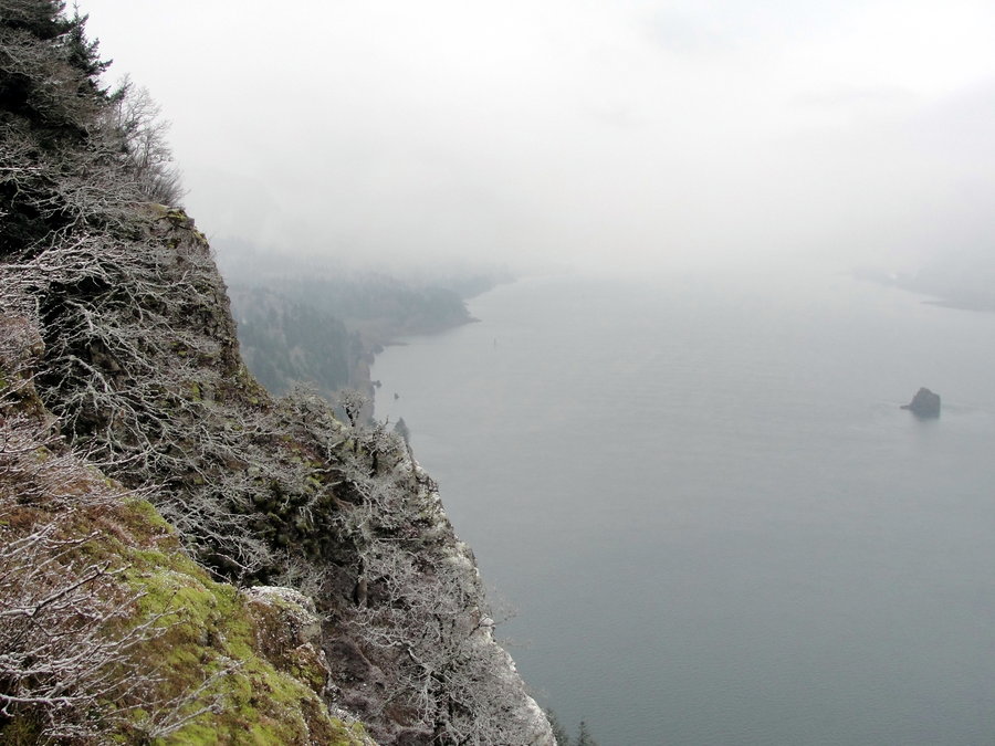
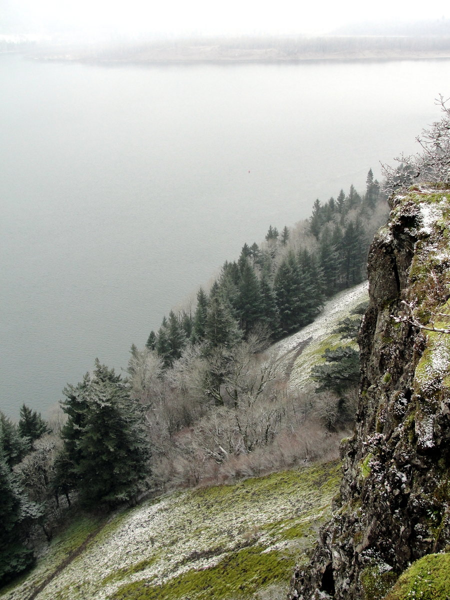
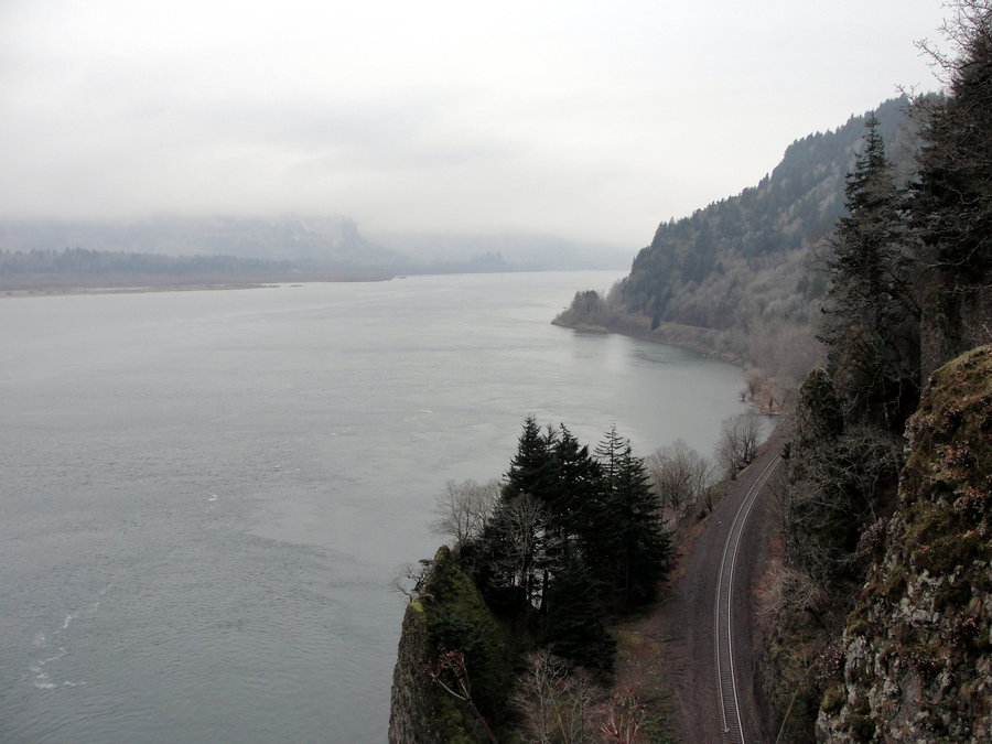
Cape Horn
7.5 miles of hiking • 1750' elevation gain •
This had been on my list for a while and I wanted to make sure I got it in before the lower part of the trail closed on January 31st to protect nesting Peregrine falcon.
January 14, 2013


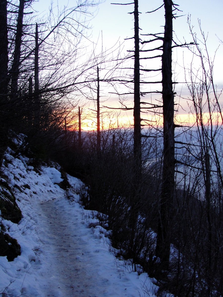
Angel's Rest
8.1 miles of hiking • 2500' elevation gain •
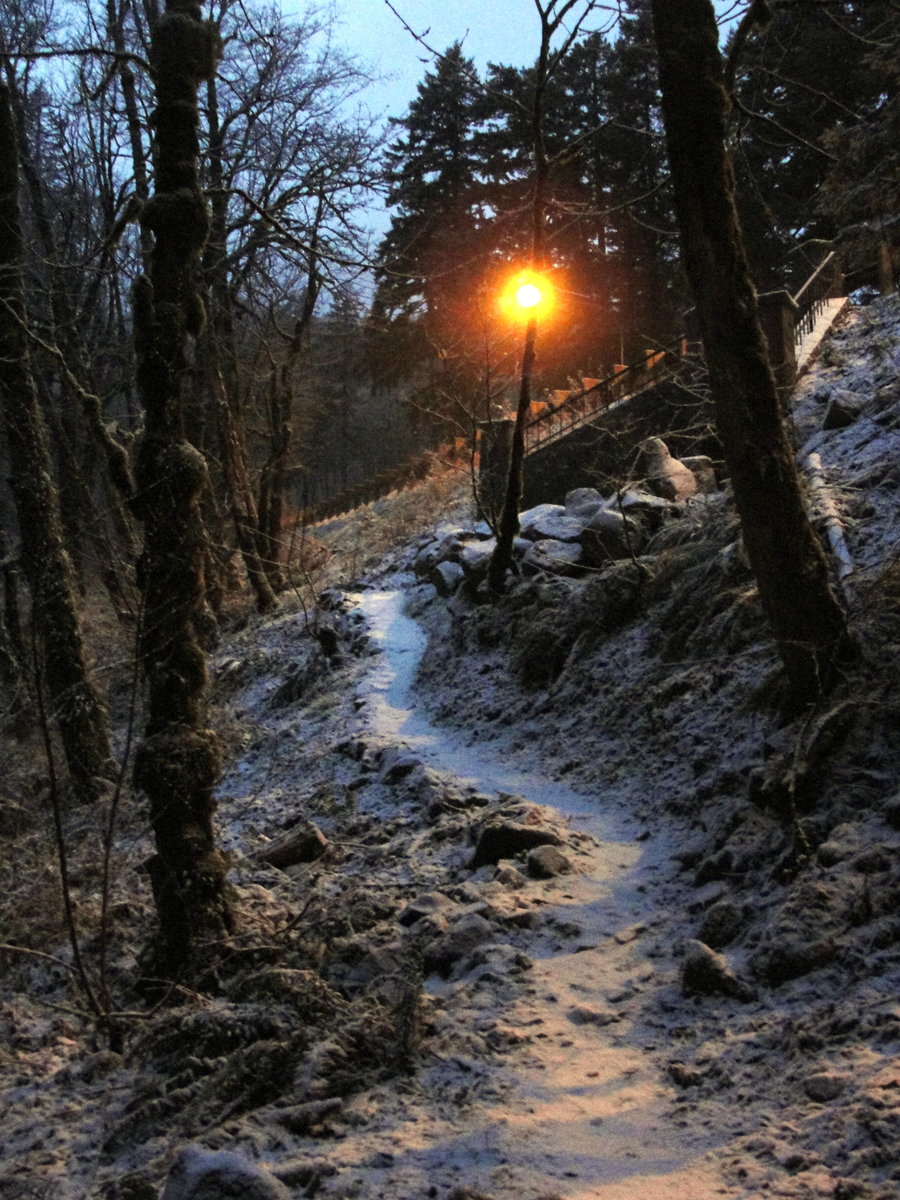
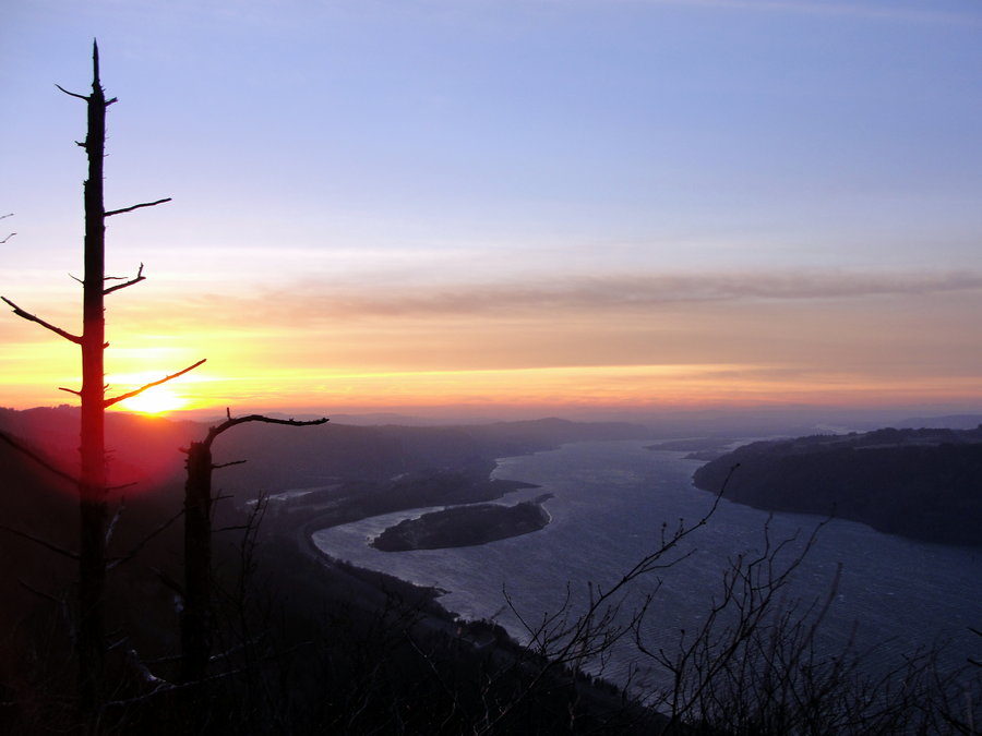
It was a cold and icy day but I wanted to bring in the New Years right - on the trail. On this clear but icy day, I decided Angel's Rest would be the best bet. A relatively short drive to the trailhead, and great views to take advantage of the clear skies. As I was on my way up, I passed several people that looked like they had been on the losing end of a prize fight. Approximately a 1/4 mile from the top of Angel's Rest, I came across a group of individuals that were building an improvised litter to carry out their injured friend. Uhhh ohhh... They insisted that I carry on with my hike, but I knew from experience that it would be difficult for four people to carry an injured person several miles. I was finally able to convince them to let me help, so we started our slow but steady journey back down the trail. After what felt like an eternity, we were able to get the woman safely down the trail.
The sun was rapidly setting, so up the trail I went, this time in overdrive. I was able to make it to the main set of switchbacks right below Angel's Rest before the sunset decided to put on a marvelous show. So I decided I would make this the 'destination' for today. After all the excitement and a wonderful sunset, it was time to head for home.
January 1, 2013

View trips from: 2013