

2012 Trips

 1
1
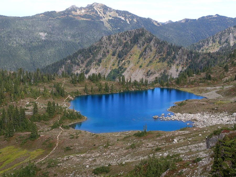
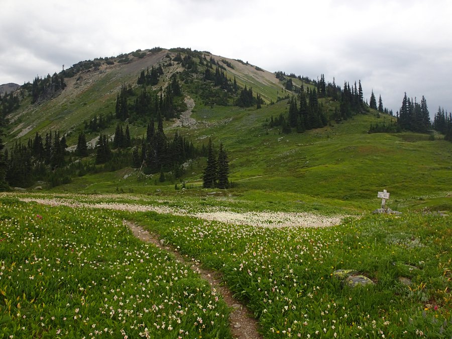
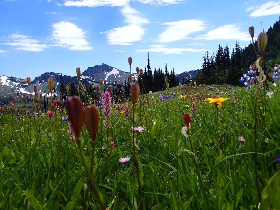
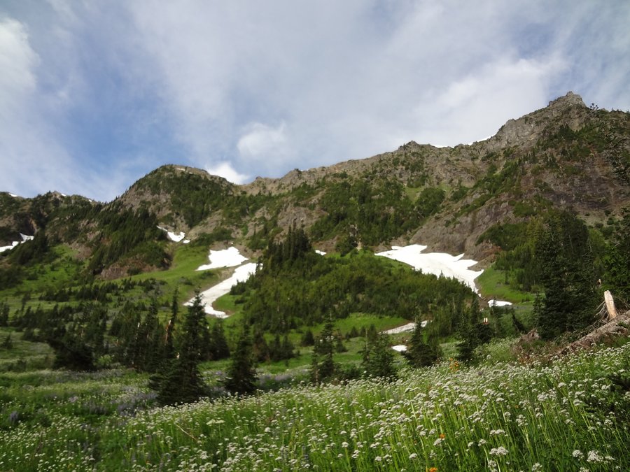
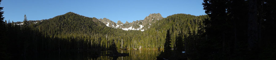
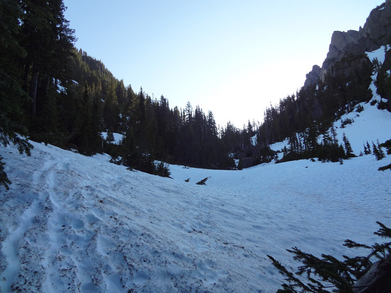
ONP - High Divide Loop - Camping At Hoh Lake
22 miles of hiking • 5750' elevation gain • 1 night
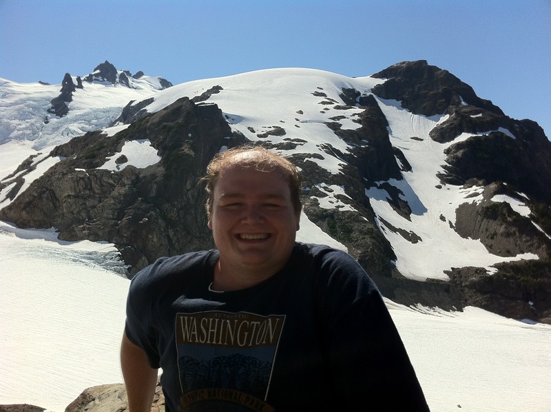
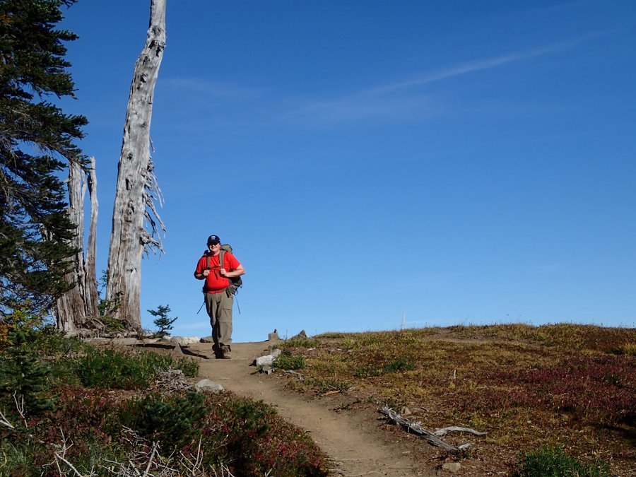
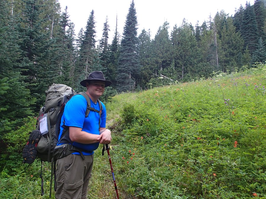
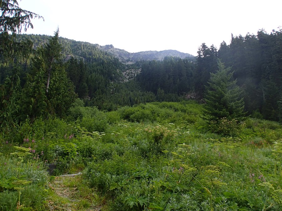
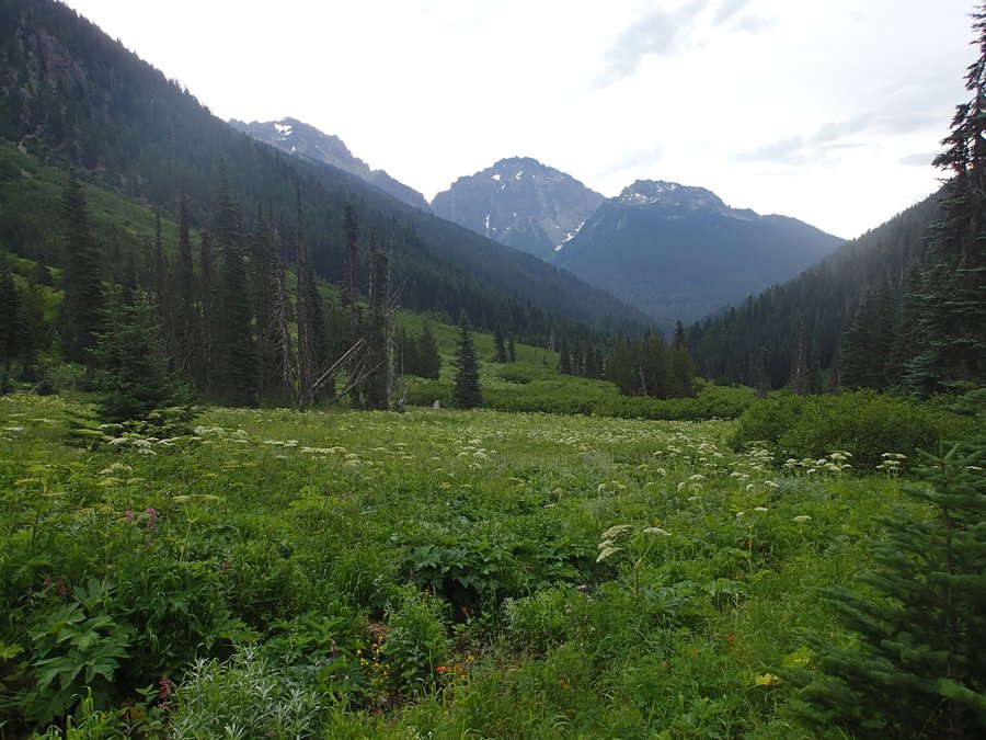
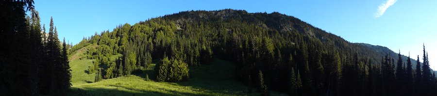
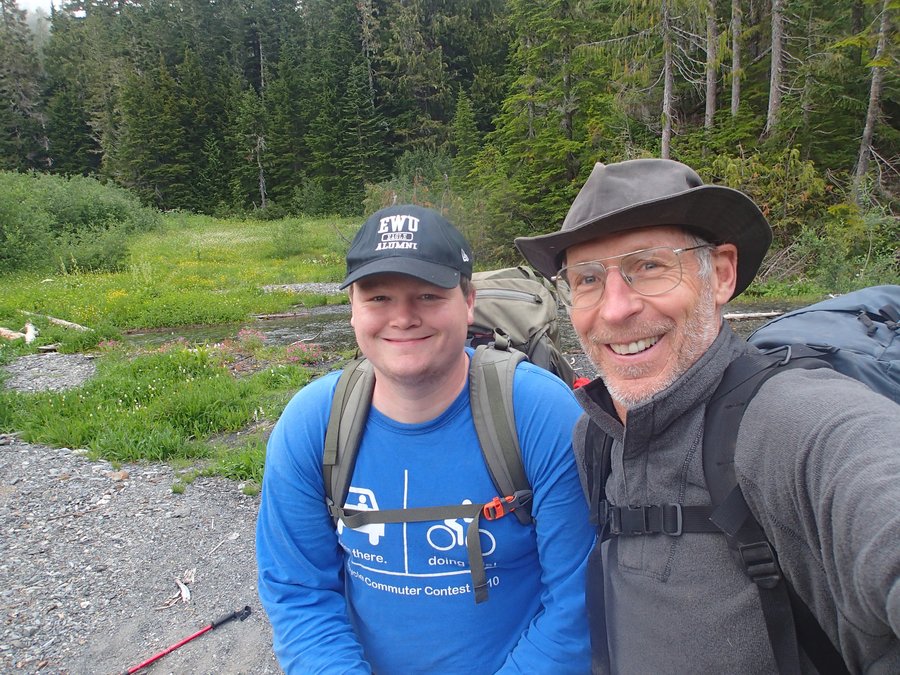
My dad and I hiked the High Divide Loop as an end of the summer season hike. The weather was amazing and the views even more so. We did the loop in two days with a camp at Hoh Lake. We went counter clockwise around the loop, so we could get the major elevation gains on the first day.
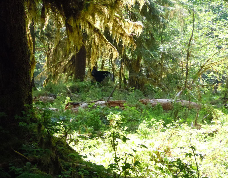
As for wildlife we saw a couple bear and a couple bull elk. We missed a herd of elk who were in full rut the night before according to some of the other backpackers we passed near Heart Lake. That would of been pretty special to see and hear.
This trip should be on anyone's list who wants to spend some time in the Olympics. Great hike.

September 29 – September 30, 2012


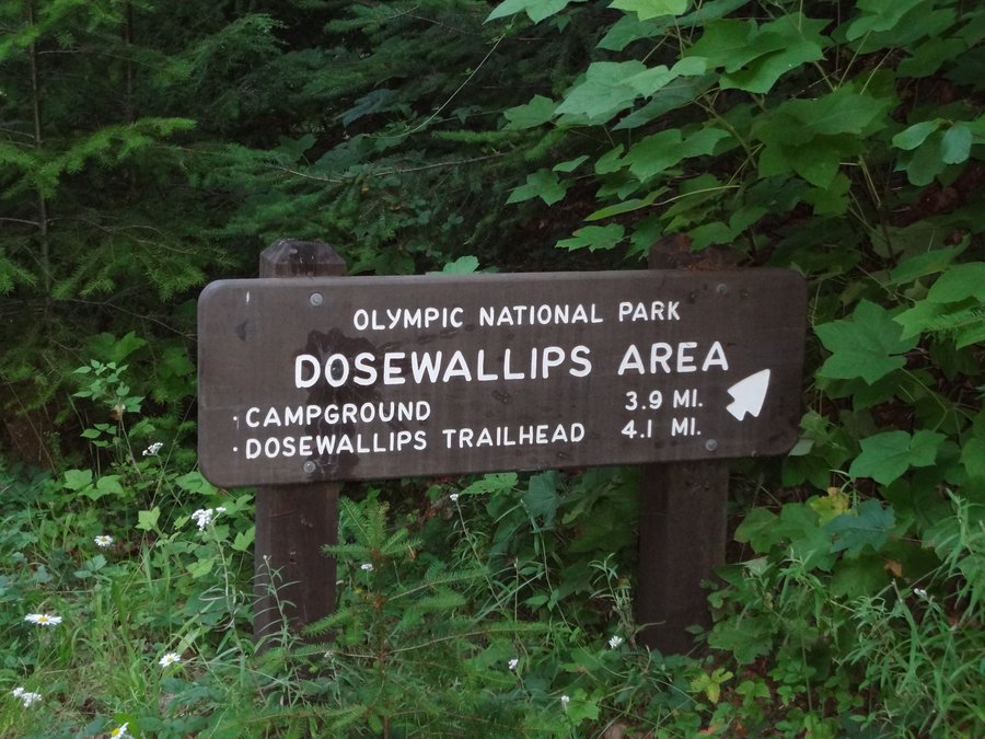
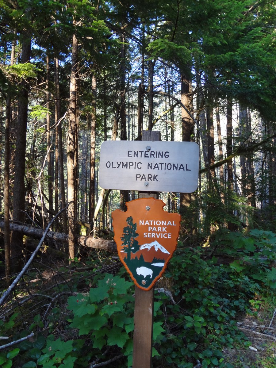
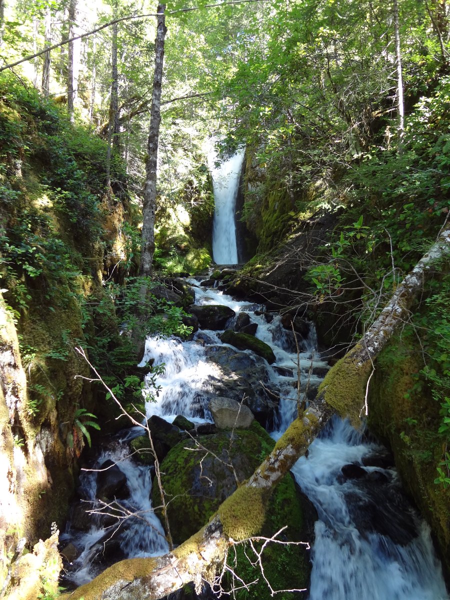
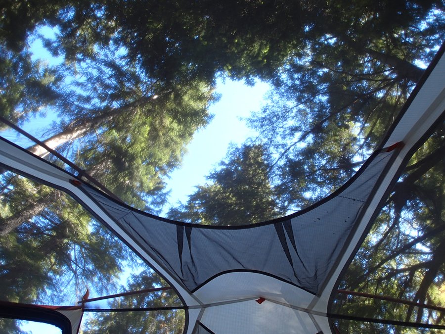
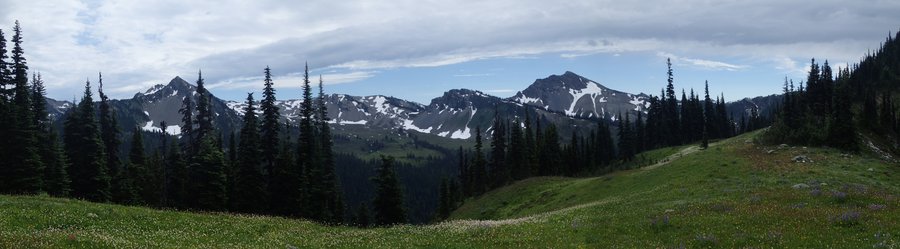
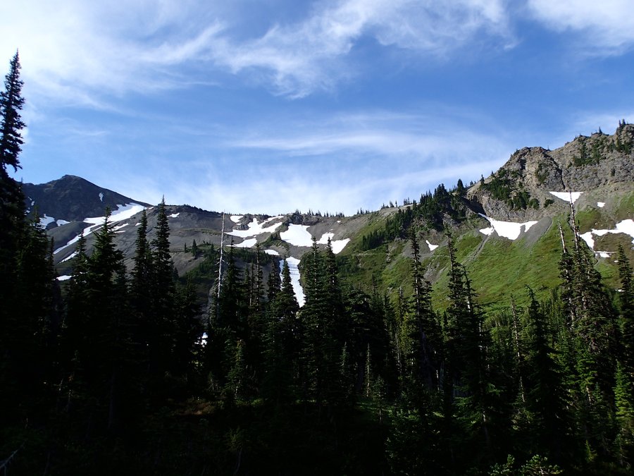
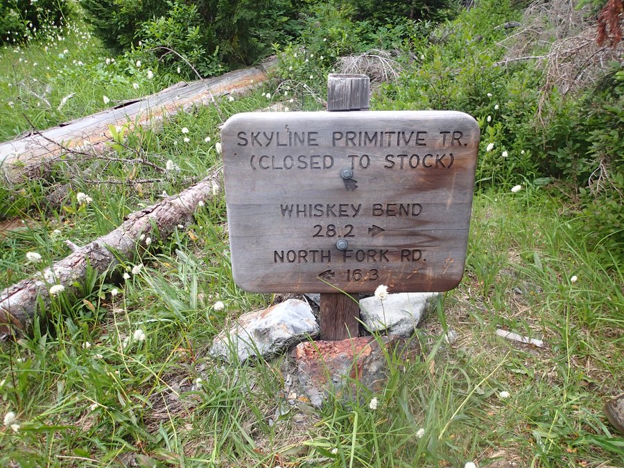
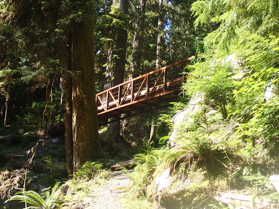
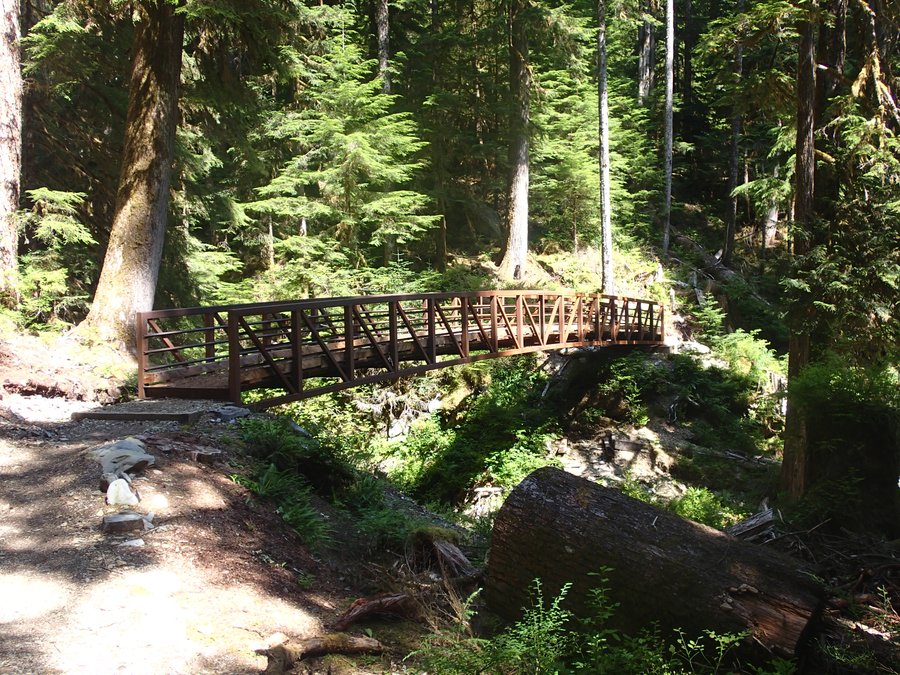
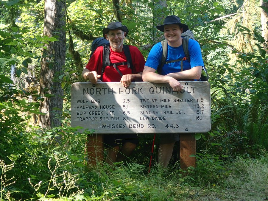
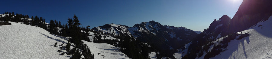
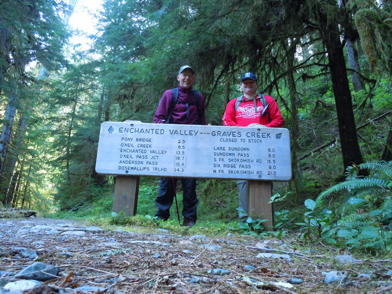
ONP - Dosewallips River Trail / Lost Pass Primitive Trail / Hayden Pass Trail / Elwha River Trail / North Fork Of The Quinault Trail
60 miles of hiking • 13000' elevation gain • 5 nights
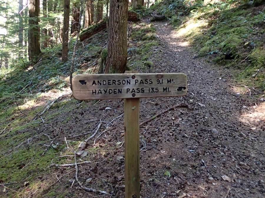
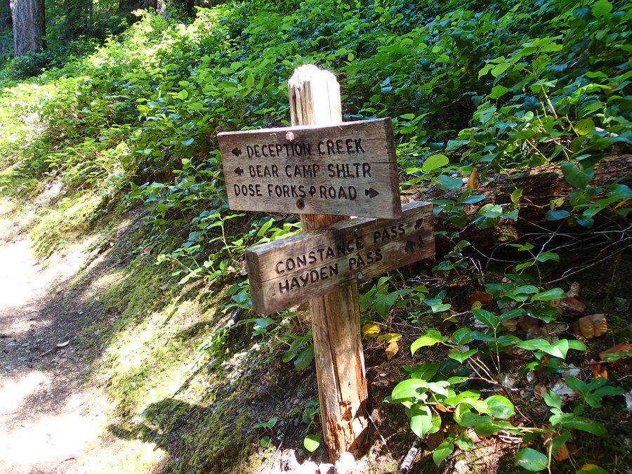
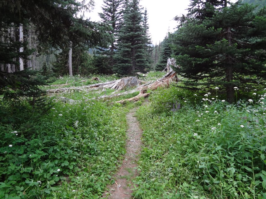
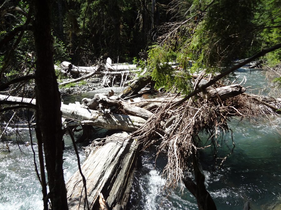
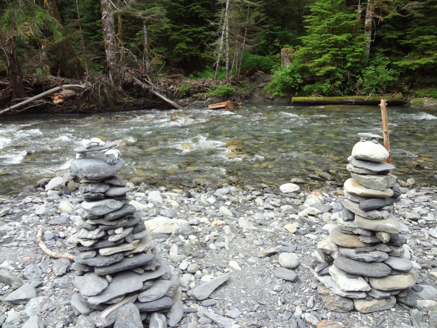
Days after my dad and I did a 36 mile hike up to Mount Olympus last year we started looking into where we would take a multi-day hike this year. We finally settled on a through hike from the Dosewallips washout to the North Fork of the Quinault trail head with a side trip to Lost Pass. This roughly 60 mile route would take us on the following trails (DOSEWALLIPS RIVER TRAIL / LOST PASS PRIMITIVE TRAIL / HAYDEN PASS TRAIL / ELWHA RIVER TRAIL / NORTH FORK OF THE QUINAULT TRAIL) and let us experience most of the terrain types of the Olympic National Park as well as experience several river fords (Something we were a bit nervous about).
Several years ago there was a major washout 5.5 miles from the Dosewallips trail head. This does add some road miles to this route. The road is mostly grown over with vegetation now.
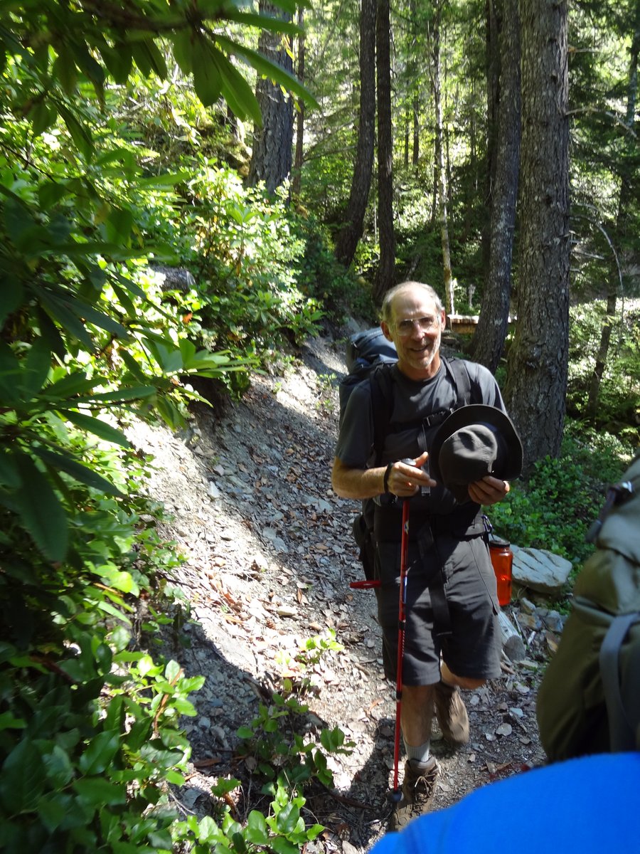
Day 1: Aug 4th, 2012
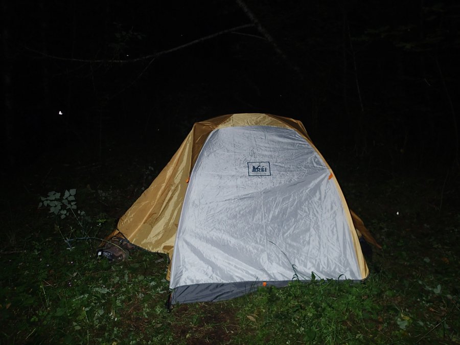
We left on my 31st birthday, and because we spent the day with family we got a very late start. We were hoping we could get the 5.5 miles of road hike out of the way. However, we didn't get to the washout until after dark, so we hiked about a 1/4 mile and camped on an abandoned forest service road. Even though we didn't hike very far in the dark I did twist my ankle on a root before we setup camp (Be very careful hiking at night, even with headlights). Luckily in my boots I could still walk fine but for the next 3 days I did pay for it every time we stopped for the night with a fair amount of pain. Nothing was going to stop us on this hike though. We waited almost a whole year to go!
Day 2: Aug 5th, 2012
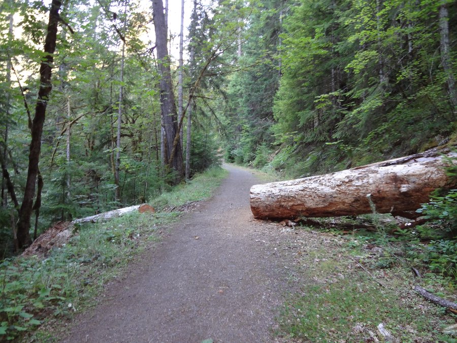
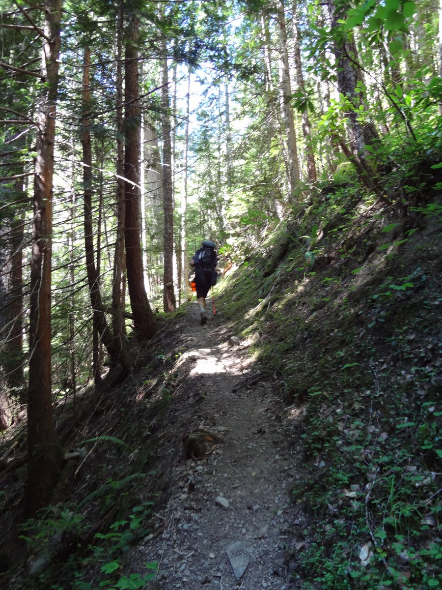
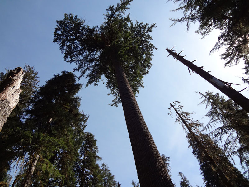
We got a very early start, and got the 5.5 miles out of the way and ate breakfast at the Dosewallips trail head. After leaving the trail head we climbed steadily pretty much for the rest of the day. It was also very hot, with temperatures reaching the low 90's. Luckily there are a lot of creek crossings so water was never a problem. By the time we reached our next camp at Deception Creek we were very tired. We hiked roughly 13 miles, most of them climbing in hot temperatures, and after eating dinner we quickly fell asleep.
Day 3: Aug 6th, 2012
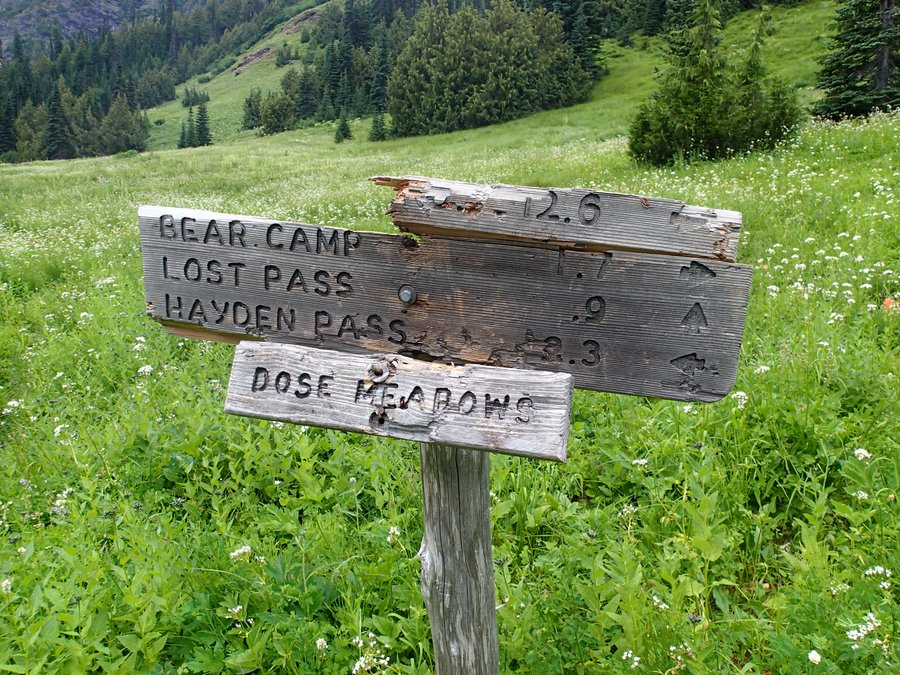
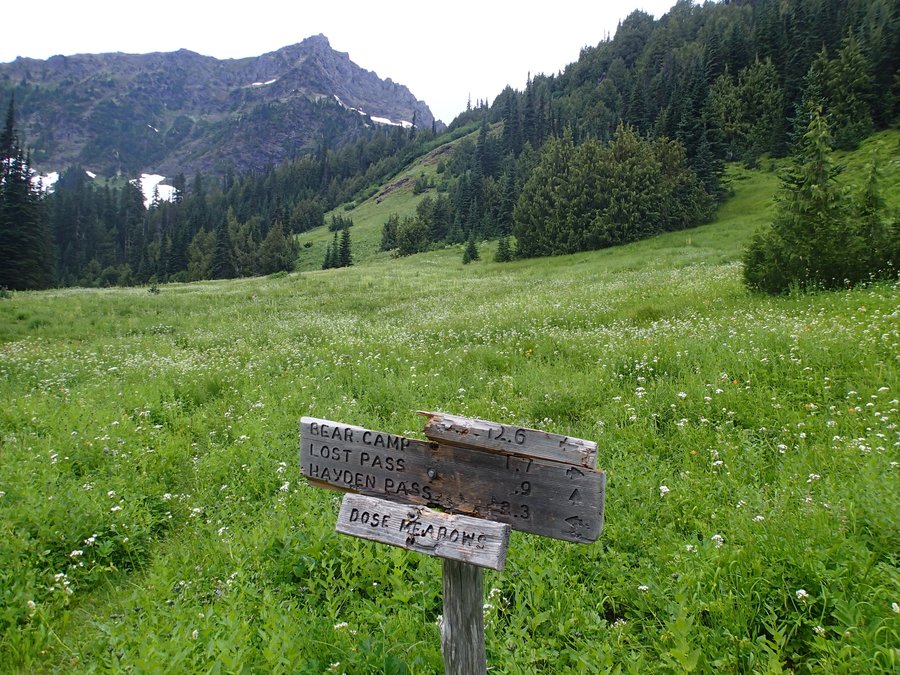
We got another early start. This was our shortest day on the whole trip. The plan was to go roughly 5 miles and set up camp at Dose Meadows. We were going to use this day as a rest day, knowing that the next couple days would be much longer.
Dad was doing pretty good, but I was dragging. I'm not sure if it was dehydration or what, but this was the hardest 5 miles I've ever hiked. Every mile or so I would have to stop and rest, and I felt sick to my stomach.
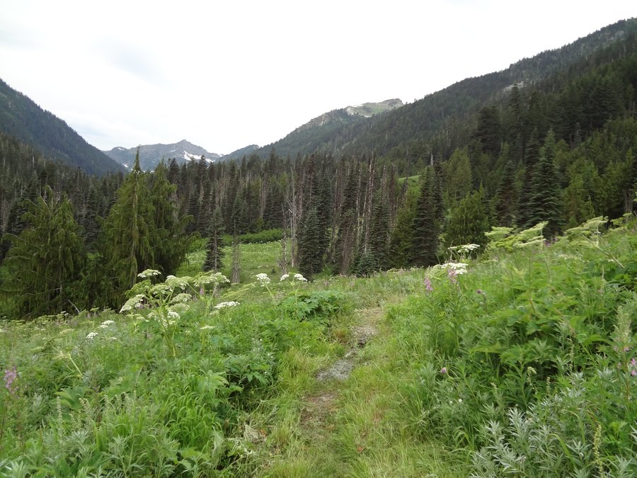
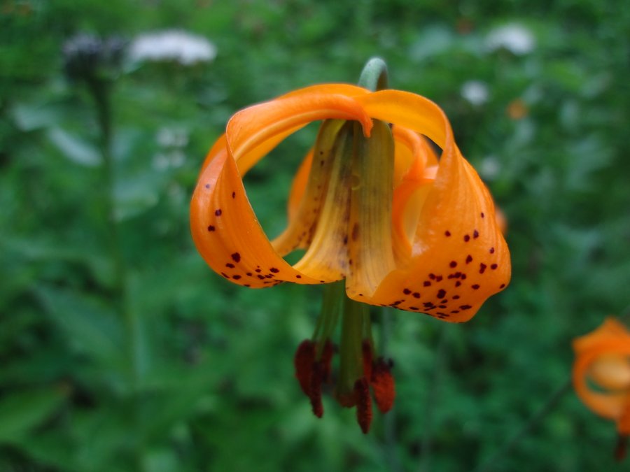
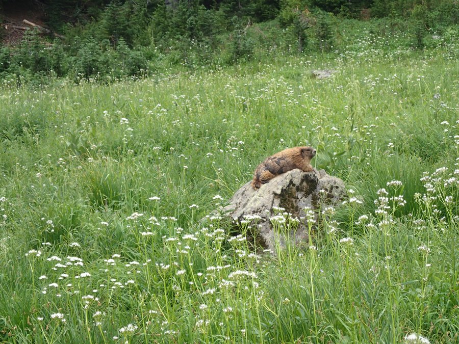
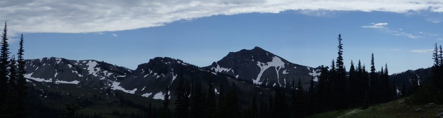
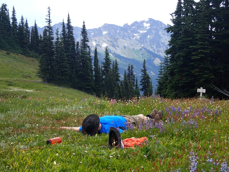
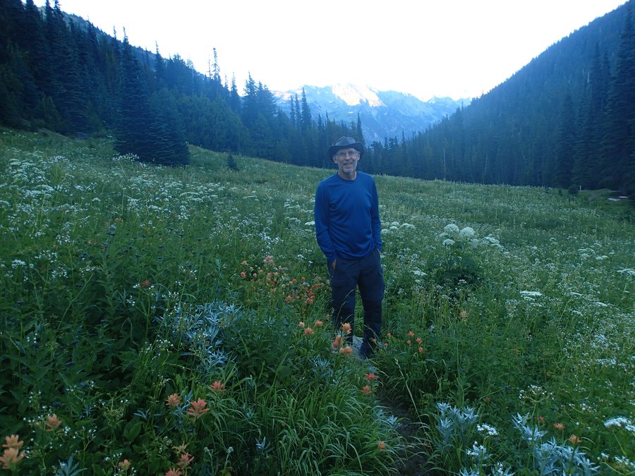
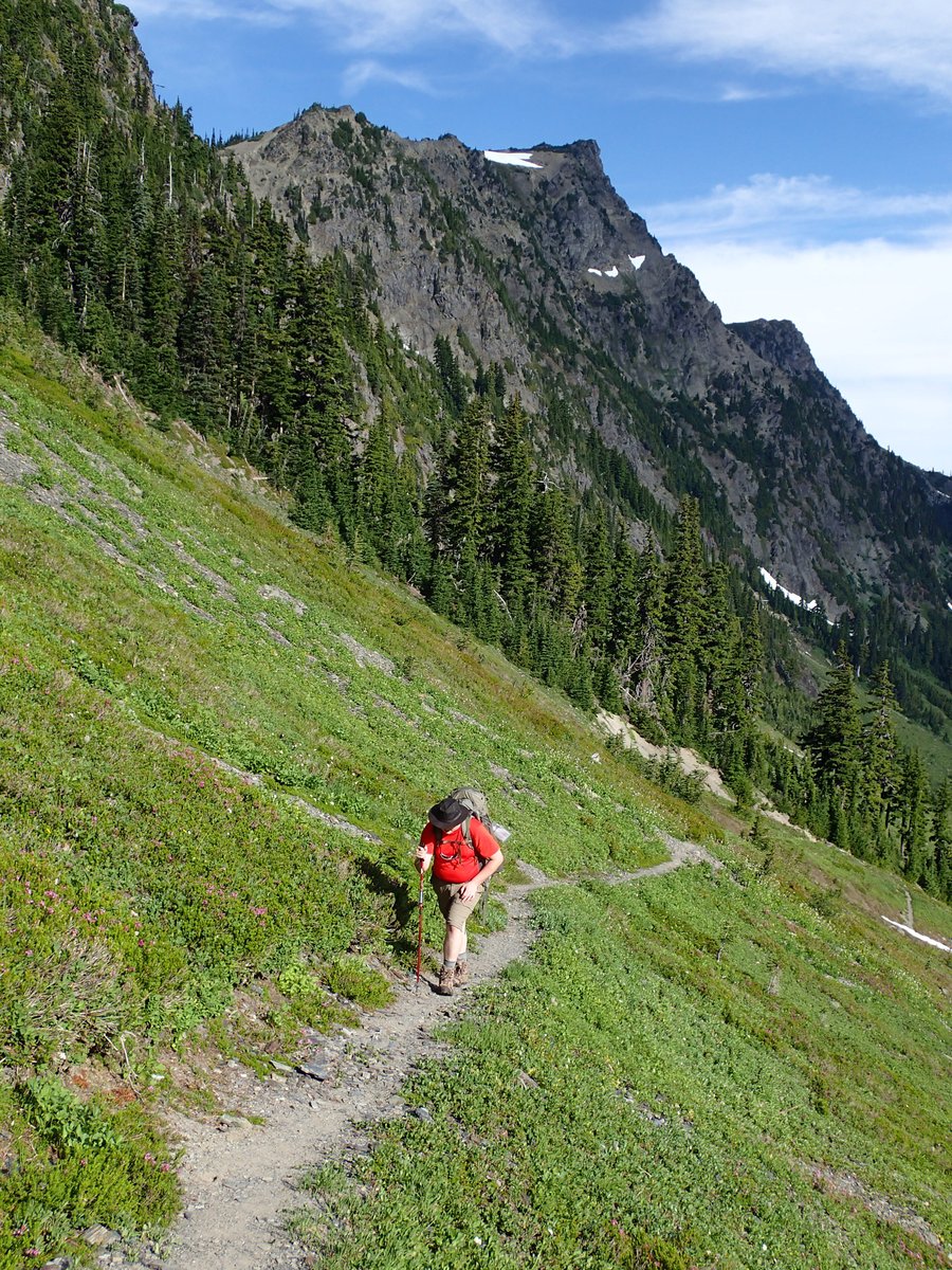
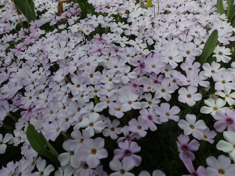
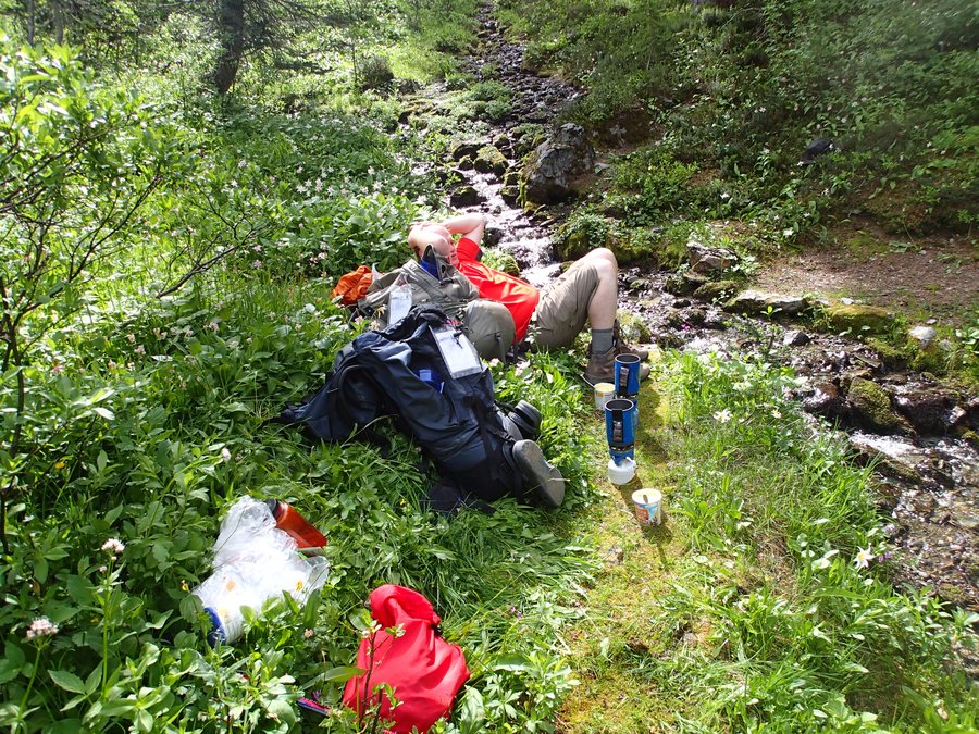
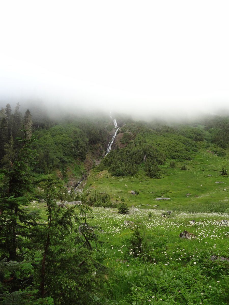
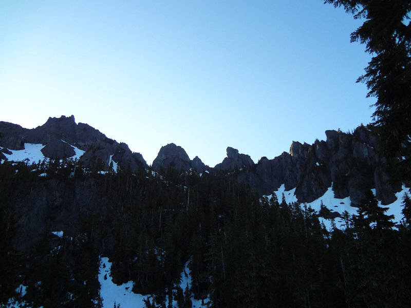
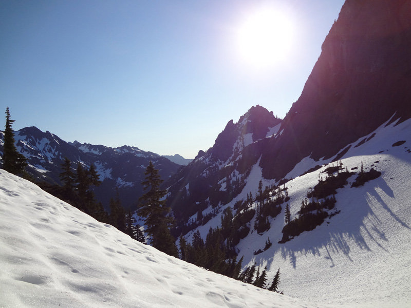
The views were stunning though. And while it took us longer than expected, we did reach camp. After setting up camp at Dose Meadows we took a side trip up the 1 mile climb to Lost Pass. While it is only 1 mile, you gain roughly 1500 feet of elevation so it is a tough climb. Without packs though it was a fun climb and I started feeling better the higher we climbed. Reaching the top made the entire day worth it.
Simply put: Lost pass is stunning. There are views in all directions and all kinds of wildflowers covered the pass. I think I can say that this was my favorite part of the entire trip. Dad and I spent almost 2 hours on the pass just looking around and enjoying the views.
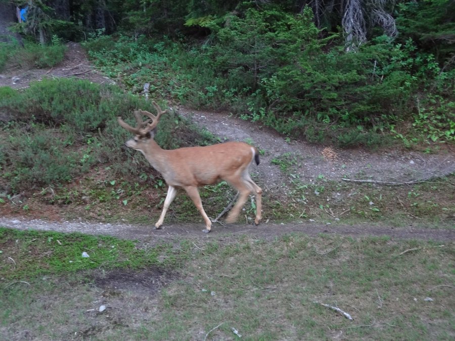
We finally made our way back down from Lost Pass and spent the rest of the day just resting and enjoying the Dose Meadows. The meadows are very peaceful and full of wildflowers. After dinner a buck deer decided it wanted to come visit us and walked right into camp. It was a great ending to the day.
Day 4: Aug 7th, 2012
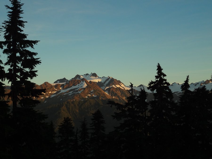
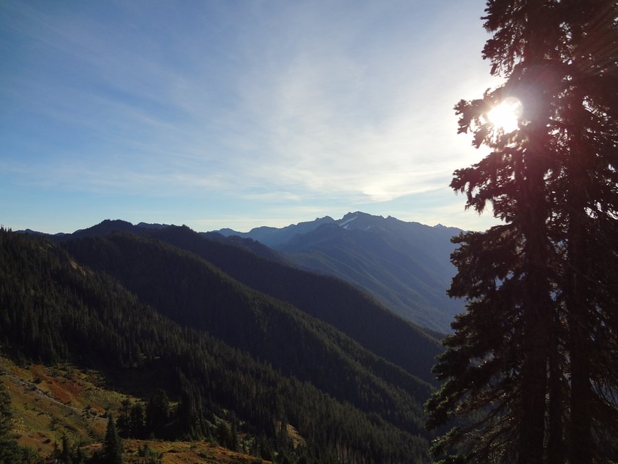
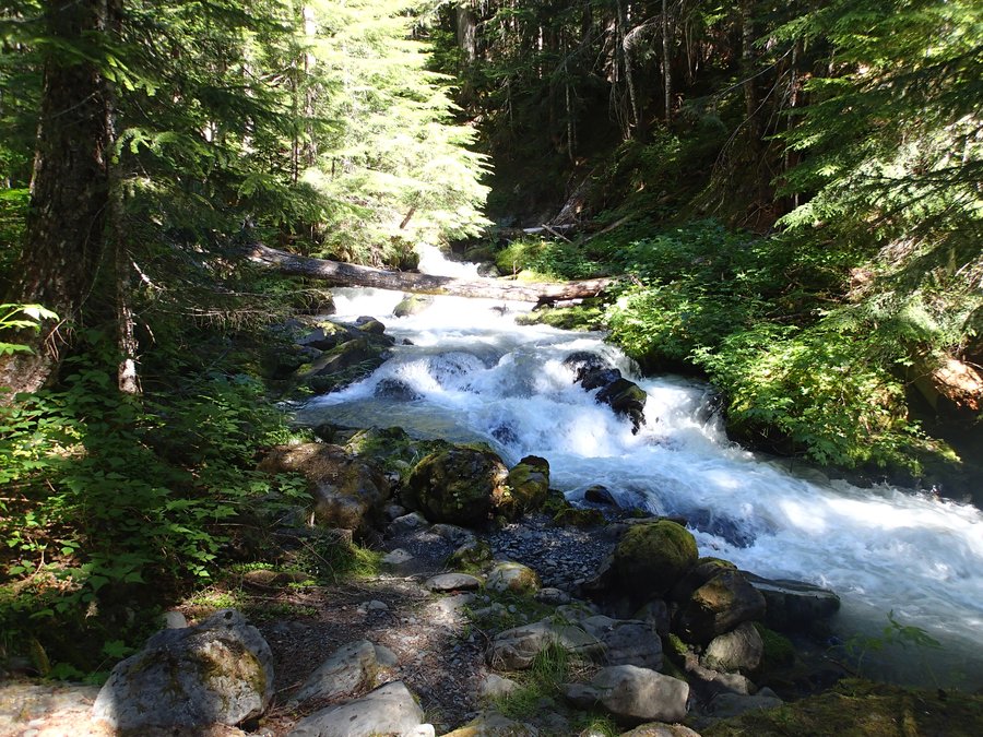
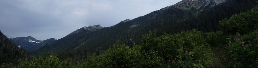
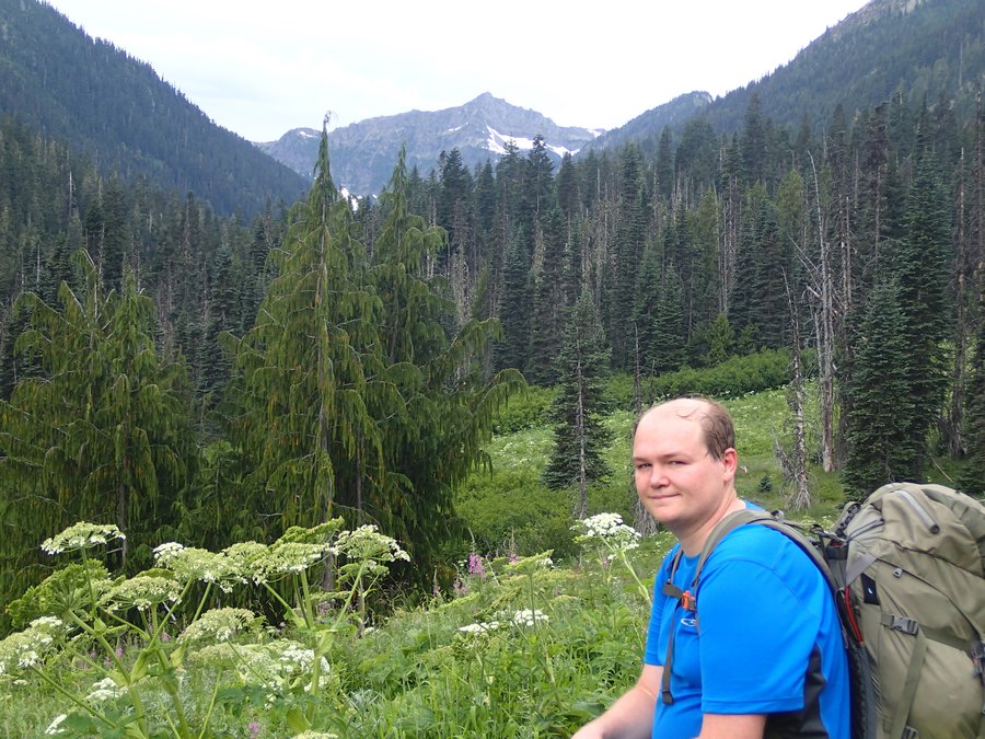
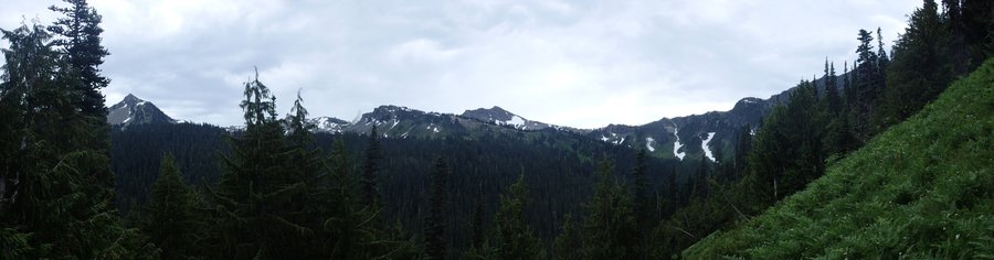
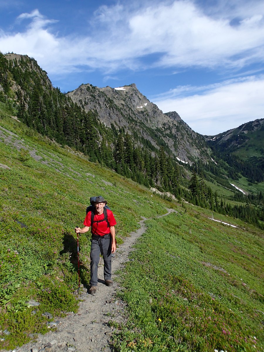
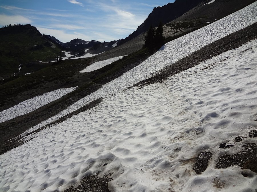
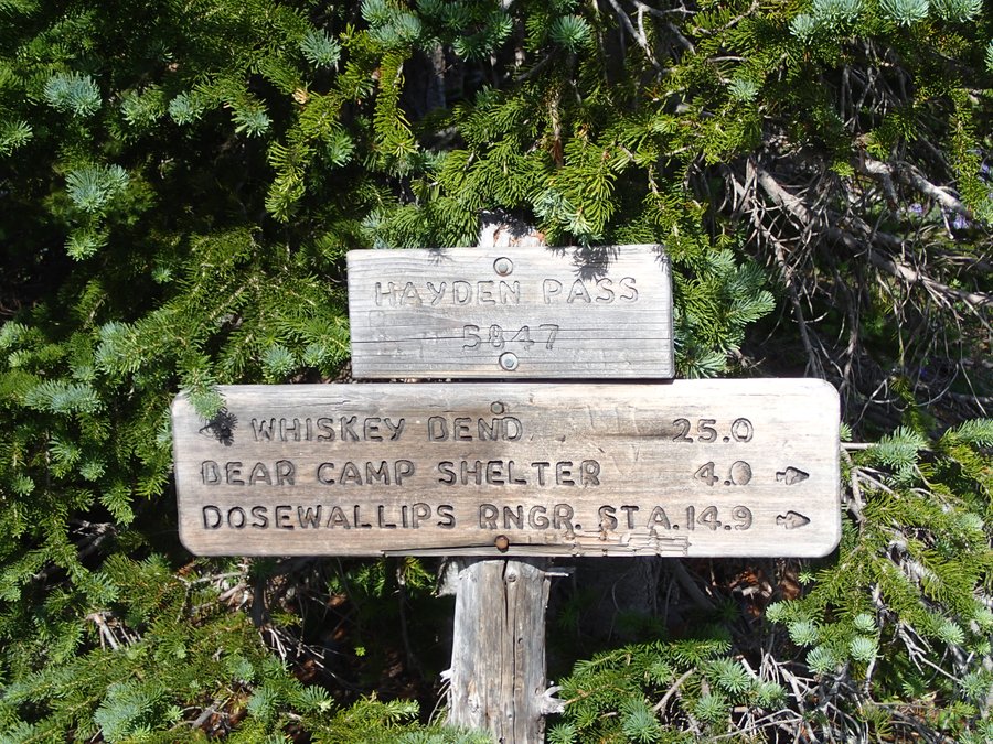
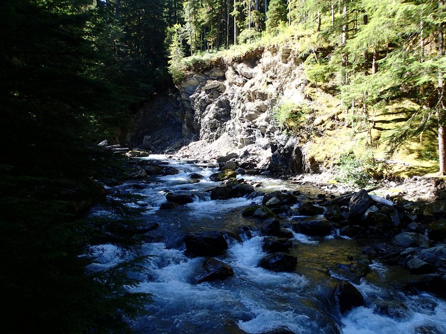
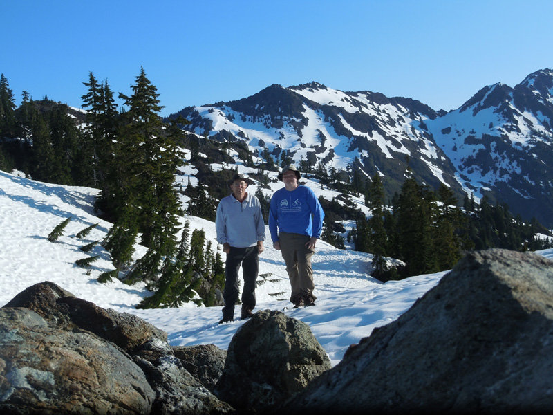
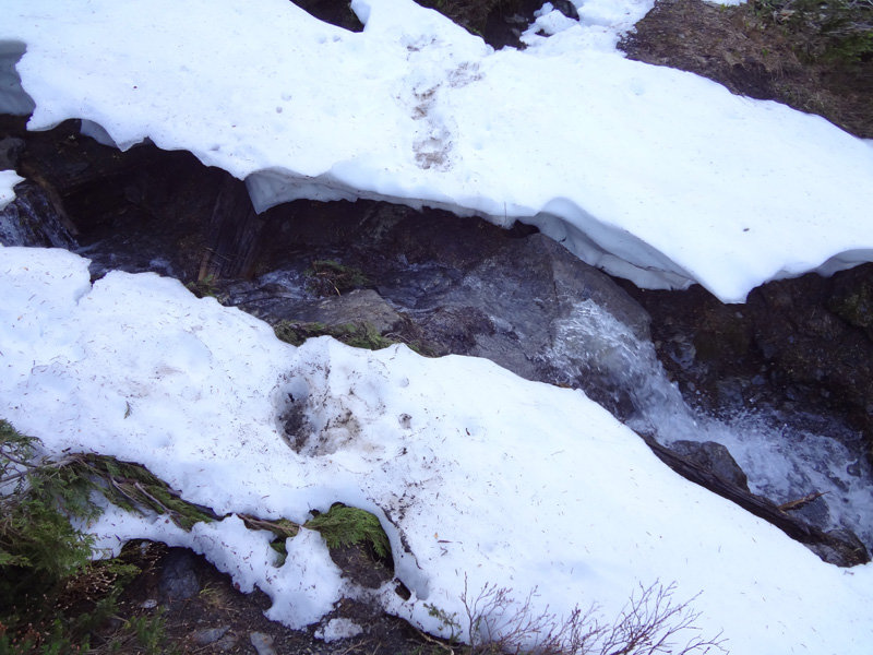
Another early start and we were heading up towards Hayden Pass. I was feeling much better and we made good time as we climbed the last few miles towards the pass. We spent a few minutes at the base of Hayden Pass visiting with some other hikers and resting near the creeks that form the headwaters of the Dosewallips river before starting the final climb up the pass. Most of the snow was melted with only a couple sections of the trail covered and about 45 minutes later we were standing on top of Hayden Pass. Once again the view was stunning. On one side of the pass we could see back down the Dosewallips River valley and on the other side we saw the Elwha River valley as well as Mt. Anderson, Mt. Olympus and the Bailey Range. We then took off heading down from Hayden Pass towards our next camp in the Elway River Valley.
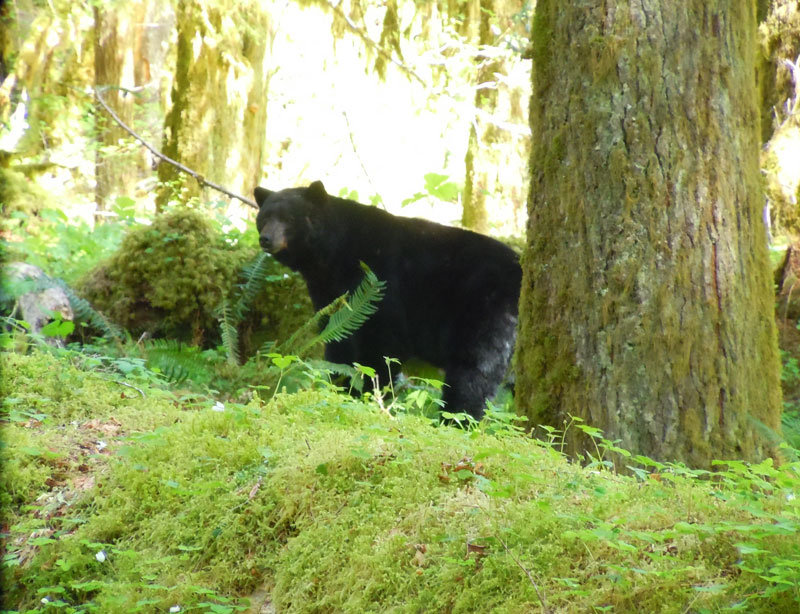
A few minutes after Hayden pass we came upon a bear that was sleeping and taking a bath in a small icy pond. He was not thrilled we woke up, glared at us and jumped over the edge into some trees.
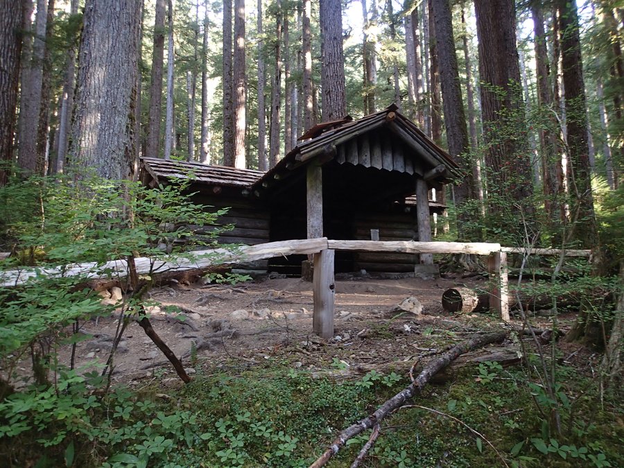
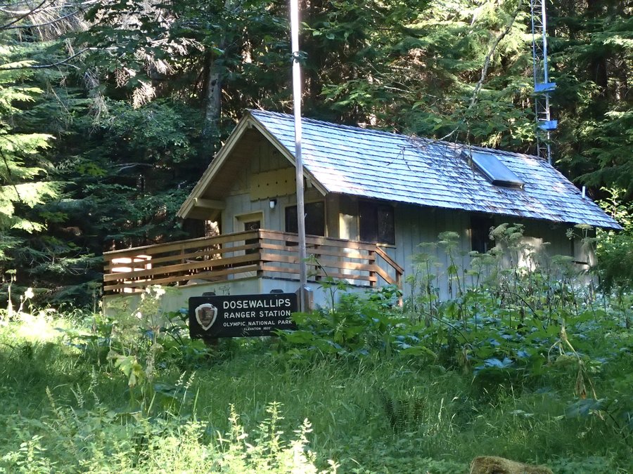
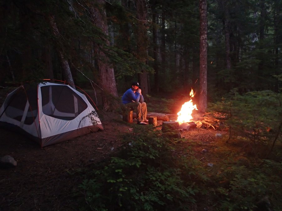
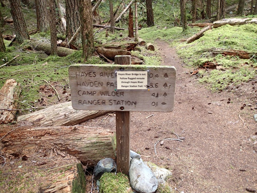
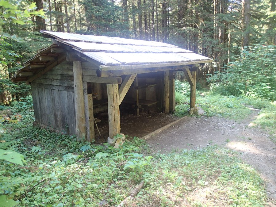
The rest of the day was mostly uneventful. The Hayden Pass trail is easy to go down on, it would be a difficult climb, but by 3 in the afternoon we had met up with the Elwha River trail and were soon at our next camp at the Hayes River Ranger Station.
We spent the afternoon exploring around the ranger station and lounging in the nice chair that was on the front porch of the ranger station. Never underestimate how nice a chair can be after 30 miles of hiking. :)
Day 4 ended up being an 11 mile day.
Day 5: Aug 8th, 2012
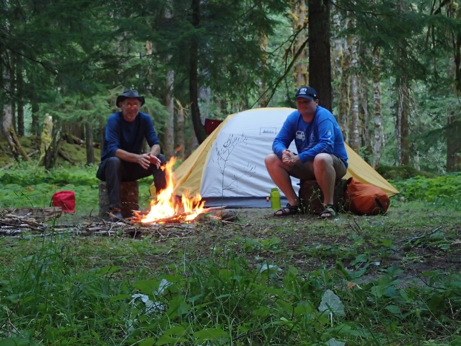
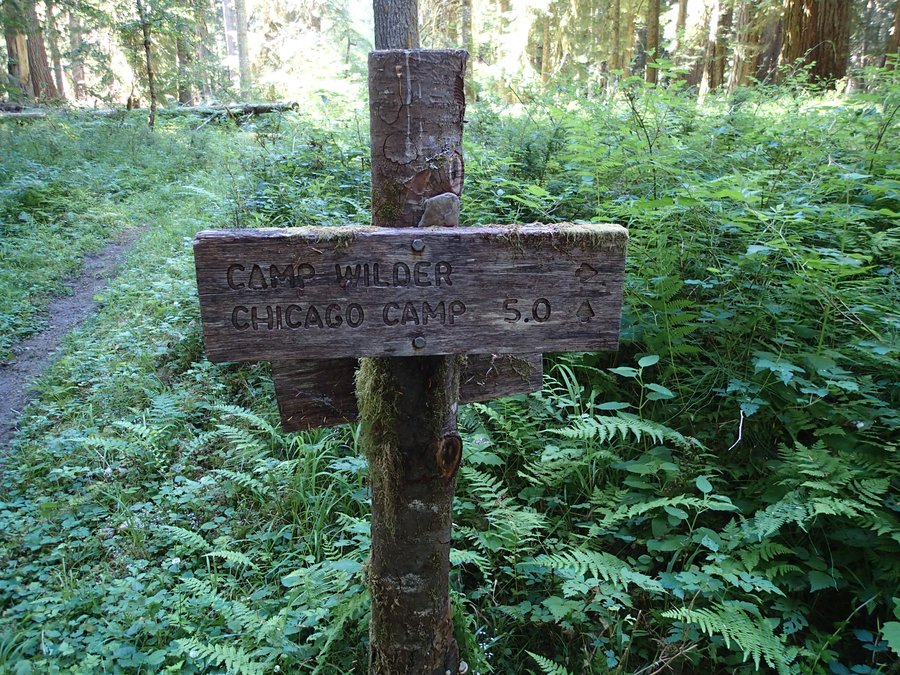
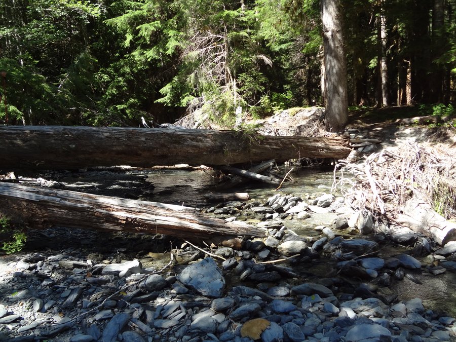
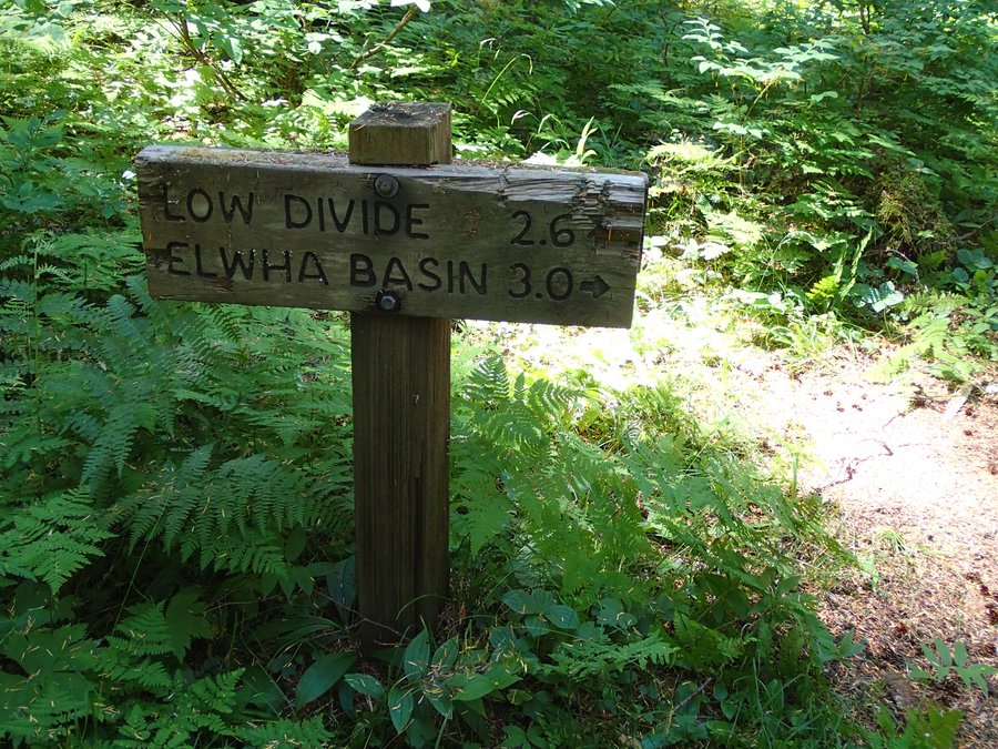
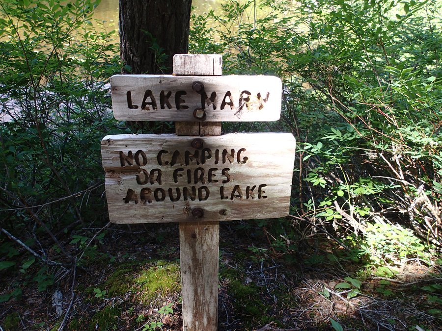
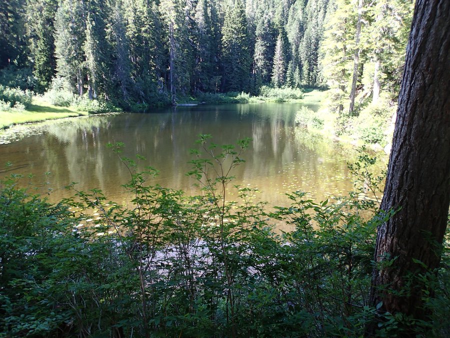
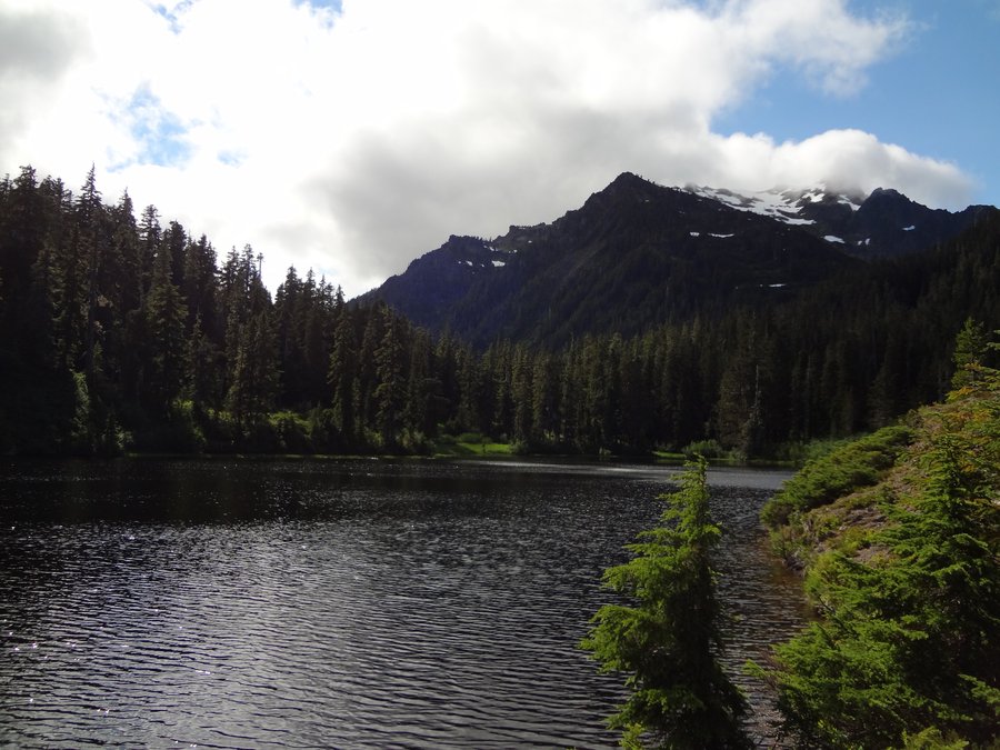
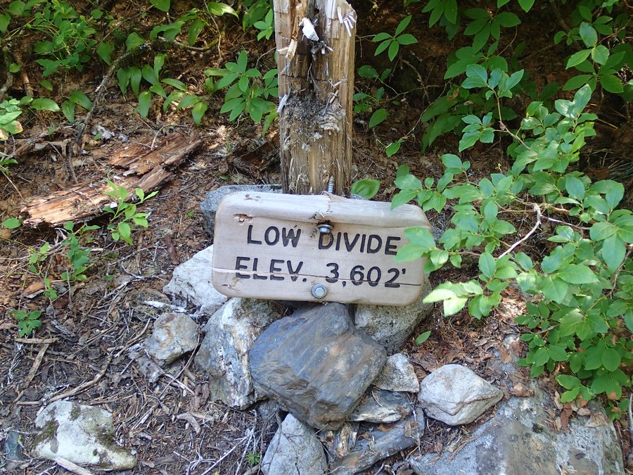
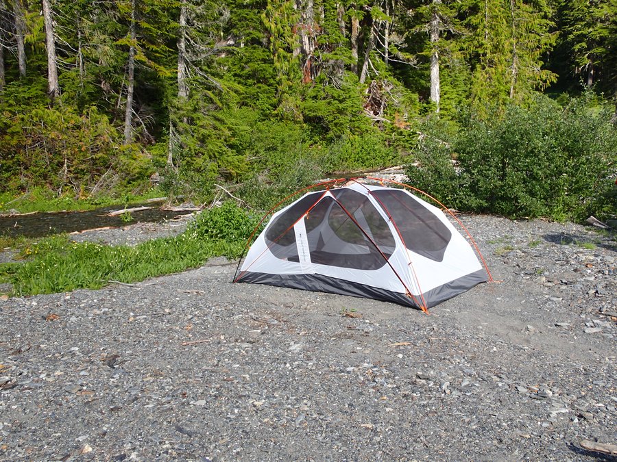
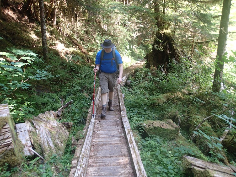
The plan for Day 5 was to hike from the Hayes River Ranger Station to Chicago Camp and have another shorter rest day. We set off and were making good time. The Elwha River Trail is a mostly flat trail, which was a nice change from all the climbing we had done to get there. We arrived at Chicago Camp around lunch time. After a nice lunch by the river, we decided we were not ready to stop for the day and wanted to push up towards the Low Divide. The river ford at Chicago Camp was easy. There were a bunch of trees down so we were able to simply walk across. If we would of had to go through the water it would of been about knee deep and was moving at a pretty good pace, so I'm glad there was an easier way across. We knew that once we left Chicago camp we would have to climb the 3+ miles up to the Low Divide as there are no other places to camp. The climb was pretty steep, but we made it to the Low Divide in a couple hours. After resting at Lake Mary and Lake Margaret we made our way to the Low Divide and explored a bit before setting up camp.
The Low Divide should of been awesome. The views were nice and the weather was mostly nice. However, the misquitos ate us alive. We ended up having to stay in the tent most of the evening to avoid them. Even with DEET they still attacked us through our clothes and I had over 50 bites. Nasty little buggers. I was very happy to get going the next morning. :)
Day 5 ended up being around a 12 mile Day.
Day 6: Aug 9th, 2012
The plan for Day 6 was to go from the Low Divide to Elip creek which would put us about 6 miles from the North Fork of The Quinault trail head.
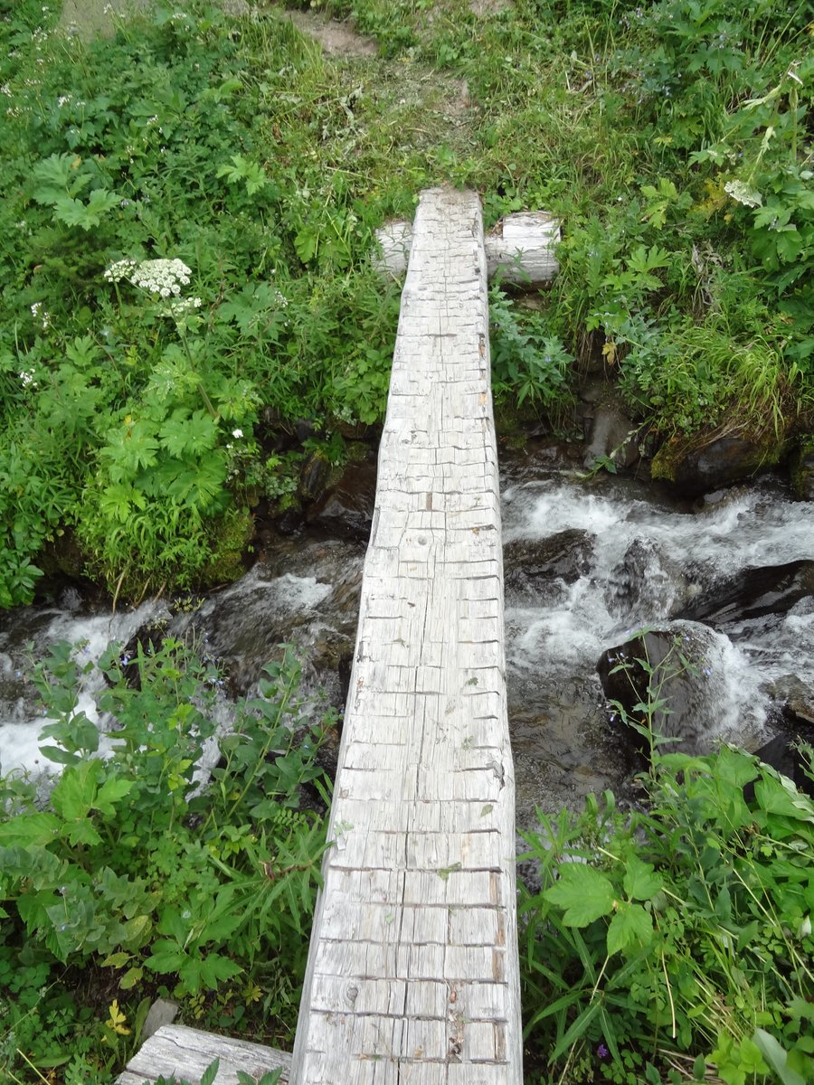
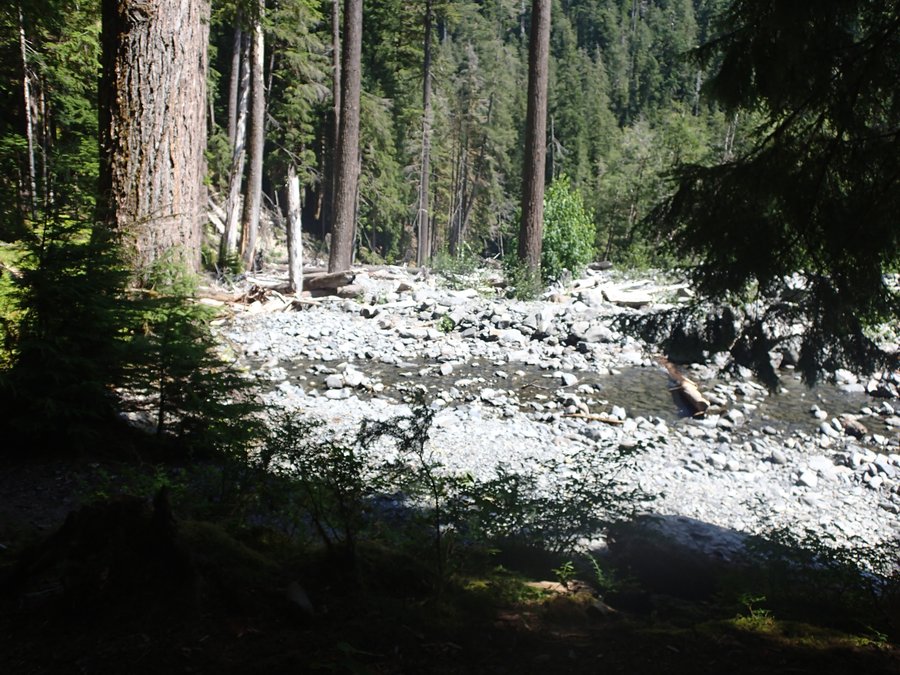
We left the Low Divide without eating breakfast to avoid those nasty mosquitos and made really good time over the 3.5 miles to the ford at 16 Mile. At the river we ate breakfast, mosquito free, and then forded the river. The ford at 16 Mile was the one ford we were most nervous about, but it ended up being a non issue. The water was between knee and lower calf deep and moving at a good pace, but with two poles (or sticks) we were able to make it across just fine.
After the 16 mile ford we kept a pretty steady pace along the North Fork Of The Quinault trail and made it to Elip Creek in the early afternoon. We ate lunch and decided that since we had already hiked 11 miles, we could probably walk 6 more and be out a day early (We were having a great time, but it would get us home to our family a day early as well, which after 6 days in the wilderness was very nice).
We lifted the backpacks up on our shoulders one final time and hiked out the final 6 miles.
Day 6 ended up being around a 17 mile day.
Final Thoughts:
Overall this was an amazing trip and a great route. We met some great people, such as a couple of scout groups working on their 50 mile badges, and saw some stunning wilderness.
I'm truly blessed I can spend this time and make lifetime memories with my dad and I can't wait to go on many more trips like this in the future.
August 4 – August 9, 2012


 1
1
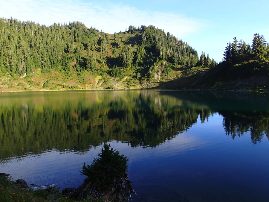
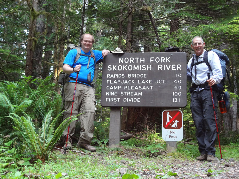
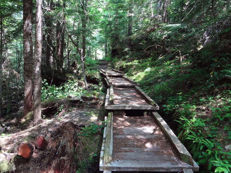
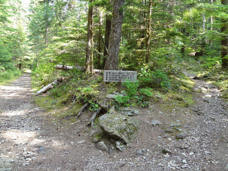
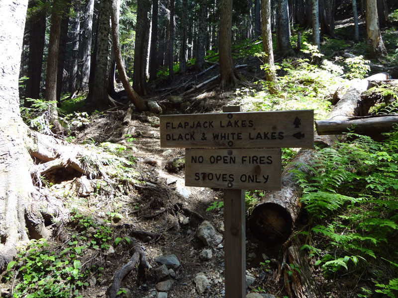
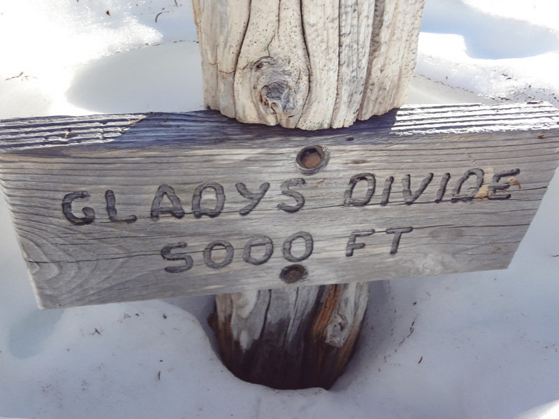
ONP - North Fork Skokomish River Trail / Flapjack Lakes Trail / Gladys Divide Primitive Trail
20 miles of hiking • 4750' elevation gain • 1 night
Took advantage of the amazing weather this last weekend to do a overnight backpacking trip with my dad up to FlapJack lakes in the Olympic National Park.
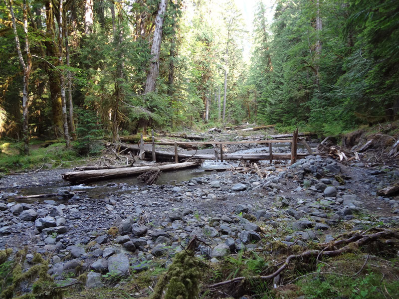
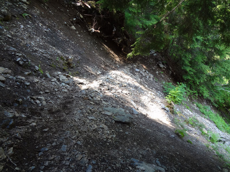
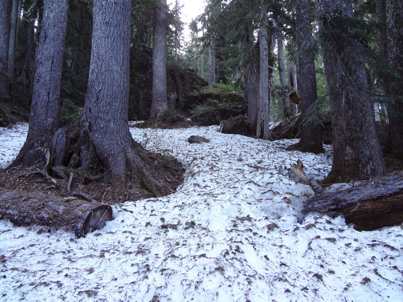
The first 3.5 miles up the North Fork Skokomish River Trail are nice and flat. At 3.5 miles you take a right and hike a pretty steep 4 mile climb (with the steepest part coming the last 1/2 mile) to the Flapjack Lakes (3900'). The climb was pretty intense, especially with our backpacks, but the lakes were very beautiful, and there were only about 5 other hikers staying at the lakes. Both trails to the Flapjack Lakes were snow free, and all campsites at the lakes were snow free except for the group camp on the backside of the lake.
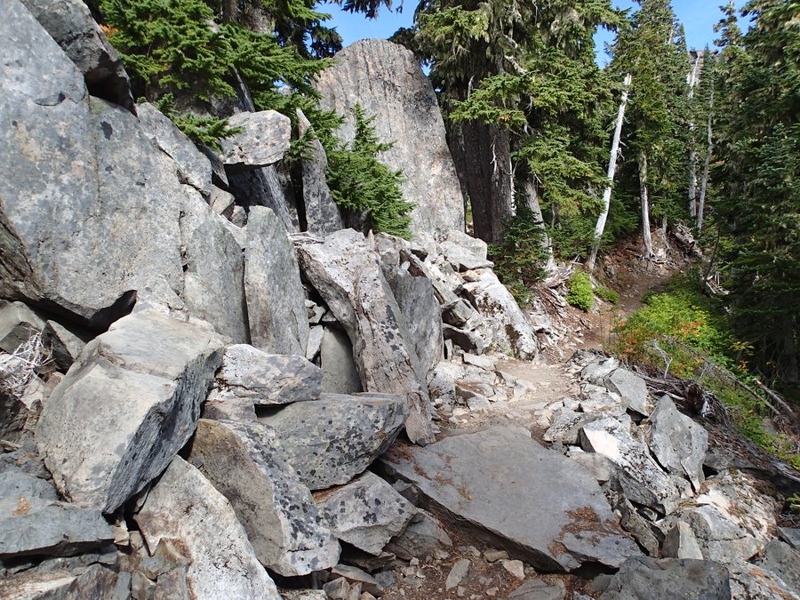
On Sunday morning we did the hike up to Gladys Divide. We left FlapJack Lakes at 6 AM to see if we could catch the sun coming over the mountains. We hit snow about 1/4 mile past the lakes, and route finding was required to get to the top of the divide. There was still a ton of snow at the top (10+ feet) but it was very walk-able (we did the whole hike in regular hiking boots) and the views were simply amazing!
July 7 – July 8, 2012


 4
4
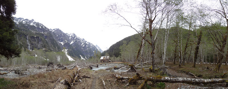
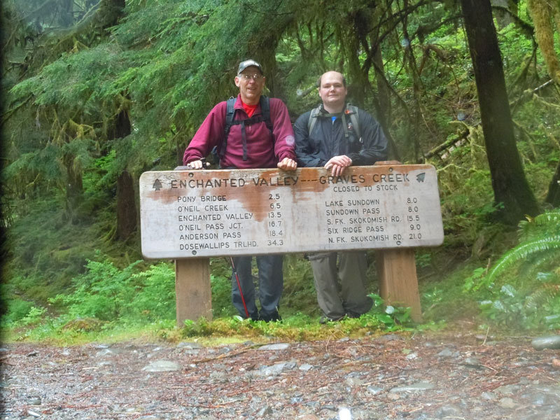
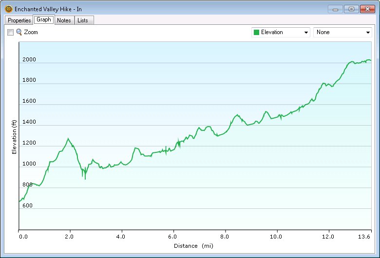
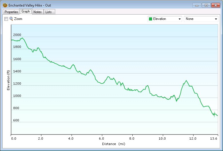
ONP - East Fork Of The Quinault to Enchanted Valley
28 miles of hiking • 2000' elevation gain • 1 night
My dad and I did a overnight hike into the Enchanted Valley this past weekend.
We had perfect weather for the way in. Sunny, clear and in the high 60's.
We left the trailhead around 8 and arrived in the valley around 3:30. Could of done the hike faster, but we were taking our time and took a ton of pictures.
The trail is in very good condition.
Workers have cleared all blow downs for the first 4 miles. All other blow downs are easy to get over or around.
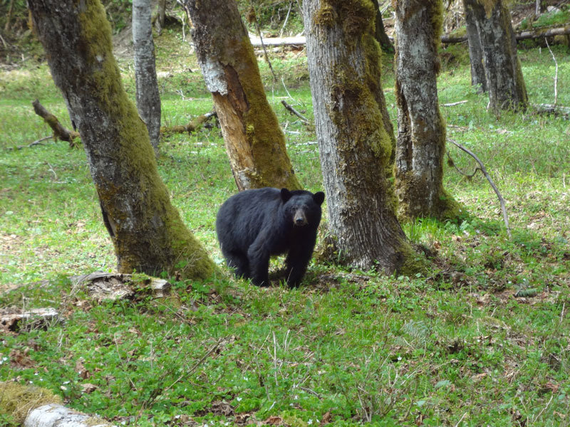
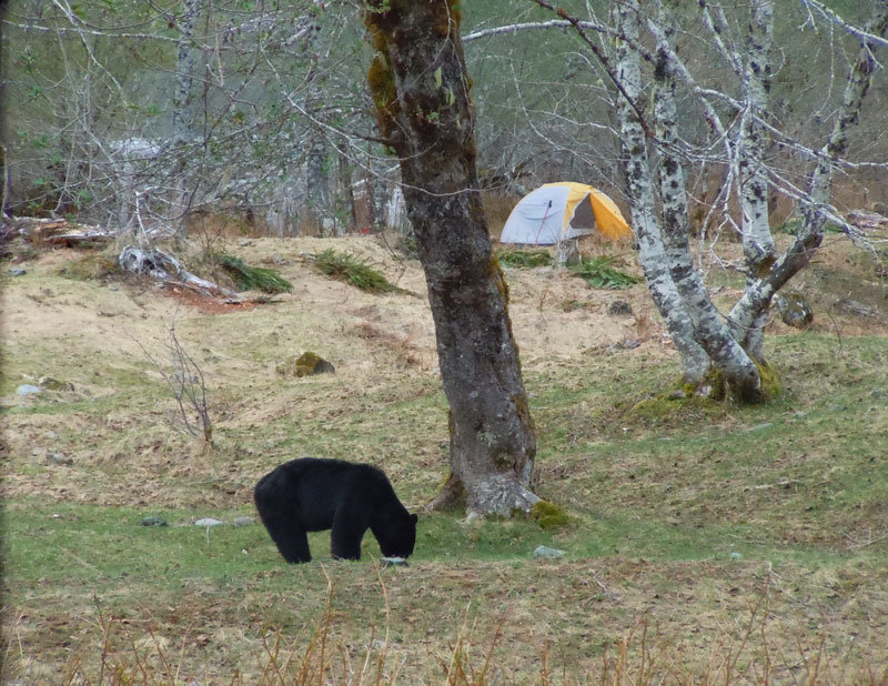
Wildlife is really out this time of year. We saw 2 small herd of elk (maybe 10 head in each, though I'm sure there were more we could not see), as well as 4 bears on the way in (2 of them 25-30 feet away and 2 of them 50 yards or more away) and 2 more in the valley. All the bears seemed mostly friendly and were more interested in the grass and bugs they were eating, than us.
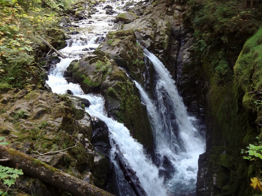
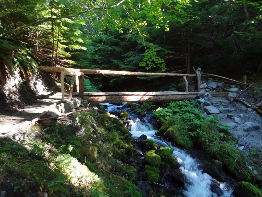
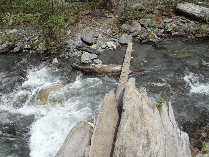
There are a ton of creek crossings on the trail in but the only 'difficult' one is Pyrites Creek. The main log bridge is out, but their is a small log bridge that has been notched for safe crossing. It is narrow, but very cross-able.
As for snow, there is very little snow before Enchanted Valley, only one or two spots, of maybe a couple hundred feet long each that cover the trail.
The valley is mostly clear with spots of snow here and there.
A half mile past the last Enchanted Valley bear wire snow picks up but is melting pretty quickly and you can still get an excellent view of Anderson Glacier without too much trouble.
There are a couple of bears in the Valley. Two of them spent the evening wandering around our camp and visiting other people in the valley.
The rain stayed away until we crossed the bridge on the way out of the valley and then it rained for the next 13 miles. At least we had one dry day in the rainforest.
May 19 – May 20, 2012


Willapa Hills Trail - Gear Test
8 miles of hiking • 250' elevation gain • 1 night
Quick overnight trip to test a new pack and sleeping gear. Walked 4 miles on a rails to trails trail and then up into the Willapa Hills to camp near a river. Hiked out the next morning. Great early spring trip and the new gear worked out great.
March 24 – March 25, 2012
