


2015 Trips


South Coldwater Ridge Snowshoe
5 miles of hiking • 1000' elevation gain •
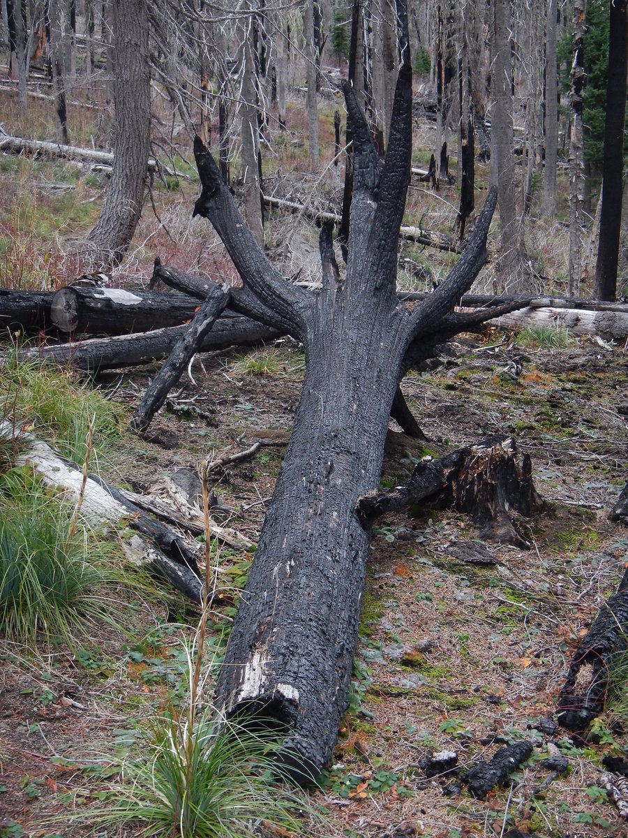
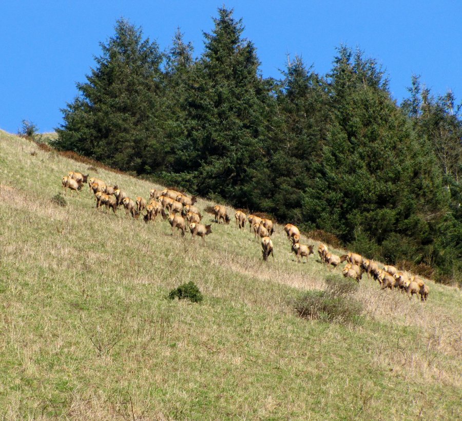
Headed up the Coldwater Ridge Trail #230A from the Hummocks TH to the logging equipment. Had the place to ourselves and saw a herd of elk right at the gate.Winds were light with high clouds, temps in the high 20's.

December 26, 2015

Clear Lake Butte Ski
8 miles of hiking • 1250' elevation gain •
Skied from Skyliner Snowpark to Clear Lake Butte Lookout and back. Saw no people except for a group that rented the LO. Very nice return, though a little steep near the top.
December 16, 2015

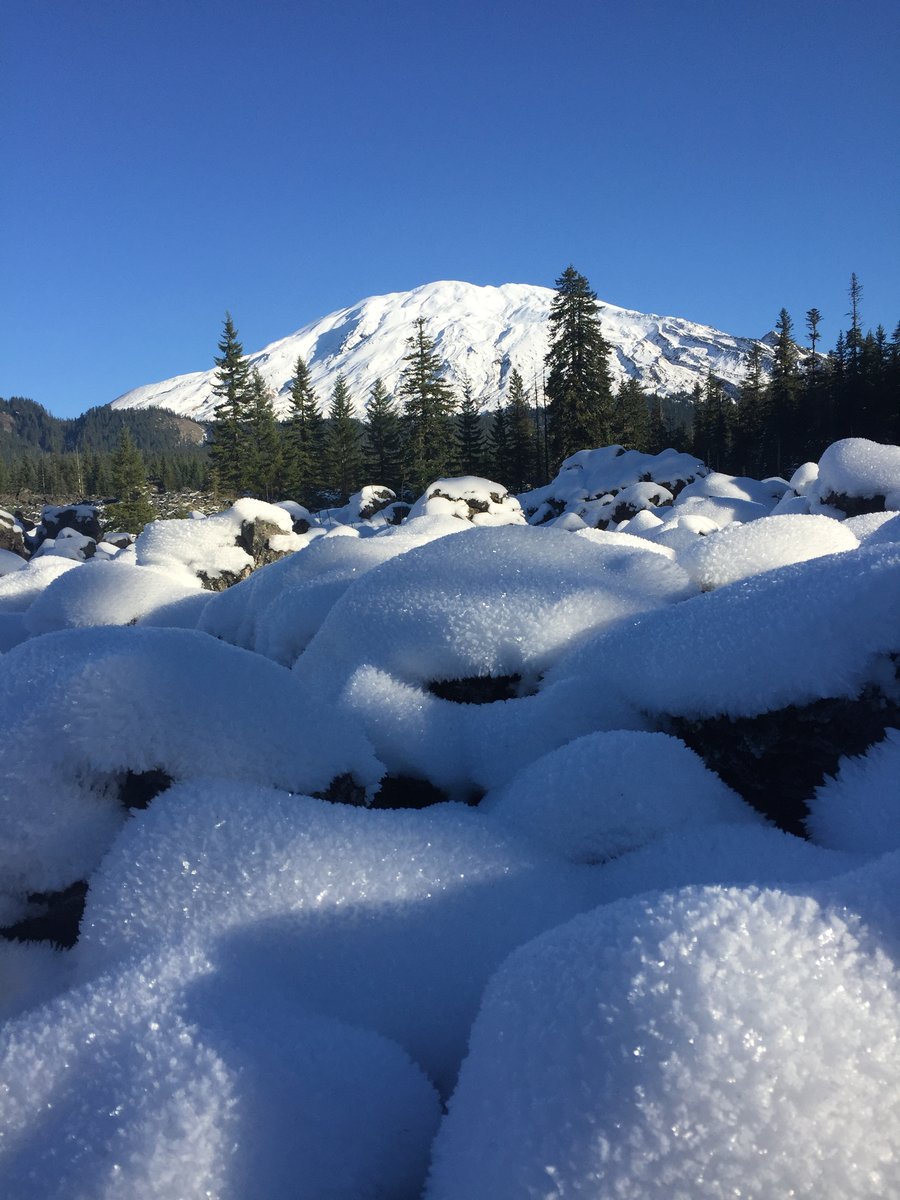
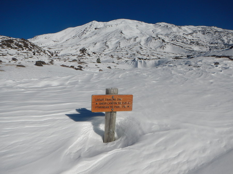
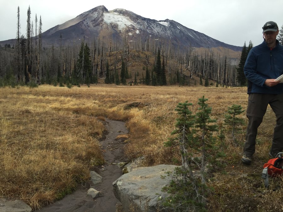
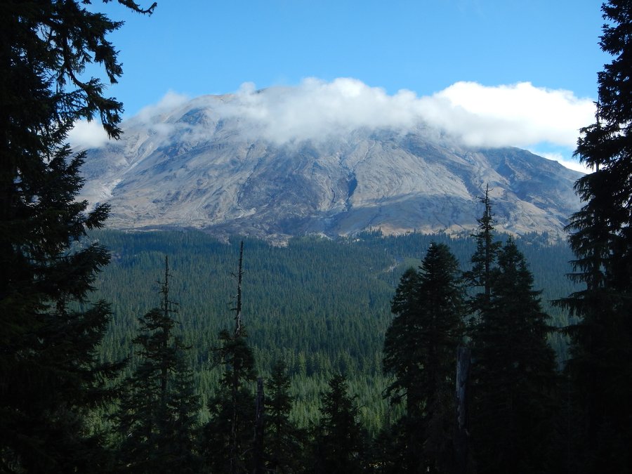
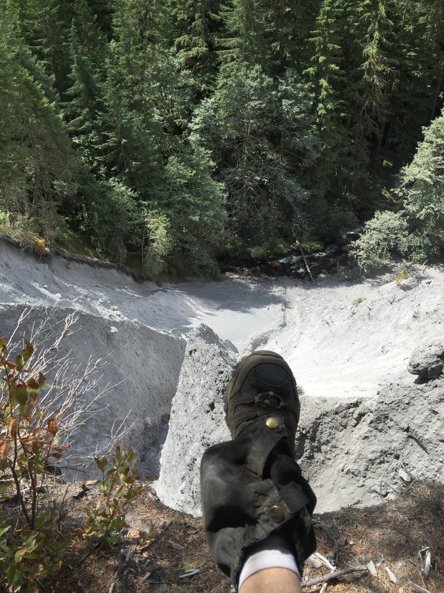
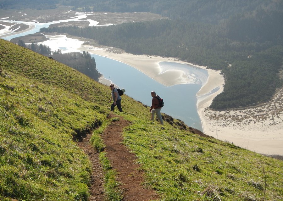
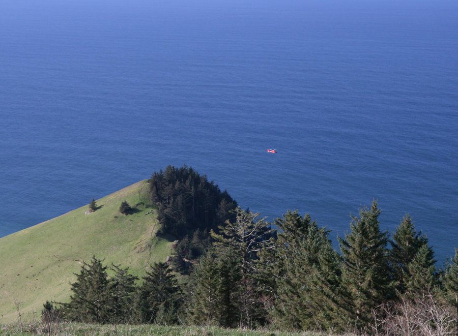
Butte Camp to the Loowit
8.1 miles of hiking • 1500' elevation gain •
We wanted to get in a hike while the skies were still blue. St. Helen's was a perfect choice. We saw zero people until we were just about back to the trail head on the return and then we only saw a couple and their dog. We enjoyed our time above treeline where is was a little breezy but not too cold. A small group of elk crossed the trail in front of us on the lower wooded section of the trail.
November 29, 2015

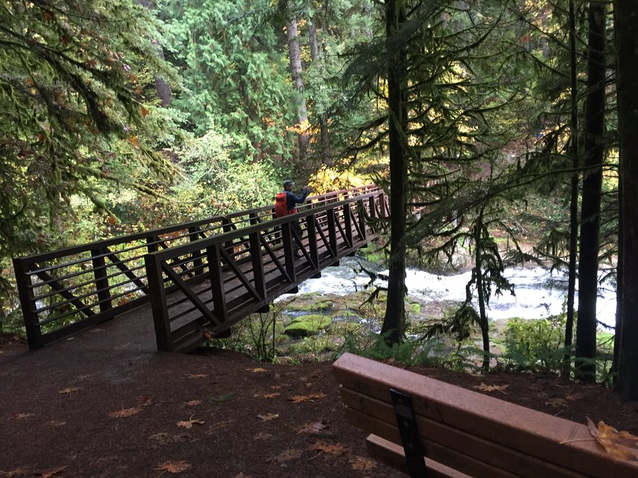
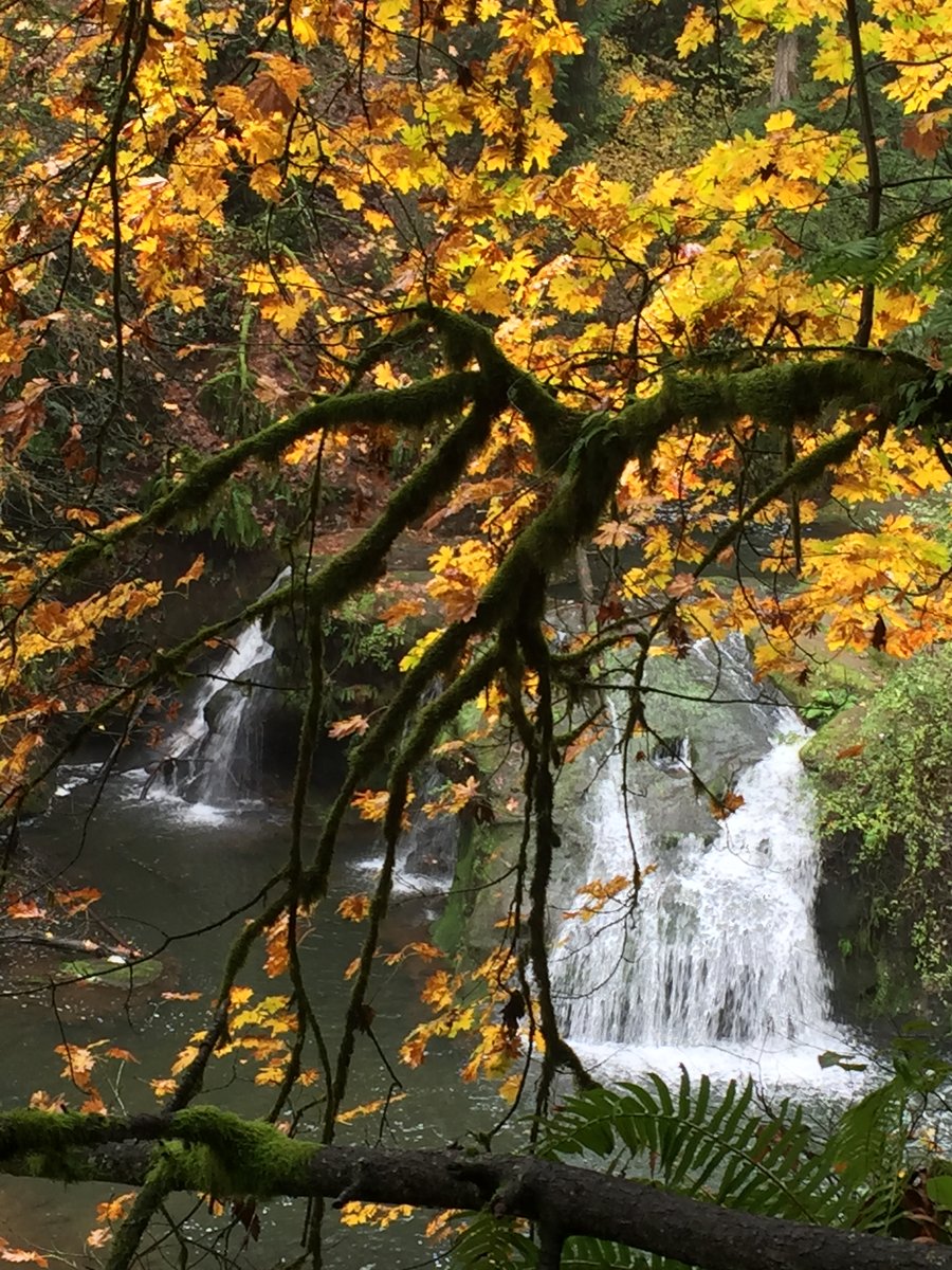
Lacamas
6 miles of hiking • 0' elevation gain •
We didn't have much time but wanted to get out and stretch our legs. The Lacamas trail fit the bill.
November 8, 2015

 1
1
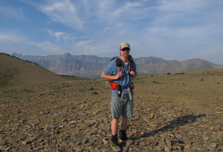
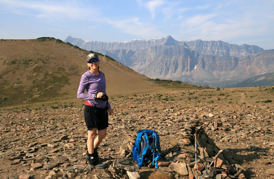
Horseshoe Meadow via Williams Mine TH. Mt. Adams
12 miles of hiking • 0' elevation gain •
Although we'd been to Horseshoe Meadow before (via the Stagman Ridge TH), this trail was new for us.This section of the PCT runs through the Cascade Creek burn of 2012. Conditions were dry and cool, the clouds high enough that we had views of the Mountains including Hood & St. Helens and of course, Adams.
The only water was a creek maybe 1/4 mile from the trailhead. The creek at Horseshoe Meadow was dry. We saw no one all day and disappointingly no wildlife. We saw tons of hoof prints along the length of the trail but no wildlife. The fall color on the drive approaching the trail head was good with tall larch trees, vine maple and aspen or aspen-like trees.
October 24, 2015

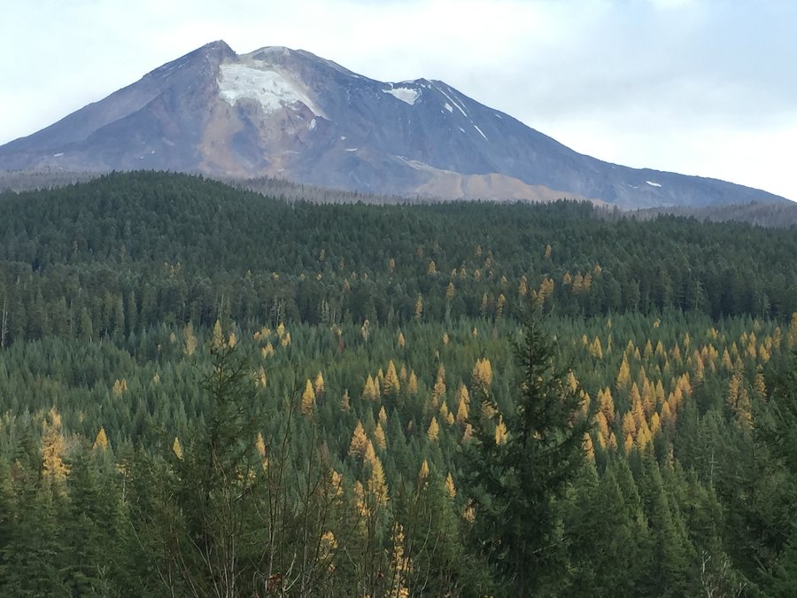
October 18, 2015

Mt. Rainier NP - Summerland / Panhandle Gap
12 miles of hiking • 3000' elevation gain •
Beautiful fall out-and-back hike from deep forest to alpine ice and rock. 12 miles / 3000 ft eg.
September 26, 2015

Johnston Canyon & Moraine Lake Rockpile
1.5 miles of hiking • 250' elevation gain •
Two short walks to popular Banff NP tourist destinations.
August 29, 2015
 1
1
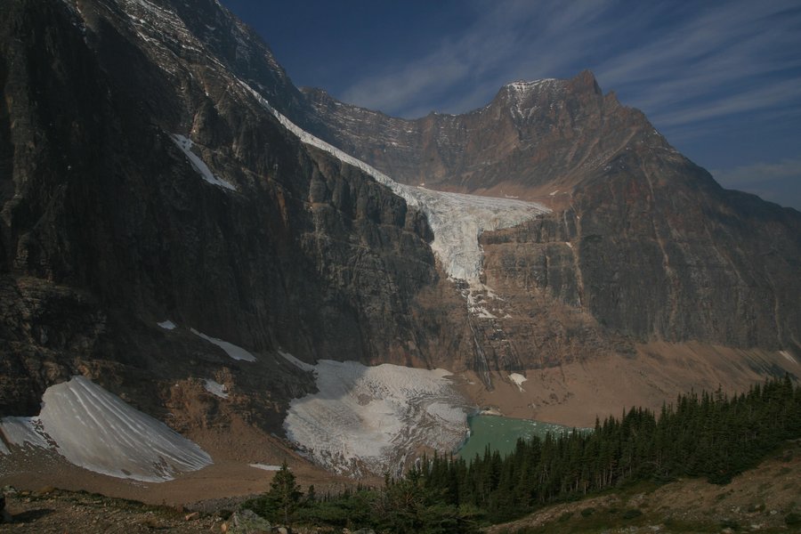
Plain of Six Glaciers, Lake Louise Alberta
10 miles of hiking • 3250' elevation gain •
Hiked from Lake Louise to the Plain of Six Glaciers upper viewpoint via Lake Agness. Stopped to see both Tea Houses. Busy but beautiful hike.
August 28, 2015

Bourgeau Lake to Harvey Pass
11.5 miles of hiking • 3250' elevation gain •
Hiked from the TH just off the Trans Canada Hwy to Bourgeau Lake. Then, continued to a series of lakes just below Harvey Pass. Challenging hike but well worth the effort. Would be good for viewing Alpine Larch in late September.
August 27, 2015

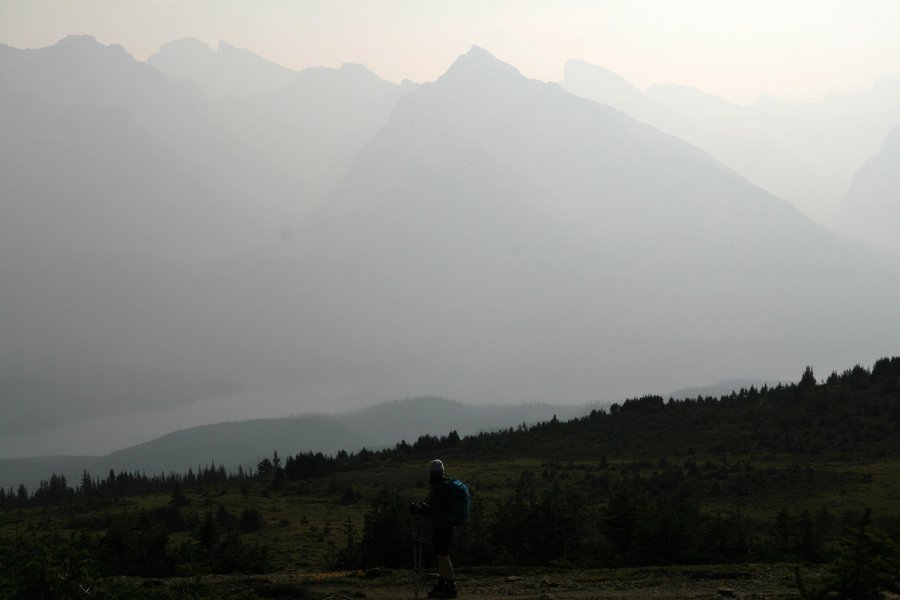
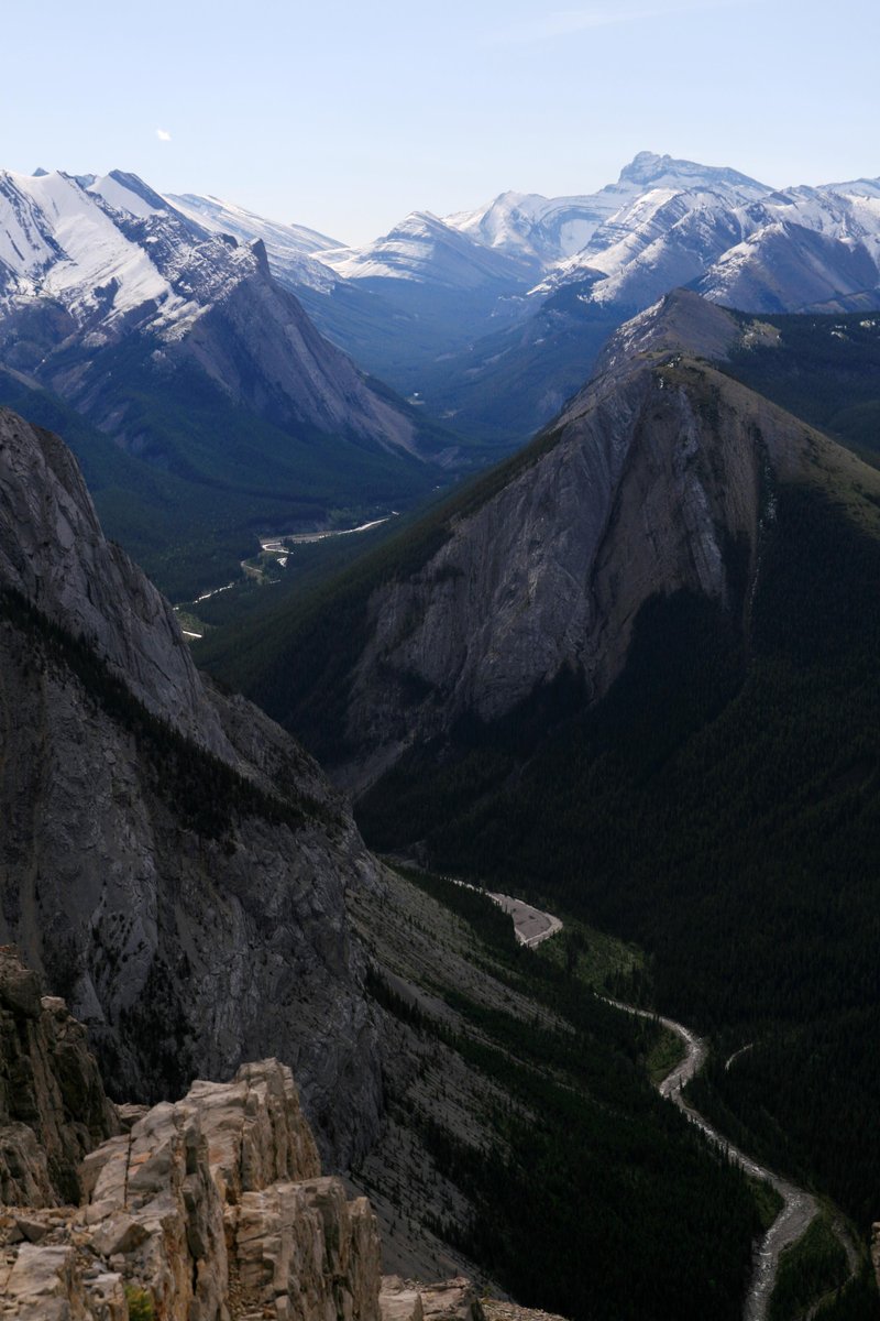
Wilcox Pass
11 miles of hiking • 1500' elevation gain •
Hike from Columbia Icefields Center to Wilcox Pass and beyond. Day was smoky but dry. Views were limited. Saw bighorn sheep and elk.
August 26, 2015

Cavell Meadow
5 miles of hiking • 1250' elevation gain •
Hike up to Cavell Meadow and the Cavell Glacier overlook.
August 24, 2015

Valley of 5 Lakes
5 miles of hiking • 0' elevation gain •
Second 5-miler of the day.This one with less elevation gain, took us around some nice lakes.
August 24, 2015

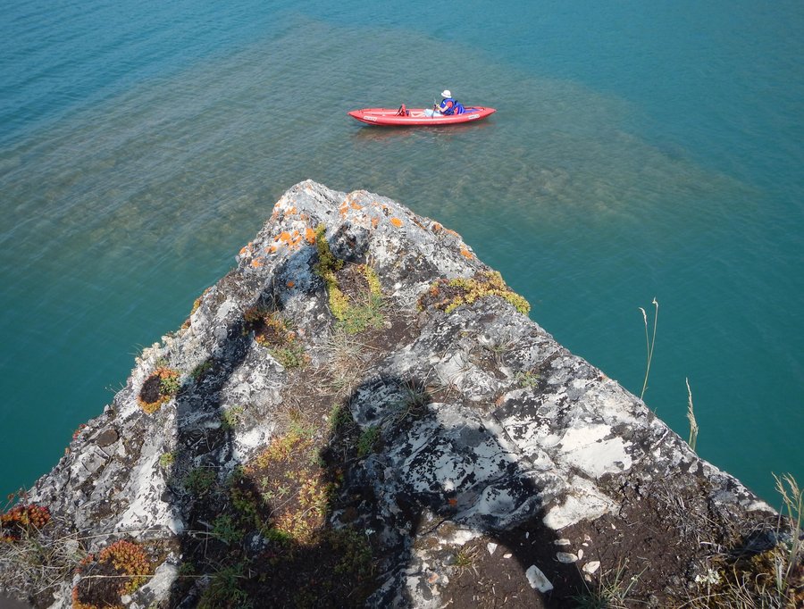
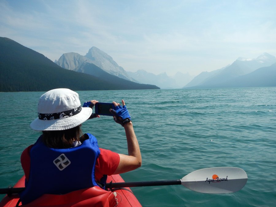
Bald Hills
1 miles of hiking • 1750' elevation gain •
Bald Hills hike from Maligne Lake ~ Jasper NP. Views were a bit hazy due to wildfire smoke but it was a decent hike. We spent the second half of the day kayaking on the lake.
August 24, 2015

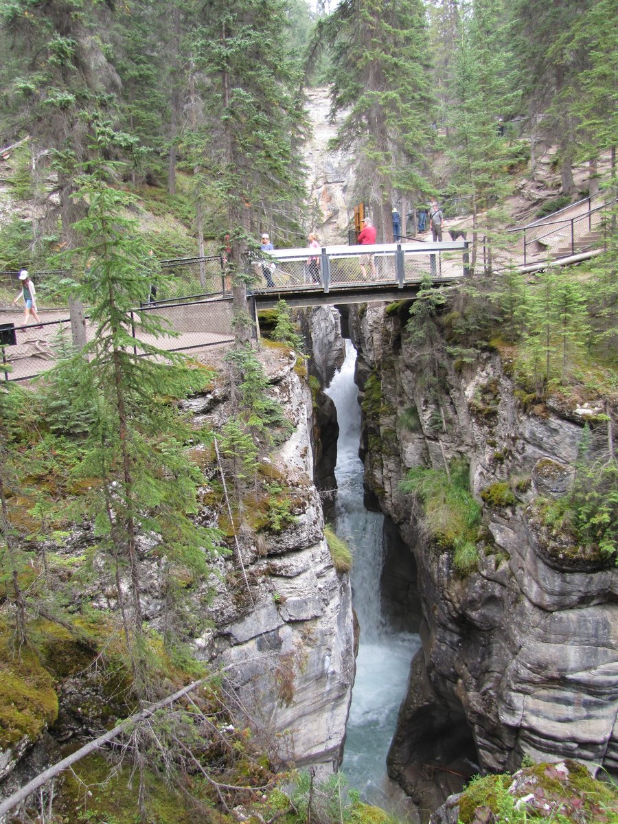
Maligne Canyon
1 miles of hiking • 0' elevation gain •
We did the short loop through Maligne Canyon.
August 23, 2015

August 23, 2015

 1
1
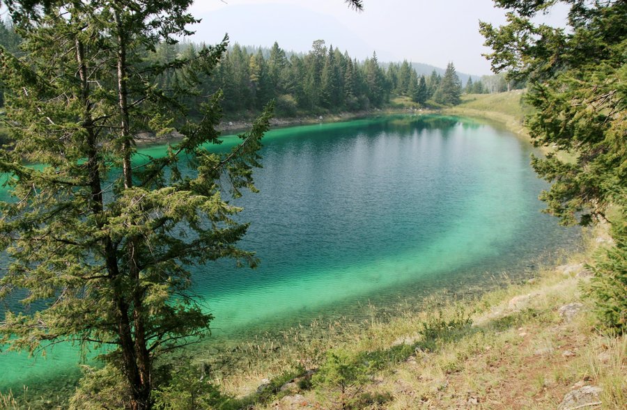
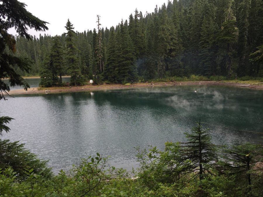
Indian Heaven lollipop loop Thomas Lake~Blue Lake~Clear Lake~Elk Lake~...Thomas Lake
17 miles of hiking • 0' elevation gain •
We hiked from the Thomas Lake Trailhead to Blue Lake then onto the PCT for a lollipop loop around Clear Lake, a side trip passed Bear Lake to Elk Lake and back on to the PCT to Blue Lake and back out.
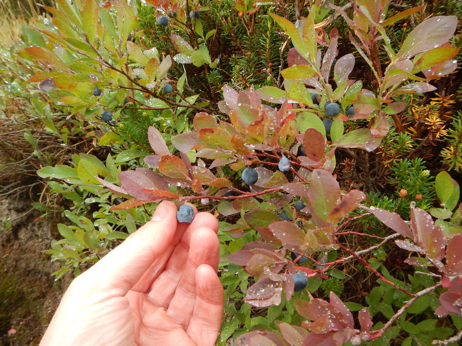
Cool, foggy and drippy weather to start gave way to partly sunny skies though it remained fairly cool especially around Blue Lake where it seemed much cooler than the surrounding areas. Huckleberries were plentiful, and there were no bugs. Although there was plenty of bear scat we didn't see any wildlife of any kind. We did however see 2 Elk on the drive in and 1 deer on the way out. We crossed paths with tons of hikers and backpackers, and met one PCT thru-hiker and one bear hunter.
Due to the clouds, views were mostly limited to the lakes but the cool weather made it great for getting some decent miles without being tempted to stop and relax for too long.
August 15, 2015

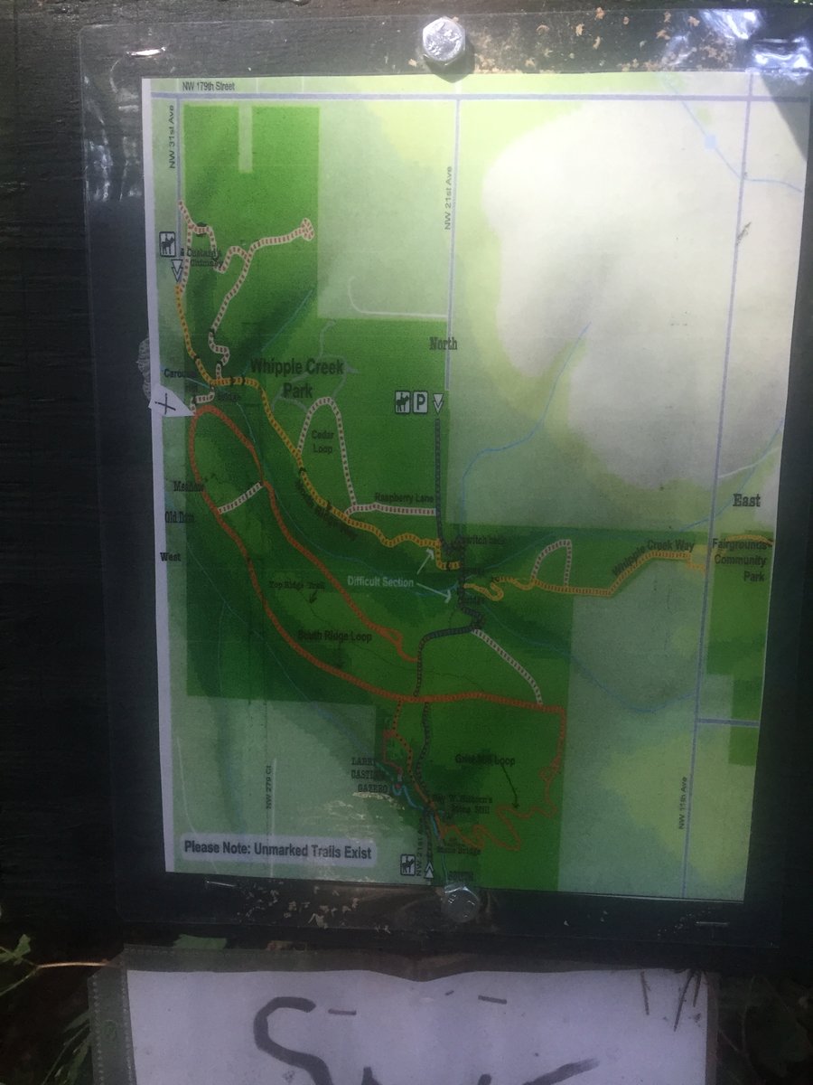
Whipple Creek
4 miles of hiking • 0' elevation gain •
We'd never been to Whipple Creek so we checked it out, hike the loop trails throughout the park and picked some blackberries on the way out. It's a nice park, with forested trails for equestrians, hikers and bikers.
August 9, 2015

 1
1
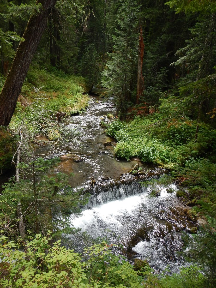
Cinnamon Trail
14.1 miles of hiking • 3000' elevation gain •
We hiked the cinnamon trail from the Kalama Horse Camp. We went counter clockwise to get the elevation out of the way early, and are glad we as it allowed a nice return trip along the stream. Due to our early start 6:30am, we did not see any equestrians until the last 1/3 of the 14+ mile hike.
August 8, 2015

Salmon Creek Greenway Trail
6 miles of hiking • 0' elevation gain •
Getting in some extra miles hiking the local Greeway trail. Saw a bunch of turtles and a deer.
August 2, 2015

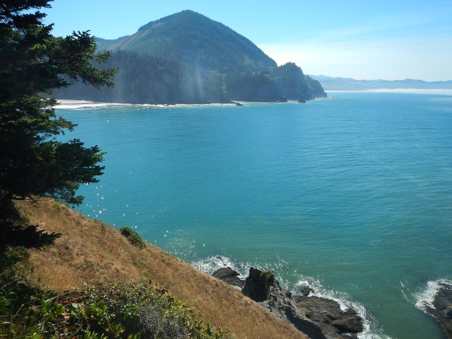
Arch Cape to Short Sand Beach
16 miles of hiking • 2750' elevation gain •
To beat the inland heat we headed to the coast for a nice long hike to kick off the Hike-A-Thon. The weather was perfect for hiking, supplying nice hiking temps and great views. Other than being stung by hornets it was a perfect trip (2 of 3 of us were stung, one on the way in one on the way back, same hornets nest, another couple we passed were both stung as well).
August 1, 2015

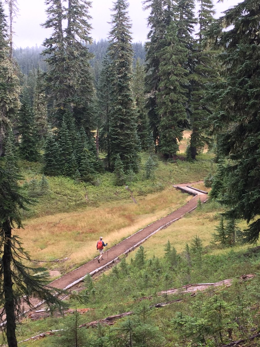
Top Spur to Cairn Basin & beyond
12 miles of hiking • 2750' elevation gain • 1 night
We packed in from the Top Spur TH to Cairn Basin and beyond for some exploration above the basin. Wildflowers are still quite nice, weather was cooler and refreshing, and most amazing of all, there were NO mosquitoes!!! It was breezy all day Saturday and into the evening unfortunately the clouds stopped moving after sunset and we were fairly socked in overnight so no star- viewing. The wind was gone Sunday and still NO mosquitoes! Thankful for the nice hiking weather and for our first pack trip in July where there were no mosquitoes.
July 11 – July 12, 2015

Vista Ridge trail to Dollar Lake
8 miles of hiking • 1750' elevation gain •
Vista Ridge Trail was great, tons of avalanche lilies carpeted the ground. There was lupine and Indian paintbrush here and there, along with some heather and a few other types of flowers. We crossed 2 tiny patches of snow not really worth mentioning other than to acknowledge what an incredibly low snow year we had.
Hood could be seen thru the burnt trees as we headed up toward 600. Upon reaching Y'East Basin we had views of St Helen's, Rainier and Adams, as well.
We got a relatively early start so backpackers were all we saw on the way up .... but we passed a lot of folks on the way out. The trailhead-parking area was full when we returned around 12:30p.
Weather was warm and sunny. There were no bugs of consequence so it was a great day!
June 14, 2015

Silverstar Mt
8.2 miles of hiking • 2500' elevation gain •
We hiked the Chinook Trail to Sturgeon Rock, then to the Indian Pits and to the Summit of Silverstar and returned via Ed's Trail. Beautiful day, the wildflowers were amazing, tons of bear grass, Indian paint brush, and so on......
June 12, 2015


Table Mountain
11.5 miles of hiking • 3500' elevation gain •
Perfect sunny day with a light breeze.
We've done this hike twice before under very different conditions. First time was March 2008, there was lots of snow and we followed the only set of boot tracks we saw which took us up a very steep direct route to the summit. The next time we did this hike was August 2009. This time it was snow free and we could follow the actual trail up Heartbreak Ridge and to the summit. Unfortunately the stubborn clouds blocked pretty much all views so it was a bit disappointing.
This time it was great, we knew to avoid the difficult tread of the Westerly route down, and descended via the PCT to the North instead, which was a whole lot better than our two prior experiences.
There was a great variety of wildflowers in bloom and we could see St. Helens, Adams, Rainier, Hood, and the very top of Jefferson making it a 5-volcano day!
The perfect weather allowed us to relax at the summit and enjoy the wonderful view!
May 2, 2015

Ape Canyon to Plains of Abe
10.5 miles of hiking • 1500' elevation gain •
Day hike up the Ape Canyon trail to the Plains of Abraham and back. Snow showers and sun breaks. 3 inches of new snow at the top. Beautiful day.
April 4, 2015

Multnomah Franklin Ridge Loop
12 miles of hiking • 3000' elevation gain •
Needed something within a relatively short drive, so we ended up at Multnomah Falls for a nice lollipop loop. With a 7:30a start we we were able to avoid the crowds and have a very peaceful day, until the approach back to Multnomah. We could smell the ice cream cones well in advance of seeing the first ones heading up to the top of the falls.... an ice cream cone gang of 5 were spotted before the bridge near the falls.
March 29, 2015

Hardy Ridge
8.5 miles of hiking • 2500' elevation gain •
Started at the Equestrian TH and did the loop with ridge walk to Phlox Point
March 6, 2015
 2
2
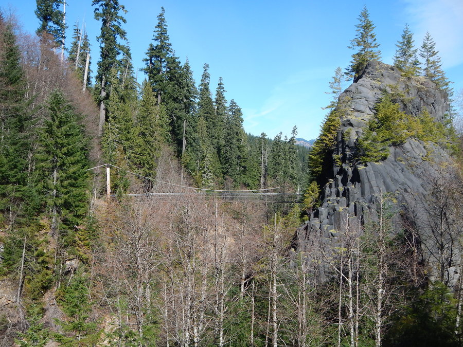
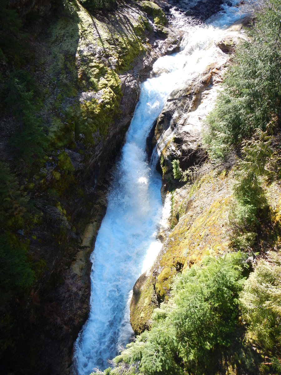
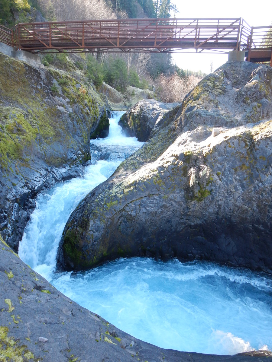
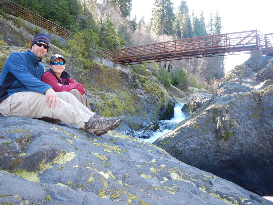
Lava Canyon
2 miles of hiking • 0' elevation gain •
We took the opportunity to bike the gated road from the Marble Mountain Sno Park to Lava Canyon and enjoy the beauty of Lava Canyon minus the crowds. By the time we returned to the Sno Park there were a ton of cars but we did not see a single person on our adventure past the gate. We even had a small bear cross the road in front of us as we made our way toward the Lava Canyon TH. The biking was just under 11 miles. We just did an out and back on the hike rather than the loop, which we have done before.
March 1, 2015

Cascade Head
4.5 miles of hiking • 1000' elevation gain •
Always a great hike with wonderful views both of the ocean and the Salmon River. The elk who reside on the head were out and about.
February 21, 2015

Tamanawas Falls & Beyond and a side trip to Little Crater Lake
11 miles of hiking • 1000' elevation gain •
February 14, 2015

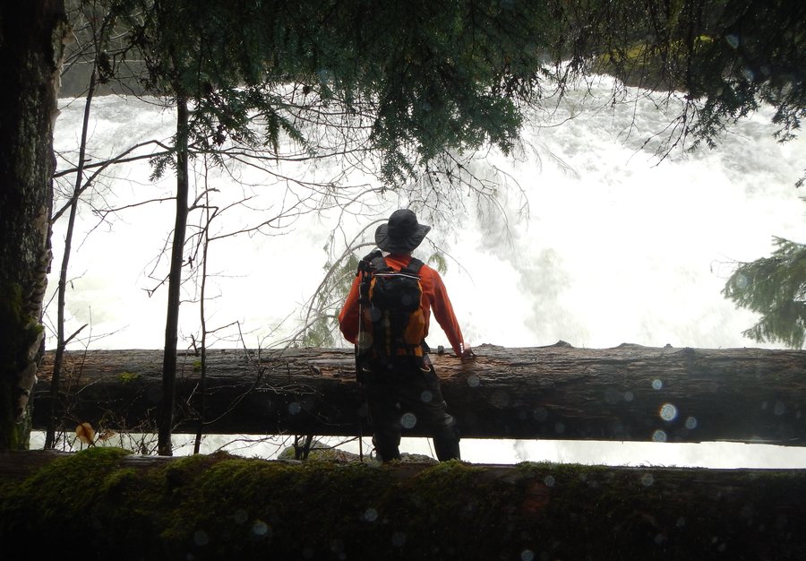
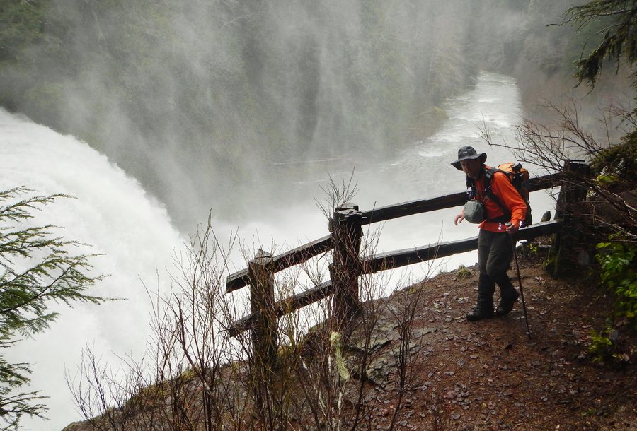
Lewis River Falls
6.5 miles of hiking • 250' elevation gain •
Lower Falls to Taitnapum Falls. Amazing amount of water on the Lewis River right now.
February 8, 2015

 1
1
Goat Marsh
9 miles of hiking • 1500' elevation gain •
9.1 Miles ~ 1600' eg. Since there is no snow to ski or snowshoe in, the goal was to get out on a hike where we could enjoy the sun and avoid the wind. We chose a hike we've not done before which always seems to be much more fun. Anyway, we headed out in the fog that was pervading the lower elevations and once we got up toward Cougar it was all sun. Arriving at the Kalama Horse Camp TH at 9:15 am there was just one other truck there. (5 other vehicles when we returned to the gate but we only saw one couple on the trail). We enjoyed the new terrain and were fortunate to see a small herd of 12 Roosevelt Elk at Goat Marsh including one that was grey with a white posterior rather than the typical tawny color with the tan hind-end.
January 31, 2015

Skyline Lake
3.5 miles of hiking • 1500' elevation gain •
Used Yak Trax on the climb up to the lake on relatively firm snow and used snow shoes on soft snow on the way down. The lake was covered with ice/snow but you could see the blue thru the cover and you could punch thru with trekking poles in various spots. We continued past the lake and climbed up to some rocks above a saddle for a snack, views and some friendly Gray Jays (aka Camp Robbers). Beautiful views of Stevens Pass ski area as well as the surrounding mountains like Mt. Stuart.
January 26, 2015


View trips from: 2016